
12 Viewpoints Around Vancouver You Can Drive Right Up To
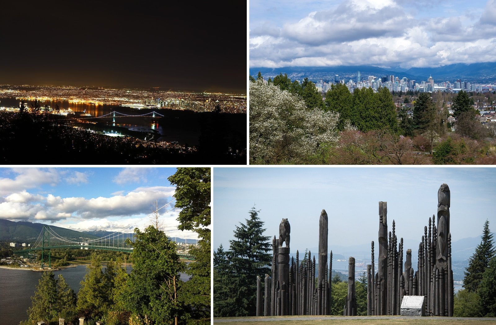
Some of the best views around Vancouver don’t ask much of you. Park, get out, walk a few steps, and the city, Howe Sound or a wall of glaciers is right there. That suits a short winter afternoon. It also works for a visiting parent with bad knees, or a kid who has already announced they are not hiking.
This list runs from the city’s highest point at Queen Elizabeth Park, 125 m above sea level, up the North Shore mountains and out along the Sea to Sky. Each stop comes with the story behind it, what parking costs where it’s been confirmed, and the gate times that catch people out. Mount Seymour Park alone drew more than one million visitors in 2022, so timing matters.
Winter changes the rules at several of these places. Roads close overnight, winter tires become mandatory, and one gate stays shut until spring. Those details are flagged as you go.
12. Brandywine Falls Provincial Park (South of Whistler, seasonal)
Where: Hwy 99, 47 km north of Squamish
When: Gate open May 1 to Oct 31; closed now
Cost: Fee not confirmed
Getting there: Hwy 99 north of Squamish
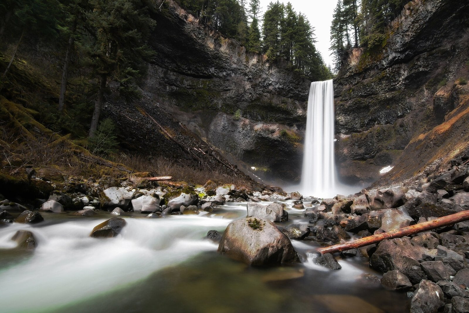
This one comes with a catch: the gate is closed for the season. When it’s open, you walk 10 to 20 minutes one way from the lot, across a covered footbridge, to a platform over the 70 m falls. A short path continues to a second viewpoint of the falls. Another viewpoint looks over Daisy Lake to the Black Tusk. BC Parks says there is no access to the lower falls area; the canyon is unsafe because of unstable slopes and falling rock, so stay on the trails and behind the fences.
The operator lists the gate as open May 1 to Oct 31. Daily gate hours vary by season; check the operator’s page (seatoskyparks.com) before you go. 2027 dates aren’t posted yet. The park is 47 km north of Squamish off Highway 99.
In the off-season, the park is walk-in only and the trails aren’t maintained. Don’t park at the gate or on the highway. BC Parks says the highway has to stay clear for safety and winter maintenance. Put this one on the calendar for May.
11. Tantalus Lookout (North of Squamish)
Where: Hwy 99, about 19 km north of Squamish
When: Clear days, especially after fresh snow
Cost: Fee and hours not confirmed
Getting there: North of Squamish on Hwy 99; watch for the signed pull-out
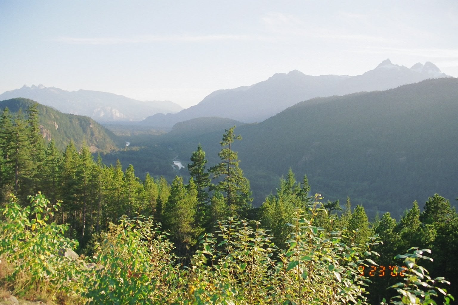
This roadside lookout faces the glaciated Tantalus Range across the Squamish River valley. The peaks sit in a 113 km² provincial park that Tourism Squamish describes as home to Squamish’s most dramatic peaks. You get a full alpine skyline without any hiking.
It’s 19 km north of Squamish on the Sea to Sky. Go on a clear day, ideally just after fresh snow has hit the peaks. Cloud can hide the whole range, so check the sky before you commit to the drive.
You’re well inside the Sea to Sky winter-tire zone, which starts just north of Horseshoe Bay. The turnoff is easy to miss at highway speed. Have a passenger watch for the sign.
10. Shannon Falls Provincial Park (Squamish)
Where: Hwy 99, about 2 km south of Squamish
When: Day use; gate closed 10 pm to 7 am; spring and fall less crowded
Cost: Fee not confirmed; read the signs
Getting there: About 58 km north of Vancouver on Hwy 99
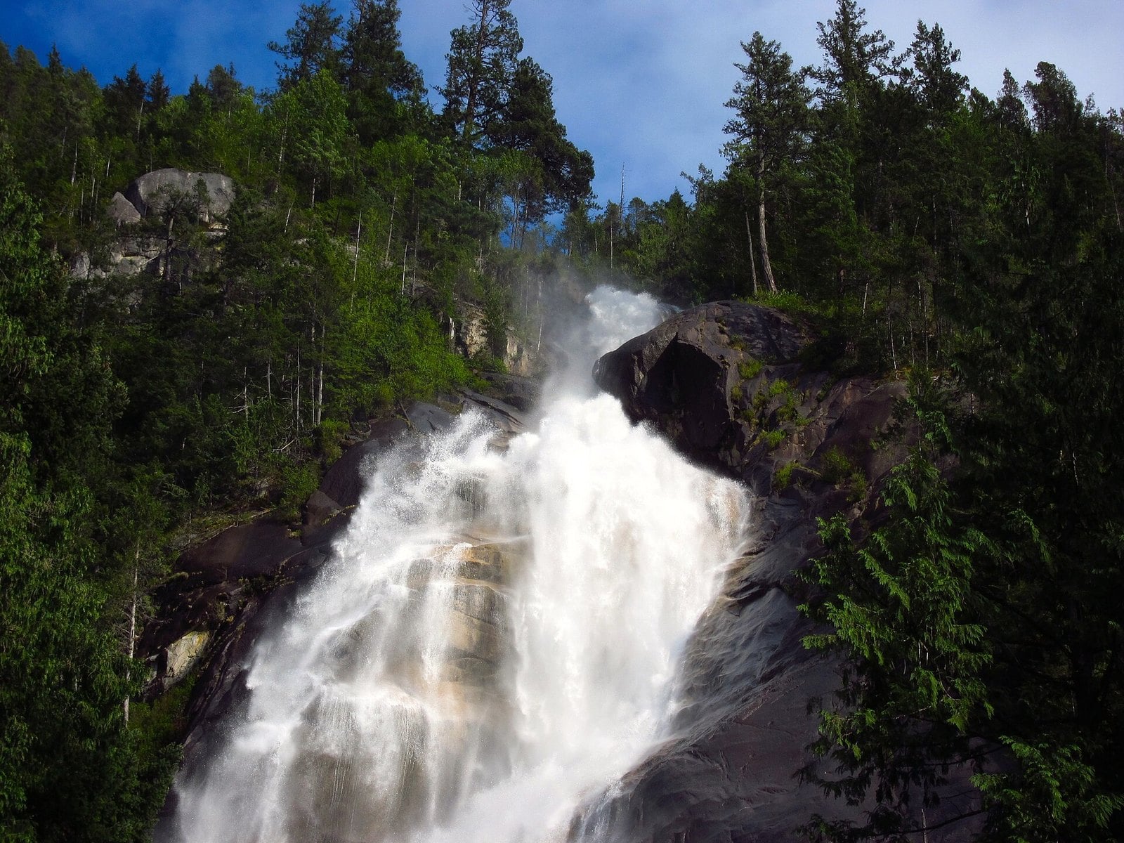
BC’s third-highest waterfall drops 335 m down a series of cliffs. The BC Parks brochure calls the trail an easy 350 m walk. The operator lists two viewing platforms a short walk from the lot. It sits right beside Stawamus Chief Provincial Park, so the Chief looms over the drive in.
It’s about 58 km north of Vancouver on Highway 99, and 2 km south of Squamish. It’s day use only, and the lot gate is closed from 10 pm to 7 am. Tourism Squamish says spring and fall are less crowded.
There are wheelchair-accessible toilets in the day-use area. The short, easy trail makes this one of the simpler Sea to Sky stops with kids.
Take everything out of the car, including what’s in the trunk. BC Parks warns the lots are extremely vulnerable to break-ins.
9. Porteau Cove Provincial Park (Howe Sound)
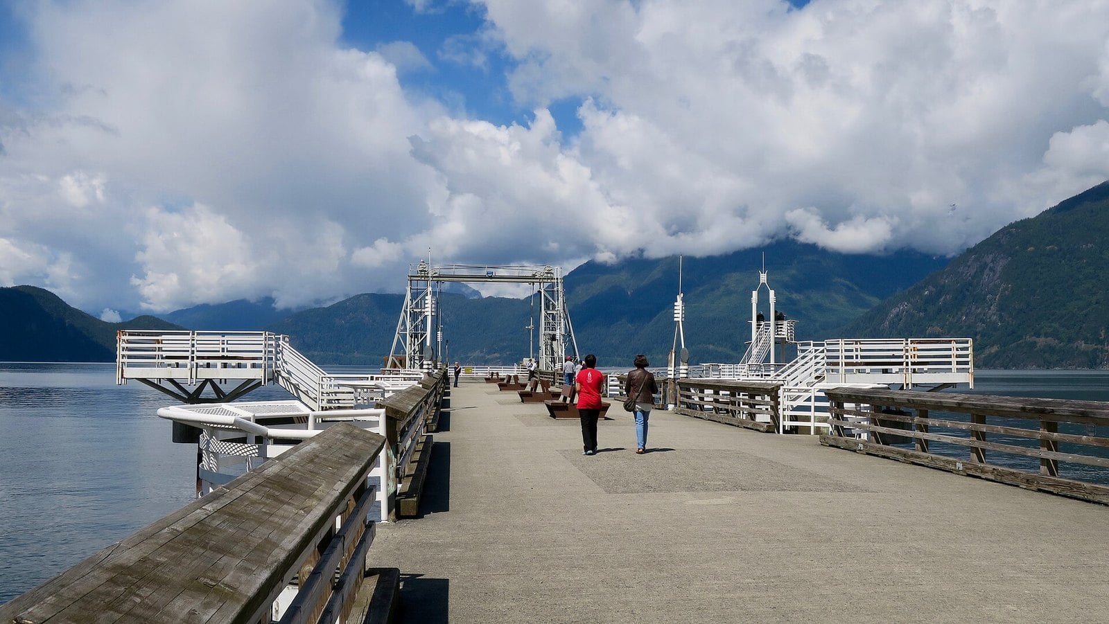
Where: Hwy 99, Howe Sound, between Lions Bay and Britannia Beach
When: Year-round; reduced winter services Nov 12 to Feb 28; be out by 10 pm
Cost: Day-use fee not confirmed
Getting there: 38 km north of Vancouver on Hwy 99
BC Parks describes Howe Sound here as the most southerly fjord in North America. A paved emergency ferry pier lets you walk straight out over the water. Steps from the main lot lead down to the shoreline.
The name dates from 1908, when John F. Deeks began mining sand and gravel here to supply Vancouver. The park was established on July 24, 1981. Offshore, sunken ships and man-made reefs draw scuba divers. After dark, the park has become a popular spot for stargazing and aurora watching.
The operator lists the park 38 km north of Vancouver on Highway 99. Winter tires or chains are required on this stretch. The park is open year-round, with limited facilities and reduced fees in winter, from Nov 12 to Feb 28. The two official sources disagree on closing time. BC Parks says the day-use area closes at 11 pm, while Sea to Sky Parks says day use and parking close at 10 pm. Plan to be out by 10.
Parking is limited, and drop-offs can’t be accommodated because they block the park road. Illegally parked vehicles, including those on the highway, are towed at the owner’s expense. On clear weekends, arrive early.
8. Burnaby Mountain Park and Kamui Mintara (Burnaby)
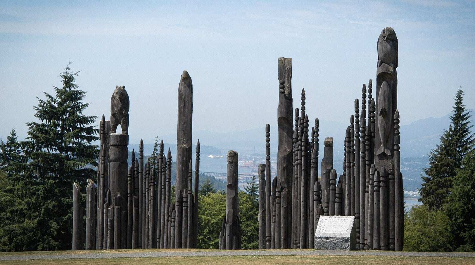
Where: 100 Centennial Way, Burnaby
When: Dawn to dusk; main lot closes 10 pm; Centennial Way and parking lot closed Nov 9 to 13 for upgrades
Cost: No admission
Getting there: Lougheed Hwy, north on Gaglardi Way to Centennial Way
The west slope looks out over Burrard Inlet and the Vancouver skyline. At the top stands Kamui Mintara, the Playground of the Gods. It’s a group of carved wooden poles by Ainu sculptor Nuburi Toko and his son Shusei Toko.
They made the work in 1989 and 1990 to mark 25 years of goodwill between Burnaby and its sister city, Kushiro, Japan. Burnaby made the mountain an official park in 1957. Beside the main lot, the Centennial Rose Garden has over 900 rose bushes. At sunset the poles stand in silhouette against the sky.
From Lougheed Highway, turn north on Gaglardi Way to Centennial Way. Burnaby lists the park as open dawn to dusk year-round, and the main lot closes at 10 pm. The City page doesn’t list an admission or parking fee. The City says Centennial Way, from the Trans Canada Trail to Mintara, and the parking lot will close Nov 9 to 13 for upgrades, weather permitting. Check the page before you go.
The playground and picnic areas are on the upper slope near the Mintara restaurant lot. Park by the rose garden and walk up to the poles. The City says the sculpture is currently fenced off while it’s protected and assessed for age-related issues, so view it from outside the fence.
7. Cleveland Dam (Capilano River Regional Park, North Vancouver)
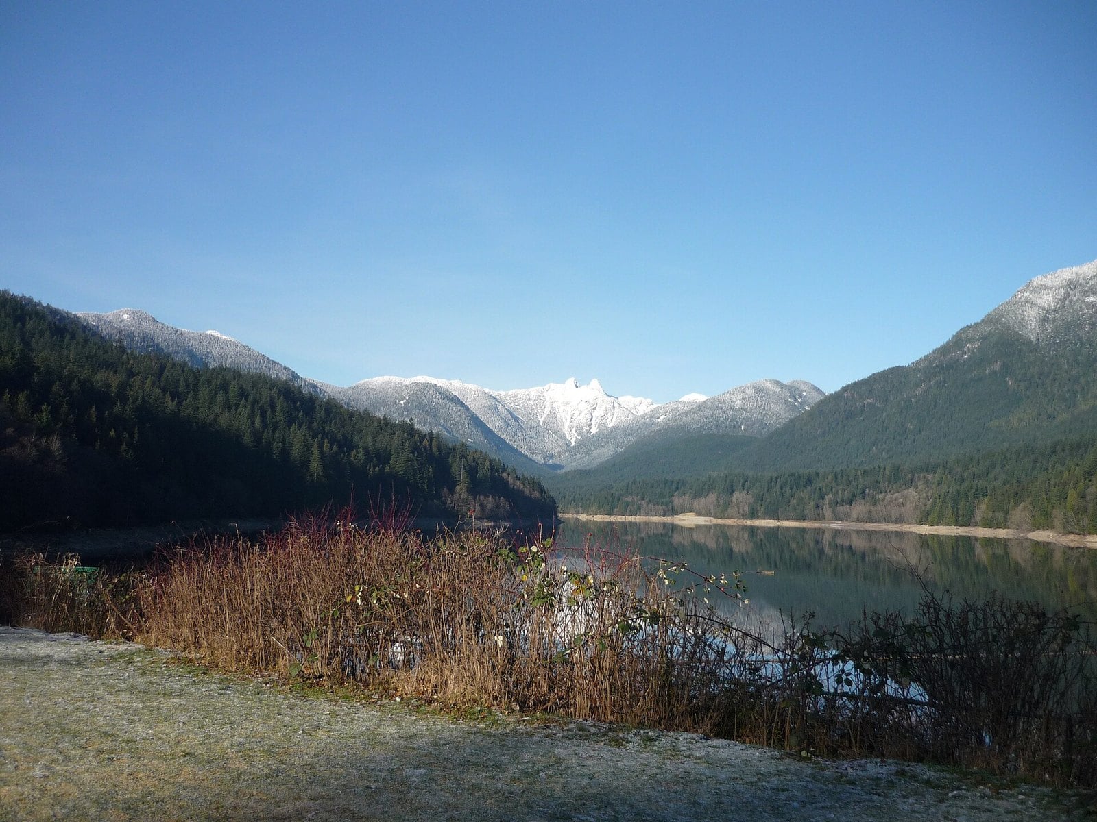
Where: Top of Capilano Road, District of North Vancouver
When: Daylight hours; gates locked at closing
Cost: Parking fee not confirmed
Getting there: Hwy 1, exit 14 (Capilano Rd./Grouse Mtn.), north to the dam lot
A short stroll from the Cleveland Dam lot brings you to the grassy Cleveland Dam Field. Metro Vancouver points to the view up Capilano Lake to the mountains, including The Lions. The park brochure also promises views up the canyon to the dam’s spillway from the trails below.
From Highway 1, take the Capilano Rd./Grouse Mtn. exit (#14) and drive north to the lot. Regional parks are generally open during daylight hours. Hours are posted at the entrance, and the gates are locked when the park closes. Don’t linger past dusk with your car inside.
The picnic and toilet facilities at the dam are wheelchair accessible. Dogs must be on leash unless signs say otherwise. Metro Vancouver tests the dam’s public-warning system at noon on Nov 19 and Dec 17. If you hear a siren on either of those days, that’s the test.
Pair it with the Capilano Salmon Hatchery, which has its own lot further down Capilano Park Road. The hatchery’s picnic and toilet facilities are also wheelchair accessible.
6. Mount Seymour Lookouts (District of North Vancouver)
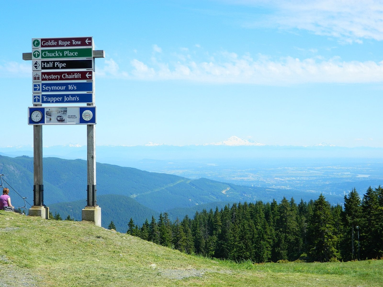
Where: Mount Seymour Road, North Vancouver
When: Winter: road closed 10 pm to 7 am; gate above P2 closed dusk to dawn; winter tires Oct 1 to Mar 31
Cost: No park fee; free day-use pass may be required in winter for lots P1 and Lower P5
Getting there: 15 km from downtown via Second Narrows Bridge and Mount Seymour Parkway
BC Parks names two kinds of drive-up views on Mount Seymour Road. One is the Deep Cove lookout lot. The others are the lots and pull-outs near the top of the road. Together they take in the Lower Mainland, the Fraser Valley and Mount Baker. Deep Cove Lookout itself faces Indian Arm and the Fraser Valley.
The lookout is small. It has a pit toilet, an information shelter and parking for about 15 vehicles. Stop there on the way up, then carry on to the top lots for the wider view. Coyotes and deer are often seen near the road, so drive accordingly.
BC Parks puts the park 15 km northeast of downtown via the Second Narrows Bridge and Mount Seymour Parkway, about 30 minutes away. The brochure lists no park fees. Winter tires are required on the road from Oct 1 to Mar 31. Mt Seymour’s hours page says that from November to April the road is closed from 10 pm to 7 am daily, and the gate above P2 is closed from dusk to dawn, so the top lots can’t be reached by car after dark.
Last winter, for lots P1 and Lower P5, BC Parks required free vehicle day-use passes on certain dates. Passes were needed daily from Dec 19 to Jan 4, then on weekends and holidays to Mar 29, 2026. Dates for the 2026/27 season aren’t posted yet. Cell service may be limited, so print or screenshot your pass.
5. Whytecliff Park (West Vancouver)
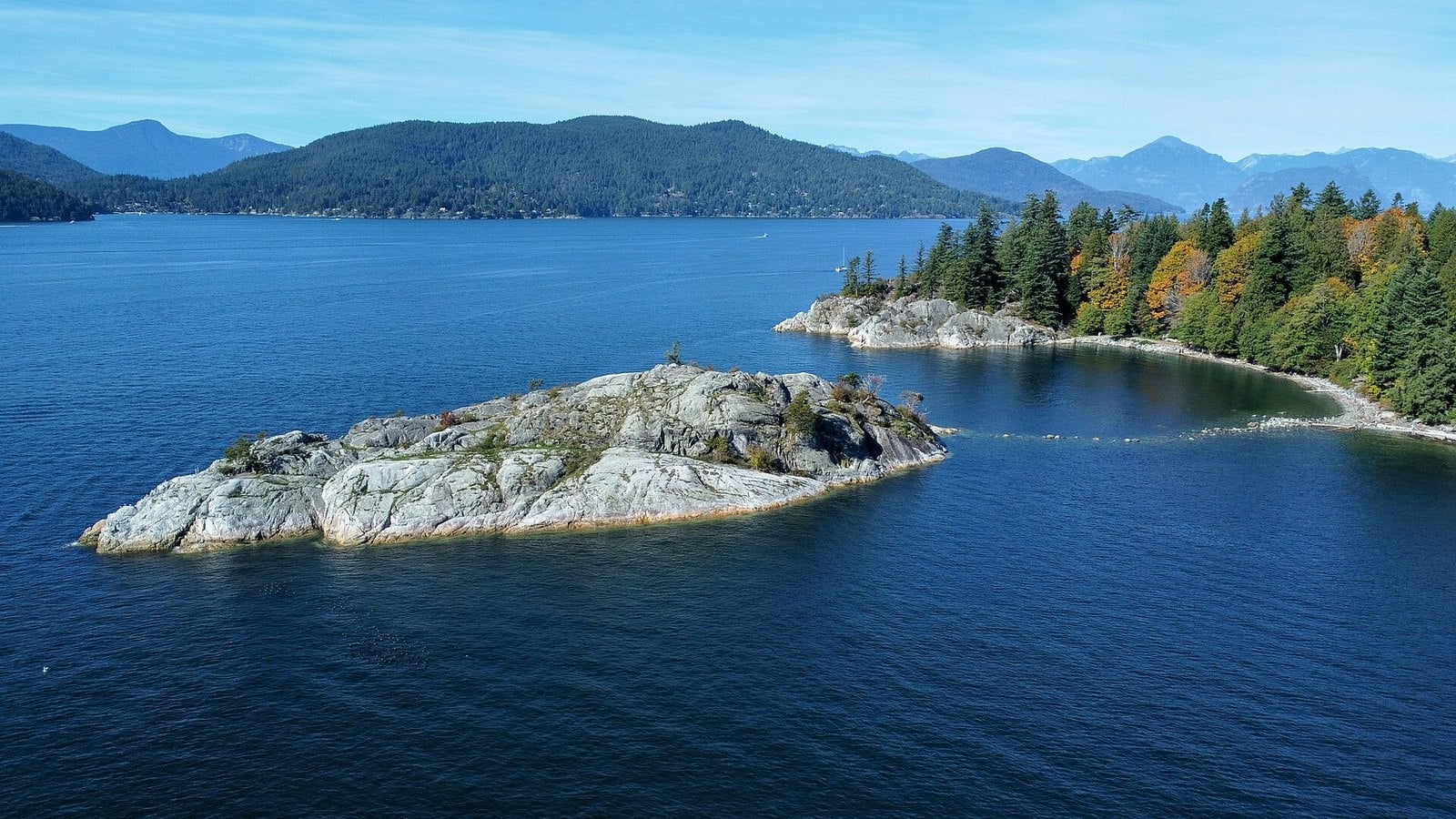
Where: End of the 7000 block of Marine Drive, West Vancouver
When: Year-round; sunset over the islands
Cost: Pay parking 7 am to 10 pm ($3.75/hr plus tax and fees at 2024 launch)
Getting there: Marine Drive west past Horseshoe Bay
Just west of Horseshoe Bay, this rugged corner of Howe Sound is a short walk from the lot. West Vancouver rates the views of Howe Sound and the distant Tantalus Mountains as the main event. Sunset over the islands is the classic time.
The water here is more than scenery. The waters offshore are a designated saltwater Marine Protected Area, and they’re popular with scuba divers. On land, the park covers more than 15 hectares. It has a playground, picnic spots, a swimming beach and tennis courts, which makes it an easy family stop.
Take Marine Drive west past Horseshoe Bay to the end of the 7000 block. Pay parking runs year-round from 7 am to 10 pm daily. The rate was $3.75 an hour plus taxes and a transaction fee when the program launched in 2024. The 2026 rate isn’t confirmed. Pay with PayByPhone (location 28658), hangTag, or a credit card at the pay station if it’s still there (it started as a one-year pilot in Sept 2025). West Vancouver residents can get a free annual parking pass.
Have the app loaded with 28658 before you arrive. Then walk the shoreline paths for a look at Whyte Island and the passing ferries.
4. Spanish Banks (West Point Grey, Vancouver)
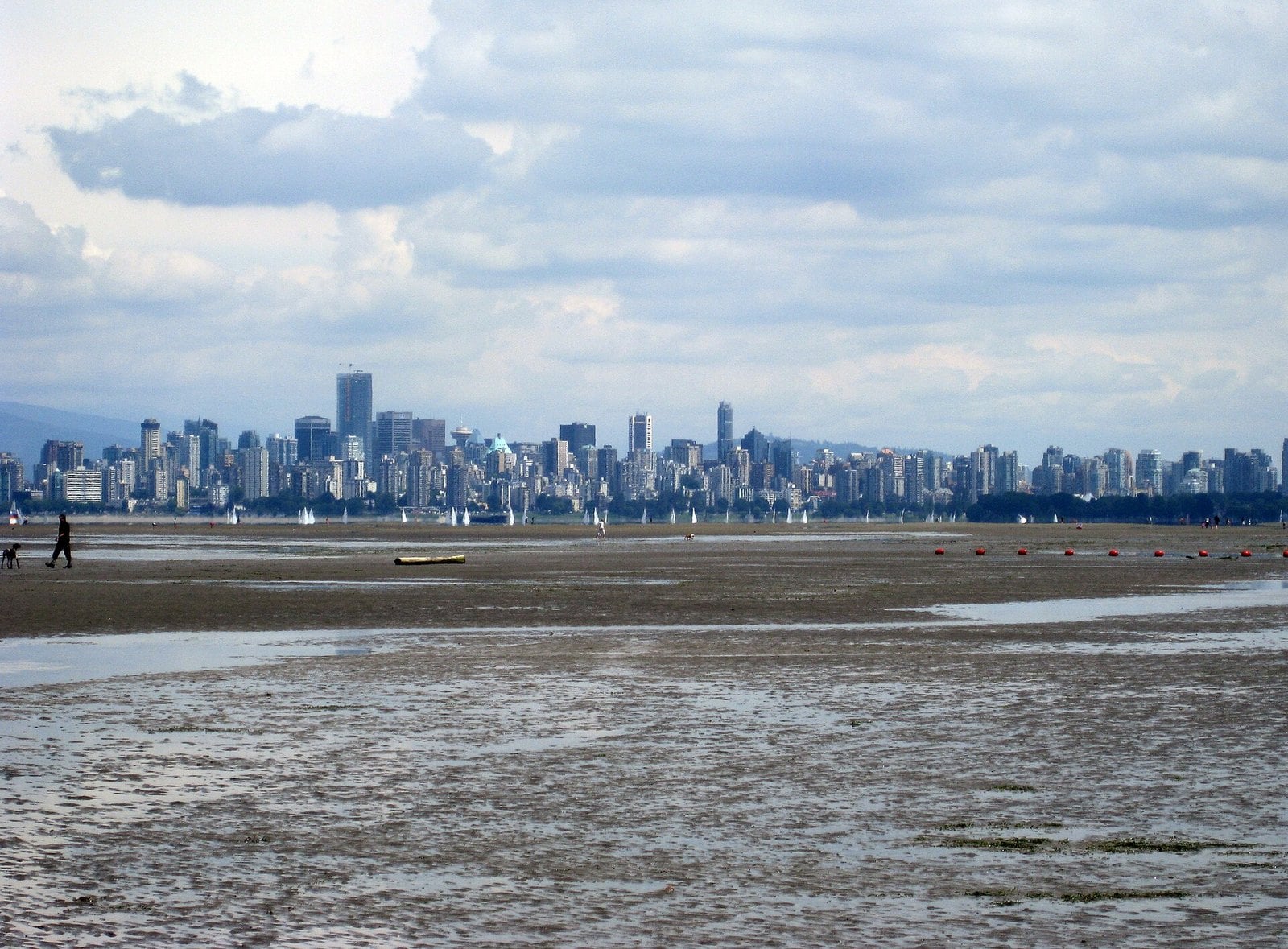
Where: NW Marine Drive, West Point Grey, Vancouver
When: Year-round; sunset and low tide
Cost: Paid parking (rate not confirmed)
Getting there: NW Marine Drive west past Locarno Beach
Here the parking runs right along the beach. You look across English Bay to downtown and the North Shore mountains, and those views are what Spanish Banks is known for. It’s on the seawall route, and it’s calmer than most of the city’s beaches.
Sunset and low tide are the local favourites. Year-round, you can sit in a parked car near the water and watch the skyline light up.
Drive west on NW Marine Drive past Locarno Beach to the Spanish Banks lots. Parking is paid and limited, and the current rate isn’t confirmed on an official page. The lots fill fast on warm summer days. TransLink has a guide to getting there by transit if you’d rather skip the hunt.
Come in the off-season. There’s room to park facing the water, and the evening light arrives earlier.
3. Prospect Point Lookout (Stanley Park)
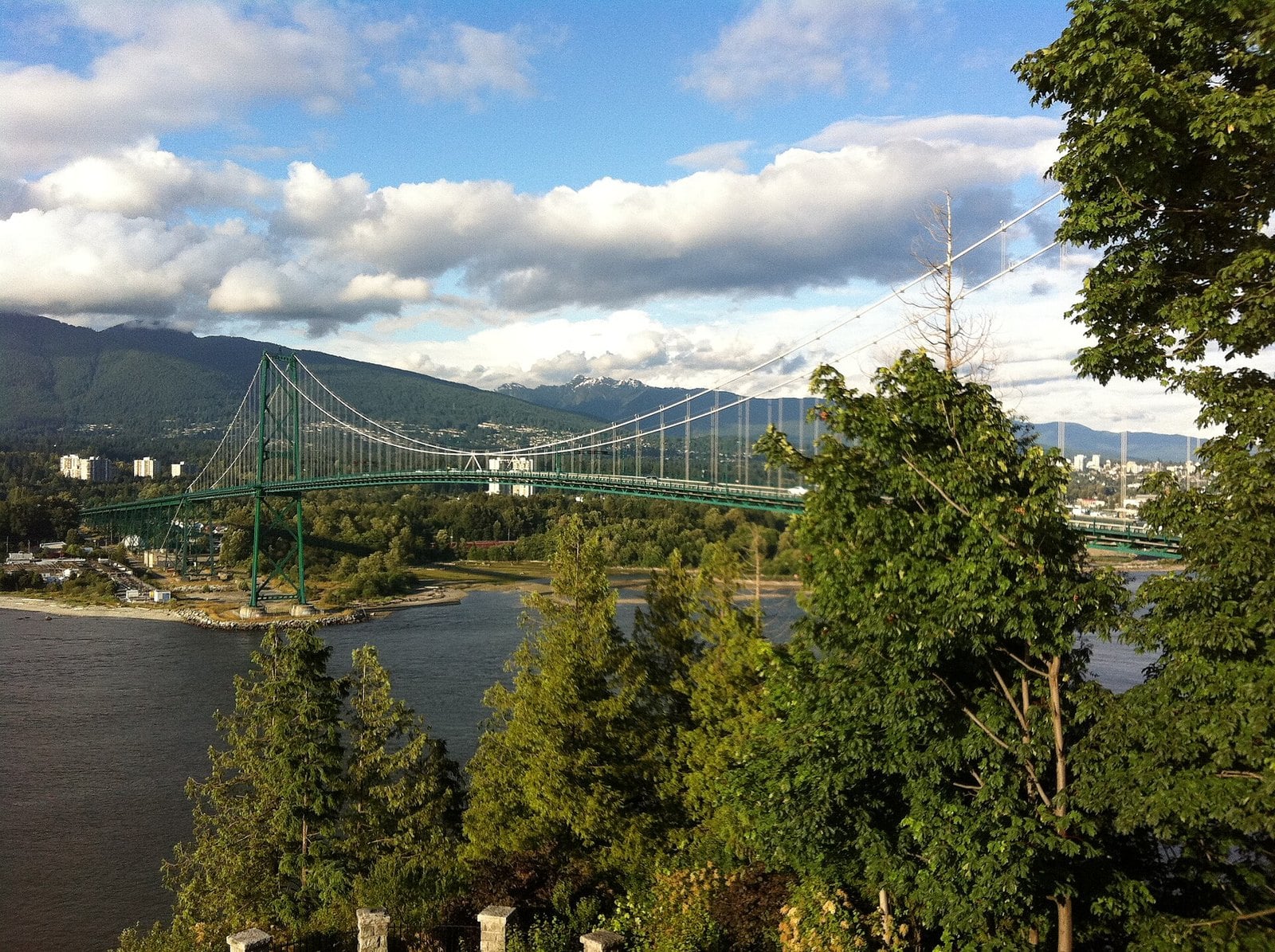
Where: Stanley Park Drive, Vancouver
When: Year-round; late afternoon for photos
Cost: Lookout free; Stanley Park pay parking year-round
Getting there: One-way Stanley Park Drive to the north-end lots
From the north tip of Stanley Park, you look straight across the Lions Gate Bridge to the North Shore. Ships slide under the deck through the First Narrows. Late afternoon light is good for photos.
This point has been about ships for a long time. A two-storey signal station once stood here to warn vessels about strong tides, winds and traffic in the Narrows. Prospect Point’s operator says the bridge’s opening in 1938 turned the point into a destination. The Prospect Point Lighthouse went up in 1948, and a tea room followed.
Drive the one-way Stanley Park Drive to the Prospect Point lots at the north end. The lookout is free. Pay parking runs year-round across the park, including all roadways. The City’s page links to EasyPark for current rates. The Prospect Point Café and Gift Shop are on site.
A daily pass works in any lot or space in Stanley Park, so buy one and keep going. Further along Park Drive there’s a lookout above Siwash Rock. You can also walk there on the Siwash Rock Trail from Prospect Point.
2. Queen Elizabeth Park (Little Mountain, Vancouver)
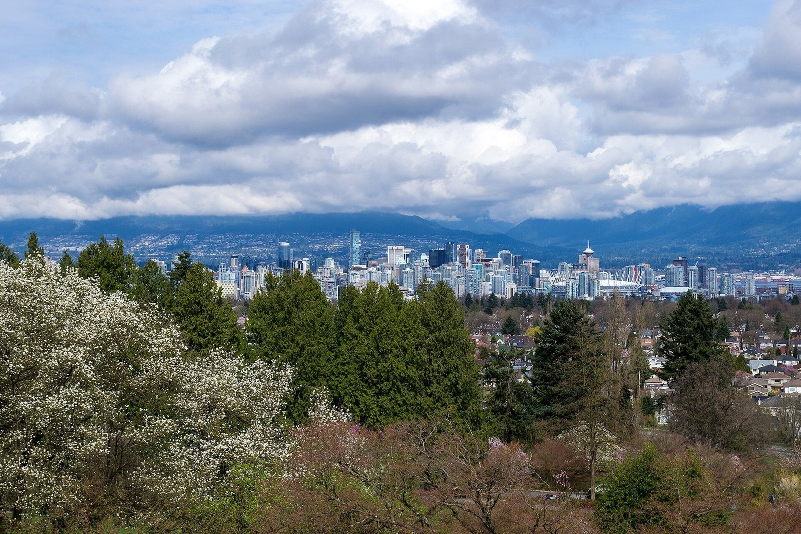
Where: Cambie St and W 33rd Ave, Vancouver
When: Year-round; spring and summer for gardens
Cost: Paid parking: $3.50/hr Oct to Mar, $4.50/hr Apr to Sep (2026)
Getting there: About 15 minutes from downtown by car or transit
At 125 m above sea level, this is the top of the city. The plaza beside the Bloedel Conservatory looks north over downtown to the North Shore mountains. The Conservatory’s dome, a tropical garden, sits at the very peak.
Below the plaza, the Quarry Gardens fill what used to be basalt quarries. They were later turned into gardens. Spring and summer bring the most colour. The quarry landscaping still makes a good winter walk, and clear evenings bring sunset light over the skyline.
The City puts the park 15 minutes from downtown by car or transit, at Cambie Street and West 33rd Avenue. Pay lots are spread through the park, with some pay parking along the park road. Under the Park Board’s 2026 schedule, Lot 67 costs $3.50 an hour from Oct 1 to Mar 31 and $4.50 an hour from Apr 1 to Sep 30. The posted meter rate is what counts.
Most paths are paved. There are accessible entrances, parking and washrooms near the Conservatory and Seasons in the Park. Park in the lot by the Conservatory and you’re steps from the plaza. If it’s pouring, the Conservatory is your indoor backup. It has its own admission and hours.
1. Barrett’s View (Cypress Provincial Park)
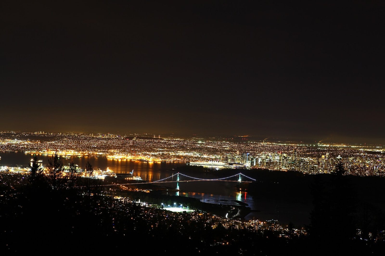
Where: Cypress Bowl Road, West Vancouver
When: Clear days for Vancouver Island; evenings for city lights (road closed 11 pm to 7 am in winter)
Cost: No BC Parks fee
Getting there: Hwy 1/99 to Exit 8, then up Cypress Bowl Road
Partway up Cypress Bowl Road, a paved lot opens onto a small lawn with picnic tables and benches facing south. BC Parks describes it mainly as a lookout over Vancouver, the Fraser Valley and the south end of Vancouver Island. An older park planning report called it the most visited site in the park. On a clear day you can see why.
Many people still call it Hi-View or Highview. In 2010 the province renamed it Barrett’s View for Dave Barrett. As an MLA in 1964, he pushed to protect Cypress Bowl. His government made Cypress a Class A provincial park in 1975. A commemorative plaque at the lookout tells the story, and it’s worth the two minutes.
Take the Upper Levels Highway to Cypress Bowl Road at Exit 8 and drive up. Tourism North Shore puts the park about 25 minutes from downtown. There are no BC Parks fees. The province began repaving 12 km of the road on July 13, 2026, and estimated it would finish by the end of October. Winter tires are required on Cypress Bowl Road from Oct 1 to Apr 30. BC Parks’ current winter advisory also closes the road north of Chippendale Road from 11 pm to 7 am, so finish city-lights visits well before 11. Check DriveBC before you head up. Expect weekend and holiday congestion in ski season.
The paths are paved, but the BC Parks Explorer listing notes areas of severe root upheaval. The benches sit right at the edge of the paved path, so you can take in the view without going further. Bring lunch. Quarry Lookout, also on the road, has a second picnic area.
| Stop | Distance |
|---|---|
| Porteau Cove | 38 km north of Vancouver |
| Shannon Falls | ~58 km north of Vancouver; 2 km south of Squamish |
| Tantalus Lookout | 19 km north of Squamish |
| Brandywine Falls | 47 km north of Squamish |
When to go
- Winter tires are required on Mount Seymour Road from Oct 1 to Mar 31, and on Cypress Bowl Road from Oct 1 to Apr 30. On the Sea to Sky, the RCMP’s 2025 notice lists Oct 1 to Mar 31, but the province says requirements on routes through mountain passes and high-snowfall areas can run to Apr 30. Follow the posted signs and check the province’s route map.
- From November to April, Mount Seymour Road closes from 10 pm to 7 am daily, and the gate above P2 is closed from dusk to dawn.
- BC Parks’ winter advisory closes Cypress Bowl Road north of Chippendale Road from 11 pm to 7 am.
- Mount Seymour may require free day-use passes from mid-December to late March. The 2026/27 dates aren’t posted yet.
- Porteau Cove runs reduced winter services from Nov 12 to Feb 28.
- The City of Burnaby’s park page says the Burnaby Mountain parking lot will be closed Nov 9 to 13 for upgrades; confirm on burnaby.ca before you go.
- The Brandywine Falls gate opens May 1 and closes Oct 31.
- Clear days matter most at Cypress, Seymour and Tantalus. Sunset works best at Whytecliff, Spanish Banks, Burnaby Mountain and Queen Elizabeth Park.
Paying for parking
The rates confirmed so far are listed with each stop. At Whytecliff, save PayByPhone location 28658 before you arrive, or use the credit-card pay station. Stanley Park charges year-round, and a daily pass works anywhere in the park. The BC Parks brochures for Cypress and Mount Seymour list no park fees. Rates at Spanish Banks and the Cleveland Dam lot aren’t confirmed on official pages, and neither are the rules at the Sea to Sky stops. Read the signs when you pull in.
What to bring
- Legal winter tires for Cypress, Seymour and the Sea to Sky.
- A parking app, with the location number saved.
- A picnic. There are picnic grounds at Barrett’s View and Quarry Lookout on Cypress, plus picnic areas at Burnaby Mountain, Cleveland Dam and Whytecliff.
- Warm layers and a headlamp for sunset stops. It gets cold fast once the light goes.
- A printed or screenshotted Seymour day pass if passes are required, since cell service may be limited.
Etiquette and safety
- Park only in marked spots. Illegally parked cars are towed at Porteau Cove, and the highway has to stay clear at Brandywine.
- Leave nothing visible in the car, especially at Shannon Falls.
- Watch for coyotes and deer on Mount Seymour Road.
- Leash dogs at Capilano River Regional Park unless signs say otherwise.
- Almost every stop here is a drive-up view; Brandywine needs a 10 to 20 minute walk and is walk-in only until May. If the view tempts you higher at Cypress in winter, know that BC Parks strongly discourages winter travel to Eagle Bluffs and along the Howe Sound Crest Trail past Bowen Lookout. Go prepared, or stay at the lookout.
- Metro Vancouver audibly tests the Cleveland Dam warning sirens monthly; a siren at noon on a scheduled test day (Nov 19 and Dec 17 were the dates listed when we checked) is not an emergency.
Getting there
The city stops are close. Queen Elizabeth Park is about 15 minutes from downtown by car or transit, and Spanish Banks and Prospect Point are a short drive across town. On the Shore, Cypress is about 25 minutes from downtown via Exit 8, and Mount Seymour is about 30 minutes via the Second Narrows Bridge. Cleveland Dam is off Highway 1 at exit 14. The Sea to Sky stops line up along Highway 99, from Porteau Cove at 38 km north of Vancouver to Brandywine at 47 km north of Squamish. The distance table shows the full spacing. Before any mountain drive, check DriveBC.
| Place | What to know |
|---|---|
| Mount Seymour Road | Closed 10 pm to 7 am daily, November to April |
| Burnaby Mountain | Open dawn to dusk; main lot closes 10 pm |
| Whytecliff Park | Pay parking 7 am to 10 pm, year-round |
| Capilano River Regional Park | Generally open during daylight; gates locked at closing |
| Porteau Cove | Day use until 10 pm (operator) or 11 pm (BC Parks); plan for 10 pm |
| Shannon Falls | Lot gate closed 10 pm to 7 am |
| Brandywine Falls | Gate open May 1 to Oct 31 only |
Pick your view by the weather. On a grey day, stay low at Queen Elizabeth Park, Prospect Point or Spanish Banks. When the sky clears, go up Cypress or Seymour, or point the car up Howe Sound. Check the gate times, pack the winter tires, and leave the car empty. Brandywine will be waiting in May.
Get the weekend plan in your inbox. Burrard Bulletin is a free email on what’s actually on from Vancouver to Whistler. Sign up here.
Photo credits
- Night View of Vancouver from Cypress Mountain (8372785006).jpg by GoToVan, CC BY 2.0 (combined into a montage, cropped). Via Wikimedia Commons.
- Vancouver from Queen Elizabeth Park.jpg by Xicotencatl, CC BY-SA 4.0 (combined into a montage, cropped). Via Wikimedia Commons.
- Lions Gate Bridge from Prospect Point, Stanley Park, Vancouver BC.jpg by Sam, CC BY 2.0 (combined into a montage, cropped). Via Wikimedia Commons.
- Kamui Mintara Totems.jpg by Jeff Hitchcock from Vancouver, BC, Canada, CC BY 2.0 (combined into a montage, cropped). Via Wikimedia Commons.
- Mt. Seymour Resorts – panoramio.jpg by Weixi Zeng, CC BY-SA 3.0 (resized). Via Wikimedia Commons.
- Whytecliff Park, West Vancouver.jpg by Northwest, CC BY-SA 4.0 (resized). Via Wikimedia Commons.
- Cleveland Dam (5310797483).jpg by Guilhem Vellut from Annecy, France, CC BY 2.0 (resized). Via Wikimedia Commons.
- Vancouver from Spanish Banks (2603586621).jpg by Ruth Hartnup from Vancouver, Canada, CC BY 2.0 (resized). Via Wikimedia Commons.
- Porteau Cove Provincial Park 02.jpg by Natulive Canada, CC BY-SA 4.0 (resized). Via Wikimedia Commons.
- Shannon Falls Provincial Park 04.jpg by Natulive Canada, CC BY-SA 4.0 (resized). Via Wikimedia Commons.
- Tantalus Range.jpg by The original uploader was Geographer at English Wikipedia., CC BY 1.0 (resized). Via Wikimedia Commons.
- Brandywine Falls Whistler.jpg by Kaden Van Buren, CC BY-SA 4.0 (resized). Via Wikimedia Commons.
