
13 Scenic Winter Drives Within Two Hours of Vancouver
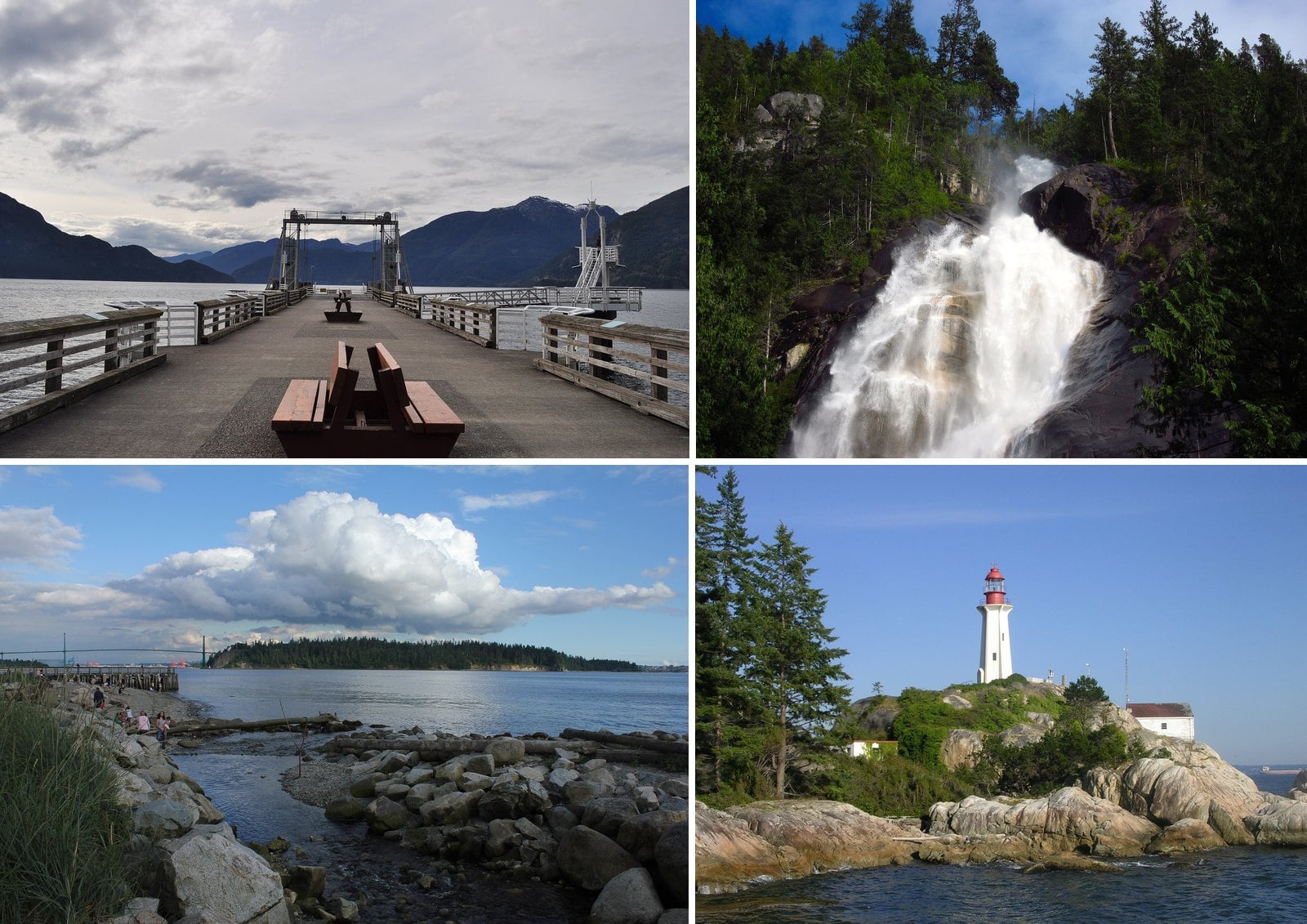
Winter is when a lot of people stop driving anywhere for fun. The rain sets in, the mountains disappear and the ski traffic takes over the Sea to Sky. That leaves some of the best scenery around Vancouver to the people who still go out: Howe Sound under low cloud, waterfalls running hard, eagles on the Harrison River and empty piers on the Shore.
This guide covers drives that work between November and March. They run along Howe Sound and up to Whistler, across West Vancouver’s waterfront and up Cypress Bowl Road, out the Fraser Valley to Harrison and Hope, over to Gibsons on the Langdale ferry and down to the South Surrey shoreline. Each stop includes what you’ll see, why it’s there, how to get in and what’s closed this season.
Winter also changes the rules of the road. From October 1 to April 30, drivers anywhere in BC have to obey winter tire and chain signs. Many coastal routes in the Lower Mainland don’t require winter tires, but the Sea to Sky and Cypress Bowl Road do. Check the tire rules for each road before you go.
| Road | When winter tires are required | Who says so |
|---|---|---|
| BC highways with winter tire and chain signs | October 1 to April 30. On some highways outside mountain passes and high-snowfall areas, the requirement ends March 31. | Province of BC |
| Sea to Sky Highway, from just north of Horseshoe Bay | October 1 to March 31 | Squamish RCMP |
| Cypress Bowl Road | October 1 to April 30 | Cypress Mountain |
13. Chilliwack Lake Road (Chilliwack River Valley)
Where: Chilliwack River Valley, east of Vedder Crossing
When: Dry, clear days only. The park gate is closed October to May.
Cost: No day-use fee listed by BC Parks
Getting there: Highway 1 to Exit 104, Vedder Road, then 40 km on Chilliwack Lake Road
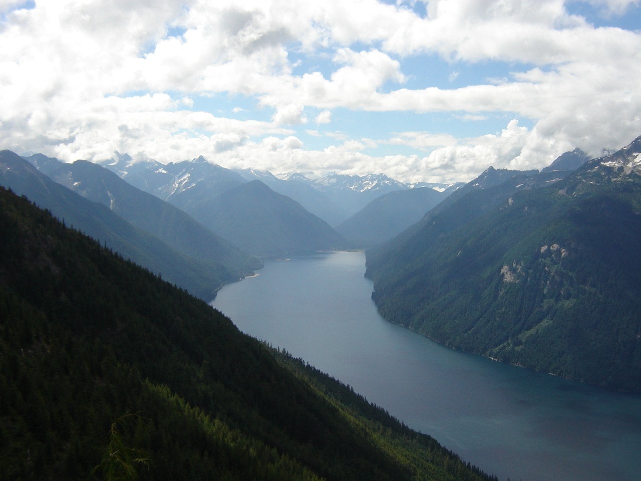
This one is only for good weather. BC Parks puts Sx̱ótsaqel/Chilliwack Lake Park 150 km east of Vancouver, at the end of a 40 km road up the valley from Vedder Crossing. The road follows the Chilliwack River into the upper valley.
Take Highway 1 to Exit 104 and follow the Cultus Lake signs. Cross the bridge on Vedder Road, then turn right on Chilliwack Lake Road. The park gate is closed from October to May. Hikers can park at the end of the pavement, not in front of the gate, and walk in on the park road or the Trans Canada Trail.
BC Parks warns of frequent severe afternoon winds on the lake and dangerous currents at the outflow. BC Parks allows hunting with firearms in the park during open season. It also says there’s no cell reception past the On the Way store on Chilliwack Lake Road. Skip it after snow, and check DriveBC and the park page first.
12. Chainsaw carvings and the Rambo tour (Hope)
Where: Hope, at the junction of Highways 1, 3, 5 and 7
When: All year for the town. The Othello Tunnels are closed in winter.
Cost: Self-guided maps are available at the Visitor Centre
Getting there: Highway 1 east to Hope. Maps are at the Visitor Centre, 919 Water Avenue.
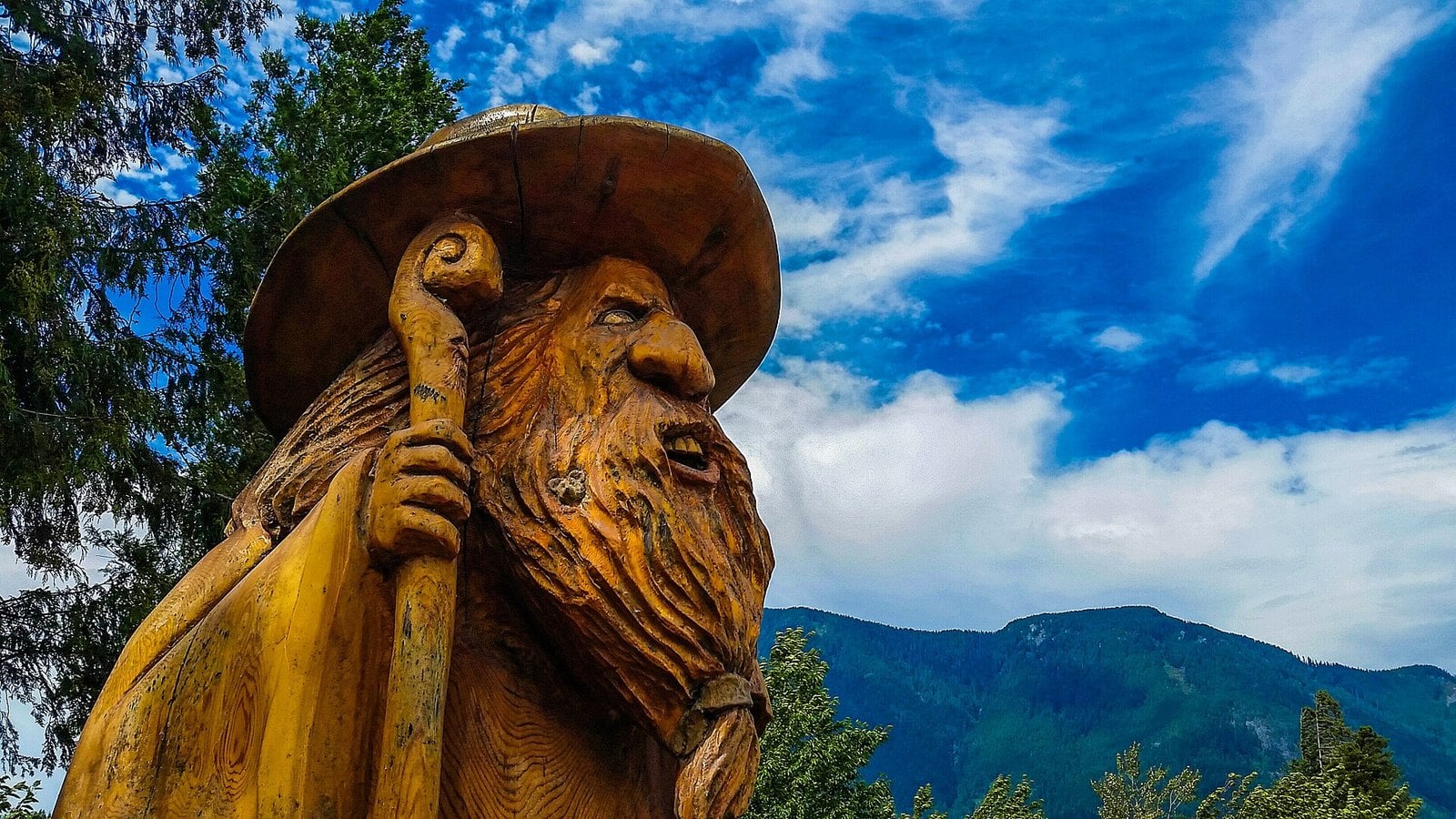
Highway 1 east ends up in Hope, where Highways 1, 3, 5 and 7 meet. Tourism Hope Cascades and Canyons counts more than 80 chainsaw carvings around the town centre. Pick up the self-guided map at the Visitor Centre, 919 Water Avenue.
Hope also has a film history. In 1981, Sylvester Stallone and his crew filmed Rambo: First Blood here. The tourism office runs a self-guided walking tour of the locations.
Two things to know before you go. Some Rambo-themed displays have been put away for winter in past years, so check with the Visitor Centre before you go. The Othello Tunnels in nearby Coquihalla Canyon Park are closed in winter. BC Parks cites unstable conditions, falling rocks and ice.
11. Harrison Hot Springs lakefront (Harrison Hot Springs)
Where: Esplanade Avenue, Harrison Hot Springs
When: All year
Cost: Free to walk the beach. Village pay parking may apply; check harrisonhotsprings.ca/payparking
Getting there: Highway 1 to Highway 9 north via Agassiz, or Highway 7 to Highway 9
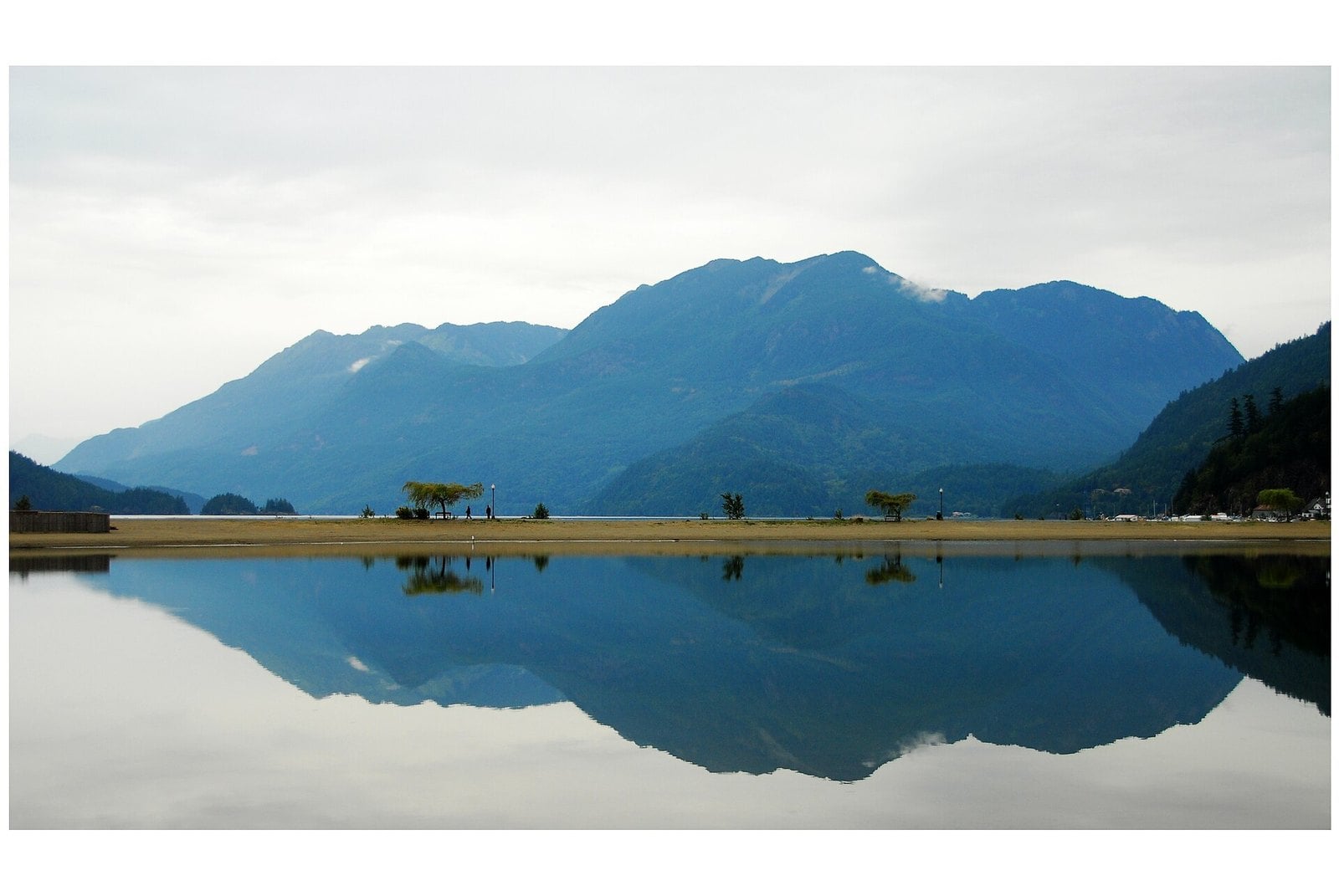
The Village of Harrison Hot Springs says Harrison Lake is the largest lake in the southern Coast Mountains. It’s fed by glaciers, about 60 km long and almost 9 km across at its widest. In winter you get grey water, snow on the peaks and a mostly empty beach.
A path circles the lagoon on the village beach. Walkers, joggers and dog owners all use it, so this works as a stop with kids or a dog. The village warns that conditions on the lake can change fast, with strong gusts. Details are on the village’s Harrison Lake page.
Don’t count on a soak. The resort-run public mineral pool was closed for renovations as of April 27, 2026, and it hasn’t been confirmed whether it has reopened. Treat this as a lakeside walk and a lunch stop, and pair it with the eagles at Harrison Mills.
10. The Sea to Sky to Whistler (Whistler)
Where: Highway 99, Squamish to Whistler
When: Blackcomb opens November 20, 2026. Whistler Mountain opens November 25, 2026. Both depend on conditions.
Cost: Sightseeing tickets are sold by Whistler Blackcomb; check its site for current prices
Getting there: Highway 99 north, roughly 2 hours in winter according to Whistler Blackcomb
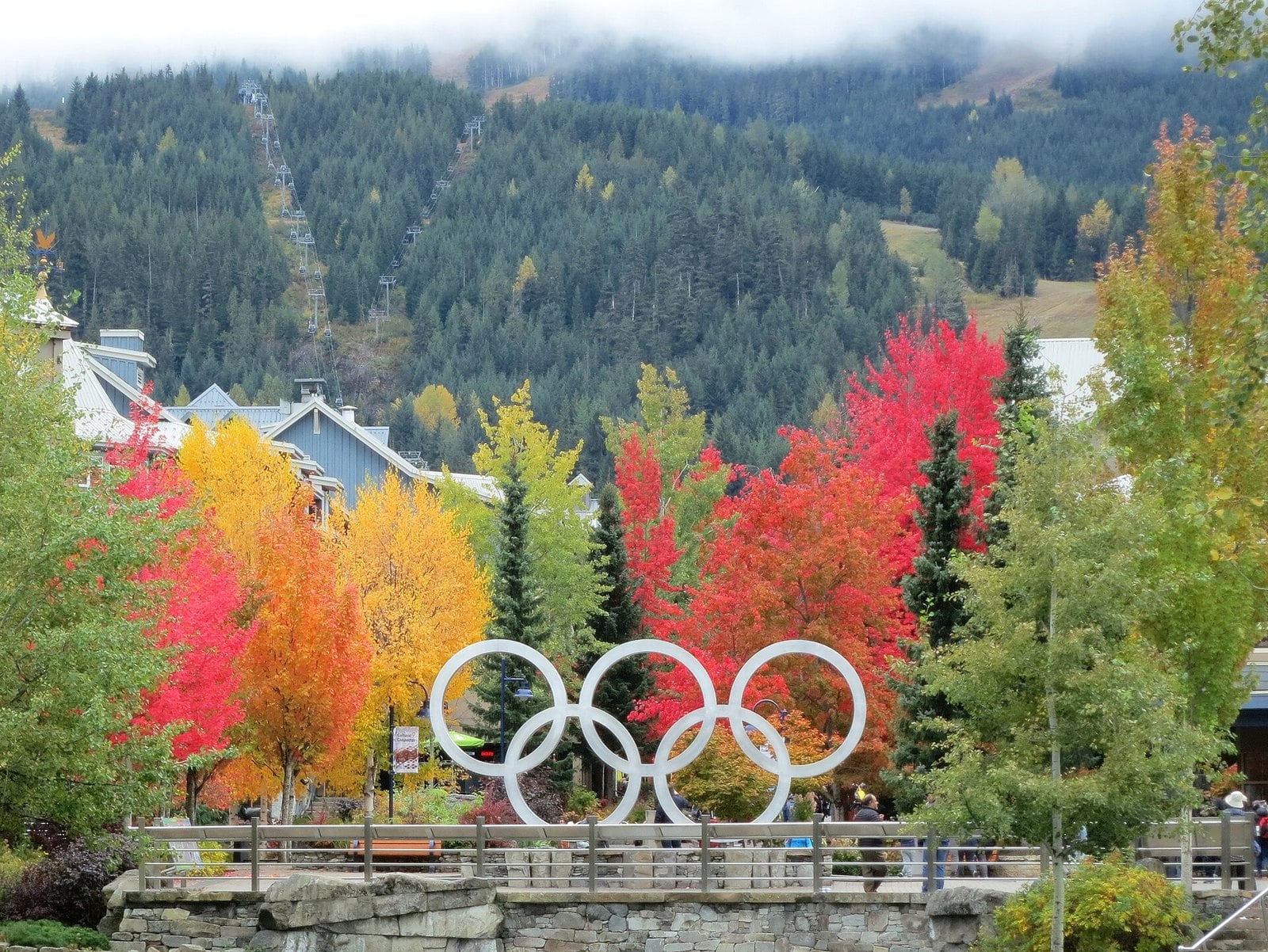
This is the full run of Highway 99, past Howe Sound and Squamish and up into the mountains. Whistler Blackcomb puts the winter drive from Vancouver at roughly two hours. That makes it the far edge of a day trip, and the drive itself is a big part of the reason to go.
You don’t need to ski to make the trip worthwhile. Tourism Whistler says mountain sightseeing runs from opening day to mid-April. The resort’s schedule has Blackcomb opening November 20, 2026, and Whistler Mountain opening November 25. The resort says dates depend on conditions. Lifts are planned to run 9 am to 3:30 pm from opening day to January 15, and sightseeing hours are 10 am to 3:30 pm. Hours and dates are on the Whistler Blackcomb hours page.
Expect a delay near town. DriveBC lists single-lane alternating traffic for wildfire fuel-reduction work near Nordic Drive, 6 am to 7 pm daily until December 31.
Brandywine Falls’ parking lot is gated in winter, and parking outside the gate on the highway is prohibited, so don’t plan it as a stop. Winter tires are required north of Horseshoe Bay.
9. White Rock pier and promenade (White Rock)
Where: Marine Drive, White Rock
When: All year. Winter parking rates run November to February.
Cost: $1.25 for 20 minutes or $3 an hour in winter. Parkades are $9 a day.
Getting there: Highway 99 south to the White Rock exit, then down to Marine Drive
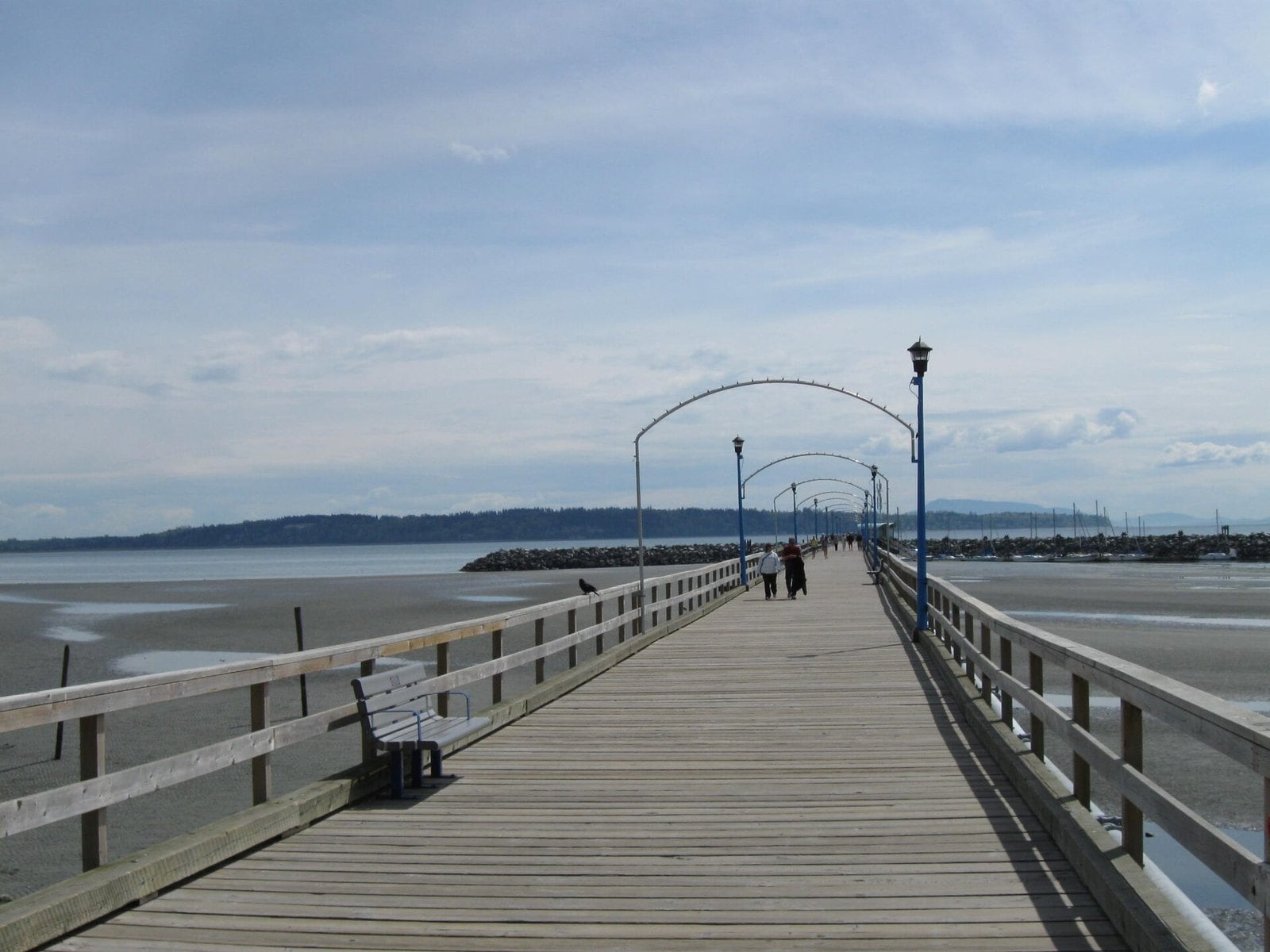
White Rock’s waterfront drive ends at the city’s long wooden pier and the beachfront promenade. It’s an easy walk on a dry winter afternoon. It also pairs well with Crescent Beach, which is just up the road.
Waterfront pay parking runs from 10 am to midnight. Winter rates apply November to February, seven days a week. Parking costs $1.25 for 20 minutes or $3 an hour. The Montecito and West Beach parkades charge $9 for the day.
Parking east of Oxford Street has a 4-hour limit, except in the parkades. If you plan to stay longer than that, use a parkade. Rates and rules are on the City of White Rock parking page.
8. Shannon Falls (Squamish)
Where: Highway 99, just south of Squamish
When: All year. Winter services are reduced and snow can limit access.
Cost: No fee listed by BC Parks
Getting there: Highway 99 north. The entrance is on the highway just south of Squamish.
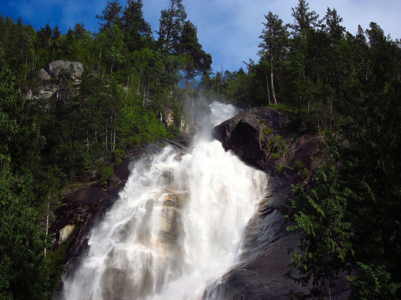
Shannon Falls is the stop right before Squamish, with the park entrance on Highway 99 just south of town. An easy 350-metre trail follows Shannon Creek through western hemlock, Douglas fir and western red cedar to the viewing platforms. It’s a short walk with a big payoff, which makes it an easy stop to fit into a longer drive.
BC Parks keeps the park open in winter with reduced services. Snow can limit access. Trail and stair treads get slippery, and BC Parks warns that ice can fall.
The falls run fullest after a heavy rain. That’s also when the creek can rise suddenly and carry debris. Watch from the platforms. BC Parks says wading in the creek or climbing on the rocks and debris is extremely dangerous.
Check the Shannon Falls park page for current conditions, and wear shoes with grip.
7. Porteau Cove (Howe Sound)
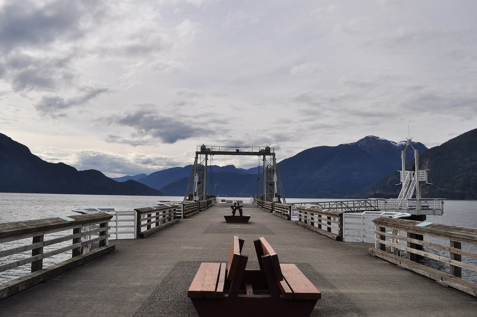
Where: Highway 99, eastern shore of Howe Sound
When: All year. Day-use has limited facilities in winter and closes at 11 pm.
Cost: No day-use fee listed by BC Parks; check the park page before you go
Getting there: Highway 99 north from Horseshoe Bay, 38 km north of Vancouver
The first stretch of the Sea to Sky out of Horseshoe Bay runs right along the edge of Howe Sound. Porteau Cove Provincial Park is on the eastern shore, 38 km north of Vancouver by the park operator’s count. Its waterfront day-use area stays open in winter with limited facilities.
The park has an industrial past. It started as a sand and gravel mine that supplied Vancouver industry. Today the main day-use area holds a BC Ferries emergency pier with a paved walkway. That walkway gives you a level spot to stand and look out over the water.
Stargazing and aurora watching have become popular here. The day-use area closes at 11 pm, and the campground is off-limits for viewing. Check the BC Parks page before a night trip.
Bring your own water. The park operator says drinking water is currently unavailable because of lead. Winter tires are required from the sign just north of Horseshoe Bay.
6. Lighthouse Park and Whytecliff (West Vancouver)
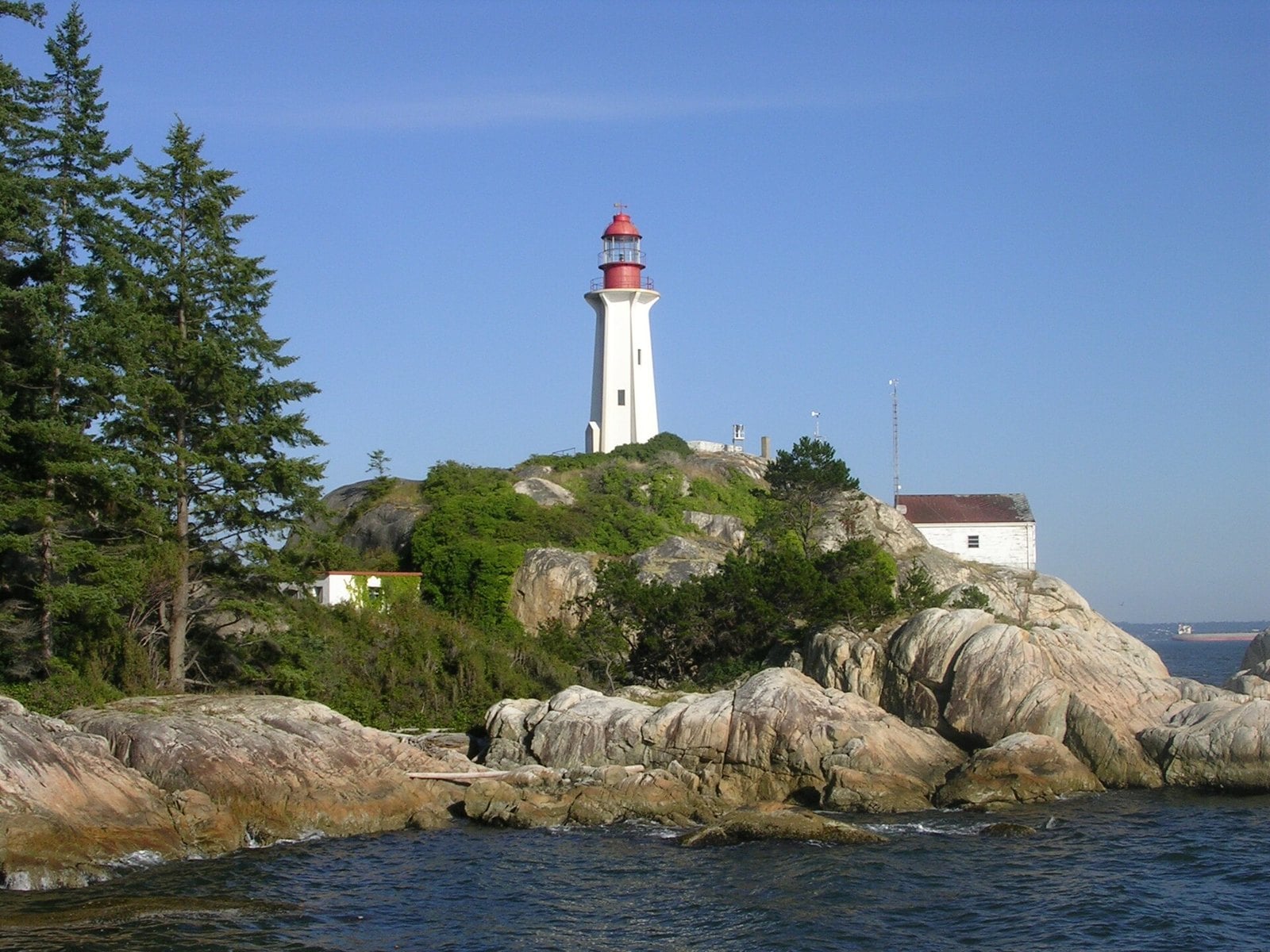
Where: Beacon Lane off Marine Drive, West Vancouver
When: All year, in daylight
Cost: Pay parking 7 am to 10 pm year-round. The rate is $5.08 an hour including taxes.
Getting there: Marine Drive west to Beacon Lane
Keep going west on Marine Drive to Beacon Lane and you reach Lighthouse Park. It covers about 75 hectares. The District of West Vancouver calls it an example of the old-growth coastal forest that still remains in the Lower Mainland. In winter the big trees keep off some of the rain.
The point has been lit for a long time. The first lighthouse at Point Atkinson went up in 1874. The current tower replaced it later. It was named a National Historic Site in 1994. The waters around the park are a Rockfish Protection Area.
Lighthouse Park and nearby Whytecliff Park both have year-round pay parking from 7 am to 10 pm. The District lists the rate as $5.08 an hour including taxes. Go in daylight.
A weekday morning makes parking easier. From here, carry on to Whytecliff and Horseshoe Bay and you’re at the start of the Sea to Sky.
5. Ambleside to Dundarave (West Vancouver)
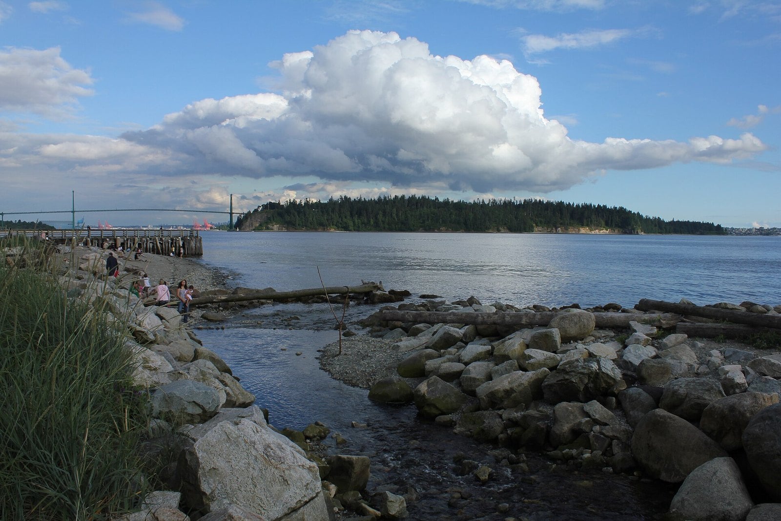
Where: Marine Drive, West Vancouver
When: All year. Winter king tides bring the biggest water.
Cost: Ambleside Park: first 90 minutes free if you start a PayByPhone session (one per licence plate per day), then $2.50 an hour (seasonal rate through 2026). Pay parking runs 7 am to 10 pm.
Getting there: Lions Gate Bridge to Marine Drive, then head west
This is one of the closest drives to downtown. It’s a flat run west along Marine Drive with two piers to stop at. Ambleside looks back at Stanley Park and the Lions Gate Bridge. Dundarave is further west along the same shoreline.
Both piers were badly damaged when a major storm hit during a king tide. The District of West Vancouver says repair work is complete. Both piers are open to the public again.
Winter king tides are the reason to come in this season. They bring big water against the seawall. Watch from a safe distance.
Park once and walk the seawall between the two piers. Then keep driving west on Marine Drive toward Lighthouse Park.
4. Gibsons Landing via the Langdale ferry (Sunshine Coast)
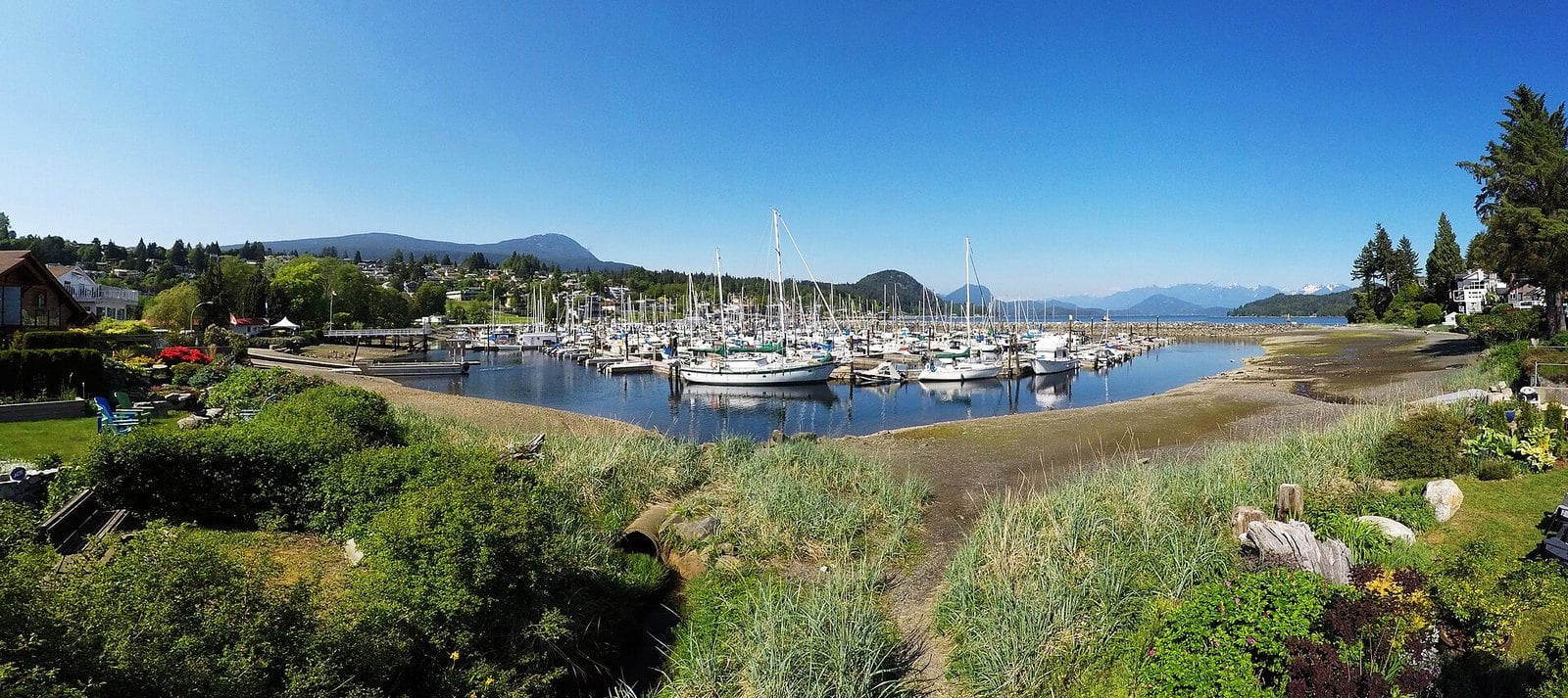
Where: Horseshoe Bay to Langdale ferry, then Gibsons
When: All year
Cost: Saver fares $39 to $59 return for a car and driver on select late-evening sailings (after 9 pm). $30 no-show fee on unused Langdale-to-Horseshoe Bay Savers.
Getting there: Horseshoe Bay terminal, then a 40-minute crossing to Langdale
This drive includes a boat. The ferry from Horseshoe Bay to Langdale takes 40 minutes, and the crossing runs up Howe Sound. Gibsons is a short drive from the Langdale terminal.
In Gibsons, the Town’s Heritage Walk follows the working harbour and the public wharf to Molly’s Reach. The building dates from 1936. It was a regular filming location for The Beachcombers. Find the route on the Town of Gibsons Heritage Walk page.
Fares can be cheaper than you’d expect. On select sailings, Saver fares from Horseshoe Bay to Langdale run $39 to $59 return for a standard car and driver. BC Ferries says Savers are offered on less busy sailings, specifically late-evening departures after 9 pm, and they’re expected to sell out. Select Saver sailings from Langdale back to Horseshoe Bay are $0 for under-height vehicles. A $30 no-show fee applies if you don’t use a Langdale-to-Horseshoe Bay Saver.
Check the schedule before you go. BC Ferries moved the 5:30 pm Horseshoe Bay to Langdale sailing to 6:10 pm in the off-peak season.
3. Cypress Bowl Road and Highview Lookout (West Vancouver)
Where: Cypress Bowl Road, West Vancouver
When: All year. Winter tires are required October 1 to April 30.
Cost: No fee listed to drive the road or stop at the lookout
Getting there: Lions Gate Bridge, Taylor Way to Highway 1, then west to Exit 8
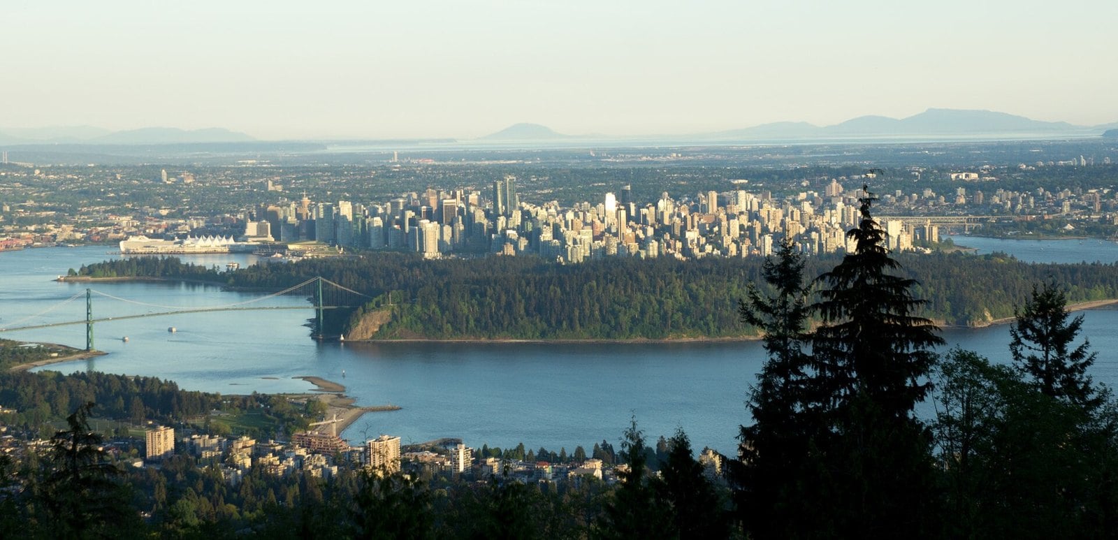
Cypress Bowl Road climbs from Highway 1 to the Cypress Mountain ski area. It runs 13 km to the Nordic area and 15 km to the downhill area. The main reason to drive it without skis is Highview Lookout, at the second hairpin turn.
From the lookout you look down on the Lions Gate Bridge, Stanley Park and the west side of Vancouver. On a clear day you can see Mount Baker in Washington. There are picnic tables at the lookout.
Go at dusk to watch the city lights come on. Cypress Mountain says winter tires are required on the road from October 1 to April 30. Check road conditions before you go after a snowfall.
2. Crescent Beach and Blackie Spit (South Surrey)
Where: Crescent Beach, South Surrey
When: All year. Winter is waterfowl season.
Cost: No fee listed by the City of Surrey. The park is open dawn to dusk, and the parking lot gate closes at 10 pm.
Getting there: Highway 99 south to Crescent Road, then west to Crescent Beach
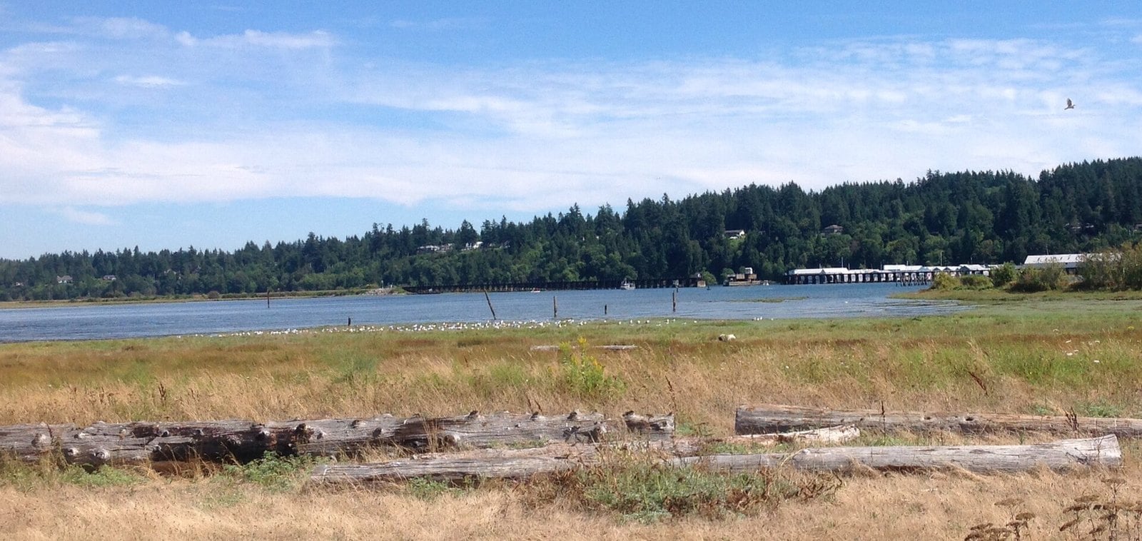
Winter is the season this spot is known for. The City of Surrey calls Blackie Spit one of the top birdwatching areas in Canada, with hundreds of species recorded each year. It sits on the Pacific Flyway and is an Important Bird Area in the Fraser River Estuary.
Migrating and wintering waterfowl rest and feed on the sandy spit, in the tidal marsh and in the eelgrass beds. Look up from the birds and you’re looking over Mud Bay to the North Shore Mountains.
Take Highway 99 south to Crescent Road, then head west to Crescent Beach. Bring binoculars. Birds generally move closer to shore near high tide. Park details are on the City of Surrey page.
1. Harrison Mills eagles and Kilby (Fraser Valley)
Where: Lougheed Highway (Hwy 7), Harrison Mills
When: Eagles October to January. Kilby is open weekends November 7 to December 13, 2026.
Cost: Kilby museum admission is $16 for adults. Check Tourism Harrison for eagle-viewing details.
Getting there: Highway 7 east through Mission. Eagle viewing starts at the Sandpiper lot, 14282 Morris Valley Road.
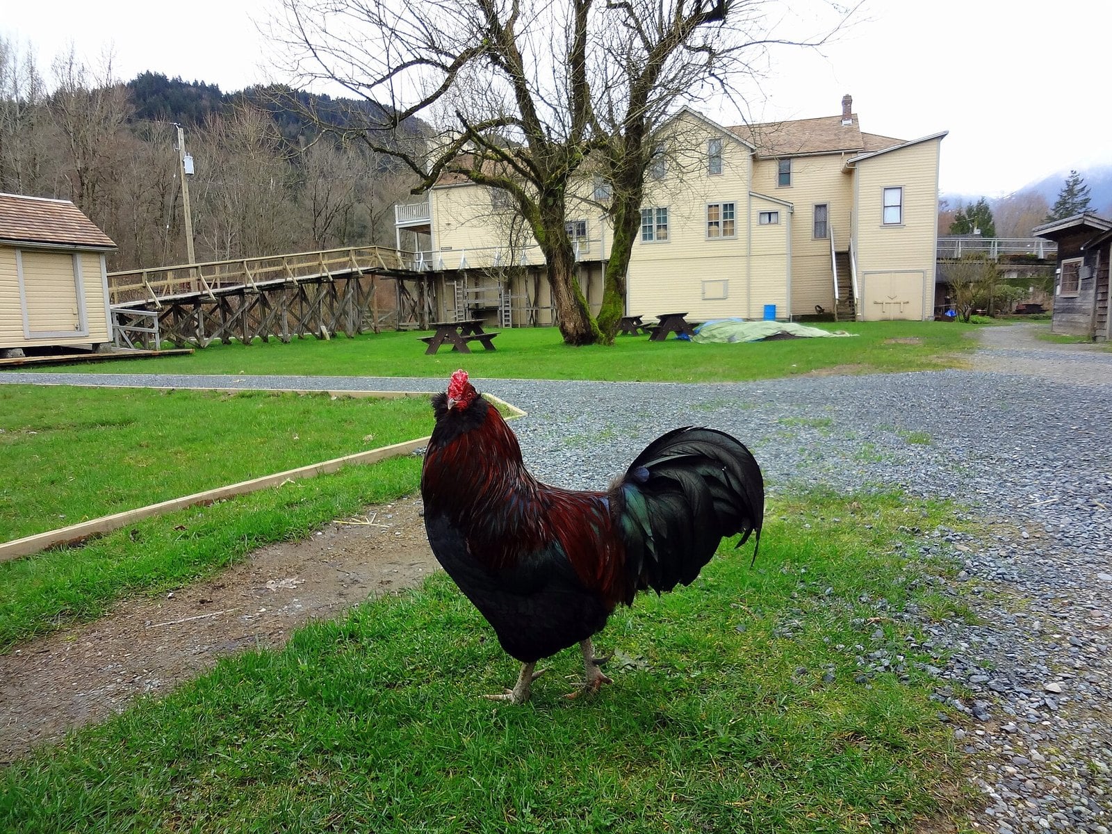
Highway 7 runs east through Mission to Harrison Mills, and in winter there’s a clear reason to make the drive. Tourism Harrison says salmon return to spawn in the Harrison River from October to January. Tens of thousands of bald eagles come to feed on them.
Park at the Sandpiper lot at 14282 Morris Valley Road. Follow the eagle signs across Elbow Creek to the viewing gazebo. Stay on the marked trail. Details are on the Season of the Wild page.
Kilby Historic Site is close by. Its museum, café and gift shop are open Saturdays and Sundays from November 7 to December 13, 2026. The café and gift shop hours are 10 am to 4 pm. Kilby then closes until spring 2027, though eight first come, first served campsites stay available through the winter after the main campground closes on November 16. Check Kilby’s hours before you go.
| Route | Figure |
|---|---|
| Vancouver to Porteau Cove | 38 km |
| Vancouver to Whistler (winter) | roughly 2 hours |
| Cypress Bowl Road, Hwy 1 to Nordic / downhill areas | 13 km / 15 km |
| Horseshoe Bay to Langdale ferry | 40 minutes |
| Vancouver to Chilliwack Lake Park | 150 km (40 km from Vedder Crossing) |
Winter tire rules
- Drivers must obey winter tire and chain signs across BC from October 1 to April 30. On some highways that don’t cross mountain passes or high-snowfall areas, the requirement ends March 31.
- Squamish RCMP say tires are required on the Sea to Sky from October 1 to March 31, starting just north of Horseshoe Bay. Some other sources give later dates, so follow the roadside signs.
- Cypress Mountain says winter tires are required on Cypress Bowl Road from October 1 to April 30.
- A legal winter tire has at least 3.5 mm of tread and either the M+S mark or the three-peaked mountain and snowflake symbol. The province’s winter tire page has the details.
- Chains over summer tires don’t meet BC’s winter tire requirement.
- RCMP say drivers without proper tires can be turned away or fined $121 to $598.
Closed this winter
- The Othello Tunnels in Coquihalla Canyon Park are closed in winter.
- The Chilliwack Lake Park gate is closed October to May.
- Kilby Historic Site’s museum and café are closed for the season from December 14, 2026. Their last open day is Sunday, December 13.
- The Harrison public mineral pool was closed for renovations as of April 27, 2026. Its current status is unconfirmed.
- Brandywine Falls’ parking lot is gated in winter, and parking outside the gate on Highway 99 is prohibited.
Storms, slides and roadwork
On November 10, 2026, the province warned of pooling water, fallen debris and short-notice closures during a heavy rainstorm. Highway 99 through the Sea to Sky corridor and Pemberton Valley, and Highway 1 through the Fraser Valley and Fraser Canyon, were named among the routes most likely to be affected. Check DriveBC the morning you leave, and again before you head home.
On Highway 99 near Nordic Drive in Whistler, single-lane alternating traffic runs 6 am to 7 pm daily until December 31. At Shannon Falls, BC Parks warns of slippery stairs and falling ice in winter.
When to go
- Harrison River salmon and eagles: October to January.
- Kilby: weekends from November 7 to December 13, 2026.
- Whistler Blackcomb: Blackcomb opens November 20, 2026, and Whistler Mountain opens November 25. Sightseeing runs to mid-April.
- White Rock winter parking rates: November to February.
- Shannon Falls: the day after heavy rain, from the platforms only.
- Ambleside and Dundarave: winter king tides, from a safe distance.
- Blackie Spit: winter, for wintering waterfowl.
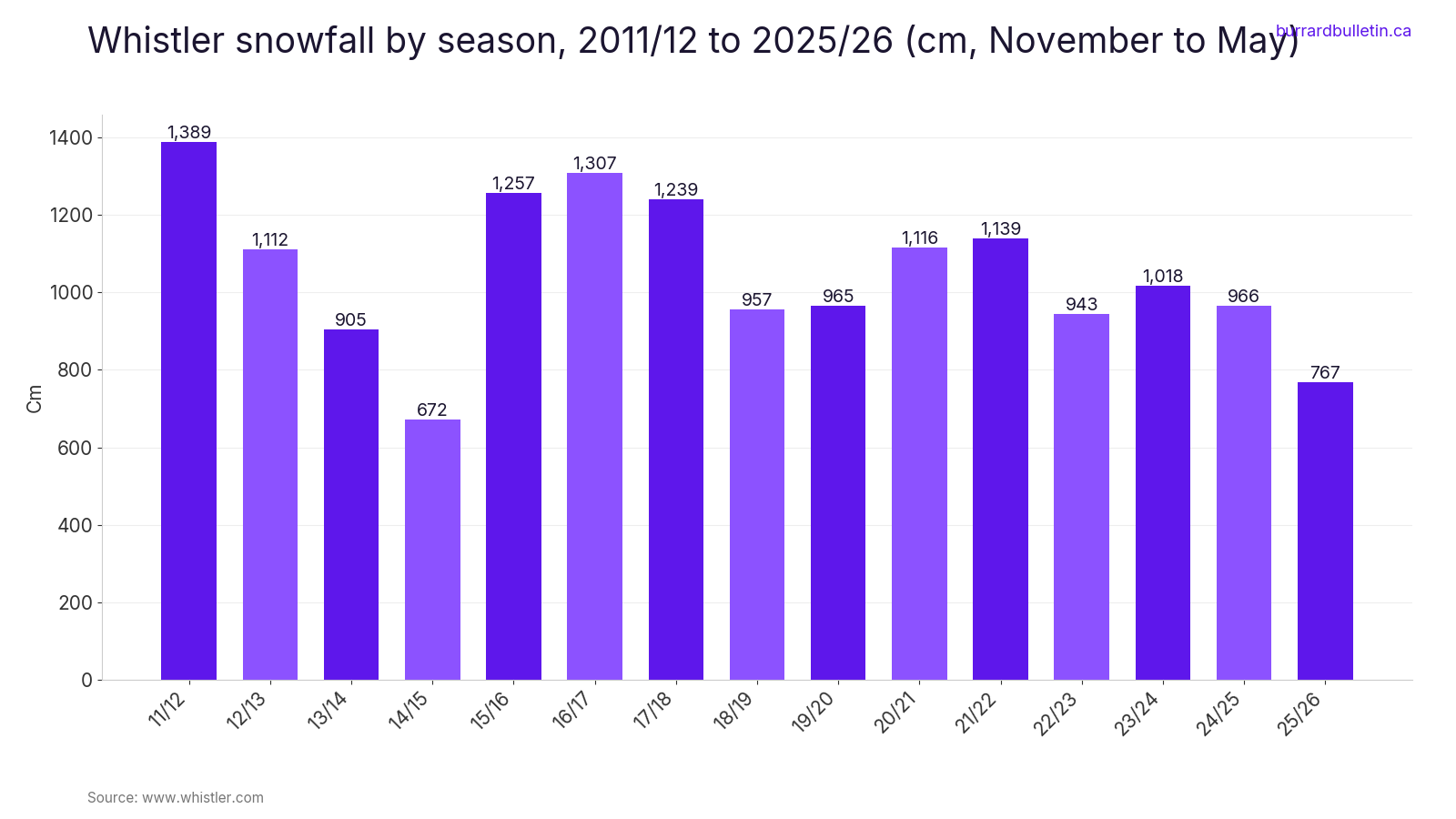
The chart below shows how much snow Whistler has had each season. It gives you a sense of what the upper Sea to Sky can look like by midwinter.
What to bring
- Legal winter tires for the Sea to Sky and Cypress Bowl Road.
- Your own drinking water for Porteau Cove, where the tap water is off because of lead.
- Shoes with grip for the stairs and trail at Shannon Falls.
- Binoculars for Blackie Spit and the Harrison River eagles.
- A phone or card for pay parking in West Vancouver and White Rock.
- A full tank and warm layers for the Chilliwack River Valley, where BC Parks says there’s no cell reception past the On the Way store.
Etiquette and safety
Stay on the marked trail at the Harrison eagle viewing area and follow the eagle signs to the gazebo; the river is spawning habitat during the October-to-January salmon run. At Chilliwack Lake, park at the end of the pavement and leave the gate clear, and remember hunting is permitted in the park during open season. The waters off Lighthouse Park are a Rockfish Protection Area. At Shannon Falls, keep off the rocks and out of the creek. On Harrison Lake and Chilliwack Lake, wind can come up fast, so stay off the water in winter. Go prepared, tell someone your route, and turn around if the weather turns.
| Stop | What you pay | When it applies |
|---|---|---|
| Lighthouse Park and Whytecliff Park | Pay parking. $5.08/hour including taxes. | Year-round, 7 am to 10 pm |
| White Rock waterfront | $1.25 for 20 minutes or $3/hour. Parkades are $9 a day. | November to February, 10 am to midnight |
| Horseshoe Bay to Langdale ferry (Saver) | $39 to $59 return, standard car and driver (late-evening sailings after 9 pm; limited and expected to sell out) | Select sailings |
| Langdale to Horseshoe Bay ferry (Saver) | $0 on select sailings. $30 no-show fee if unused. | Select sailings |
Winter cuts down on daylight, so pick one direction and give it the whole day. Howe Sound and Whistler make one trip. The Shore and Cypress make an easy afternoon. Harrison and Hope fill a day in the Fraser Valley, and Gibsons, Crescent Beach and White Rock each make a good trip on their own. Check your tires, check DriveBC and bring water.
Get the weekend plan in your inbox. Burrard Bulletin is a free email on what’s actually on from Vancouver to Whistler. Sign up here.
Photo credits
- Porteau Cove Provincial Marine Park 01.jpg by Joe Mabel, CC BY 3.0 (combined into a montage, cropped). Via Wikimedia Commons.
- Shannon Falls Provincial Park 04.jpg by Natulive Canada, CC BY-SA 4.0 (combined into a montage, cropped). Via Wikimedia Commons.
- Ambleside Park, West Vancouver (5871883370).jpg by GoToVan, CC BY 2.0 (combined into a montage, cropped). Via Wikimedia Commons.
- Lighthouse Lighthouse Park.JPG by Clayoquot, CC BY-SA 3.0 (combined into a montage, cropped). Via Wikimedia Commons.
- Rooster+KilbyStore.JPG by Mwoodbc, CC BY-SA 3.0 (resized; cropped for the featured image). Via Wikimedia Commons.
- Autumn in Whistler Village (24404000548).jpg by Ruth Hartnup from Vancouver, Canada, CC BY 2.0 (resized). Via Wikimedia Commons.
- Cypress Lookout (213003317).jpeg by Ian Spence, CC BY 3.0 (resized). Via Wikimedia Commons.
- Harrisons Hot Springs Mountain by ajithrajeswari.jpg by Ajith Rajeswari, Public domain (resized). Via Wikimedia Commons.
- Hope, BC (28113043123).jpg by Mike from Vancouver, Canada, CC BY-SA 2.0 (resized). Via Wikimedia Commons.
- Chilliwack Lake.jpg by Iwona Erskine-Kellie from Vancouver, Canada, CC BY 2.0 (resized). Via Wikimedia Commons.
- Labonte Park in Gibsons, BC.jpg by NothingEatsYou, CC BY-SA 4.0 (resized). Via Wikimedia Commons.
- Mud Bay from Blackie Spit.jpg by Canuckle, CC0 (resized). Via Wikimedia Commons.
- White Rock Pier view1.jpg by Leoboudv, CC BY-SA 3.0 (resized). Via Wikimedia Commons.
