If You Grew Up in Surrey, You’ll Remember These 17 Things
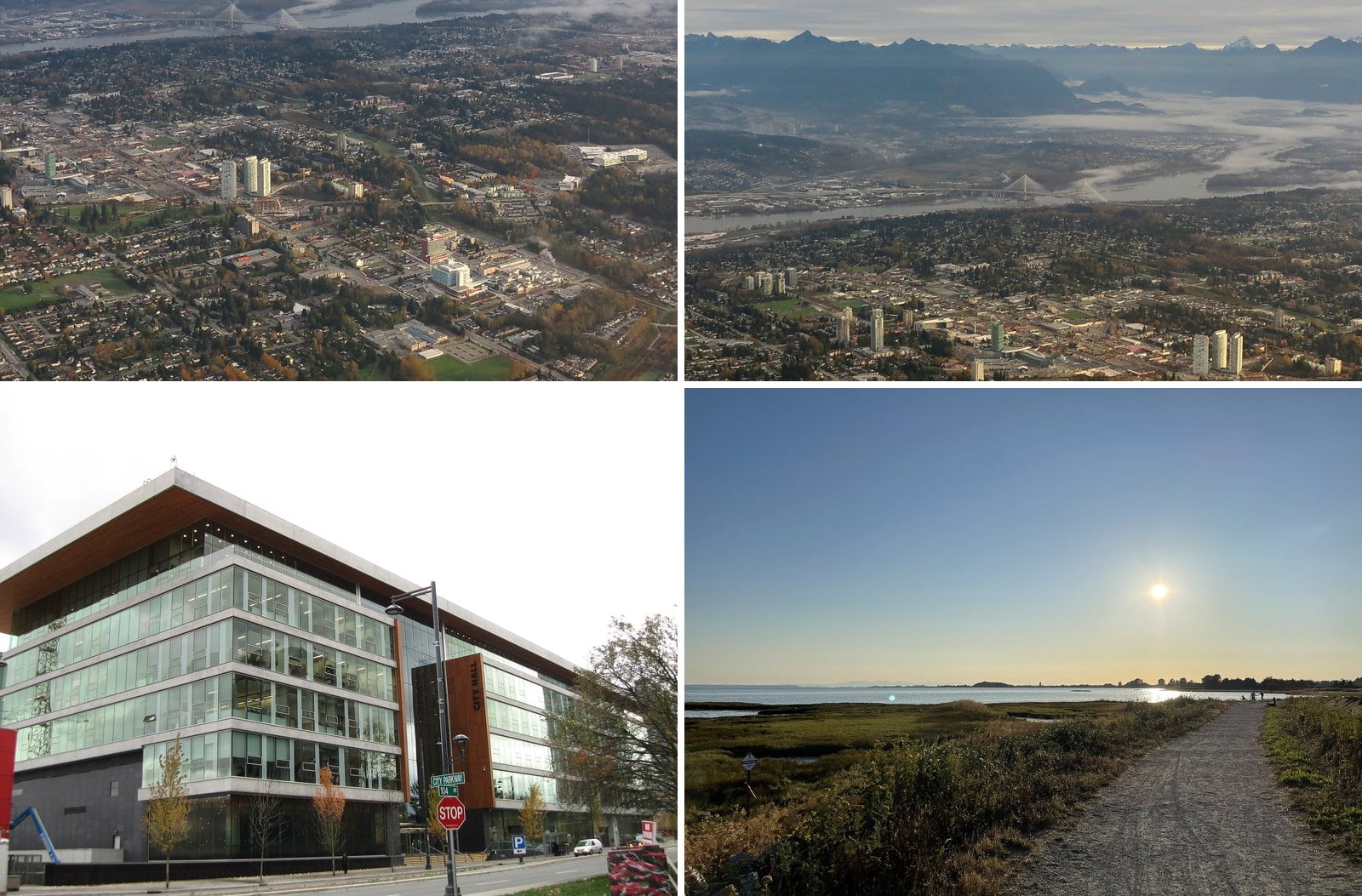
Surrey was a municipality for 114 years before it became a city in September 1993. Until 1957 its roads had names, not numbers. In 1951 about 33,670 people lived here. By the 2021 census it was 568,322. If you grew up somewhere in that stretch, your Surrey and your kids’ Surrey are not the same place.
This is a list of the things that shaped growing up here. Some of them were malls and drive-ins. Some were bridges that decided where Surrey could grow. A few are still standing and easy to visit. Others are gone, and the dates below tell you when.
Surrey grew around a six-town idea: Whalley, Guildford, Newton, Fleetwood, Cloverdale and South Surrey. Most of those towns show up here. Every date and number has been checked against city, provincial, heritage and news records.
17. Born at Surrey Memorial (96 Avenue)
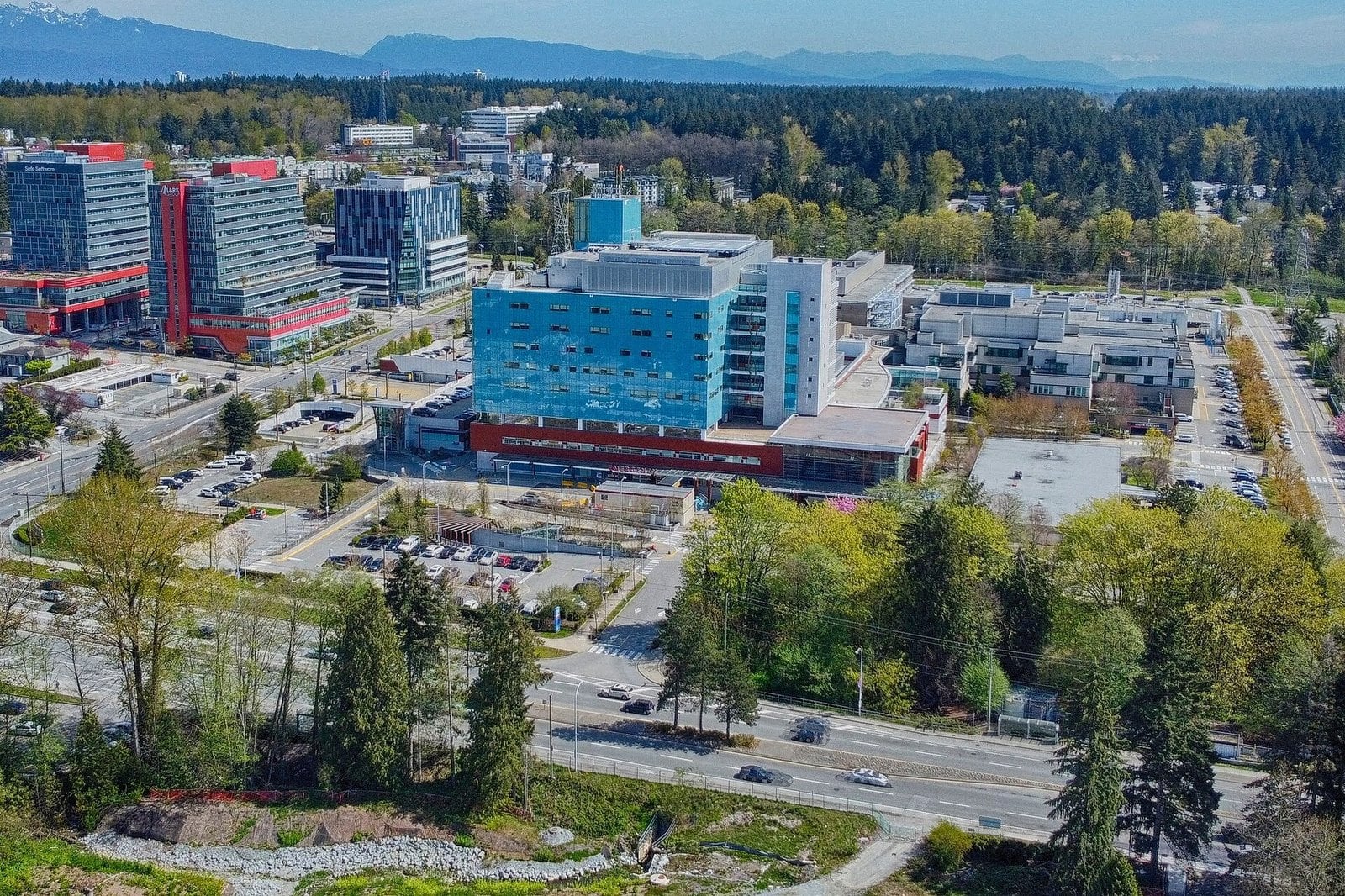
Where: 13750 96 Avenue
When: Opened 1959; operating hospital
Getting there: 96 Avenue and King George Boulevard
Volunteers spent 12 years lobbying and fundraising before the first Surrey Memorial Hospital opened in 1959. It had 103 beds.
Today it delivers more newborns every year than any other hospital in Fraser Health. If you were born in Surrey, there’s a good chance your birth certificate leads back here.
It’s a working hospital at 13750 96 Avenue, near King George Boulevard. Treat it as one. Fraser Health’s website has current services and visitor information.
16. North Surrey Recreation Centre (Whalley)
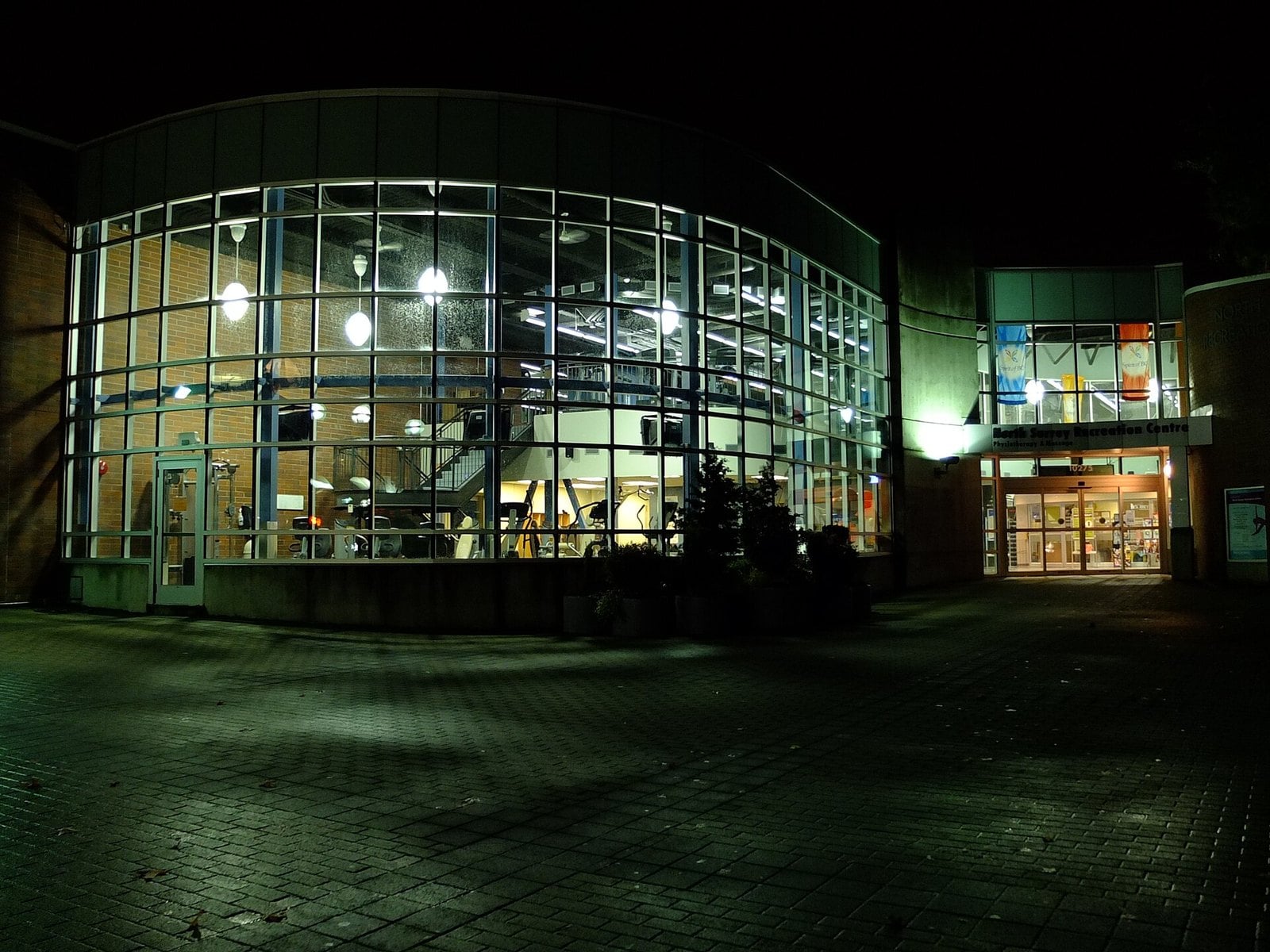
Where: Just west of Surrey Central SkyTrain, Whalley
When: Closed 2019; demolished 2025
Getting there: Surrey Central station (Expo Line)
North Surrey Recreation Centre was built in 1965 and renovated several times after. For 54 years it was where North Surrey skated, swam, worked out and held birthday parties.
Its last programs ended December 22, 2019. A new three-rink complex had opened near Scott Road station. Demolition started on May 13, 2025, to clear the site for the Centre Block development.
There’s nothing left to visit. The former site is just west of Surrey Central SkyTrain. If you’re looking for where the swimming went, its aquatics programs moved to Guildford Recreation Centre.
15. Cloverdale Raceway and Fraser Downs (Cloverdale)
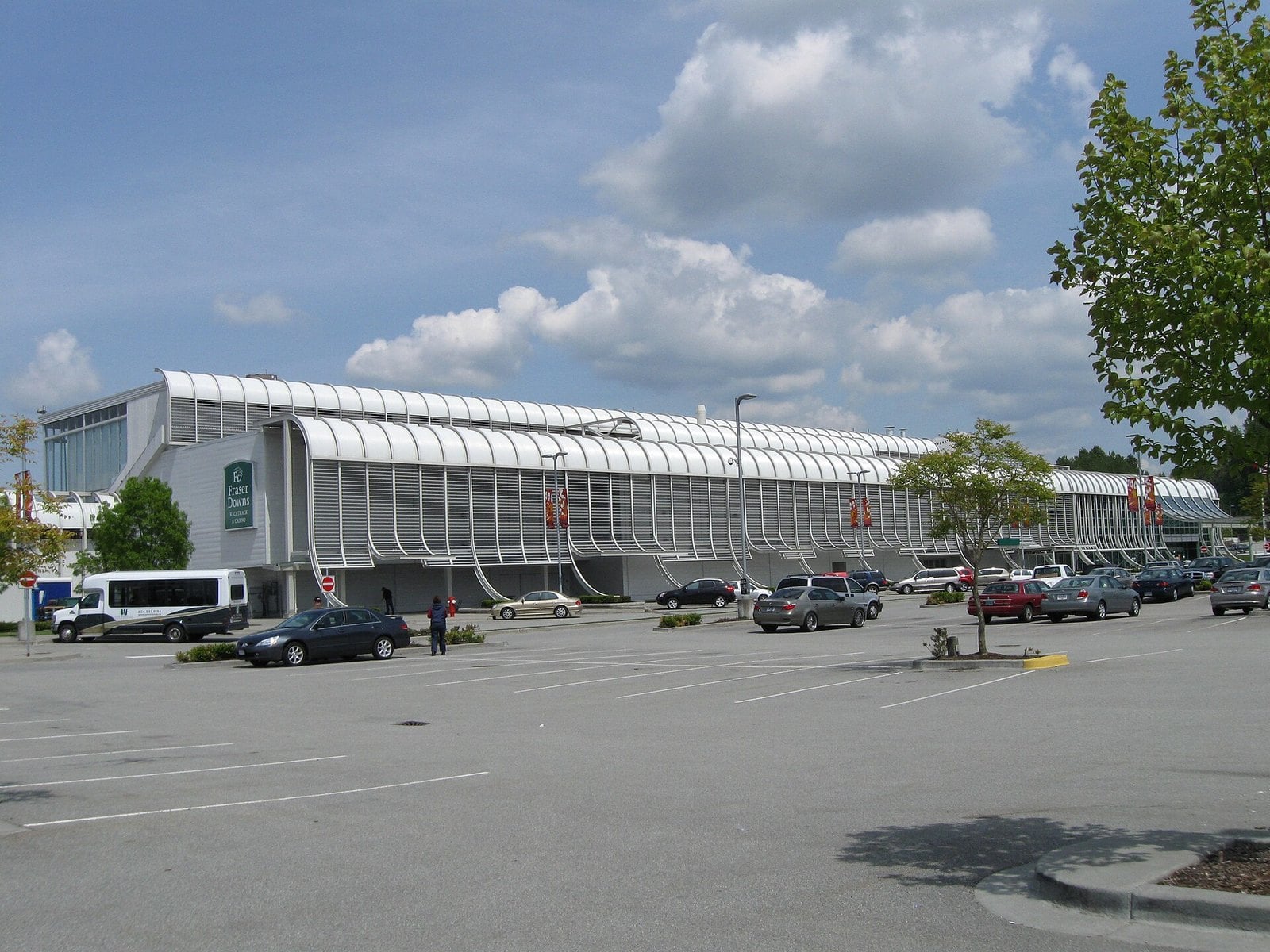
Where: Cloverdale Fairgrounds
When: Racing has ended; the adjacent Elements Casino remains open
Getting there: Off 176 Street, Cloverdale
The harness-racing track opened in 1976 as Cloverdale Raceway. It was renamed Fraser Downs in 1996.
Racing has ended for good.
Elements Casino in the grandstand stayed open, so the building is still in use. The oval itself no longer has racing. You’ll find it at the Cloverdale Fairgrounds, off 176 Street.
14. Surrey Fusion Festival (Holland Park)
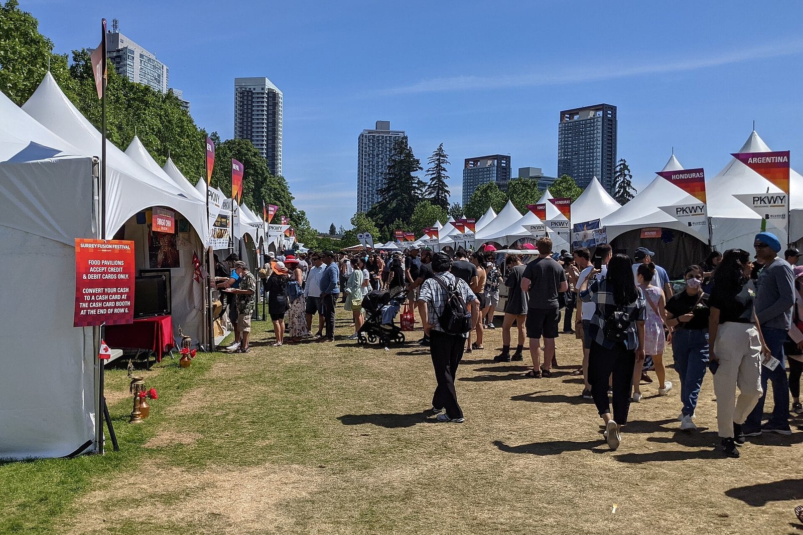
Where: Holland Park
When: Every July; 2026 was July 18 and 19; 2027 dates not yet posted
Cost: Free admission (2026)
Getting there: Across from King George SkyTrain station
Fusion Festival started in 2008 as a three-day event. That was the year Surrey was a Cultural Capital of Canada. If you were a teenager then, you remember when it was new.
It now fills Holland Park every July with cultural pavilions, food and music stages. The 2026 edition ran July 18 and 19, from 11 am to 10 pm, with free admission. 2027 dates aren’t posted yet.
Holland Park is across from King George SkyTrain, so take the train. Watch the festival’s site for next year’s dates. July afternoons in an open park get hot, so bring water and a hat.
13. The Cloverdale interurban (Cloverdale)
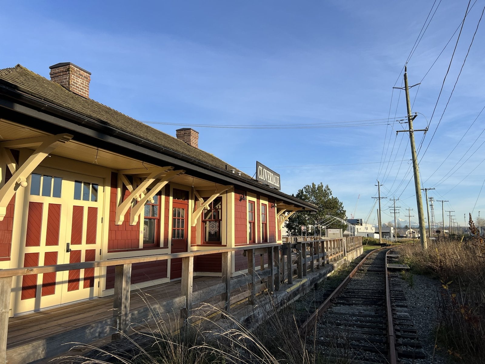
Where: Cloverdale Station, Highway 10 at 176A Street
When: Regular rides on weekends, May to September (2026 season ended September 27); check fvhrs.org for 2027 dates
Getting there: Highway 10 at 176A Street
BC Electric interurban trains ran through Cloverdale starting in 1910. Passenger service lasted until 1950. For 40 years it tied Cloverdale to the rest of the region by rail.
Volunteers brought it back. The society that runs it is entirely volunteer-run. They spent about 20,000 hours restoring Car 1225.
The station is at Highway 10 and 176A Street. Heritage rides are seasonal. The 2026 season of regular weekend rides ran May 2 to September 27, and the December 5 and 6 Electric Express Christmas trips are sold out. Check the Fraser Valley Heritage Railway Society before you go.
12. Surrey’s drive-in theatres (Newton, the Pattullo approach and Clayton)
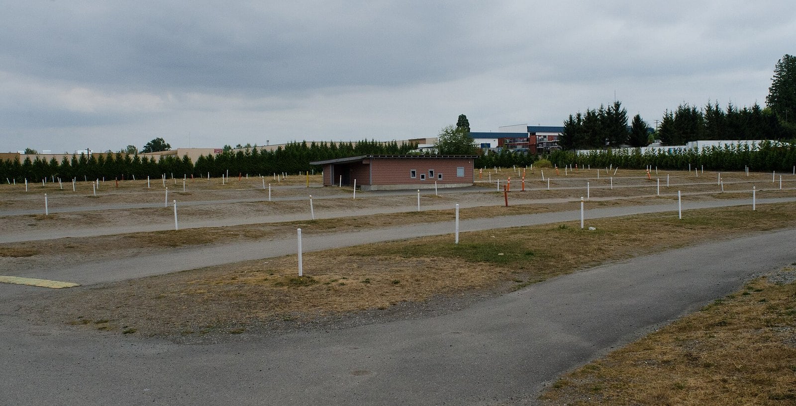
Where: Newton, the Pattullo approach, and Fraser Highway in Clayton
When: All closed; the last, the Hillcrest, in 2003
Getting there: Former Hillcrest site: 18694 Fraser Highway
Surrey had three drive-ins. The Surrey Drive-In opened in Newton in June 1951, at roughly 82 Avenue and King George. The Westminster Drive-In sat at the foot of the Pattullo Bridge. The Hillcrest, on Fraser Highway, had stalls for 571 cars.
They weren’t only for movies. On Sundays the lots turned into swap meets, so the same gravel you sat on Friday night was a market two days later.
They closed one at a time. The Surrey Drive-In went in 1983 and the Westminster in 1985. The Hillcrest held on until 2003. Its site at 18694 Fraser Highway is now a shopping centre with a Save-On-Foods.
The Hillcrest’s last operators didn’t give up on the idea. In 2005 they moved the business to Aldergrove as the Twilight Drive-In, which ran until it closed for good in October 2024.
| Drive-in | Location | Closed | Today |
|---|---|---|---|
| Surrey Drive-In | Newton, roughly 82 Avenue and King George (opened June 1951) | 1983 | Gone |
| Westminster Drive-In | Foot of the Pattullo Bridge | 1985 | Gone |
| Hillcrest Drive-In | 18694 Fraser Highway, 571 car stalls | 2003 | Shopping centre with a Save-On-Foods; operators reopened as the Twilight Drive-In in Aldergrove in 2005 (closed 2024) |
11. Walking the White Rock Pier (White Rock)
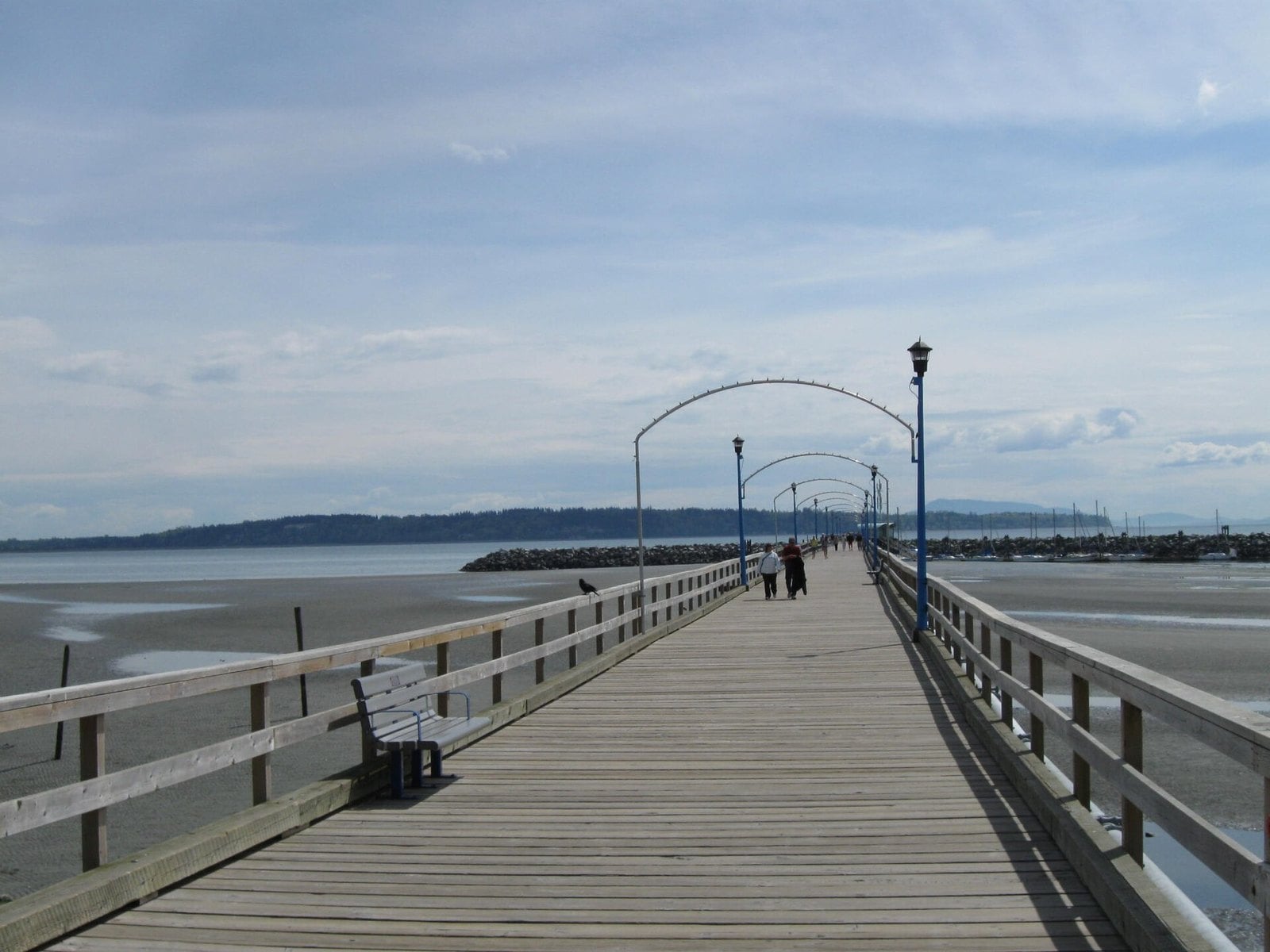
Where: Marine Drive, City of White Rock
When: Year-round
Getting there: Marine Drive, White Rock
The pier is 470 metres of wood. It was built in 1914 and restored in 1977. Technically it’s in White Rock, not Surrey. Generations of South Surrey families walked it anyway, usually with fish and chips.
On December 20, 2018, a windstorm with king tides tore it in half. The repaired pier reopened in summer 2019.
It’s open year-round off Marine Drive. The city says the remaining two-thirds of the pier needs reconstruction to meet current seismic safety requirements, so expect rebuilding work down the road. Dogs aren’t allowed on the pier at any time. The City of White Rock’s pier page is where updates will show up.
10. The Clova Theatre (Cloverdale)
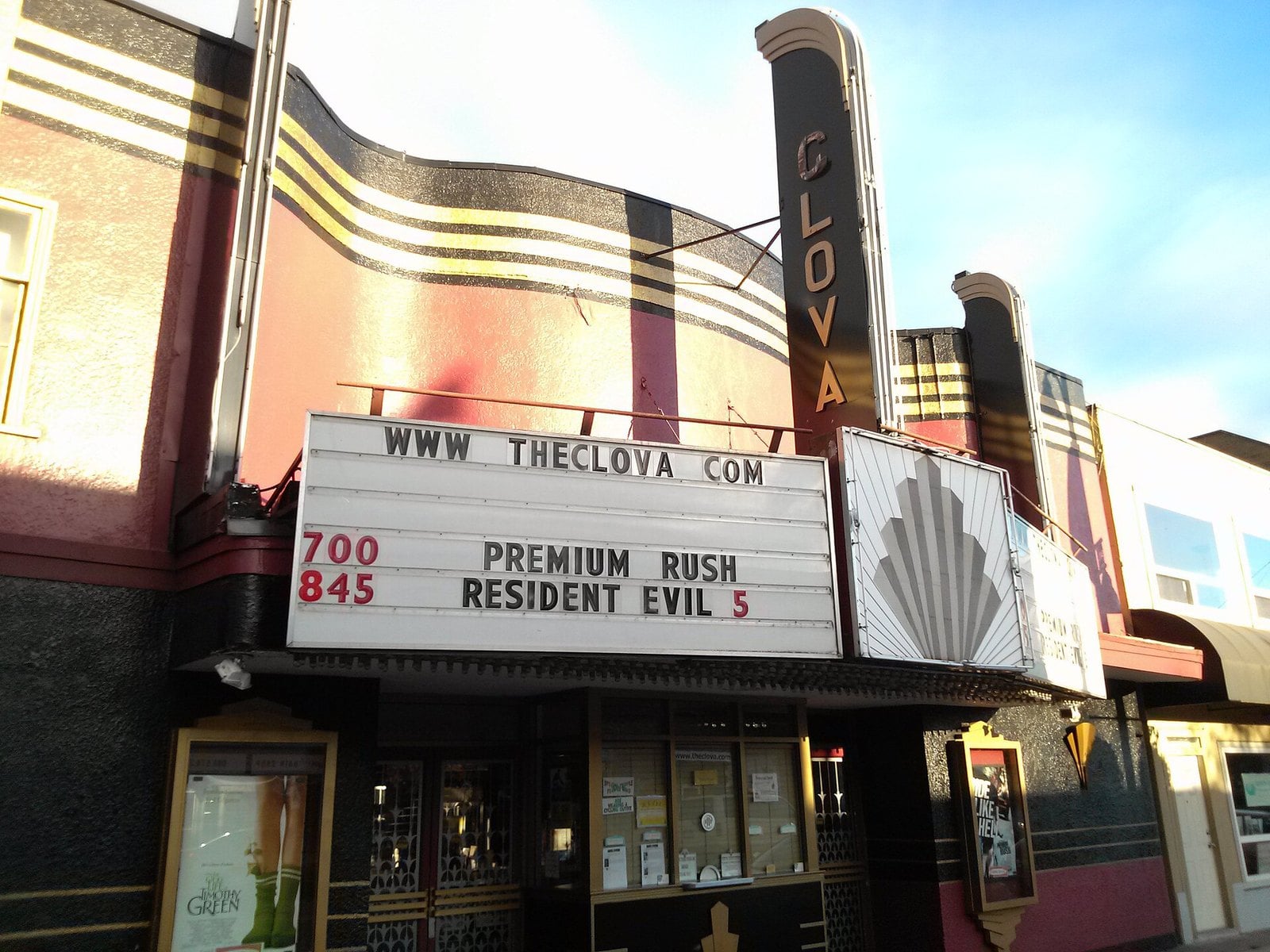
Where: 5732 176 Street, Cloverdale
When: No longer a cinema; exterior visible from the street any time
Cost: Free to look at from the street
Getting there: Downtown Cloverdale on 176 Street, near 57 Avenue
The Clova is a curved, stucco-fronted Art Deco movie house on 176 Street. The city’s heritage register says it was built in 1946, one of the first modern buildings in Cloverdale. It started showing movies in 1947.
It ran as a single-screen theatre for 67 years and closed in 2014. If you saw a first-run movie in Cloverdale, this is probably where. The building was sold after it closed, and a restoration plan for it includes the vertical Clova neon sign and the projecting front marquee.
It’s no longer a cinema, so you’re looking from the sidewalk. The exterior can be seen any time, and that costs nothing. The city calls it one of the first Mid-Century Modern buildings in Cloverdale. The city’s heritage listing has the architectural details.
9. Green Timbers Urban Forest (Whalley / Fleetwood)
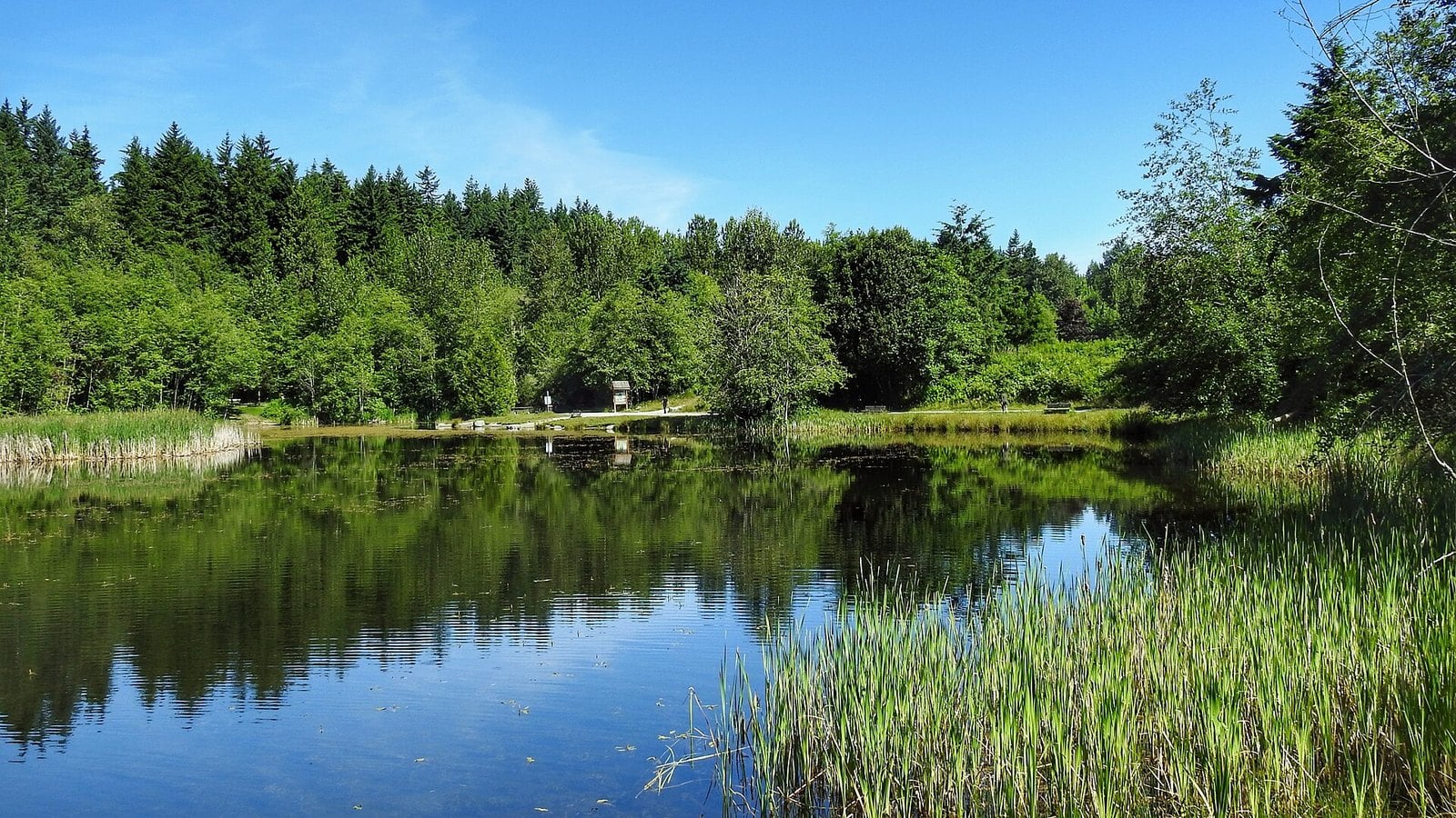
Where: 100 Avenue, 140 to 148 Street area
When: Year-round
Cost: Free (city park)
Getting there: Main area off 100 Avenue; Fraser Highway runs through
Green Timbers is where reforestation in BC began. After the original forest was logged, the first replanting ceremony was held here on March 15, 1930. The city lists it as the first attempt at reforestation in the province’s history.
In 1987, 42 acres (about 17 hectares) were cleared for a sports complex. Residents were outraged. They formed the Green Timbers Heritage Society to protect the forest, and the cleared land later became a meadow.
It is a City of Surrey park. The main area is off 100 Avenue, and Fraser Highway runs through it. Look for the Inaugural Plantation, the grove from that 1930 planting. Forest trails get muddy, so wear proper shoes.
8. Picnics at the Peace Arch (Douglas, South Surrey)
Where: Peace Arch Provincial Park, Douglas (South Surrey)
When: Year-round; check bcparks.ca for advisories
Getting there: Next to the Peace Arch border crossing, Highway 99
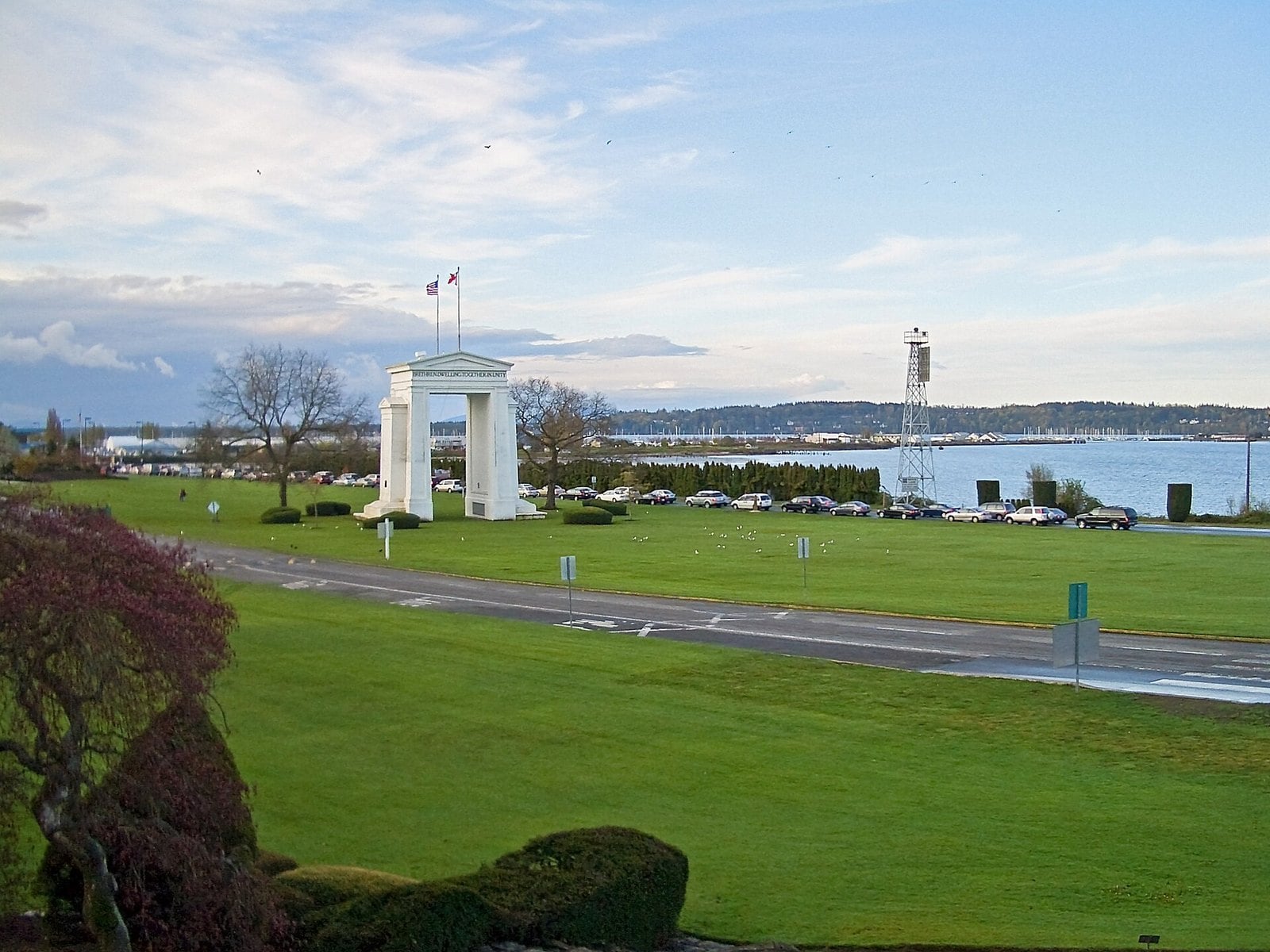
The Peace Arch was dedicated in 1921. BC Parks says it was the first structure of its kind in the world. It has two iron gates, left open to symbolize peace between Canada and the United States.
The land around it was bought with money from school children on both sides of the border. The Canadian park was dedicated in 1939. If your school sent you here on a trip, that’s the story you probably heard.
The park has lawns, formal gardens, and indoor and outdoor picnic facilities. It sits next to the Peace Arch border crossing on Highway 99. Because it’s right on the border, check BC Parks for current rules and advisories before you go.
7. The old Port Mann Bridge (Port Mann, North Surrey to Coquitlam)
Where: Highway 1 across the Fraser, North Surrey to Coquitlam
When: Opened June 1964; replaced by the new bridge in late 2012, then dismantled
Getting there: The current bridge’s multi-use path, on foot or by bike
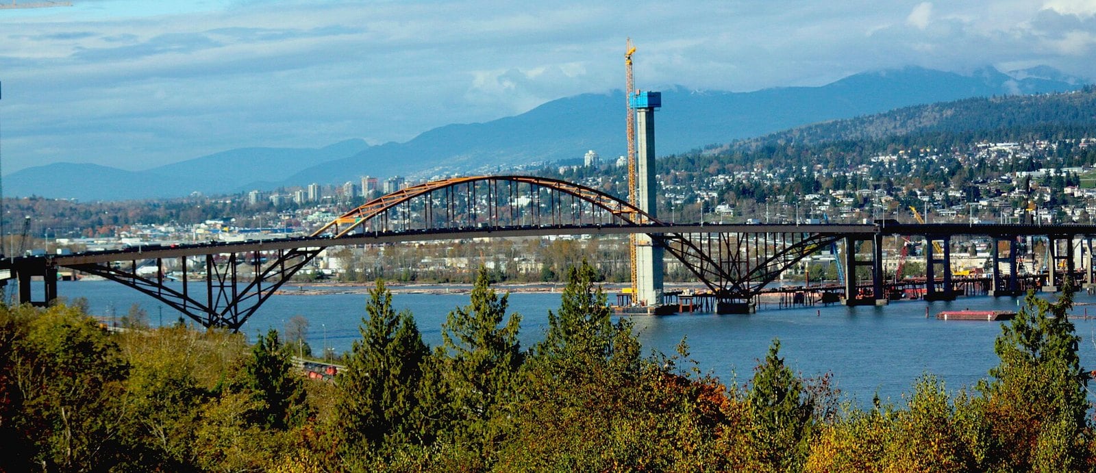
The first Port Mann Bridge opened in June 1964. At the time it was the most expensive piece of highway in Canada. It had its own orange arch, and for a generation of drivers it was the other way off the south side of the Fraser.
Its real legacy is on the map. The bridge and the four-lane Trans-Canada opened Guildford and Fleetwood for development. A lot of North Surrey subdivisions exist because of it.
The new 10-lane bridge opened in stages. Eastbound traffic moved to the new bridge in September 2012 and westbound traffic in November, and the new bridge opened to eight lanes on December 1, 2012. Crews then took the old bridge apart piece by piece, starting from the middle. The province kept a commemorative plaque from the 1964 bridge, to be mounted on the new bridge’s walking and cycling path.
If you want to see the crossing without a windshield in the way, that multi-use path is how you do it. Wind on the bridge can be stronger than on the ground, so bring a layer.
| Crossing | Opened | What happened to it |
|---|---|---|
| 1904 double-span road-and-rail bridge | 1904 | Surrey’s only fixed link until the Pattullo took over its road traffic; still carries trains |
| Pattullo Bridge | November 15, 1937 | Closed to vehicles February 2026; arch removed October 2026 |
| First Port Mann Bridge | June 1964 | Replaced by the new bridge in 2012, then dismantled |
| SkyBridge (Expo Line) | March 16, 1990 | Still carries SkyTrain to Scott Road |
6. Summers at Crescent Beach (South Surrey)
Where: Crescent Beach, South Surrey
When: Year-round; summer is peak beach season
Cost: Free to visit
Getting there: 12160 Beecher Street; best beach access points are Beecher Street, Sullivan Street and Target Street
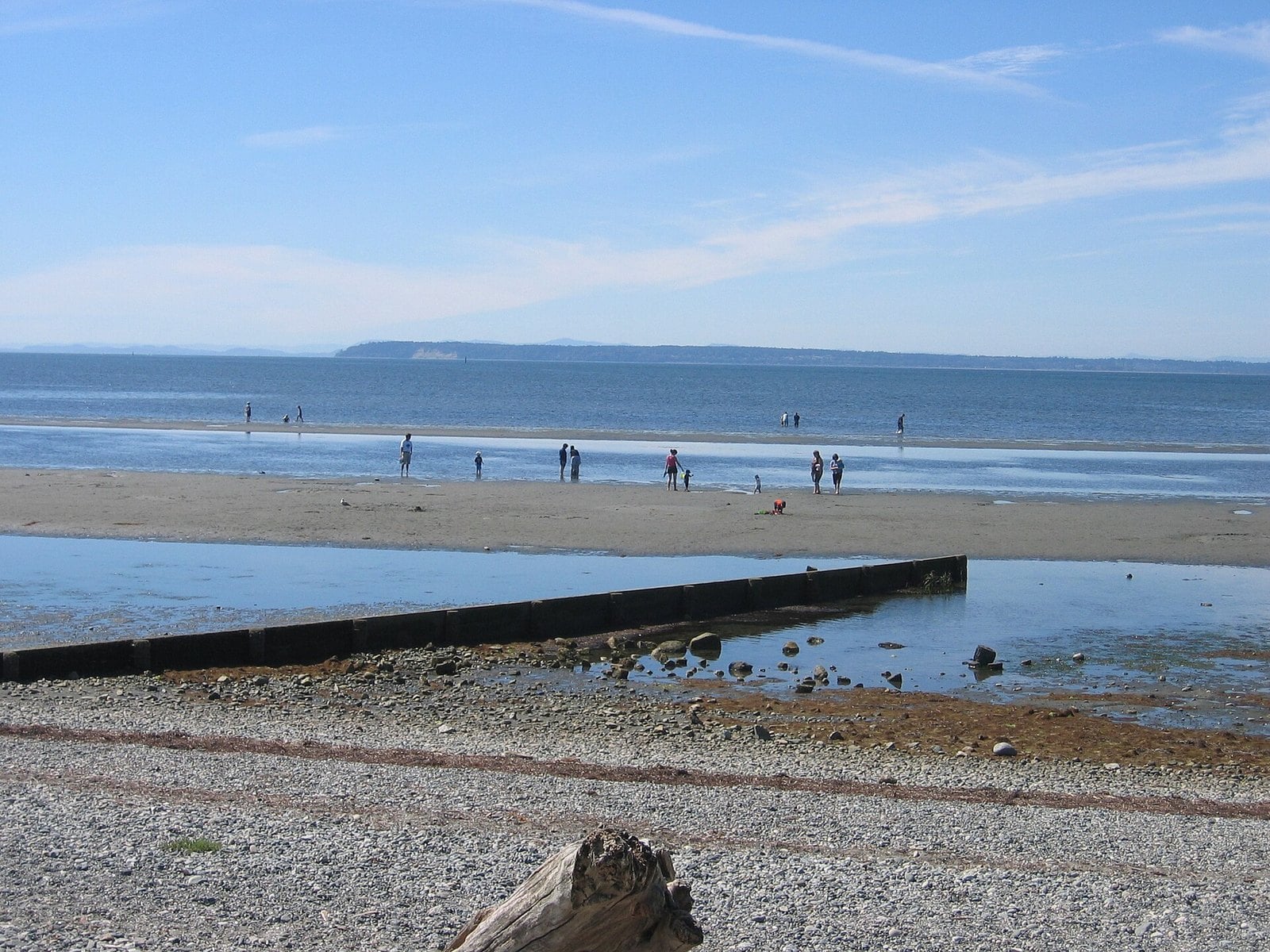
Crescent Beach became easy to reach in 1909, when the Great Northern Railway arrived. By 1912 it was being promoted as a resort, with a hotel, a pier and a train station. Dykes went in a year later. Today those dykes are the waterfront path you walk along.
The Crescent Hotel burned down around 1950. In 2002 the city added Memory Stones, a public art program the city commissioned at Crescent Beach. Finding them all is a good way to spend an afternoon with kids.
Summer is the city’s peak beach season, but the beach is open dawn to dusk year-round. The city lists Beecher Street, Sullivan Street and Target Street as the best beach access points; the park address is 12160 Beecher Street.
Blackie Spit is a short walk north and counts as one of the best bird-watching areas in the country. The city’s Crescent Beach page has current park information.
5. When SkyTrain finally reached Surrey (Scott Road to King George)
Where: Scott Road, Gateway, Surrey Central and King George stations
When: Scott Road opened March 16, 1990; extension opened March 28, 1994
Cost: Standard TransLink fares
Getting there: Expo Line from downtown Vancouver
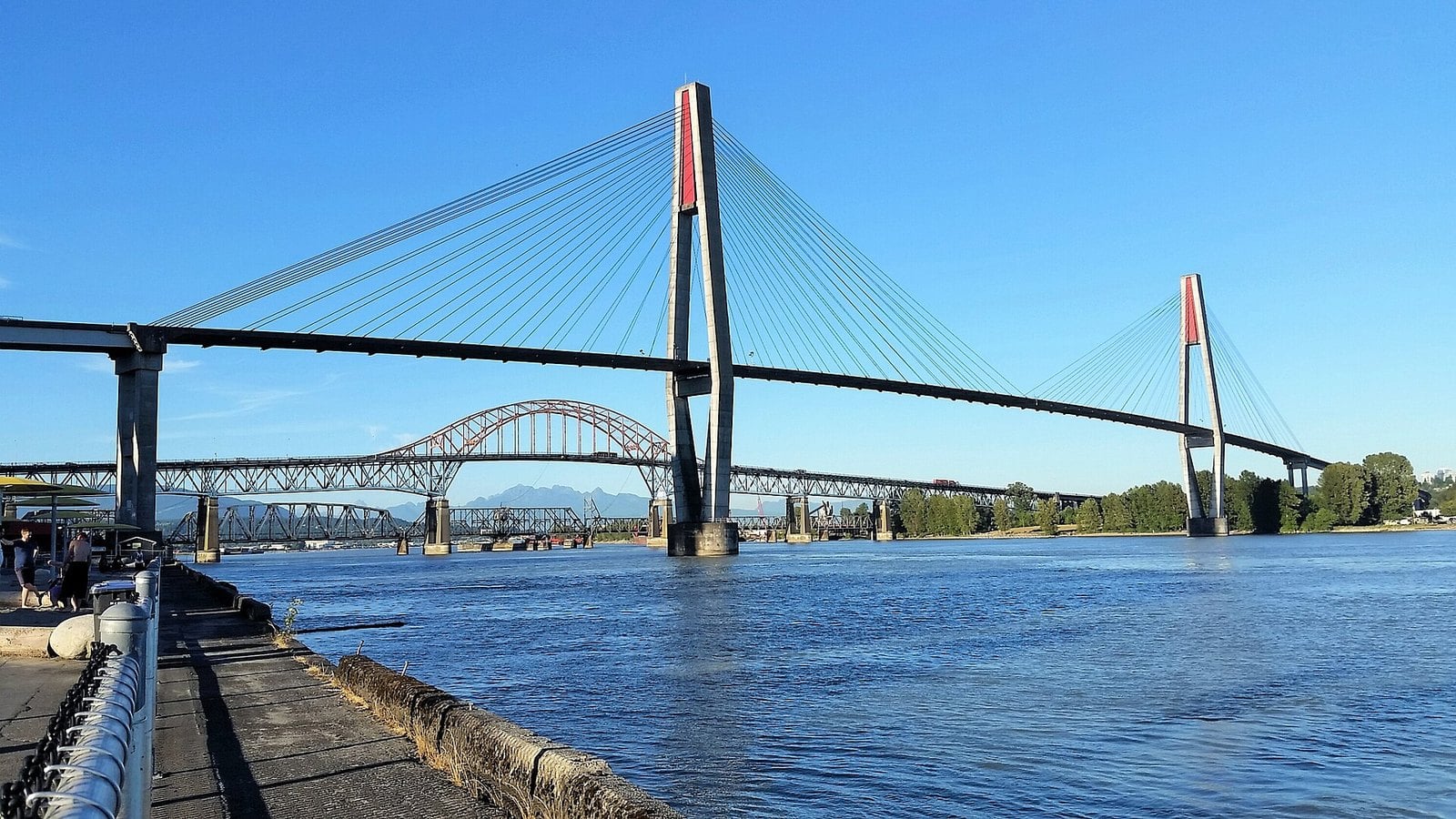
SkyTrain crossed the Fraser on the SkyBridge to Scott Road Station on March 16, 1990. For four years, that was the end of the line.
The extension to Gateway, Surrey Central and King George stations opened on March 28, 1994. It’s the reason a trip downtown from Whalley stopped meaning a bus and a bridge.
It’s still the Expo Line, at standard TransLink fares. Ride it from downtown Vancouver and watch for the SkyBridge over the river. Several places on this list are a short walk from a station.
4. The King George Highway (Pattullo Bridge to South Surrey)
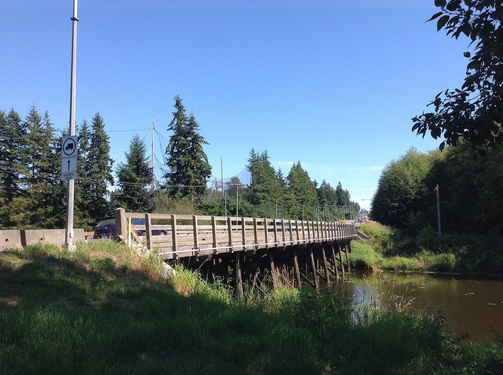
Where: Pattullo Bridge south through Surrey
When: Opened October 1940; now King George Boulevard
Getting there: Oaks are mostly between the Nicomekl River and the Highway 99 junction
Surrey’s main road opened in October 1940. It was named King George VI Highway to honour the reigning king. Today it’s King George Boulevard, but plenty of people still call it the highway.
The road carries a living memorial. Royal oak seedlings were sent across the Commonwealth to mark the king’s 1937 coronation, and some were planted along this road. Most of the surviving oaks are on the South Surrey stretch, between the Nicomekl River and the Highway 99 junction.
The road runs the length of Surrey, from the Pattullo approach south. It’s a busy arterial, so look at the oaks from a sidewalk or a parked car, not while driving.
3. Guildford Town Centre’s early years (Guildford)
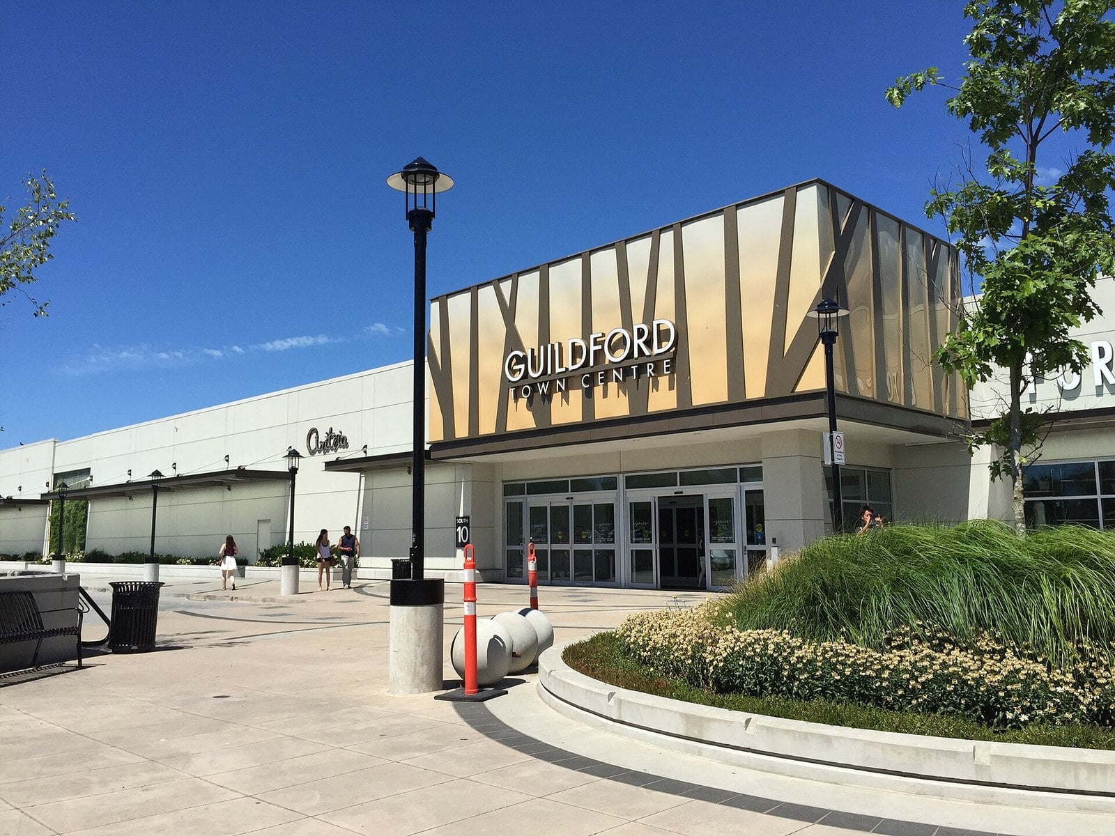
Where: 10355 152 Street, Guildford
When: Open year-round
Cost: Free to visit
Getting there: Guildford Exchange bus loop, under part of the mall
Guildford Town Centre opened on November 8, 1966. For a lot of North Surrey kids, it was the big mall. It came before Surrey Place by six years.
The timing was no accident. Local historians tie Guildford’s growth to the 1964 Port Mann Bridge and the new four-lane Trans-Canada Highway. Together they opened up Guildford and Fleetwood for development, and the mall grew with them.
It’s open year-round and free to visit at 10355 152 Street. The mall is served by Guildford Exchange, a bus loop, so transit gets you close to the door.
2. Surrey Place Mall, now Central City (Whalley)
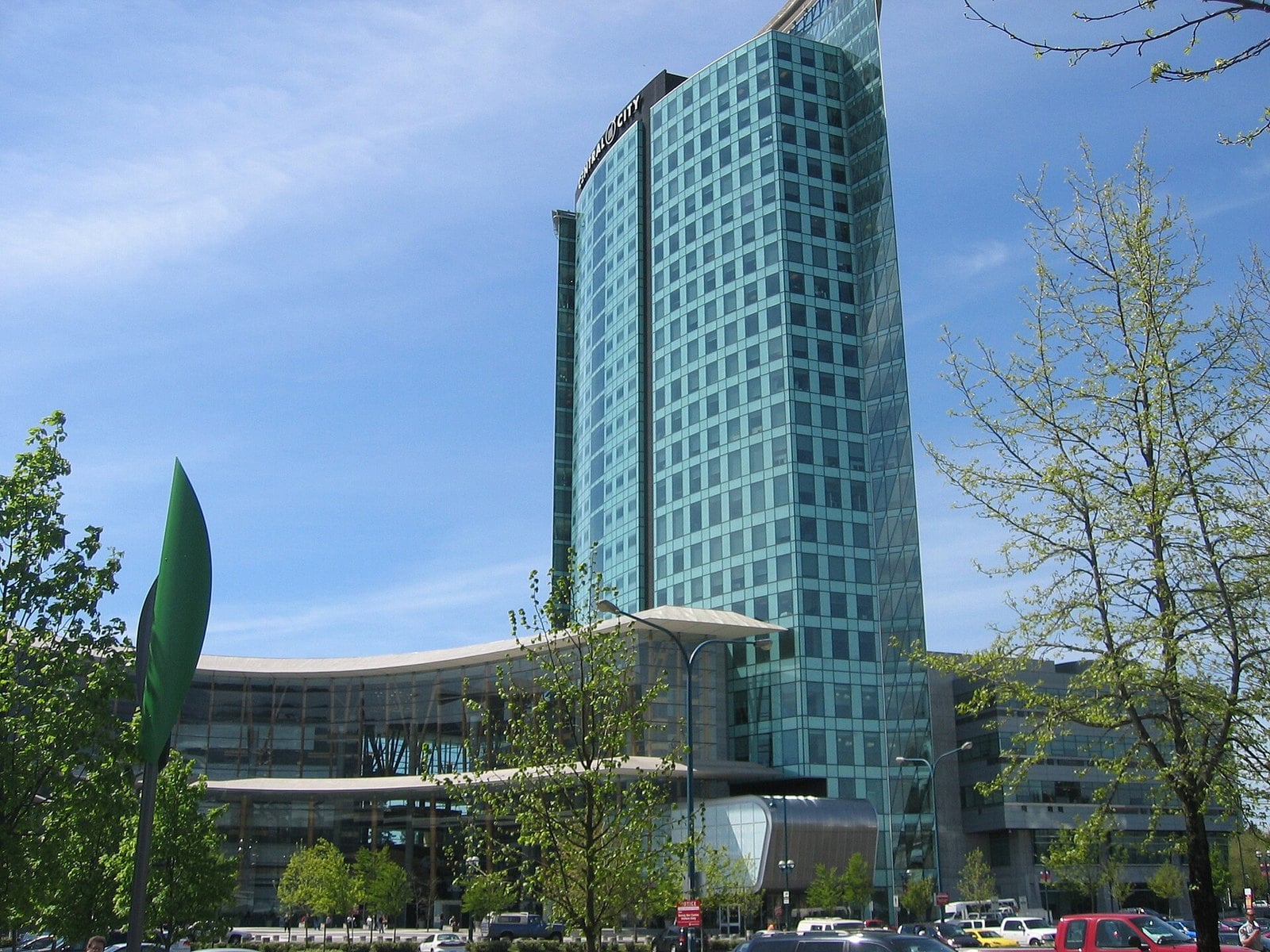
Where: Whalley / City Centre
When: Open year-round as Central City shopping centre
Cost: Free to visit
Getting there: Next to Surrey Central SkyTrain station (Expo Line)
Surrey Place opened in August 1972. It had two department stores, Simpson-Sears and Hudson’s Bay. It also had a Super Valu, an automotive service centre and 47 specialty stores. On October 29, 1980, it reopened after a major expansion.
About 30 years after it opened, it was redeveloped. The name changed to Central City. The bus loop beside it had its own rename earlier. Whalley Exchange became Surrey Central Station in 1994, the year SkyTrain reached Surrey Central.
The mall is open year-round and free to walk through. Surrey Central station on the Expo Line is right next door, so you don’t need a car. Stand on the platform and look around. Most of what you see grew up around the old mall.
1. The orange-arched Pattullo Bridge (Surrey to New Westminster)
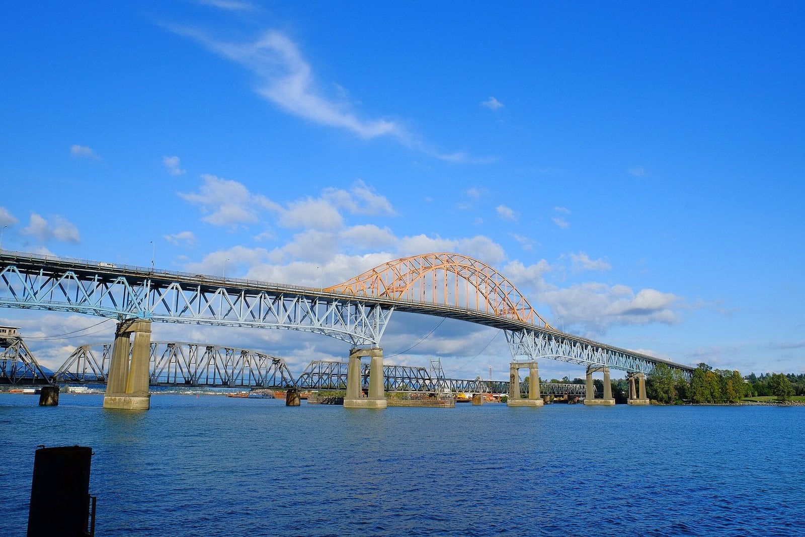
Where: Fraser River crossing, Surrey to New Westminster
When: Closed to vehicles February 2026; arch removed October 9 to 11, 2026; demolition about two years
Getting there: Brownsville Bar Park in Surrey was a viewing spot during the arch removal
Before 1937, a double-span bridge built in 1904 was Surrey’s only fixed link to New Westminster and Vancouver. The Pattullo opened on November 15, 1937, at a cost of $4 million. It replaced that old combined road-and-rail bridge. For decades it was the main road link between South of the Fraser and the rest of the region.
It closed to vehicles on February 6, 2026, and all four lanes of the new stal̕əw̓asəm (Riverview) Bridge opened on February 14. Walkers and cyclists got a farewell stretch on the old span until mid-February. Then, over the October 9 to 11, 2026 long weekend, crews lowered the steel arch onto barges to be taken away for recycling.
The province says removal of the whole bridge will take about two years. During the arch removal, Brownsville Bar Park on the Surrey side was one of the places to watch from. The project director said talks were under way to keep some of the old bridge’s materials for a historical display. Where that display will go hasn’t been announced.
TransLink put together a farewell history of the bridge if you want the long version.
What’s still standing, and what isn’t
Some of this list you can visit today: Central City, Guildford Town Centre, Crescent Beach, the Clova’s exterior, Green Timbers, the Peace Arch, the White Rock Pier, the Expo Line, the King George oaks, the Cloverdale interurban station and Fusion Festival. Some is gone: the Pattullo is being taken down, the old Port Mann was dismantled, all three drive-ins closed, racing ended at Fraser Downs and North Surrey Rec Centre was demolished in 2025.
A Cloverdale loop
The Cloverdale interurban station and the Clova Theatre are a few blocks apart, near Highway 10 and 176 Street. The Fairgrounds, home of the old Fraser Downs track and the still-open Elements Casino, are just north. It’s an easy walk between them if you park once.
Getting there by SkyTrain
- Surrey Central station: Central City and the former North Surrey Rec Centre site.
- King George station: Holland Park and Fusion Festival.
- Scott Road station: the first Surrey stop, open since March 16, 1990.
- The Expo Line has run through Surrey Central to King George since the mid-1990s.
Watching the Pattullo come down
The province says removing the Pattullo will take about two years. The arch is already gone. During its removal, Brownsville Bar Park on the Surrey side was one of the viewing spots along the river. Stay out of any fenced work zones.
Etiquette and safety
- The Clova is no longer a cinema and is private property. Look and take photos from the street.
- Surrey Memorial is a working hospital, not a heritage site. Keep visits for people who need to be there.
- Both roads into Crescent Beach cross the BNSF tracks. Use the crossings with care.
- Peace Arch Park sits on the border. Check BC Parks for current rules before you go.
- Check the Fraser Valley Heritage Railway Society for interurban ride dates, since the schedule changes by season.
Surrey went from 33,670 people in 1951 to more than half a million, and the places on this list were built, used up and replaced along the way. The bridges came first, then the malls, then the train. The drive-ins and the rec centre didn’t make it. The forest at Green Timbers did, because people fought for it. Pick one you can still visit and go this weekend. Tell your kids what used to be there.
Get the weekend plan in your inbox. Burrard Bulletin is a free email on what’s actually on from Vancouver to Whistler. Sign up here.
Photo credits
- Over British Columbia, Surrey (504712) (23631914924).jpg by Robert Linsdell from St. Andrews, Canada, CC BY 2.0 (combined into a montage, cropped). Via Wikimedia Commons.
- Over British Columbia, Surrey (504713) (24151992722).jpg by Robert Linsdell from St. Andrews, Canada, CC BY 2.0 (combined into a montage, cropped). Via Wikimedia Commons.
- Surrey, BC City Hall (2014b).jpg by Leoboudv, CC BY-SA 3.0 (combined into a montage, cropped). Via Wikimedia Commons.
- Sunset from Mud Bay Park in Surrey, BC 1.jpg by Tmv, CC BY-SA 4.0 (combined into a montage, cropped). Via Wikimedia Commons.
- The Pattullo Bridge (20591465243).jpg by Reg Natarajan from Vancouver, Canada, CC BY 2.0 (resized; cropped for the featured image). Via Wikimedia Commons.
- Ctrl-city-ext.jpg by Arnold C, Attribution (resized). Via Wikimedia Commons.
- Guildford town centre mall exterior.jpeg by Clee7903, CC BY-SA 4.0 (resized). Via Wikimedia Commons.
- Port Mann.jpg by Andrew Prost, CC BY-SA 2.0 (resized). Via Wikimedia Commons.
- Cresbeach-groyne.jpg by Arnold C, Attribution (resized). Via Wikimedia Commons.
- Clova Theatre 01.jpg by OlEnglish, CC BY-SA 3.0 (resized). Via Wikimedia Commons.
- Twilight Drive-In Theatre (14853040217).jpg by Jeff Hitchcock from Seattle, WA, USA, CC BY 2.0 (resized). Via Wikimedia Commons.
- Fraser Downs Race Track & Casino bldg (2009).jpg by Leoboudv, CC BY-SA 3.0 (resized). Via Wikimedia Commons.
- North Surrey Recreation Centre (8199795980).jpg by Reg Natarajan from Vancouver, Bogotá, CC BY 2.0 (resized). Via Wikimedia Commons.
- Green Timbers Urban Forest (51260149823).jpg by Dennis Sylvester Hurd, CC BY 2.0 (resized). Via Wikimedia Commons.
- Peace-Arch-3614 edit.jpg by Peace-Arch-3614.jpg: User:Vmenkov derivative work: Myrabella (talk), CC BY-SA 3.0 (resized). Via Wikimedia Commons.
- White Rock Pier view1.jpg by Leoboudv, CC BY-SA 3.0 (resized). Via Wikimedia Commons.
- Westminster Pier Park 2015-06-27.jpg by Mike, CC BY-SA 2.0 (resized). Via Wikimedia Commons.
- KG bridge Nicomekl 2014.jpg by Canuckle, CC BY-SA 4.0 (resized). Via Wikimedia Commons.
- Surrey Memorial Hospital (2024).jpg by Northwest, CC BY 4.0 (resized). Via Wikimedia Commons.
- Fraser Valley Heritage Railway Society – Cloverdale Station Platform.jpg by IngeniousPachyderm, CC0 (resized). Via Wikimedia Commons.
- 2022 Surrey Fusion Festival.jpg by Northwest, CC BY-SA 4.0 (resized). Via Wikimedia Commons.