4 Vancouver Snowstorms Everyone Still Talks About
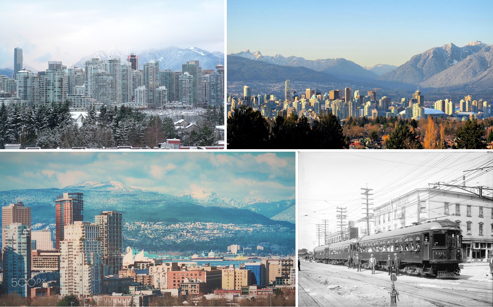
Vancouver isn’t built for snow, and most years it doesn’t need to be. Environment and Climate Change Canada’s 1991 to 2020 climate normals put the yearly average at 36.6 cm. December (13.9 cm) and January (12.3 cm) do most of the work. That’s a few slushy mornings, not a season.
So when a real storm lands, people remember it. They remember where they were stuck, what broke and who got home at midnight. The storms below are the ones that still come up at work and around the dinner table, with the official numbers behind each.
One caveat before the numbers. The official weather station was downtown from 1900 to 1937 and has been at YVR in Richmond since 1938. Older and newer totals come from different places, so treat long-range comparisons as close, not exact.
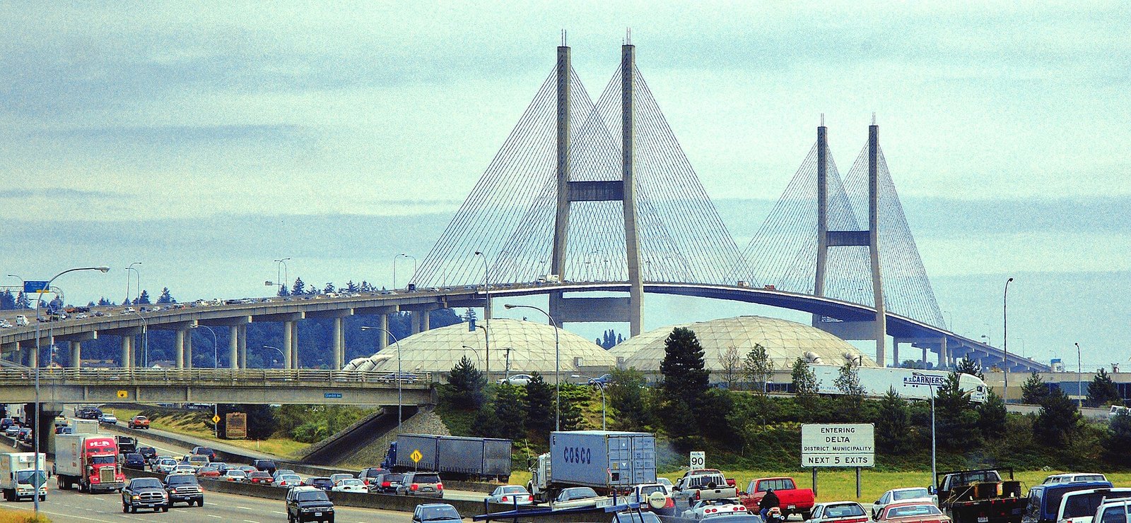
4. The 12-Hour Commute (Alex Fraser Bridge, Highway 91 and Highway 1)
Where: Alex Fraser Bridge, Highway 91, Highway 1
When: November 29 to 30, 2022
Cost: n/a (historic event)
November 29, 2022 brought the season’s first major snowfall, and it came at the worst possible time of day. The snow started in the afternoon, so people tried to leave work early all at once. The congestion that usually builds around 4:30 started at 2 p.m.
Environment Canada reported 10 to 20 cm across the Lower Mainland. That isn’t a huge total on paper. But several crashes blocked the Alex Fraser Bridge, one of the main crossings over the Fraser River, and the network jammed behind it. Drivers were stuck for hours on Highway 1 too, and some on an eastbound section of Highway 91 were stuck overnight until the next morning.
Some commutes that normally take 45 minutes took nearly 12 hours. BC Hydro had about 93,000 customers lose power. At YVR, an EVA Air jet skidded off a taxiway.
The lesson locals took from it is simple. When snow is forecast for the afternoon, leave early or stay put. Bridges are where a snowy commute goes from slow to stopped, and they lock up fast.
3. #VancouverSnowStorm2020 (Metro Vancouver, Fraser Valley and Vancouver Island)
Where: Metro Vancouver, Fraser Valley, Vancouver Island
When: January 10 to 16, 2020
Cost: n/a (historic event)
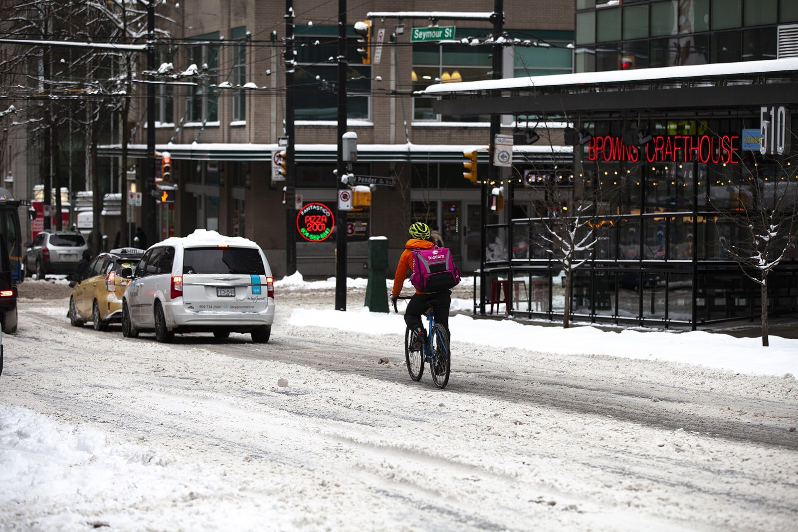
This one arrived as a series rather than a single hit. Storms between January 10 and 15, 2020 brought 34 cm to Vancouver, about three times the monthly average. Higher parts of Metro Vancouver got up to 40 cm in a matter of hours.
On January 15, the region more or less stopped. After at least 25 cm fell in many areas, schools and post-secondary institutions across the region, from the Fraser Valley to Vancouver Island, cancelled classes. CBC’s coverage that day reported transit staff telling commuters to give up and go home.
Wind made it worse. Trees came down on power lines, and about 30,000 people lost power across the Lower Mainland and Vancouver Island. By January 16, there were 14 cm on the ground. That made it Vancouver’s deepest snow on that date since records began.
2. The White Christmas of 2008 (Metro Vancouver and YVR)
Where: Metro Vancouver; YVR
When: December 14, 2008 to January 8, 2009 (peak December 21 to 25)
Cost: n/a (historic event)
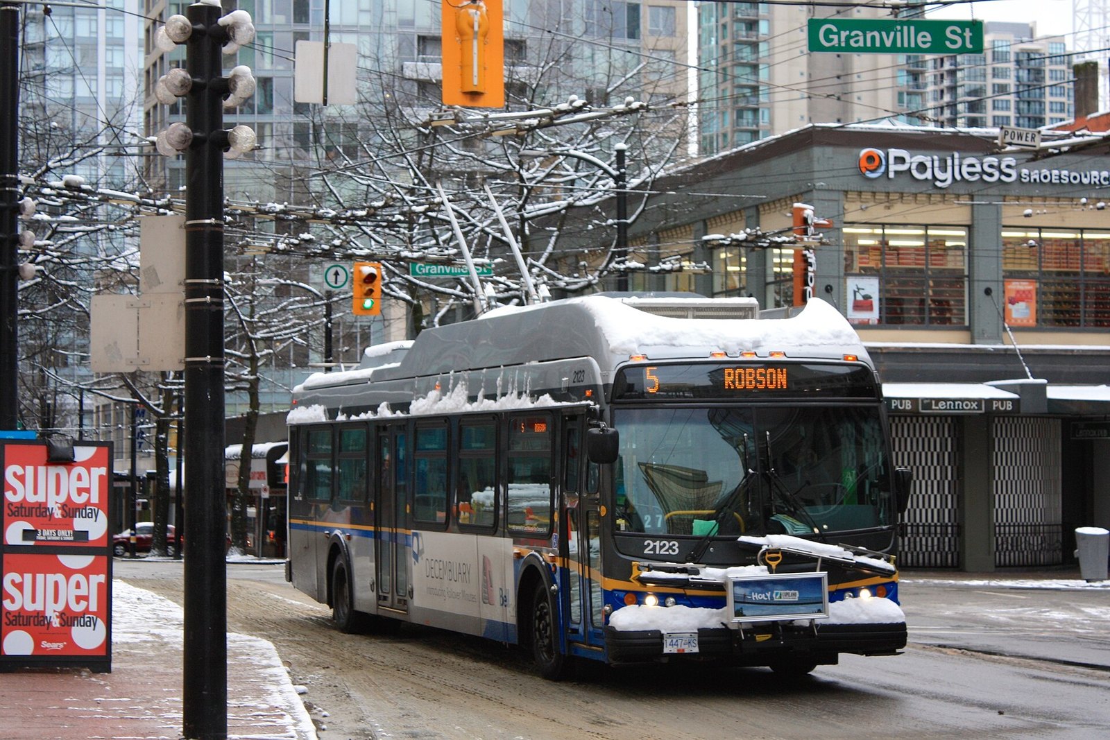
Environment Canada calls it a white Christmas if there are at least 2 cm of snow on the ground at 7 a.m. on December 25. In 2008, there were 41 cm. That is the deepest Christmas snow in Vancouver’s records, and it wasn’t close to the threshold.
Three snowfalls of at least 15 cm hit in a single week, December 21 to 26. About 3,000 people were stranded overnight at the airport in the middle of holiday travel. Almost 90 cm fell at the YVR weather station that December alone.
The storm didn’t let go quickly. Between December 14, 2008 and January 8, 2009, 102 cm fell. That is nearly three times what a normal Vancouver year gets in total. There were at least 20 cm on the ground for nine days straight, and snow stuck around until March.
Why it matters: the timing was awkward, with the 2010 Olympics a year away, and the embarrassment pushed officials to buy more snowplows. When locals talk about “a real Vancouver winter,” this is usually the one they mean.
1. The Late-November Dump and BC Place’s Torn Roof (South Coast and downtown Vancouver)
Where: South Coast; BC Place, 777 Pacific Blvd, downtown Vancouver
When: November 26 to 30, 2006; roof failure January 5, 2007
Cost: n/a (historic event)
Getting there: BC Place is near Stadium-Chinatown SkyTrain station
The 2006 to 2007 winter started wet. Weeks of rainstorms soaked the region through November. Then Arctic air moved in. Over four to five days in late November 2006, some parts of the South Coast recorded about a metre of snow over four to five days.
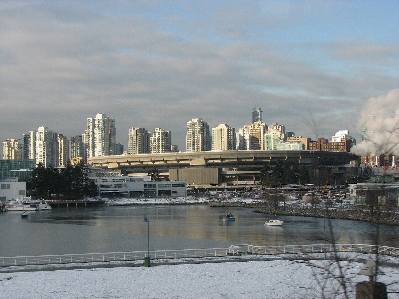
The winter’s most famous moment came on January 5, 2007. During a storm of wind and heavy, wet snow, BC Place’s air-supported fabric dome tore and sagged down into the stadium bowl. No one was hurt. The image of the city’s landmark roof drooping like a punctured balloon stuck with people.
It also had a long tail. The incident led the province to replace the old dome with a $458-million retractable roof. The roof you see over Pacific Boulevard today is a direct result of that storm.
Local tip: the old “marshmallow” dome hung on a few more years. It was deflated for the last time in May 2010, after the Olympics, to make way for the new roof. BC Place is at 777 Pacific Blvd, a short walk from Stadium-Chinatown SkyTrain station.
When big snow tends to hit
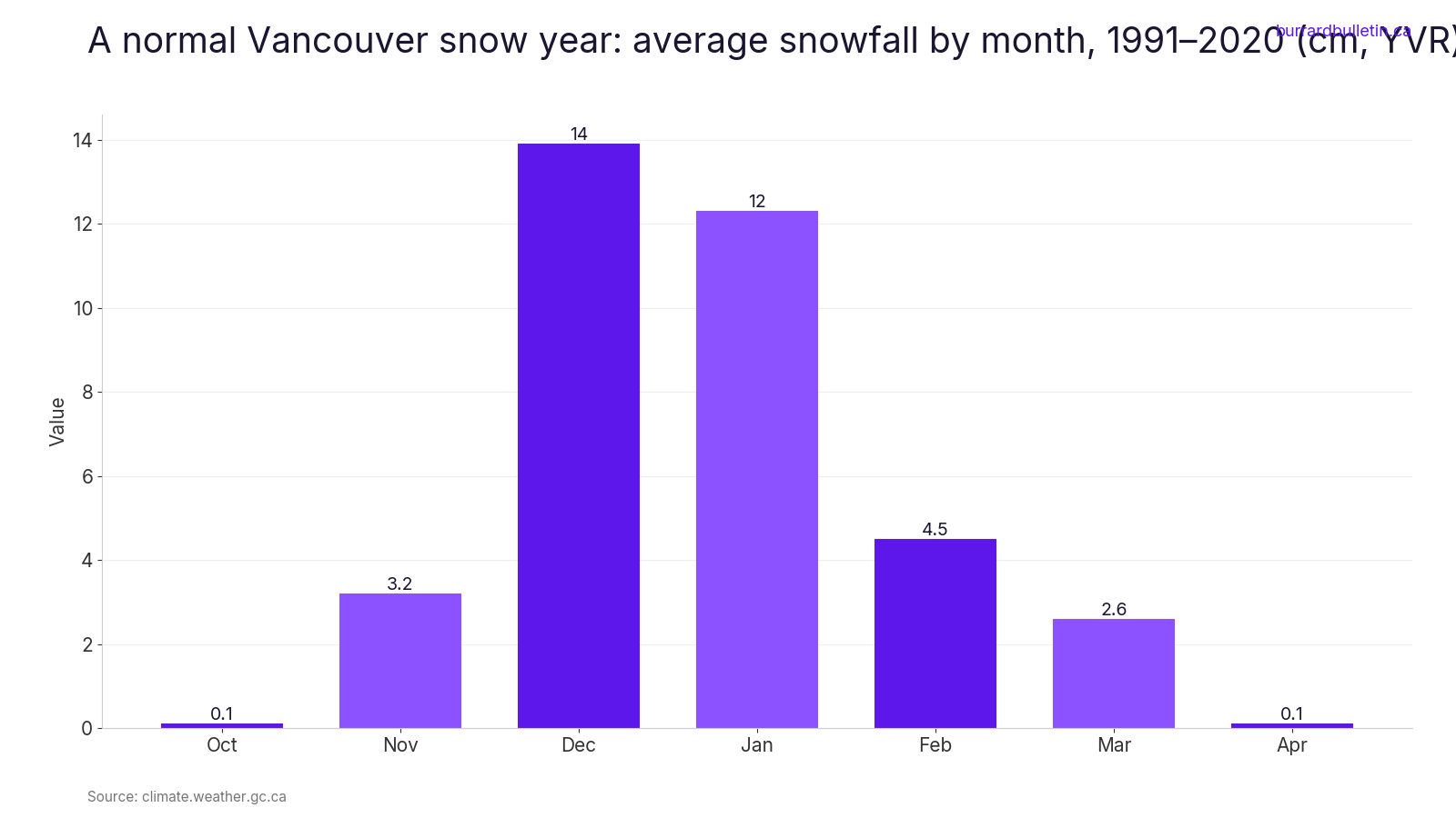
In a normal year, most of Vancouver’s snow falls in December (13.9 cm) and January (12.3 cm). Smaller amounts come in November (3.2 cm), February (4.5 cm) and March (2.6 cm). The chart below shows how lopsided that is.
The storms above fit the pattern. The earliest started in late November (2006) and on November 29 (2022). The latest wrapped up in mid-January (2020). If you’re planning travel through YVR or over the bridges, late November through January is the window to watch.
Who clears what in Vancouver
- The City brines, salts and plows major roads, bus routes and bridges first, including bridge sidewalks.
- Residential side streets are not part of the plan, except priority hills and access routes to hospitals and schools.
- Property owners and occupants must clear the sidewalk in front of their property; the full width must be cleared by 10 a.m. the day after a snowfall
- Missing the 10 a.m. deadline can mean a $250 fine, rising to $750 if snow and ice stay more than 24 hours. Details are on the City’s winter maintenance page.
Snow-day etiquette and safety
- Snowplows move slower than other traffic. Give them space and be patient.
- If a neighbour is a senior or has mobility challenges, offer to help clear their walk.
- Shovel first, then salt.
- Check that your salt is rated for the temperature. Some products stop working below about -10 °C. The City’s salt guide covers this.
- If snow is forecast for the afternoon, leave early or stay home. Go prepared if you have to drive, because a bridge crash can turn a short trip into an overnight one.
Will we get a big one in 2026 to 2027?
Forecasters expect a strong El Niño. CBC reports a high likelihood of a milder-than-normal winter and a higher chance of below-normal precipitation. Together, that could mean an unusually low snowpack on the coast.
That lowers the odds of a big storm. It doesn’t rule one out. A single afternoon of 10 to 20 cm was enough to strand drivers overnight in 2022.
| Storm | Dates | Snow | Power outages | What came of it |
|---|---|---|---|---|
| Late-November dump and BC Place roof | Nov 26 to 30, 2006; Jan 5, 2007 | About a metre in parts of the South Coast over 4 to 5 days | n/a | $458-million retractable roof for BC Place |
| White Christmas of 2008 | Dec 14, 2008 to Jan 8, 2009 | 102 cm; 41 cm on the ground Christmas morning | n/a | About 3,000 stranded at YVR; more snowplows bought |
| #VancouverSnowStorm2020 | Jan 10 to 16, 2020 | 34 cm in Vancouver; up to 40 cm on higher ground | About 30,000 people | Classes cancelled from the eastern Fraser Valley to Victoria and Nanaimo |
| The 12-hour commute | Nov 29 to 30, 2022 | 10 to 20 cm across the Lower Mainland | About 93,000 BC Hydro customers | Commutes of nearly 12 hours; drivers stuck overnight on Highway 91 |
Most of these storms were short by prairie standards. Many did their damage in a few days, sometimes a few hours. What makes them stick is how little it takes to stop a city that expects 36.6 cm a year. A torn roof, a closed runway, a blocked bridge. Keep a shovel by the door, check the forecast before you cross the river, and you’ll have your own story for the next one.
Get the weekend plan in your inbox. Burrard Bulletin is a free email on what’s actually on from Vancouver to Whistler. Sign up here.
Photo credits
- Vancouver in snow – panoramio.jpg by Colin W, CC BY-SA 3.0 (combined into a montage, cropped). Via Wikimedia Commons.
- Vancouver Skyline and Mountains.jpg by Kyle Pearce/ DIY Genius, CC BY-SA 2.0 (combined into a montage, cropped). Via Wikimedia Commons.
- The Lions (250662429).jpeg by Bryon Grove, CC BY-SA 3.0 (combined into a montage, cropped). Via Wikimedia Commons.
- B.C. Electric Railway Company Fraser Valley Railway line cars.jpg by Matthews, James Skitt, Major (1878-1970), Public domain (combined into a montage, cropped). Via Wikimedia Commons.
- BC Place Deflated2.jpg by Andrew Phillips (Tawker), CC BY-SA 2.5 (resized; cropped for the featured image). Via Wikimedia Commons.
- Vancouver trolleybus on Robson St in snow (2008).jpg by Scazon, CC BY 2.0 (resized). Via Wikimedia Commons.
- Snowfall, January 15th, 2020 (49391452702).jpg by GoToVan from Vancouver, Canada, CC BY 2.0 (resized). Via Wikimedia Commons.
- AlexFraserBridge.jpg by Bobanny, Public domain (resized). Via Wikimedia Commons.