BC Ghost Towns You Can Still Walk Through (Sandon, Barkerville and More)
British Columbia was built on rushes. Gold pulled people into the Cariboo in the 1850s and 1860s. Silver did the same in the Kootenays a few decades later. Towns went up fast, and many emptied just as fast when the ore ran out, the railway went elsewhere, or fire and flood finished the job.
Some of those towns are gone. Others still have streets, storefronts and cemeteries you can walk through today. Barkerville was founded in 1862 and became a National Historic Site of Canada in 1924. Quesnel Forks is older still, dating to 1859. Sandon once held over 5,000 people. Fort Steele was preserved because the railway skipped it for Cranbrook in 1898.
This guide covers the original townsites, one rescued collection of heritage buildings, and one place you should only see from the road. Each entry has what you’ll see, what it costs, and where things stand as of late October 2026.
7. Bradian (Bridge River Valley)
Where: Southeast side of Bralorne, north of Pemberton
When: Summer to early fall via the Hurley River FSR
Cost: No visitor site; view from the road only
Getting there: About four hours from Vancouver via Pemberton and the Hurley River FSR
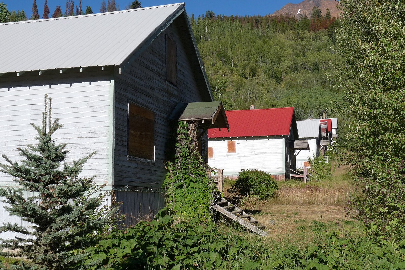
Bradian was a company townsite for the gold mines near Bralorne. By the time Bralorne’s mine shut down, only a dozen families were left in a townsite of 80 homes. BC now lists it as an abandoned locality.
This one is look-only. The remaining houses are on private property, so don’t go in. Take your photos from the road and spend your time in Bralorne instead.
From the Sea to Sky side, this is a summer to early fall trip. The Bridge River Valley is about four hours from Vancouver and two from Whistler, via Pemberton and the Hurley River Forest Service Road. The Hurley River FSR is closed to cars in winter and maintained for snowmobiles only.
6. Sandon (Slocan Valley)
Where: Off Highway 31A between New Denver and Kaslo
When: 2026 dates aren’t posted; recent seasons ran May to Thanksgiving
Cost: Most attractions free; museum $5
Getting there: 15 minutes east of New Denver, 45 minutes west of Kaslo
Sandon was a silver boomtown that once held over 5,000 people. A flash flood in 1955 destroyed many of its buildings. What remains still draws over 60,000 visitors a year.
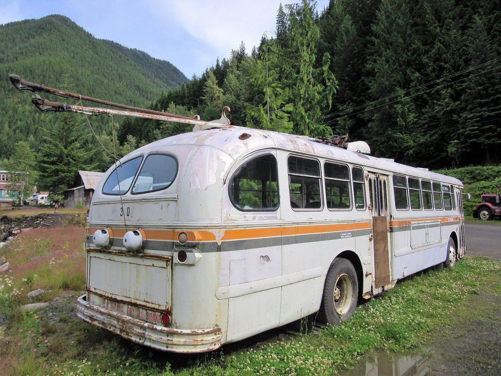
The Silversmith generating station has run since 1897 and still supplies power. Down the street sits a row of Brill trolley buses from Vancouver, Calgary, Saskatoon, Winnipeg and Regina. If you grew up riding trolleys in Vancouver, some of these will look familiar. Volunteers restored the brick Slocan Mercantile Block, which now houses the Sandon Historical Society museum.
Most attractions are free, with donations welcome. The museum charges $5 per person. The operator hasn’t posted 2026 dates. Its hours page still shows a 2023 season of May 20 to Oct 9, and Kootenay Rockies Tourism listed the 2025 season as running to Thanksgiving weekend. Expect the museum and services to be closed this late in the year.
Sandon is just off Highway 31A, 15 minutes east of New Denver and 45 minutes west of Kaslo. Pair it with the Nikkei Internment Memorial Centre in New Denver. It’s normally open May 1 to Sept 30. Shoulder-season visits in October or April can be arranged by emailing [email protected] ahead of time.
5. Quesnel Forks (Cariboo)
Where: Confluence of the Quesnel and Cariboo rivers, near Likely
When: Self-guided and unstaffed; snow-season access not confirmed
Cost: No fees listed
Getting there: From Likely, 13 km past Keithley Creek Road, mostly gravel
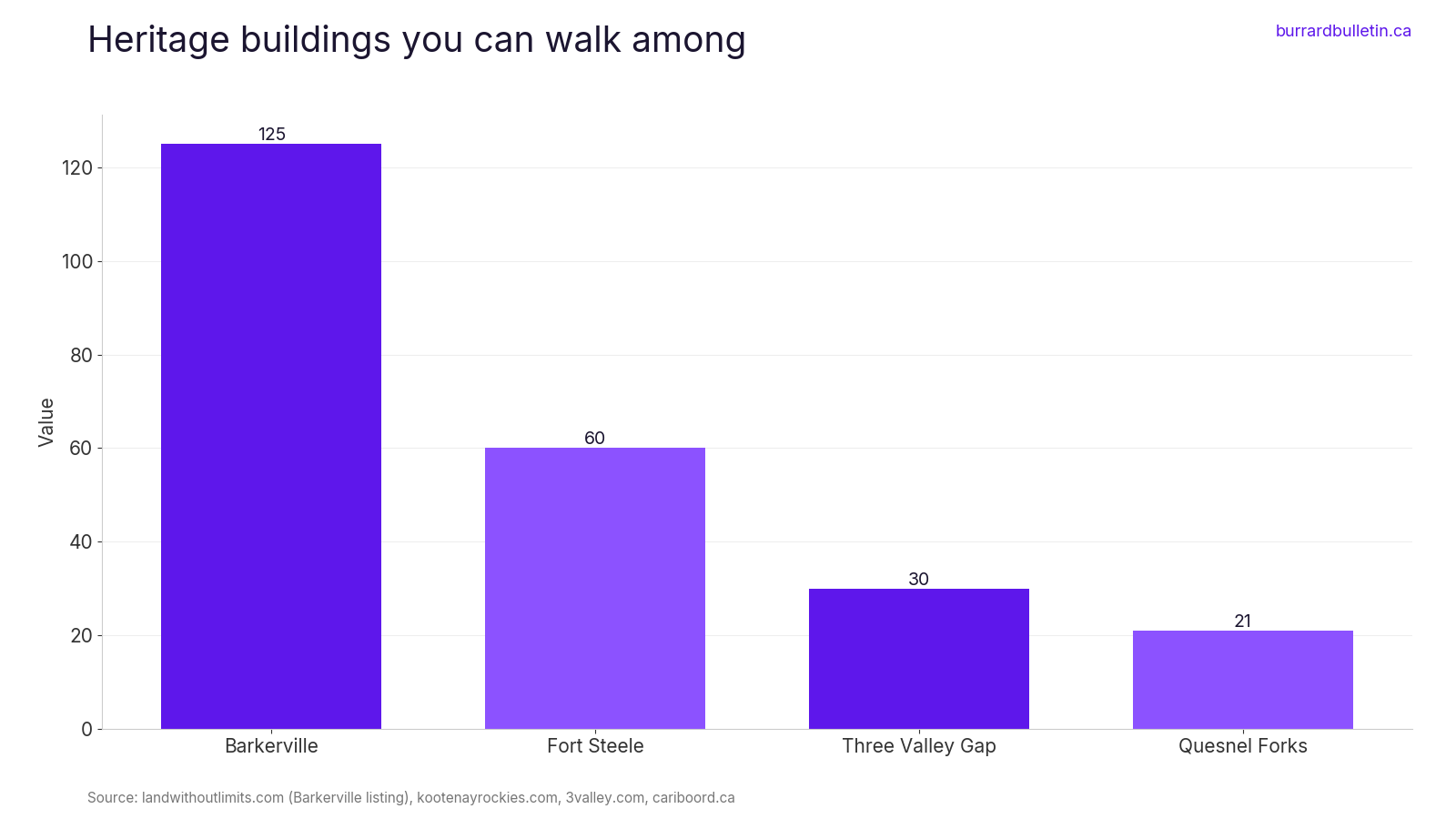
Quesnel Forks sits where the Quesnel and Cariboo rivers meet. It was founded in 1859 as a gold-rush supply town, so it predates Barkerville. The Cariboo Regional District counts 21 buildings on the townsite. Some are stabilized ruins and some are full replicas.
Low-mobility trails link the buildings to a gold-rush cemetery. The interpretive signs are in Chinese and English, which tells you something about who lived and worked here. A small log building at the entrance serves as a welcome centre. The site is unstaffed and self-guided, and the recreation site lists no fees.
Drive to Likely, turn at the Community Hall and follow Rosette Lake Road, which turns to gravel. The townsite is 13 km from Keithley Creek Road. No official source confirms snow-season access, so treat this as a late spring to fall trip.
The riverbanks here are eroding. Recreation Sites and Trails BC has closed campsites 1 and 2 and the day-use area because of erosion and unstable trees. Stay back from the banks. The regional district says the whole area is at risk from ongoing deterioration, which is a reason to see it while you can.
4. Granite Creek townsite and cemetery (Similkameen)
Where: Near Coalmont, west of Princeton
When: Unstaffed; no official season posted
Cost: No fee posted
Getting there: 19 km west of Princeton via Coalmont, then 1 km east on Blakeburn Road
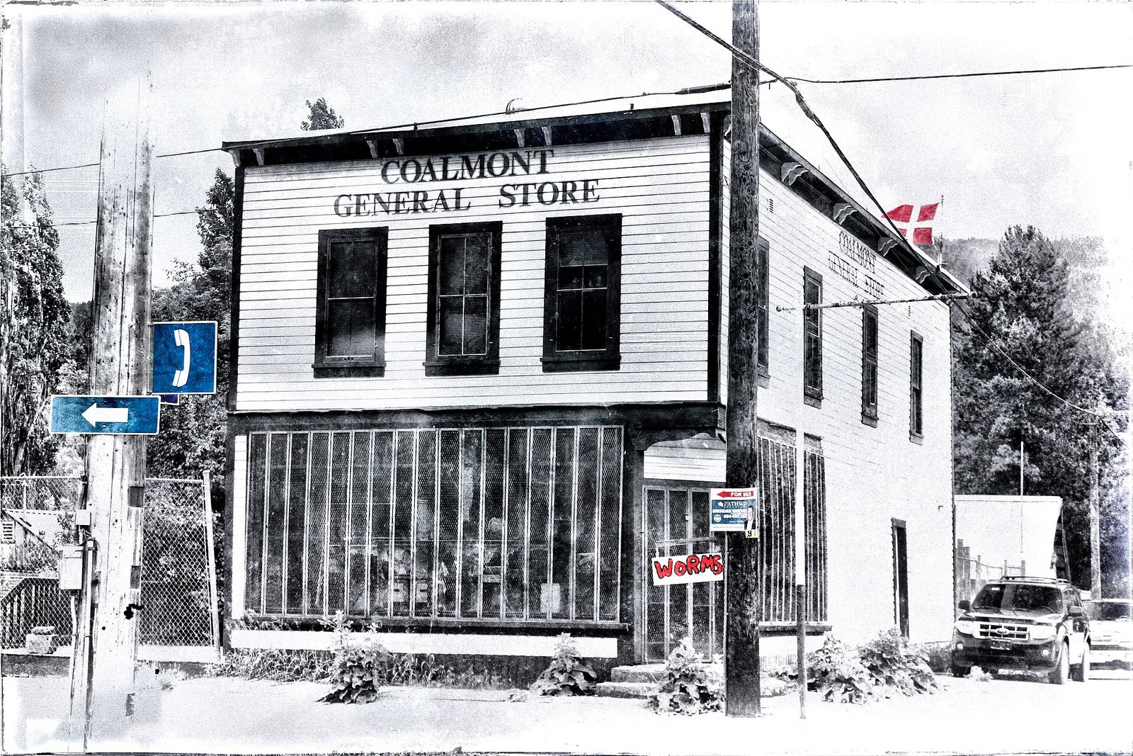
Granite Creek boomed after the 1885 gold rush and once housed about 2,000 people. In 1907 the whole town burned to the ground. What’s left is ruins in the grass and a restored cemetery on the hill above.
The Granite Creek Preservation Society runs a self-guided walking tour. It starts at a cairn, where a mailbox holds maps to 10 interpretive signs. The route is about three city blocks long. The site is unstaffed, no season is posted and the society lists no fee.
Granite Creek is 19 km west of Princeton. Drive through Coalmont, cross the Tulameen River, then go 1 km east on Blakeburn Road. The cemetery is also reached from Blakeburn Road and overlooks the old townsite.
The cemetery is still an active burial ground for local families. Treat it that way. Leave the graves and the ruins exactly as you find them.
3. Three Valley Gap Heritage Ghost Town (Revelstoke area)
Where: 8903 Trans-Canada Highway, 19 km west of Revelstoke
When: Regular season ended Oct 12, 2026; Fright Night Oct 23 and 24, 2 to 8 pm
Cost: Adults $18, youth $13, kids $10, family $50, 5 and under free
Getting there: On the Trans-Canada, free parking
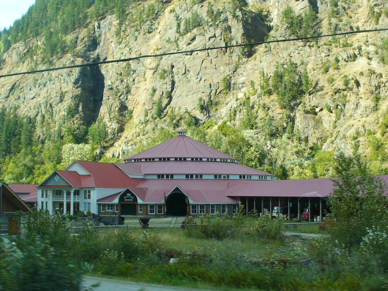
Three Valley Gap is a different kind of ghost town. It’s a privately run collection of heritage buildings that were rescued and restored here, not an original townsite. There are 30 of them, including a saloon, a jail, a one-room schoolhouse and a church.
The site also has an antique auto museum and a railway roundhouse with locomotives and a working turntable. That makes it the easiest stop on this list for kids who need more than old buildings. Admission is $18 for adults (18+), $13 for youth, $10 for kids and $50 for a family. Kids 5 and under are free. Leashed pets are welcome, which is not the case everywhere.
The 2026 regular season ran April 24 to Oct 12 and has ended. Fright Night runs Friday, Oct 23 and Saturday, Oct 24, 2026, from 2 to 8 pm. Tickets can be bought at the theatre doors on the day; no reservations are required. The hotel and restaurant are closed during the event.
The address is 8903 Trans-Canada Highway, 19 km west of Revelstoke. Parking is free.
2. Fort Steele Heritage Town (East Kootenay)
Where: Highway 95, northeast of Cranbrook
When: Year-round; fall hours 10 am to 4 pm, Thursday to Monday
Cost: Not confirmed on the official site; check before you go
Getting there: About 15 minutes from Cranbrook on Highway 93/95
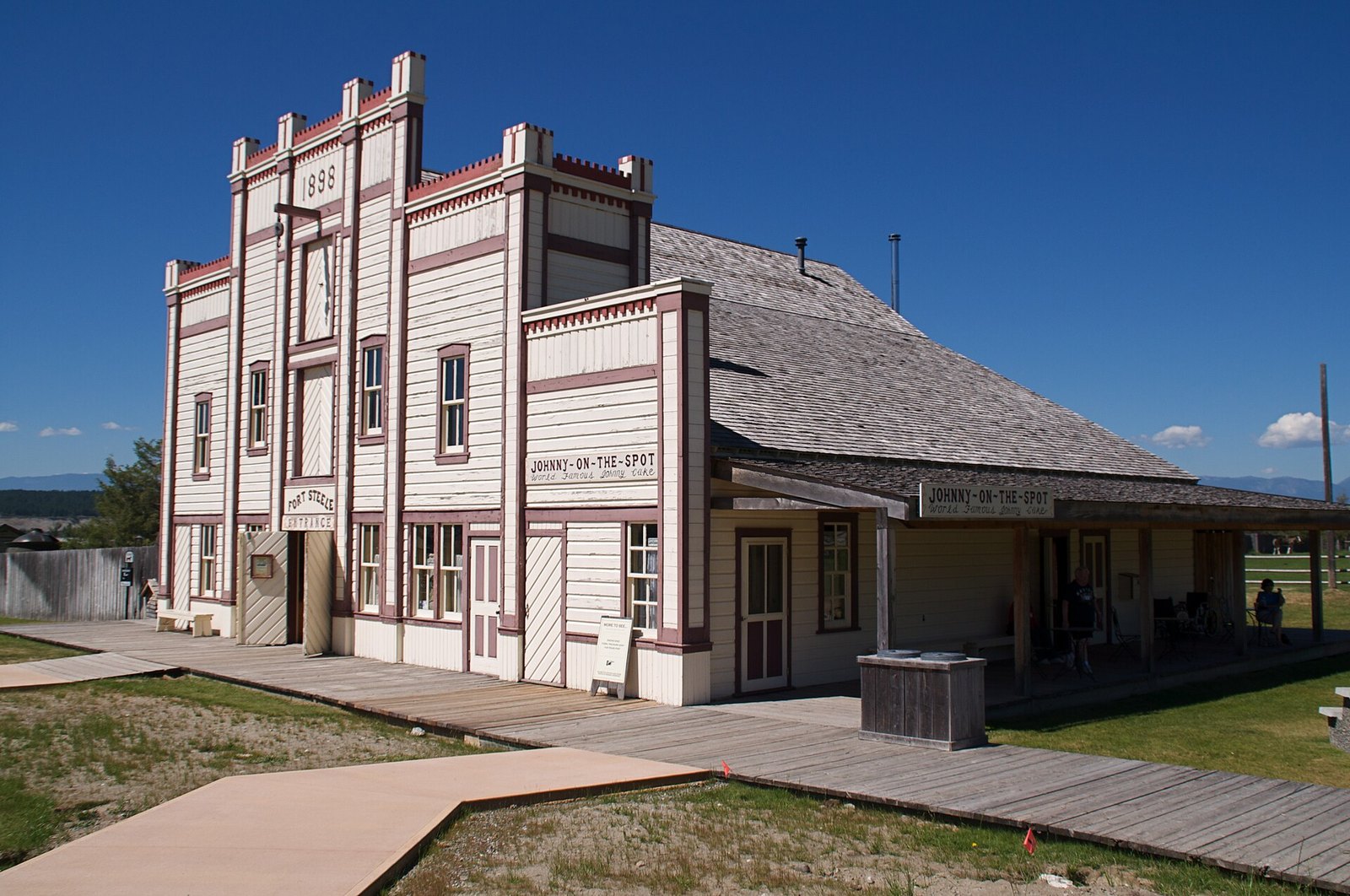
Fort Steele started as Galbraith’s Ferry during the Wild Horse gold rush of the 1860s. In 1887 the first North West Mounted Police post in BC was set up here, and the town was renamed for Sam Steele. Then in 1898 the railway bypassed it in favour of Cranbrook. Businesses and residents moved away, and the decline is what kept the old town intact.
Today there are over 60 restored or reconstructed homes and buildings. Gold panning is free with admission. Fort Steele was designated a National Historic Site of Canada in 1925.
The site is now open year-round. Fall hours started Sept 11: 10 am to 4 pm, Thursday to Monday. Posted holiday closures include Dec 25 and Jan 1, 2027. Current admission prices weren’t confirmed on the official page, so check before you go.
It’s about 15 minutes northeast of Cranbrook on Highway 93/95. Plan on two to four hours. The visitor page warns that some ground is uneven and the boardwalks get slippery when wet, so wear good shoes.
1. Barkerville Historic Town & Park (Cariboo)
Where: End of Highway 26, east of Quesnel
When: Winter season to May 13, 2027, gate open daily 8 am to 5 pm; main season May 29 to Sept 12, 2027
Cost: Winter by donation; 2026 main season $22.05 + GST adult, $14.48 + GST youth
Getting there: From Quesnel on Highway 97, east on Highway 26 for 82 km
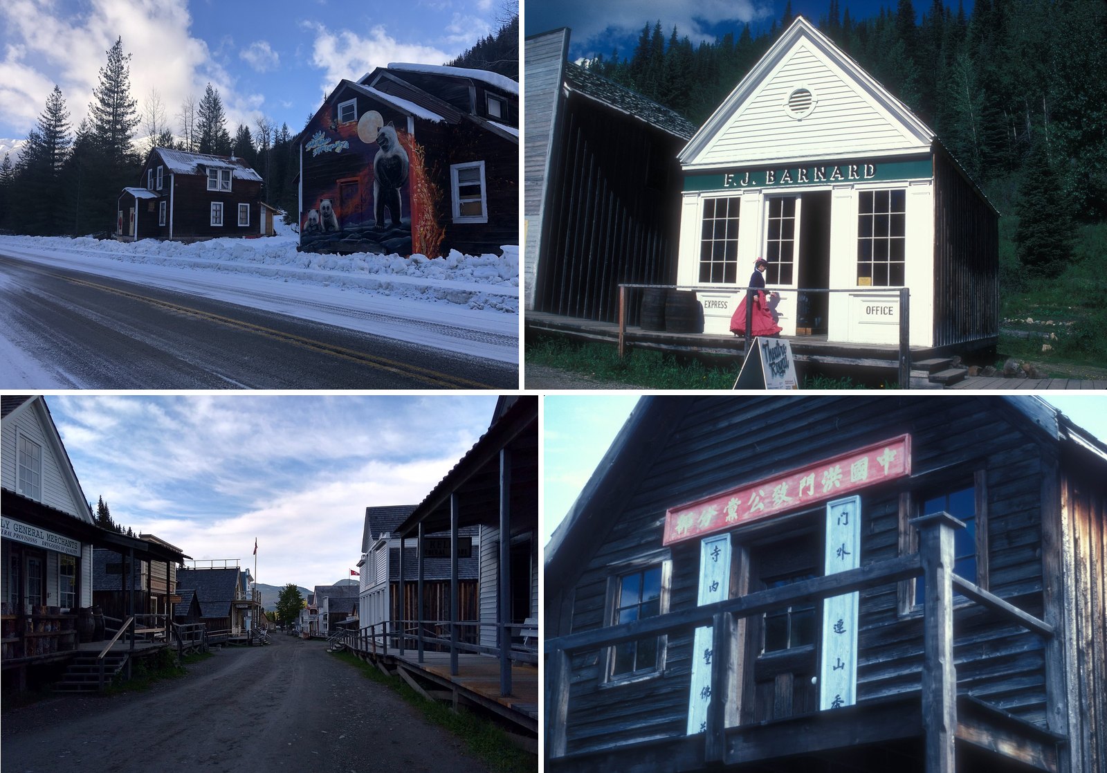
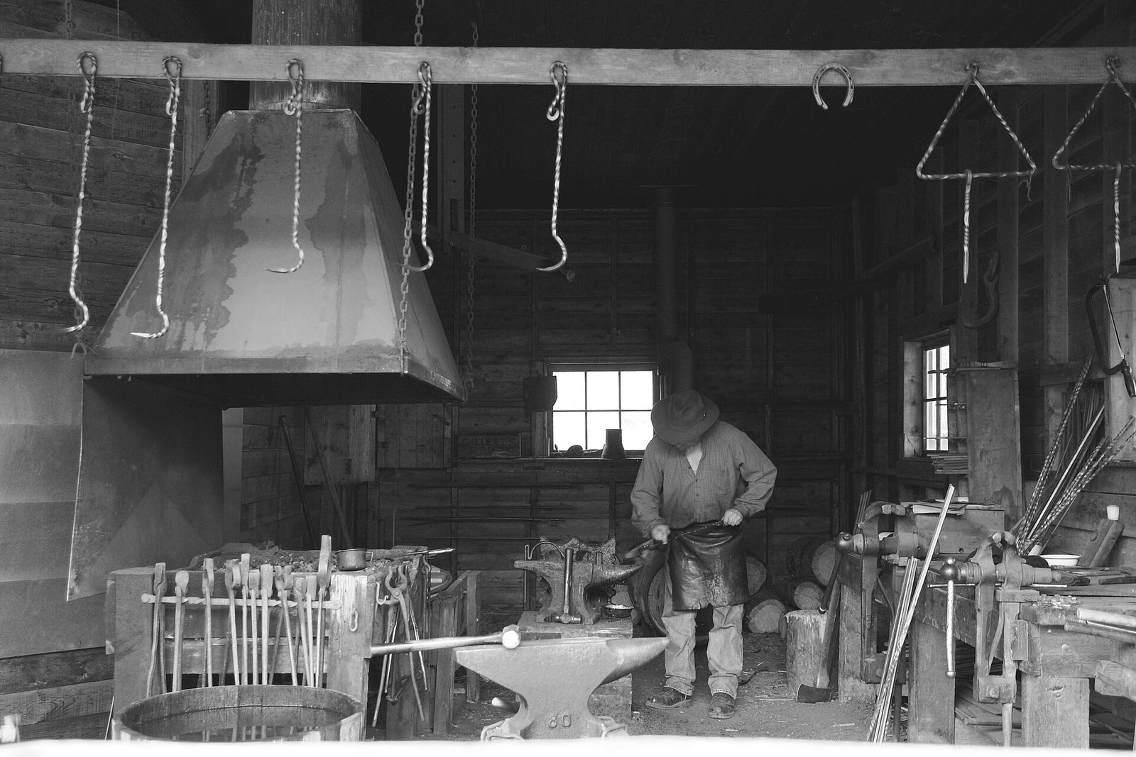
Barkerville was the main town of the Cariboo gold fields. It was founded in 1862, burned in 1868 and was rebuilt almost right away. Today it’s the largest living-history museum in western North America, with dozens of heritage buildings along its streets. The site sits on the traditional, ancestral and unceded territories of the Lhtako Dene Nation and Secwépemc Peoples.
Right now it’s the winter season, which runs from Sept 14, 2026 to May 13, 2027. Visits are self-guided and by donation. The walk-in gate is open daily from 8 am to 5 pm. The Welcome Centre is closed, so call ahead if you need an appointment. There’s no programming, and shops and restaurants are closed except during Olde-Fashioned Christmas. Check the official site for this year’s Christmas dates before you plan around them.
In summer the town fills in with costumed interpreters, shows at the Theatre Royal, stagecoach rides and gold panning. The 2027 main season runs May 29 to Sept 12, 2027. For reference, 2026 single-day admission was $22.05 + GST for adults (17 to 64) and $14.48 + GST for youth (6 to 16), with kids 5 and under free. The theatre, stagecoach and panning lessons cost extra.
About 75% of Barkerville is wheelchair accessible, including the historic town and campgrounds, according to the visitor guidelines. Pets aren’t allowed in the Heritage Zone during the shoulder season, main season or special events. The site doesn’t address dogs in winter, so leave them at home unless you’ve confirmed otherwise. On the drive in, stop at Cottonwood House Historic Site on Highway 26. It’s one of the last gold-rush roadhouses and has a 3 km wheelchair-accessible trail system. Check its 2027 dates first.
| Column 1 | Column 2 |
|---|---|
| Quesnel Forks | founded 1859 |
| Barkerville | 1862 / fire 1868 / National Historic Site 1924 / Provincial Heritage Property 1958 |
| Fort Steele | railway bypass 1898 / National Historic Site 1925 / Provincial Heritage Property 1988 |
| Granite Creek | burned 1907 |
| Sandon | flood 1955 |
| Column 1 | Column 2 |
|---|---|
| Barkerville | donation now; $22.05 + GST main season |
| Three Valley Gap | $18 adult |
| Sandon | most free; museum $5 |
| Quesnel Forks | no fees |
When to go (as of Oct 23, 2026)
- Barkerville is open by donation, with the gate open daily 8 am to 5 pm until May 13, 2027. The full summer program returns May 29, 2027.
- Fort Steele is open year-round. Fall hours are 10 am to 4 pm, Thursday to Monday.
- Three Valley Gap runs Fright Night on Oct 23 and 24, then it’s closed until next season.
- Sandon’s 2026 dates aren’t posted.
- Quesnel Forks has no confirmed snow-season access, so plan for late spring to fall.
- The Hurley River FSR to the Bridge River Valley is closed to cars in winter.
What to bring
Wear good shoes. Fort Steele warns about uneven ground and slippery boardwalks, and the unstaffed sites have trails and old townsites underfoot. Several of these drives involve mountain highways or gravel, so go prepared and check DriveBC before you leave. If you’re bringing a dog, Three Valley Gap welcomes leashed pets. Barkerville doesn’t allow them in the Heritage Zone during its busier seasons and events.
Etiquette and safety
- Stay on trails, especially at Quesnel Forks, where erosion and unstable trees have closed part of the site.
- Respect cemeteries. Granite Creek’s restored cemetery overlooks the old townsite and should be treated as an active place of remembrance.
- Don’t dig, disturb ruins or remove artifacts at any of these heritage sites.
- Keep off private land. At Bradian, look from the road only.
- Check DriveBC for mountain highways before you go.
Getting there
No official source posts door-to-door drive times from downtown Vancouver for most of these places. Wells gives the distances from Quesnel on Highway 26 as 74 km to Wells and 82 km to Barkerville. The Bridge River Valley is about four hours from Vancouver up the Sea to Sky and through Pemberton, in summer only. For the rest, use the nearest-town distances in the table above and plan from there.
| Site | Nearest town | Distance or time | Road notes |
|---|---|---|---|
| Barkerville | Quesnel | 82 km | Highway 26 east from Highway 97 |
| Quesnel Forks | Likely | 13 km | From Keithley Creek Road, mostly gravel |
| Sandon | New Denver | 15 minutes | Just off Highway 31A |
| Fort Steele | Cranbrook | About 15 minutes | Highway 3/95 northeast |
| Granite Creek | Princeton | 19 km | Through Coalmont, then Blakeburn Road |
| Three Valley Gap | Revelstoke | 19 km | On the Trans-Canada, free parking |
| Bradian | Whistler | About two hours | Hurley River FSR, closed to cars in winter |
These towns survived for different reasons. Barkerville rebuilt after its fire. Fort Steele was saved by being ignored. Sandon kept its power plant running. Quesnel Forks and Granite Creek hung on as ruins that volunteers and local governments still look after. If you’re heading out this fall or winter, Barkerville and Fort Steele are your open options. Most of the others are best saved for late spring through early fall, when the roads and seasons line up again.
Get the weekend plan in your inbox. Burrard Bulletin is a free email on what’s actually on from Vancouver to Whistler. Sign up here.
Photo credits
- Zincton.jpg by Treefender K, CC BY 4.0 (combined into a montage, cropped). Via Wikimedia Commons.
- BARKERVILLE N.H.S., BRITISH COLUMBIA.jpg by KERRYE AND ROY KLOTZ MD, CC BY-SA 3.0 (combined into a montage, cropped). Via Wikimedia Commons.
- View North from Main Street in Barkerville Historic Town & Park.jpg by Bubblenymph, CC BY-SA 4.0 (combined into a montage, cropped). Via Wikimedia Commons.
- CHEE KUNG TONG NATIONAL HISTORIC SITE IN BARKERVILLE.jpg by JERRYE AND ROY KLOTZ MD, CC BY-SA 3.0 (combined into a montage, cropped). Via Wikimedia Commons.
- Blacksmith in Barkerville, BC – 2006.jpg by Ssarjola at en.wikipedia, Public domain (resized). Via Wikimedia Commons.
- Old trolley buses of Sandon (28607213216).jpg by Mike from Vancouver, Canada, CC BY-SA 2.0 (resized). Via Wikimedia Commons.
- Forte Steele entrance.jpg by WillowGoodf, CC BY-SA 3.0 (resized). Via Wikimedia Commons.
- Coalmont General Store (50144600112).jpg by Crusty Da Klown, CC0 (resized). Via Wikimedia Commons.
- 3 Valley Gap, BC (6197074796).jpg by CK Golf from Vancouver, Canada, CC BY-SA 2.0 (resized). Via Wikimedia Commons.
- Bradian townsite.JPG by Shaundd, CC BY-SA 3.0 (resized). Via Wikimedia Commons.