Where to See Hundreds of Bald Eagles Near Squamish This Winter
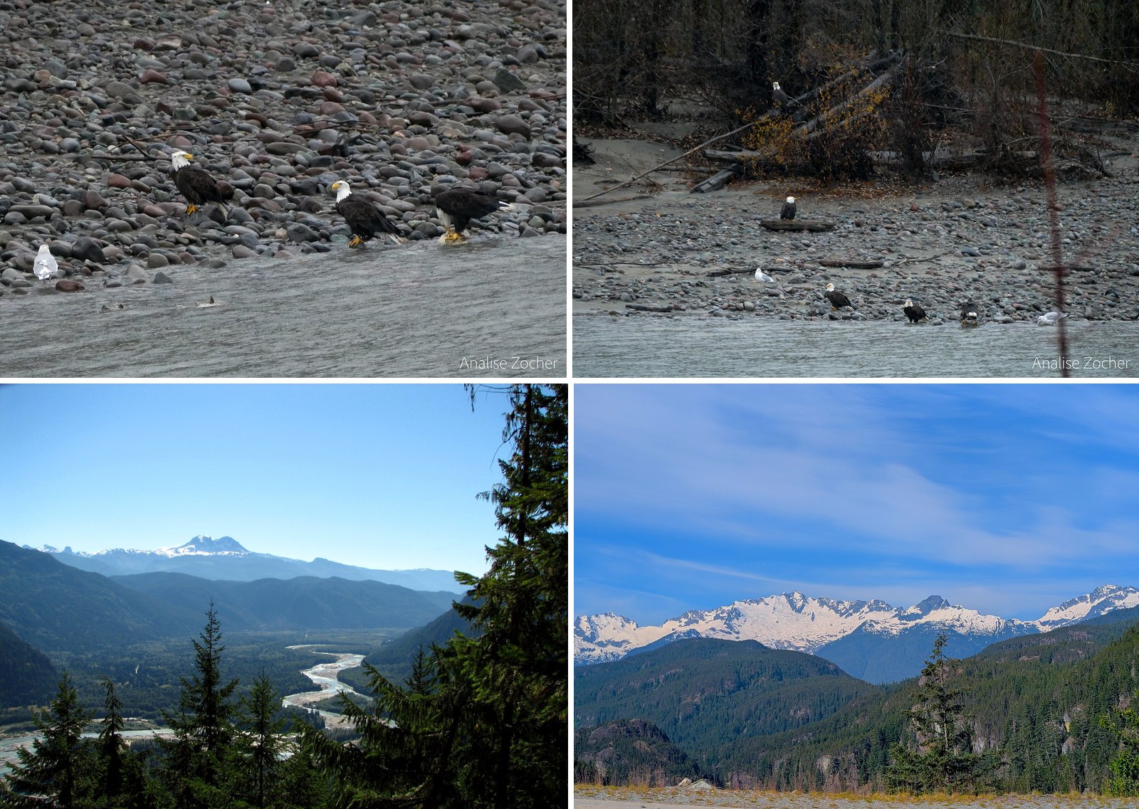
Volunteers counted 1,397 bald eagles in the Squamish Valley on January 4, 2026. That was the 40th Brackendale Winter Eagle Count. It was the highest total since 2007 and above the 40-year average of 1,320. The record still belongs to this valley: 3,769 eagles, counted in 1994.
The eagles come for chum salmon. Once the runs spawn and die in the Squamish, Cheakamus and Mamquam rivers, birds arrive from across the Pacific Northwest and the BC Interior to feed on the carcasses. Hundreds is accurate for the valley. It isn’t what you’ll see from one bench in one hour. The count covers about 65 km of river, and the main viewing dike shows a slice of it.
This guide covers where to stand, when numbers tend to peak, how to check the live count before you drive, and the rules that keep the birds coming back. The core habitat, Brackendale Eagles Park, is closed to recreation except fishing from October 1 to March 31. You watch it from across the river.
7. Brackendale Eagles Park (west bank, Squamish River)
Where: West bank of the Squamish River, Brackendale
When: Closed to recreation except fishing October 1 to March 31; eagles November to February
Cost: Viewing from the dike is free; the park can’t be entered in season
Getting there: No road access and no river crossing from the east side; view it from Eagle Run dike
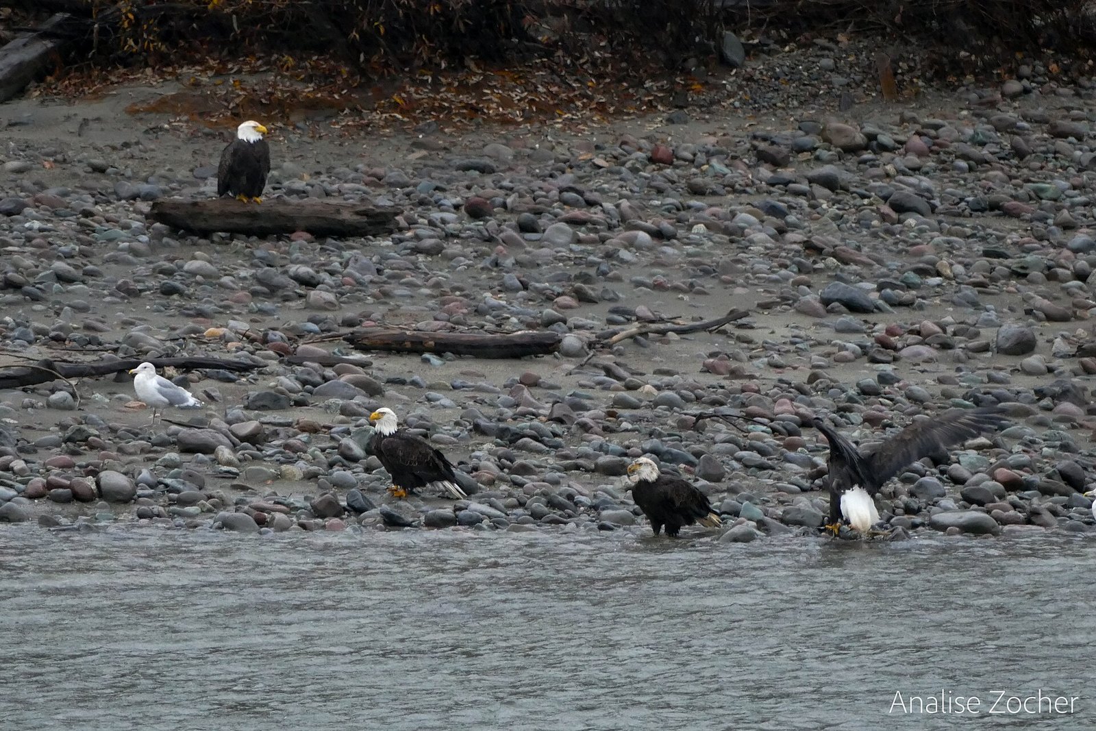
This is the protected area the eagles actually use, on the west bank of the Squamish River. BC Parks describes the Squamish River Valley as one of the most significant wintering areas for bald eagles in North America. The organizers of the Brackendale Winter Eagle Count say the count helped build the case for protecting it.
From October 1 to March 31 the park is closed to all recreation except fishing. There’s no road access and no river crossing from the east side. BC Parks also discourages angling from the west side or the park’s sandbars while eagles are present. The only commercial activity allowed is river rafting under a Park Use Permit, with proper wildlife viewing practices.
The eagles are only part of it. BC Parks lists black bear, cougar, gray wolf, Roosevelt elk and Columbian black-tailed deer in the park. About 148 bird species use it at different times of year. You won’t see most of that from the dike, but it explains the closure.
Don’t try to get closer by crossing gravel bars or paddling over. The official rules are to stay on the dikes, off the gravel bars and off private land. EagleWatch notes that eagles feeding on gravel bars are especially easy to disturb, and people, dogs and paddlers are the usual cause.
6. Harrison Mills, Kilby Park and the Harrison River (Fraser Valley)
Where: Harrison Mills, Highway 7 between Mission and Harrison Hot Springs
When: Eagles November to January; boat tours October to January
Cost: Boat tour from $69 CAD; Kilby Historic Site regular admission
Getting there: Highway 7 east through Mission; 15 minutes from Harrison Hot Springs
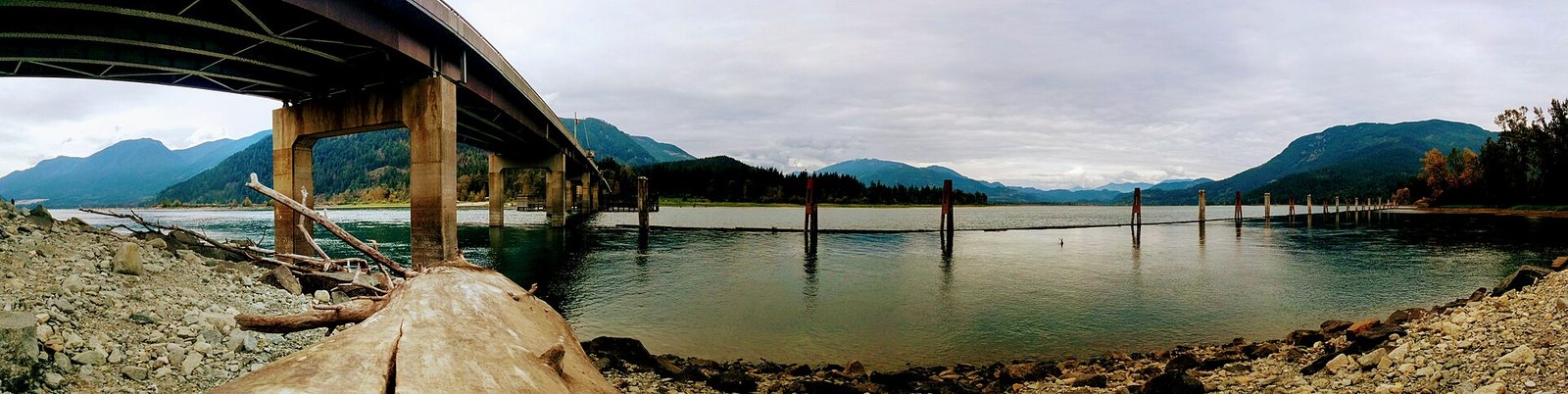
If you’re east of Vancouver, the Fraser Valley has its own winter eagle gathering. Kilby Historic Site says the Kilby Park campground beside the Harrison River is a designated British Columbia Wildlife Watch area. It calls the campground an excellent place to see large concentrations of wintering eagles, along with snow geese and trumpeter swans that migrate from Alaska. Tourism Harrison puts the eagles there from November to January.
The historic site is a preserved general store and farm on Highway 7 between Mission and Harrison Hot Springs. It runs Embrace the Wild Sundays from November 8 to 29, 2026, plus seasonal café menus, as part of Tourism Harrison’s Season of the Wild. Regular admission applies. The current listing shows Thursday to Sunday, 10 am to 4 pm, but winter hours may differ, so check first. Leashed, well-behaved dogs are allowed on site.
For a look from the water, Harrison Eco Tours runs a 1.5-hour Bald Eagle Viewing Boat Tour from $69 CAD, October to January. The boats are heated and enclosed. The operator still suggests dressing for the weather.
The Fraser Valley Bald Eagle Festival has no 2026 dates posted, so don’t build a trip around it. Harrison Mills is about 15 minutes from Harrison Hot Springs. Eagles in the morning, lunch at Kilby and an afternoon on the Harrison Hot Springs lakefront makes a full day.
| Source | Covers | Season | Peak |
|---|---|---|---|
| BC Parks | Squamish Valley | November to February | November to December |
| EagleWatch brochure | Squamish viewing sites | Late October to early February | Mid-December |
| EagleWatch counts, 2024-25 | Eagle Run dike | Not stated | November 20 (78 eagles) |
| EagleWatch counts, 2025-26 | Eagle Run dike | Counts posted November 1 to January 4 | Week of November 15 to 21 (average 22.5 per count) |
| Tourism Harrison | Harrison Mills | November to January | Not stated |
5. Squamish Estuary and the Spit (Downtown Squamish)
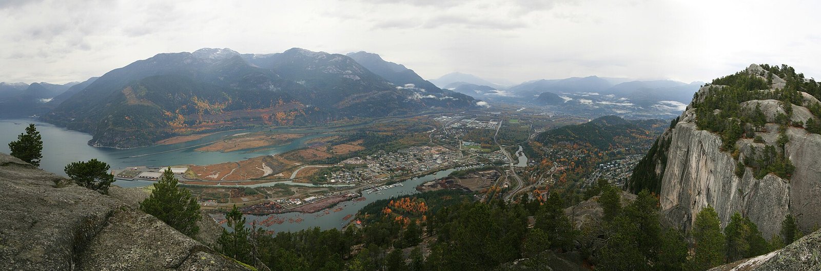
Where: West side of downtown Squamish, where the Squamish River meets Howe Sound
When: November to early February (brochure)
Cost: Free
Getting there: Off the end of Vancouver Street, Bailey Street or Third Avenue, or along the Squamish River training dike to the Spit
Where the Squamish River meets Howe Sound, the estuary is sedge meadow, marsh and mountain view. The brochure lists it as site 5, with bald eagles possible from November to early February.
Walk in from downtown off the end of Vancouver Street, Bailey Street or Third Avenue. Or follow the Squamish River training dike out to the Spit. You won’t get the riverbank gatherings of Brackendale here. Come for a longer winter walk with a chance of eagles over the marsh.
It pairs well with lunch downtown. Stop at the Squamish Adventure Centre on the highway first. Tourism Squamish hands out a map there, with a rundown of tours and current viewing spots.
4. Mamquam River spawning channels (Centennial Way, Squamish)
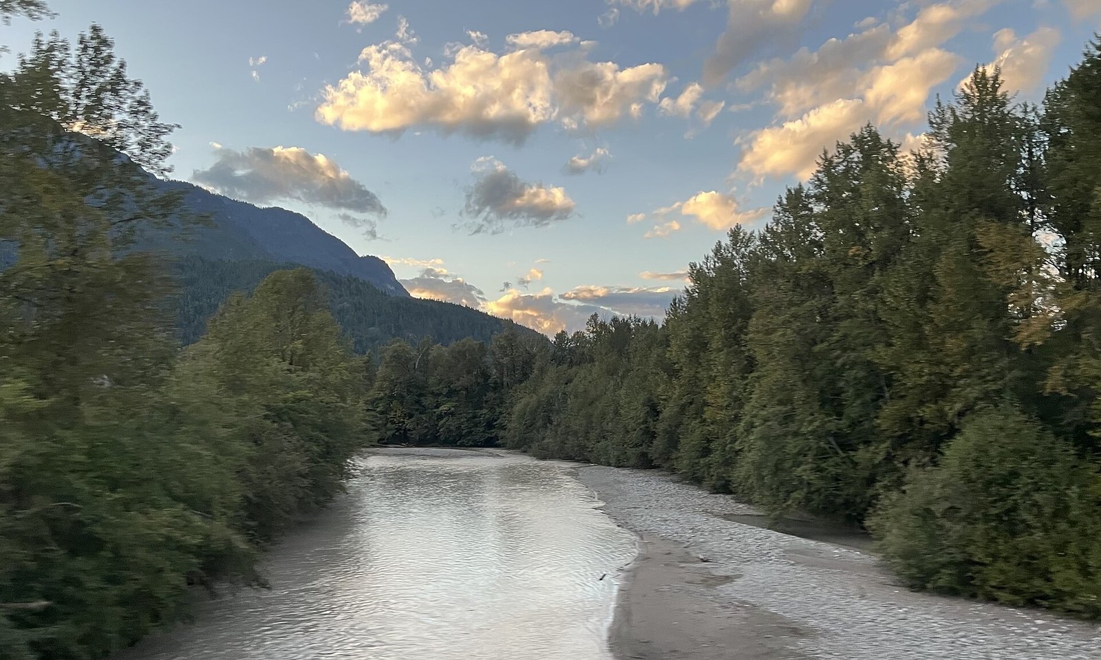
Where: South side of the Mamquam River off Centennial Way, Squamish
When: Late October to early February (brochure); worth checking later in the season
Cost: Free
Getting there: Park off Centennial Way and walk the south-side Mamquam River dike
The brochure lists the constructed salmon spawning channels on the Mamquam River as site 4. Eagles gather near them, and the brochure flags them as sensitive feeding areas. Stay off the gravel bars.
Park off Centennial Way, get onto the dike on the south side of the Mamquam, and stay on it. It’s one of the closest eagle sites to downtown Squamish and the highway.
It earns its place later in the season. The count organizers explain that high water in late November and December can wash spawned salmon in the lower Squamish River out to sea. When that happens, eagles move to shallower water upriver or to inland spawning channels. Riverbank numbers drop even though the birds are still in the valley. Channel sites like this one are worth a look when the dike counts fall off.
Tourism Squamish explains why the dike rule matters. An eagle pushed off its food may not come back to it, and it needs that energy to get through winter.
3. Tenderfoot Creek Hatchery (Brackendale)
Where: 1000 Midnight Way, Brackendale
When: 8 am to 3 pm daily (DFO); 9 am to 3 pm (Tourism Squamish)
Cost: No admission fee listed
Getting there: Squamish Valley Road 4 km to Cheekye, right fork 4 km, right on Midnight Way 1 km
Fisheries and Oceans Canada started building this hatchery in 1981. It raises coho, pink, chum and chinook salmon for the Squamish River watershed and releases more than 3.3 million smolts a year. DFO makes the connection plainly. Keeping salmon stocks going also helps keep the local bald eagle population going.
The spawning channels draw eagles, herons and ducks. Adult coho are on site November to January and adult chum in November, which lines up with eagle season. There’s a self-guided tour with information signs. Guided tours happen when operations allow. Call the hatchery at 604-898-3657 ahead of time to ask. Salmon in the channels give kids the other half of the eagle story.
Hours differ by source. DFO lists 8 am to 3 pm daily. Tourism Squamish lists 9 am to 3 pm, seven days a week. Arrive after 9 and you’re covered either way. DFO says public washrooms are currently closed, so use the toilets at Eagle Run or in town first. Neither source lists an admission fee.
DFO’s directions: Highway 99 north, watch for hatchery signs just before Alice Lake Provincial Park, and turn left onto Squamish Valley Road. Go 4 km west to Cheekye and take the right fork. Continue 4 km, turn right onto Midnight Way and go another 1 km.
2. Cheakamus and Cheekye river confluence (Squamish Valley Road)
Where: Near Cheekye, off Squamish Valley Road, north of Brackendale
When: Late October to early February, peaking mid-December (brochure)
Cost: Free
Getting there: Highway 99, turn onto Squamish Valley Road before Alice Lake Provincial Park, about 4 km west to Cheekye
The official EagleWatch viewing-sites brochure lists the meeting of the Cheakamus and Cheekye rivers as a place where large numbers of eagles gather. It’s site 2 on the brochure map. BC Parks notes that eagles congregate along the Squamish and Cheakamus rivers in winter to feed on salmon carcasses.
This is a roadside spot with no facilities. Parking is limited and the brochure asks for caution on the road. Don’t stop on the bridge, don’t block traffic, and respect private property.
The brochure gives a season of late October to early February, peaking mid-December. Turn off Highway 99 onto Squamish Valley Road just before the Alice Lake Provincial Park junction. It’s the same turn signed for the Tenderfoot hatchery. The confluence area is near Cheekye, about 4 km west. Treat it as a short stop on the way to the hatchery. If you can’t pull fully off the road, keep driving.
1. Eagle Run dike and viewing shelter (Brackendale)
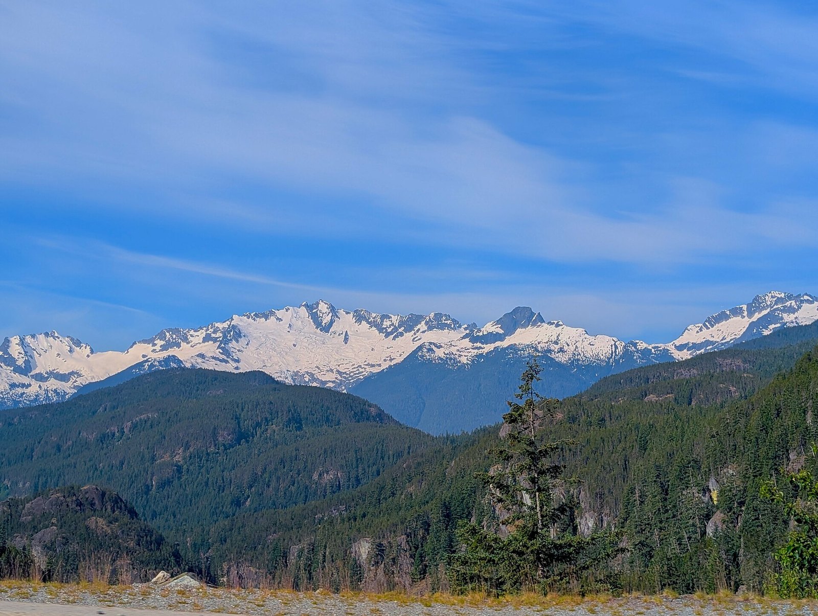
Where: Government Road, Brackendale, across from the Easter Seals Camp at 41015 Government Road
When: Year-round; best November to mid-December, mornings
Cost: Free
Getting there: Highway 99, exit at Garibaldi Way, north on Government Road. BC Transit route 1 Brackendale, $2.50 adult single fare
This is the main public viewing site and the one BC Parks sends people to. It’s a municipal dike on the east bank of the Squamish River, across from the Easter Seals Camp at 41015 Government Road. You look west over the water to Brackendale Eagles Park, where the eagles roost and feed. There’s a covered shelter with interpretive panels on the eagle life cycle and the salmon they eat. You’ll also find picnic tables and portable toilets supplied by the District of Squamish.
Scan the tall trees on the far bank, not the sky. Eagles spend most of their time roosting. In 2025-26 the highest single-hour count here was 46, on the afternoon of November 16. The season peak was 78 in 2024-25 and 171 in 2022-23. A good year and a lean year look very different from the same spot. Volunteers also log other wildlife sightings and weather with each count.
Mornings from early November to mid-December are best, according to the EagleWatch 2024-25 season report. That report also notes more adults than juveniles are usually seen. Volunteers count twice a day, around 10 to 11 am and 2 to 3 pm, from November 7, 2026 to January 2, 2027. A light snow in the trees makes white-headed adults harder to pick out.
The gravel path is level. Tourism Squamish rates it suitable for strollers and wheelchairs, with a ramp at the south end. Volunteers clear snow from the ramp when they can, but winter access is more limited. Keep dogs on leash. The Watershed Grill sits at the north end of the dike at 41101 Government Road and advertises a riverside patio.
| Season | Peak | Date |
|---|---|---|
| 2006-07 | 568 | Dec 9, 2006 (morning) |
| 2012-13 | 221 | Dec 8, 2012 (morning) |
| 2017-18 | 159 | Dec 2, 2017 (morning) |
| 2022-23 | 171 | Dec 8, 2022 |
| 2024-25 | 78 | Nov 20, 2024 |
| 2025-26 | 46 | Nov 16, 2025 (afternoon) |
| Spot | Facilities | Cost | Best for |
|---|---|---|---|
| Eagle Run dike | Shelter, interpretive panels, picnic tables, portable toilets, accessible ramp | Free | First visit, families, strollers |
| Tenderfoot Creek Hatchery | Self-guided signage; washrooms listed closed by DFO | No fee stated | Salmon + eagles, quiet |
| Cheakamus/Cheekye confluence | None; limited roadside parking | Free | Quick stop en route to hatchery |
| Mamquam spawning channels | Dike walk off Centennial Way | Free | Close to town; later season |
| Squamish Estuary / Spit | Trails, downtown nearby | Free | Longer walk + lunch downtown |
When to go
- The eagles follow the chum salmon. BC Parks says viewing peaks November to December, with significant numbers possible into January.
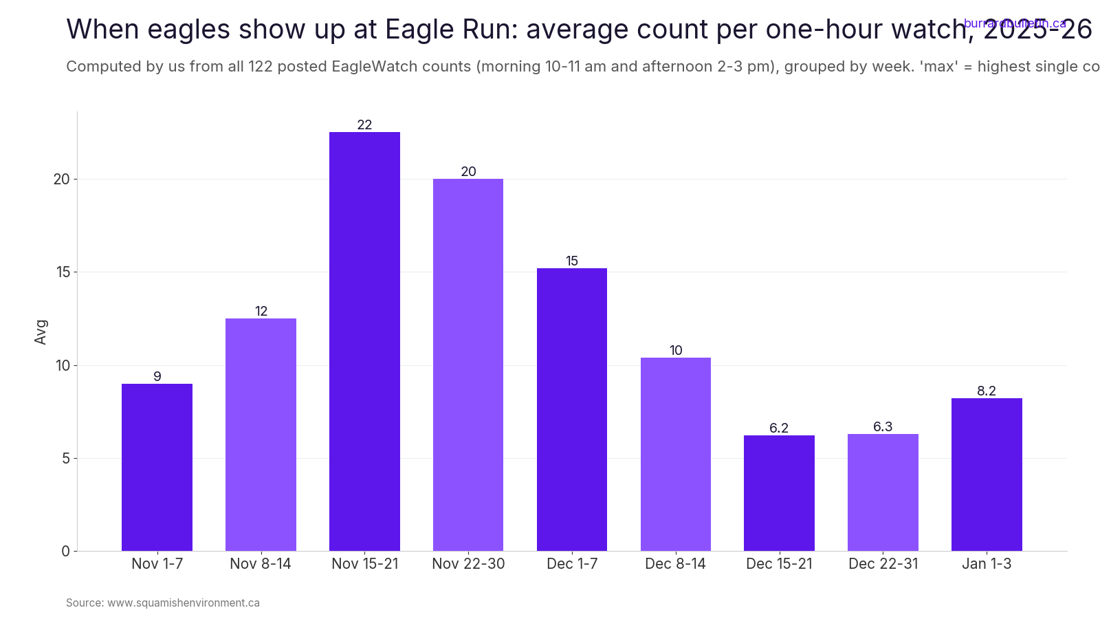
- Recent dike data points earlier than the brochure’s mid-December peak. In 2025-26 the weekly average at Eagle Run was highest from November 15 to 21, at 22.5 eagles per one-hour count. After mid-December it fell to about 6. The chart below shows the full season.
- Late in the season, high water can wash carcasses out to sea. Eagles then move upriver or into spawning channels, and riverbank numbers drop.
- Time of day: Tourism Squamish suggests early morning, when eagles are hunting after a cold night, and roughly 2:30 to 3:30 pm, when they head back to roost.
Check the live count before you drive
EagleWatch, run by the Squamish Environment Society, posts morning and afternoon counts from Eagle Run with weather notes on its daily count page. The 2026-27 season runs November 7, 2026 to January 2, 2027.
Counts swing hard. The organizers have seen a dozen eagles one day and close to 90 the next. When the weather turns cold and snowy, eagles shelter deep in the forest or head upriver to protected spawning channels, and the dike thins out.
The Brackendale Winter Eagle Count
The Brackendale Winter Eagle Count is a one-day volunteer census held on the first Sunday after New Year’s Day. Volunteers cover 20 areas over about 65 km, from the Elaho River to downtown Squamish, on foot, snowshoe, ski and raft. The Brackendale Art Gallery has been home base since the first count in 1986. Pre-registration is required to volunteer.
The 2027 date isn’t announced yet. By the first-Sunday rule it would fall on Sunday, January 3, 2027.
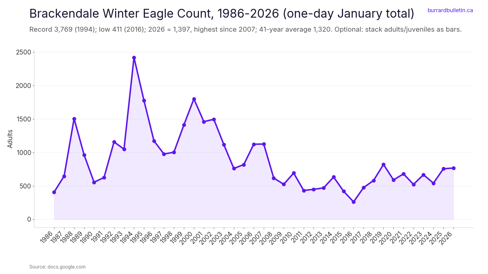
On January 4, 2026, 57 volunteers counted 1,397 eagles: 767 adults, 618 juveniles and 12 unclassified. The one-day total has ranged from 3,769 in 1994 to 411 in 2016. The long-term chart below shows how much it moves from year to year.
Etiquette and safety
- Give them space. Winter is hard on eagles, and early morning is key feeding time. Never disturb a feeding eagle.
- No drones. Use binoculars or a telephoto lens instead.
- Stay on the dikes, off gravel bars and off private land.
- Keep dogs on leash and don’t let them chase wildlife.
- Brackendale Eagles Park is closed to recreation except fishing from October 1 to March 31.
- At the Cheakamus and Cheekye confluence, don’t stop on the bridge or block traffic.
The full rules are in the EagleWatch brochure.
What to bring
- Binoculars. They’re the one essential, since the eagles roost in tall trees across the river.
- Rain gear and warm layers. Count logs from November to January 2025-26 mostly record 0 to 12°C, with rain, fog and the odd snowfall. Go prepared to stand still in the wet for a while.
- A telephoto lens if you shoot, rather than trying to get closer.
Getting there
Drive north on Highway 99, the Sea to Sky. Brackendale is about 70 km from Vancouver, according to BC Parks. For Eagle Run, exit at Garibaldi Way and head north on Government Road. Park along Government Road, but not in the bike lane, as the official route map notes.
Once you’re in Squamish, BC Transit route 1 Brackendale runs toward the dike. Fares are $2.50 for an adult single ride and $5 for a DayPASS, and kids 12 and under ride free.
Accessibility: the Eagle Run path is level gravel with a ramp at the south end. Snow can limit access in winter.
Start at Eagle Run on a November morning, binoculars in hand and the live count checked. If the dike is thin, the hatchery and the Mamquam channels are short drives away. The valley count says the birds are out there. Some days they’re just spread along 65 km of river instead of lined up across from the bench.
Get the weekend plan in your inbox. Burrard Bulletin is a free email on what’s actually on from Vancouver to Whistler. Sign up here.
Photo credits
- Bald eagles eating salmon (39714826931).jpg by Analise Zocher, CC BY 2.0 (combined into a montage, cropped). Via Wikimedia Commons.
- Bald eagles (39714821051).jpg by Analise Zocher, CC BY 2.0 (combined into a montage, cropped). Via Wikimedia Commons.
- Squamish valley.jpg by McKay Savage, CC BY 2.0 (combined into a montage, cropped). Via Wikimedia Commons.
- Downtown Squamish.jpg by Madhumanti Mandal, CC BY-SA 4.0 (combined into a montage, cropped). Via Wikimedia Commons.
- TantalusJune2025.jpg by Tarun1323, CC BY-SA 4.0 (resized). Via Wikimedia Commons.
- Bald eagles (39714818171).jpg by Analise Zocher, CC BY 2.0 (resized). Via Wikimedia Commons.
- Mamquam River.jpg by LittleT889, CC BY 4.0 (resized). Via Wikimedia Commons.
- Panobv.JPG by Paulrudd, Public domain (resized). Via Wikimedia Commons.
- Harrison River at Highway 7 bridge facing North.jpg by Kissmykumbaya, CC0 (resized). Via Wikimedia Commons.