
6 BC Towns Where Homes Are Still Valued Under $500K on Vancouver Island
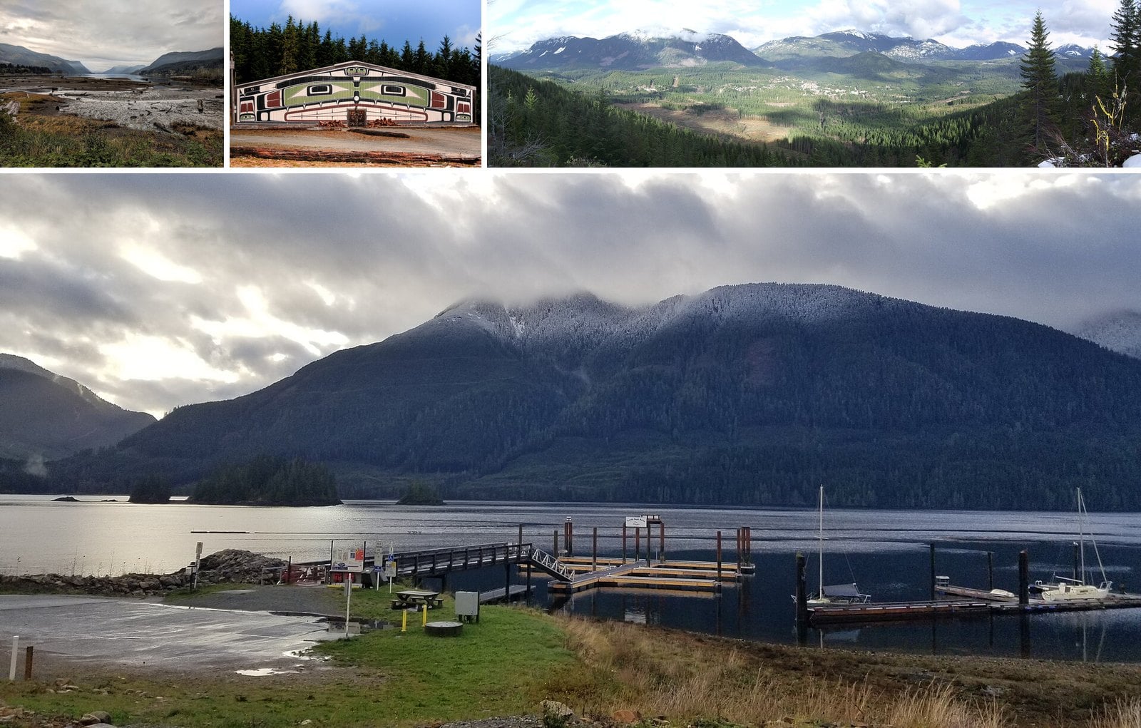
BC Assessment’s 2026 roll put the typical single-family home in the City of Victoria at $1,128,000. Oak Bay came in at $1,647,000. Nanaimo was $769,000. Keep driving north and west, though, and the numbers drop below half a million.
The towns here run from Tahsis at $204,000 to Port McNeill at $434,000. These are typical assessed values, based on market value as of July 1, 2025. They are not list prices. One clarification on the title: Alert Bay is on Cormorant Island, a short ferry ride off the North Island. BC Assessment counts it in its Vancouver Island region, so it’s included here.
Each section covers what you’ll see, what it costs and how to get there. Most of these places sit hours past Nanaimo, and it’s November. Check winter tires, gas and ferry times before you set out.
| Community | Typical 2026 value |
|---|---|
| Oak Bay | $1,647,000 |
| City of Victoria | $1,128,000 |
| Gulf Islands | $867,000 |
| City of Nanaimo | $769,000 |
| North Cowichan | $733,000 |
| Ladysmith | $723,000 |
| Lake Cowichan | $606,000 |
| Duncan | $592,000 |
6. Gold River (Strathcona Regional District)
Where: End of Highway 28, on Muchalat Inlet
When: Uchuck III Tuesday cruise ran Apr 7 to Oct 27 in 2026; 2027 dates not posted
Cost: Nootka Sound Day Cruise (2026): adults $108, 6 to 17 $63
Getting there: 90 km west of Campbell River on Highway 28 through Strathcona Park; no gas on the way
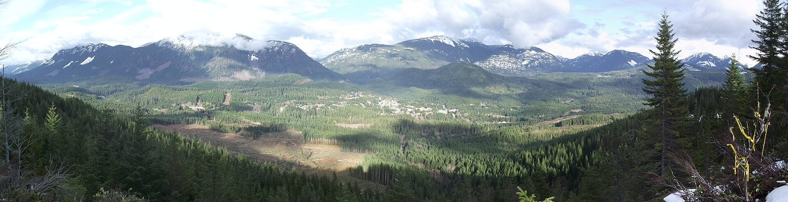
Gold River sits at the end of Highway 28, 90 km west of Campbell River. Its typical 2026 single-family value is $333,000, up 1% from $329,000. The regional district says it was founded in 1965 as Canada’s first all-electric town with underground wiring. After the pulp mill closed in the late 1990s, the town turned to tourism.
The village dock on Muchalat Inlet is home port for the MV Uchuck III. It’s a 41-metre (136-foot) wooden-hulled ship that has carried passengers and freight around Nootka Sound since 1955. In 2026 the Nootka Sound Day Cruise ran Tuesdays from April 7 to October 27, except May 12, 19 and 26. Fares were $108 for adults and $63 for kids 6 to 17. Summer-only Friendly Cove (Yuquot) day cruises ran Wednesdays (June 24 to Sept 9) and Saturdays (June 20 to Sept 12) in 2026, leaving Gold River at 10 a.m., at $138 per adult.
2027 dates aren’t posted yet. The operator also calls the Tuesday cruise year-round on one page, so check the Uchuck III schedule and call before planning a winter sailing.
Upana Caves is on the road toward Tahsis and is run by Recreation Sites and Trails BC. There are five caves and a waterfall viewpoint, and no permit is required. Pick up a cave map in Gold River before you go. Carry two light sources, watch your footing and mind your head. The Gold River Chamber says never to explore caves with fewer than two or three people.
5. Port Hardy (Mount Waddington region)
Where: North end of Highway 19
When: Seawalk and beaches year-round; Salmon Centre July 2 to Aug 30 in 2026
Cost: Seawalk and beaches free; Salmon Centre charges admission
Getting there: Nanaimo to Port Hardy 390 km, about 4.5 hours
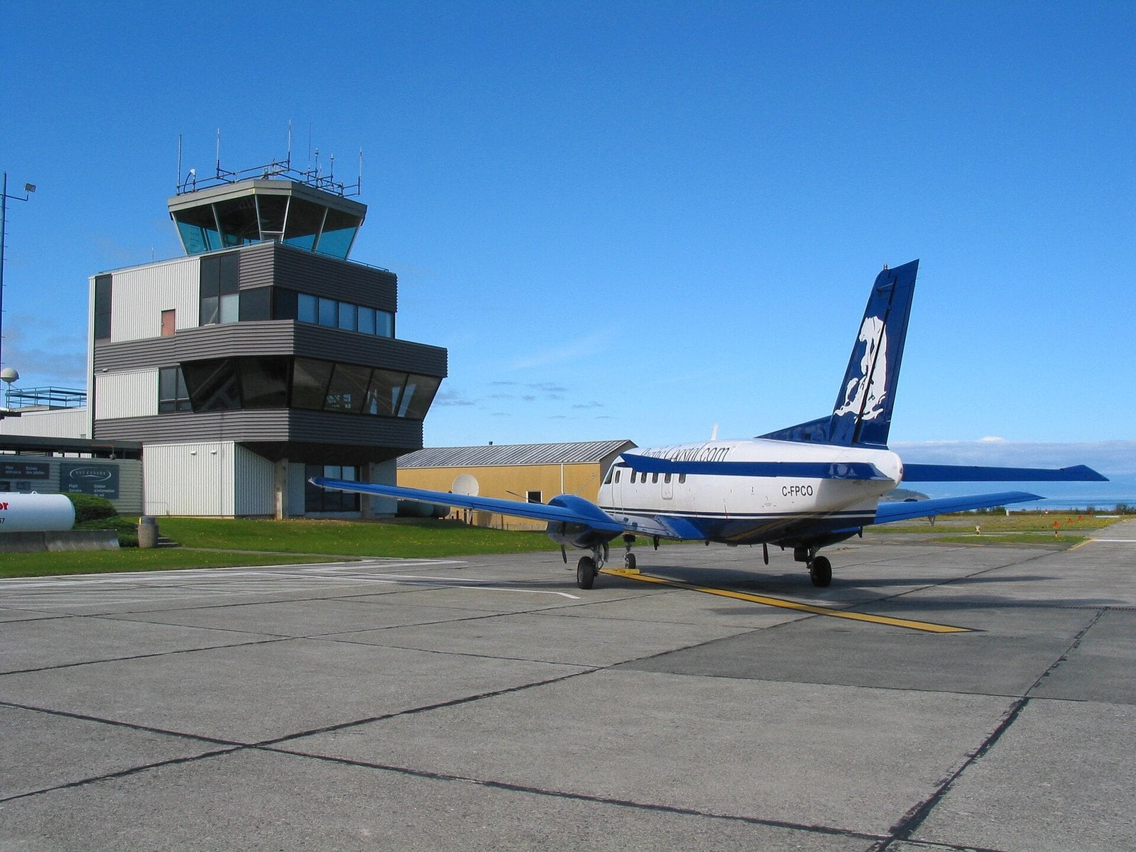
Port Hardy is the northernmost town on Vancouver Island and the biggest community in the region. Its typical 2026 single-family value is $370,000, up 3% from $360,000. It’s also where BC Ferries leaves for the Inside Passage route to Prince Rupert.
In town, the seawalk starts at Rotary Park, also called Carrot Park. It has two playgrounds, public washrooms and the visitor centre, so it’s an easy start with kids. Storey’s Beach has the area’s longest white-sand beach. The Quatse Salmon Stewardship Centre runs a hatchery and gallery and has worked on North Island salmon since 1983. For 2026, its own website listed it as open July 2 to August 30, Wednesday to Sunday, 10 a.m. to 3 p.m., and closed August 1, so confirm days and hours before you go. It charges admission; check the centre’s site for current rates. 2027 dates aren’t posted yet; check the Salmon Centre’s site.
For a taste of Cape Scott, BC Parks points to the San Josef Bay trail. It’s 2.5 km from the trailhead, about 45 minutes each way. The rest of Cape Scott and the North Coast Trail are wilderness hiking, and BC Parks recommends carrying a satellite phone or VHF radio, since cell phones don’t work in the park and help may be days away. Bear encounters are common there, and the access road carries logging trucks. Read the BC Parks hiking page first.
Vancouver Island North Tourism lists Nanaimo to Port Hardy as 390 km and about 4.5 hours. Add 1 h 40 min for the Horseshoe Bay sailing and about 25 minutes from downtown Vancouver to the terminal.
4. Port Alice (Neroutsos Inlet)
Where: Neroutsos Inlet, off Quatsino Sound
When: Year-round; Walkout Island at low tide
Cost: Sea Walk free; typical 2026 value $335,000
Getting there: About 30 minutes off Highway 19 on paved Highway 30
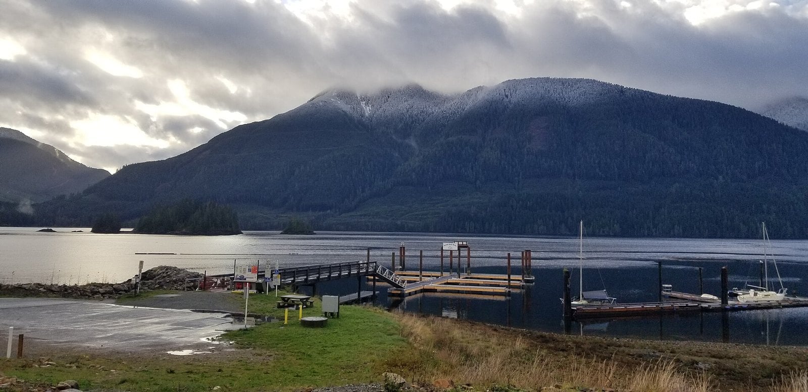
Port Alice is built on a mountainside above Neroutsos Inlet, off Quatsino Sound. Most of the town looks out over the water as a result. Its typical 2026 single-family value is $335,000, essentially flat from $334,000. The village sits on the traditional territory of the Quatsino First Nation.
The main walk is the 3 km Sea Walk along the shoreline. It’s wheelchair-accessible, with benches and picnic tables along the way, which makes it an easy outing with kids or grandparents. At the end, a trail leads to Walkout Island, which you can reach at low tide. Check a tide table before you set out. The village says to watch for whales, sea otters and sea lions.
The regional recreation map lists two karst sights nearby: the Eternal Fountain and Devil’s Bath. The map calls Devil’s Bath Canada’s only cenote. Details are on the village’s marina and attractions page and the regional map.
Port Alice is about thirty minutes off Highway 19 on paved Highway 30, which turns off between Port McNeill and Port Hardy. Nanaimo to Port McNeill is about 4 hours (340 km), so plan for a full travel day from the ferry.
3. Port McNeill (Broughton Strait)
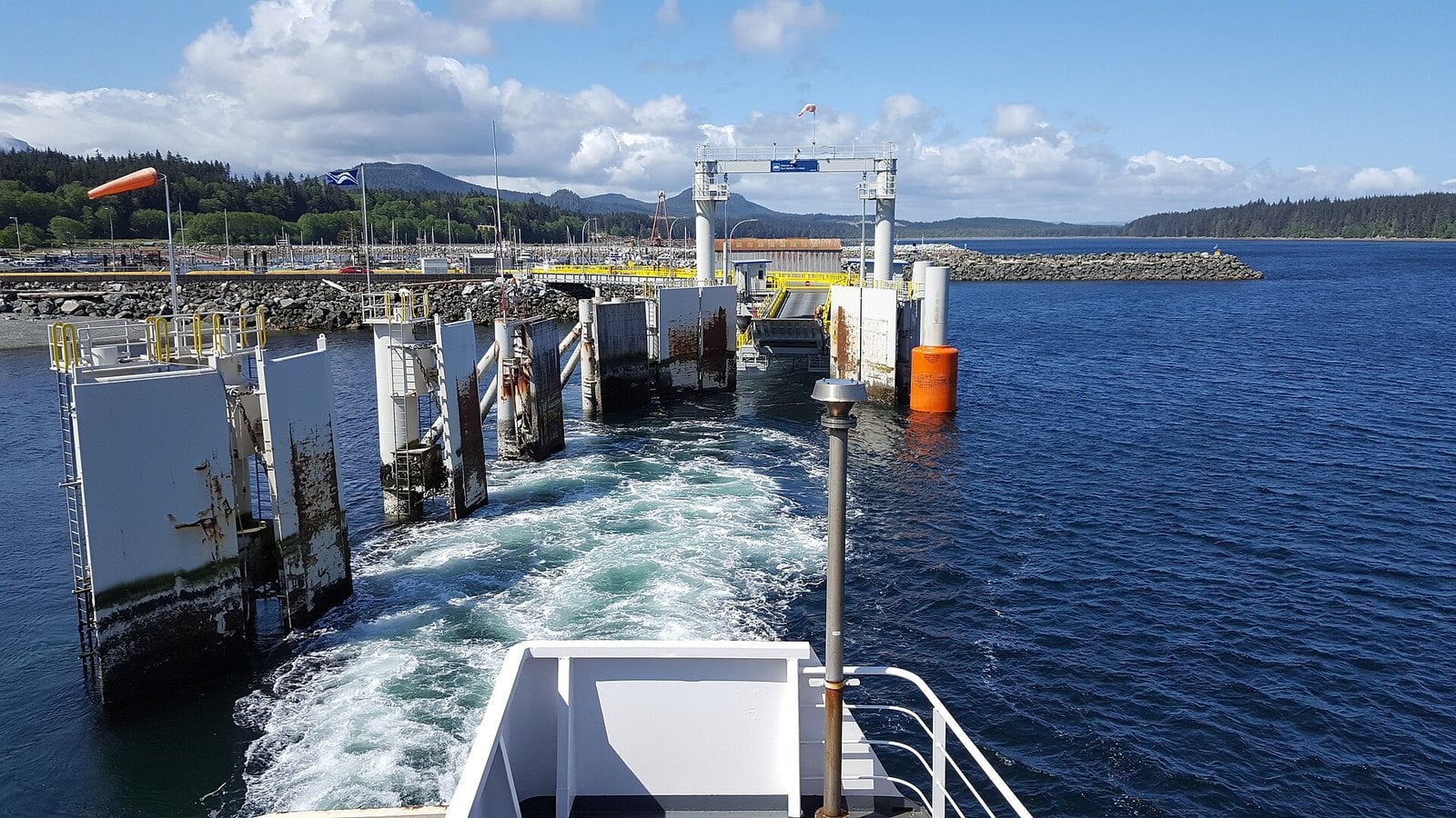
Where: Broughton Strait, Highway 19
When: Visitor centre Mon to Sat 9 a.m. to 4:30 p.m. (closed noon to 1) Sept 1 to Apr 30; daily 9 a.m. to 5 p.m. May 1 to Aug 31
Cost: Burl and seawall free; typical 2026 value $434,000
Getting there: Nanaimo to Port McNeill 340 km, about 4 hours
Port McNeill’s typical 2026 single-family value is $434,000, down 2% from $442,000. Vancouver Island North Tourism calls it the second-largest community on the North Island and a regional centre for wildlife eco-tourism. It’s also the gateway to the Broughton Archipelago.
The roadside stop everyone knows is the World’s Largest Burl. Canadian Geographic reports it was found in 2005 on a spruce about 525 years old. After a 2023 fire, it was moved to a new spot closer to downtown. Vancouver Island North Tourism says a second giant burl sits on Highway 19 about five minutes north of town, so you can see both on the way through.
Around town there’s a seawall and the Schoolhouse Trail, just steps from the centre. The Port McNeill Heritage Museum focuses on logging. Call ahead to confirm it’s open. The town’s visitor centre keeps winter hours from Sept 1 to Apr 30: Monday to Saturday, 9 a.m. to 4:30 p.m., closed noon to 1 p.m. and on stat holidays. Hours are on the town’s visitor page.
Nanaimo to Port McNeill is 340 km, about 4 hours. BC Ferries sails from here to Alert Bay and Sointula. Use Port McNeill as your base for a day trip to Alert Bay. The island is hilly, so the village recommends bringing your car unless you’re a determined walker.
2. Alert Bay, ‘Yalis (Cormorant Island)
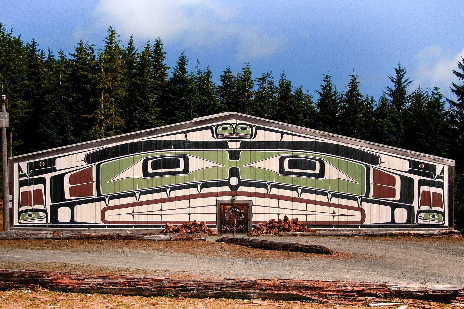
Where: Cormorant Island, by ferry from Port McNeill
When: U’mista: weekdays Sept to May, daily from third weekend of May to Labour Day, 9 a.m. to 5 p.m.
Cost: T’sasala dances (2026): $30 adult, $15 child 12 and under; U’mista $15 adult, $12 seniors/students, $5 youth 8 to 18, plus GST
Getting there: BC Ferries from Port McNeill, about 40 to 45 minutes
Alert Bay’s typical single-family value rose 7% in 2026, from $300,000 to $320,000. That was the biggest rise in BC Assessment’s Vancouver Island region. The village is on Cormorant Island, not Vancouver Island itself. The village puts the ferry ride from Port McNeill at about 40 minutes (Tourism Vancouver Island says 45).
The main reason to come is the U’mista Cultural Centre, which works to keep every part of Kwakwaka’wakw cultural heritage alive. A boardwalk runs from downtown to U’mista. The ‘Namgis Big House isn’t open for viewing, but you can see it from the outside. Beyond the village core, the island has 16 km of walking, biking and hiking trails. They pass the Alert Bay Ecological Park, a boardwalk through a bog-like environment with birds and wild cranberries. It was renamed the Alert Bay Ecological Park in 1998.
U’mista keeps winter hours from September to May: Monday to Friday, 9 a.m. to 5 p.m. From the third weekend of May to Labour Day it opens daily, same hours. In 2026 the T’sasala Cultural Group danced on Saturdays from July 4 to August 29, with August 1 cancelled. Tickets were $30 per adult and $15 for kids 12 and under. 2027 dates aren’t posted yet. U’mista admission is $15 for adults, $12 for seniors and students and $5 for youth 8 to 18, plus GST (under 8 free). Check BC Ferries for the fare and the village’s attractions page before you go.
The island is compact and the village core and U’mista are walkable, but the village warns it is hilly and recommends bringing your vehicle on the ferry unless you’re a determined walker. View the memorial poles at the ‘Namgis Original Burial Grounds from the public road only.
1. Tahsis (Nootka Sound)
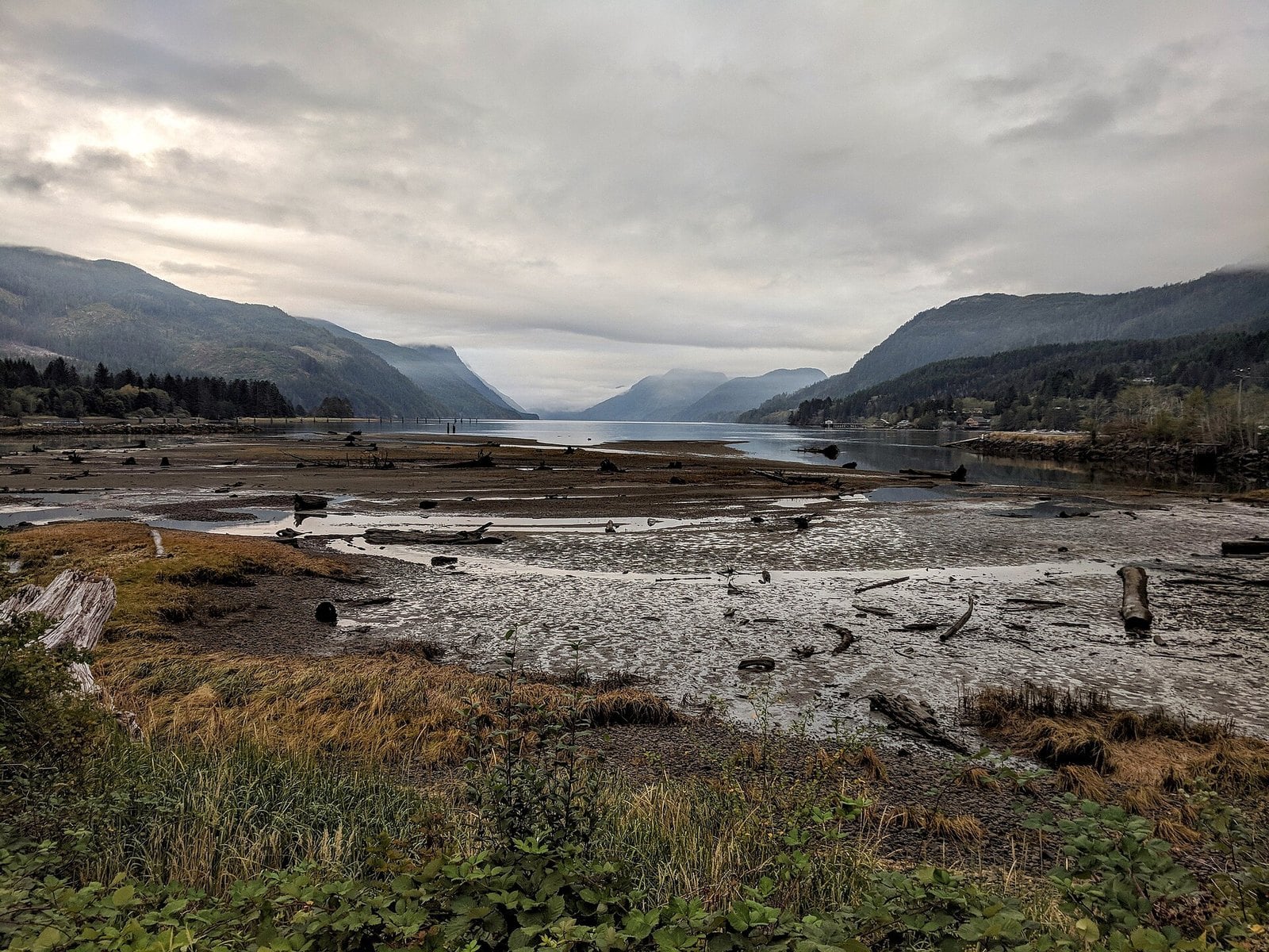
Where: Head of Tahsis Inlet, Nootka Sound
When: Year-round by road; late summer to early fall for salmon snorkelling
Cost: No fee to visit; typical 2026 value $204,000
Getting there: Highway 28 to Gold River, then the road to Tahsis; about 3 hours from Campbell River
Tahsis sits at the head of Tahsis Inlet in Nootka Sound, on the traditional territory of the Mowachaht/Muchalaht First Nation. Its typical 2026 single-family value is $204,000, up 2% from $201,000. No other town on this list comes close to that low.
The village sells itself on what’s in the water and under the ground. Sport fishing, hiking, caving, wildlife viewing and cold-water diving are the draws. Divers come for a gorgonian coral grove at Mozino Point in the Tahsis Narrows, which the village calls rare. It starts just over 30 metres (100 feet) down. Weymer Provincial Park nearby has some of the Island’s best caving, climbing and bouldering, according to the village.
Come in late summer or early fall if you want to snorkel. That’s when salmon return to spawn in the Tahsis and Leiner rivers, and the village points snorkellers to both. You can drive in year-round. Highway 28 needs winter tires from Oct 1.
The drive is part of the trip. Take Highway 28 from Campbell River to Gold River, then the road to Tahsis. The village’s getting-here page puts the whole run at about 3 hours, with 60 to 90 minutes on the last stretch depending on conditions. Stop at Upana Caves on the way in. You can also arrive by water taxi, passenger ship, helicopter or seaplane.
| Leg | Distance | Time |
|---|---|---|
| Downtown Vancouver → Horseshoe Bay | about 20 km | about 25 min |
| Horseshoe Bay → Nanaimo (ferry) | — | 1 h 40–42 min |
| Nanaimo → Port McNeill | 340 km | 4 h |
| Nanaimo → Port Hardy | 390 km | 4.5 h |
| Campbell River → Gold River | 90 km | — |
| Campbell River → Tahsis | — | about 3 h |
| Port McNeill → Alert Bay (ferry) | — | 45 min |
What typical assessed value means
The figures in this story are BC Assessment’s typical single-family values on the 2026 roll. They reflect market value as of July 1, 2025, and physical condition as of October 31, 2025. BC Assessment publishes them to show market trends by community. They are not list prices, and a given house can sell well above or below them.
The 2026 Island roll covers about 400,000 properties, and BC Assessment expected most homeowners to see changes between -5% and +5%. The 2027 roll isn’t out yet. Full numbers are in the BC Assessment release.
Getting there from Vancouver
- Horseshoe Bay is about 20 km, or 25 minutes, from downtown Vancouver.
- The Horseshoe Bay to Departure Bay (Nanaimo) sailing takes about 1 h 40 to 42 min.
- Since fall 2025, every vehicle sailing from Horseshoe Bay to Departure Bay needs a reservation. Book on BC Ferries before you leave.
- From Nanaimo, Port McNeill is about 4 hours and Port Hardy about 4.5 hours. Port Alice is about thirty minutes off Highway 19.
- From Campbell River, Gold River is 90 km and Tahsis is about 3 hours.
- Alert Bay is a 40- to 45-minute ferry from Port McNeill.
Winter driving
- Winter tires are required on designated sections of Highway 19 north of Campbell River (the route to Port McNeill, Port Alice and Port Hardy) and on Highway 28 to Gold River. The fine for not having them is $121.
- The requirement runs from Oct 1 to Mar 31, or to Apr 30 on mountain passes and high-snowfall routes. Follow the posted signs.
- Tires need the M+S or mountain/snowflake symbol and at least 3.5 mm of tread.
- There is no gas or other services on Highway 28 between Campbell River and Gold River.
- The Gold River–Tahsis road is about 64 km of gravel. The Village of Tahsis says it takes 60–90 minutes depending on road conditions, and four-wheel drive may be needed after heavy winter snowfalls.
When to go
- Mid-May to Labour Day: U’mista in Alert Bay switches to daily summer hours.
- April to October: the Uchuck III Tuesday day cruise season out of Gold River (Apr 7 to Oct 27 in 2026).
- July and August: the Quatse Salmon Centre in Port Hardy opens (July 2 to Aug 30 in 2026), and T’sasala dances run Saturdays in Alert Bay (July 4 to Aug 29 in 2026).
- Late summer and early fall: salmon return to the Tahsis and Leiner rivers.
- 2027 dates for all of these aren’t posted yet.
What to bring
- A full tank of gas, food and offline maps. Services thin out fast past Campbell River.
- For Upana Caves: two light sources, warm layers and sturdy footwear.
- For winter driving: proper winter tires.
- For Cape Scott beyond San Josef Bay: a satellite phone or VHF radio, as BC Parks recommends.
Etiquette and safety
- In Alert Bay, view the burial-ground memorial poles from the public road only, and see the ‘Namgis Big House from the outside.
- At Upana Caves, mind the low ceilings and never go caving with fewer than two or three people.
- Black bears are often seen on Port Hardy’s Fort Rupert Trail.
- Port Hardy’s Tex Lyon Trail is a challenging 12 km trek to Dillon Point. Treat it and Cape Scott beyond San Josef Bay as wilderness routes, not casual walks. Go prepared.
| Attraction | Town | 2026 season | 2026 price |
|---|---|---|---|
| Uchuck III Nootka Sound Day Cruise | Gold River | Tuesdays, Apr 7 to Oct 27 (not May 12, 19, 26) | Adults $108, seniors $103, 6 to 17 $63, under 6 free |
| Uchuck III Friendly Cove Day Cruise | Gold River | Summer only: Wed June 24 to Sept 9, Sat June 20 to Sept 12 | Adults $138 |
| T’sasala Cultural Group dances | Alert Bay | Saturdays, July 4 to Aug 29 (not Aug 1) | $30 adult, $15 child 12 and under |
| U’mista Cultural Centre | Alert Bay | Daily from third weekend of May to Labour Day; weekdays Sept to May | Adults $15, seniors/students $12, youth 8 to 18 $5, plus GST |
| Quatse Salmon Stewardship Centre | Port Hardy | July 2 to Aug 30, Wednesday to Sunday | Admission charged; see thesalmoncentre.org |
None of these towns is a short hop from Vancouver, and that distance is a big part of why the numbers look the way they do. What you get for the drive is real coastline: Nootka Sound, Quatsino Sound, Broughton Strait and the open North Island. Book the ferry, fill the tank and check the tires. Then go see what $204,000 to $434,000 looks like from the water.
Get the weekend plan in your inbox. Burrard Bulletin is a free email on what’s actually on from Vancouver to Whistler. Sign up here.
Photo credits
- Tahsis River Estuary, Tahsis, British Columbia.jpg by Tim Gage, CC BY-SA 2.0 (combined into a montage, cropped). Via Wikimedia Commons.
- Big house near Alert Bay.jpg by Owen Lloyd, CC BY-SA 3.0 (combined into a montage, cropped). Via Wikimedia Commons.
- Gold River Viewpoint – panoramio.jpg by Kiwibirdman, CC BY 3.0 (combined into a montage, cropped). Via Wikimedia Commons.
- Port Alice 2020.jpg by VQwertyvv, CC BY-SA 4.0 (combined into a montage, cropped). Via Wikimedia Commons.
- Port Hardy (105079130).jpg by Shawn from Airdrie, Canada, CC BY-SA 2.0 (resized). Via Wikimedia Commons.
- Leaving Port MacNeill (26435126753).jpg by Brian Burger from Victoria, Canada, CC BY 2.0 (resized). Via Wikimedia Commons.
