If You Grew Up in Delta or Tsawwassen, You’ll Remember These 12 Things
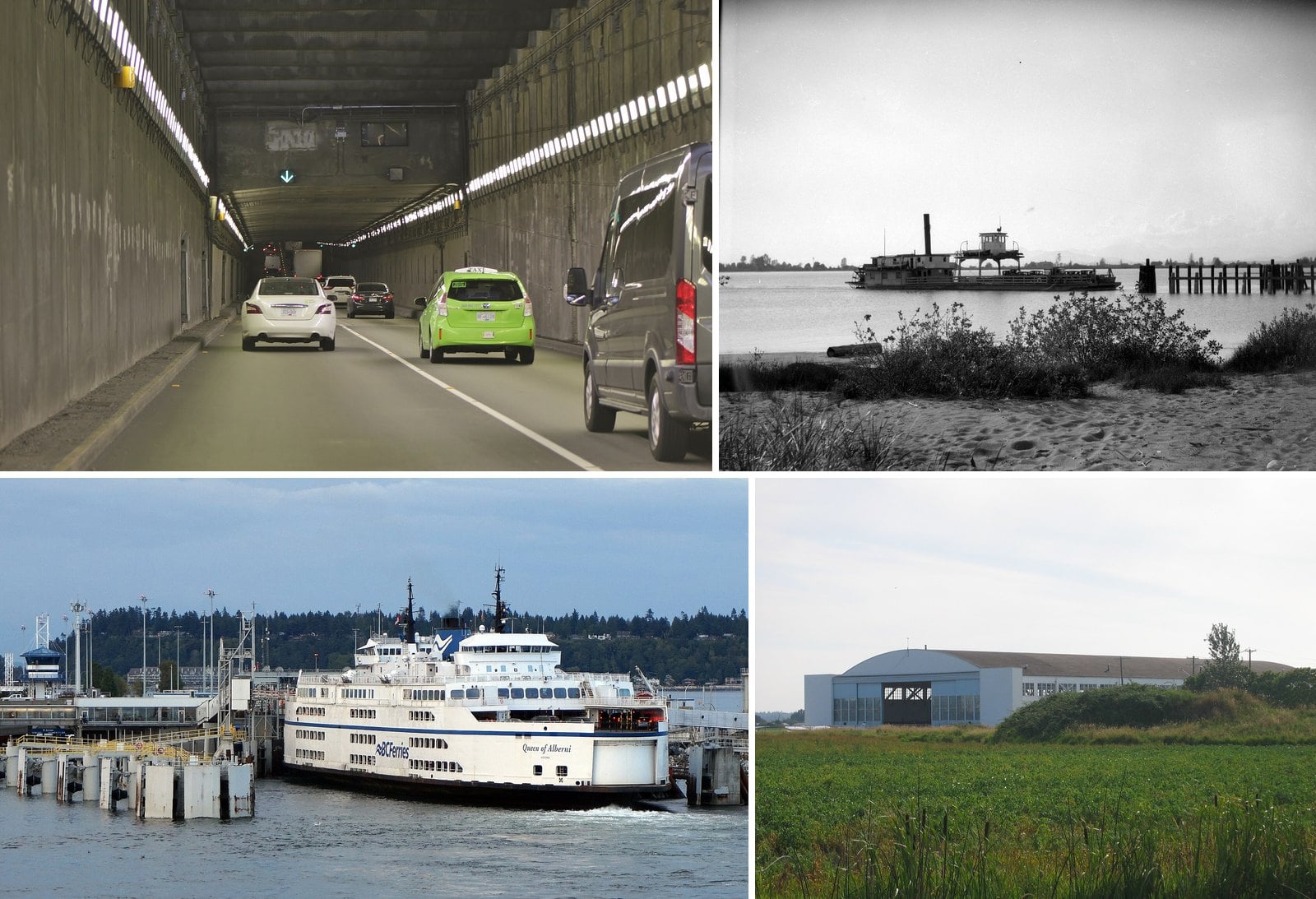
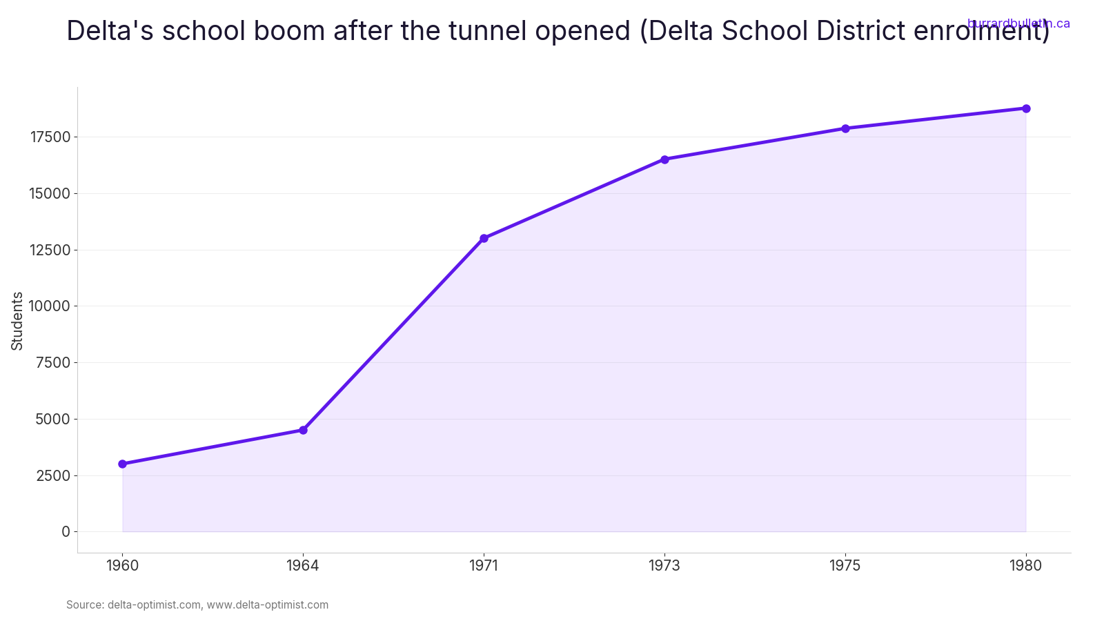
Before May 1959, the main way to drive from Ladner to Vancouver meant lining up for a ferry at the foot of Ferry Road. Then the tunnel opened, and Delta changed fast. Between 1969 and 1972 alone, the population went from 32,635 to 52,693. The schools filled just as fast. Enrolment more than quadrupled between 1960 and 1971.
This one is for people who grew up in Ladner, Tsawwassen or North Delta, or whose parents did. It covers the crossings that tied Delta to everything else, the summer beach, the runs to Point Roberts, the ducks on Westham Island, the coal port, the owls and the mall that went up on Tsawwassen First Nation lands.
The dates and numbers were checked against the Delta Optimist, Delta Archives material and official records. Where a place is still around, you’ll also find hours, rules and how to get there.
12. Tsawwassen Mills opening day (Tsawwassen First Nation lands)
Where: Highway 17 and 52nd Street, Tsawwassen First Nation lands
When: Opened October 5, 2016
Cost: Free entry
Getting there: Highway 17 at 52nd Street, a short drive from the ferry terminal
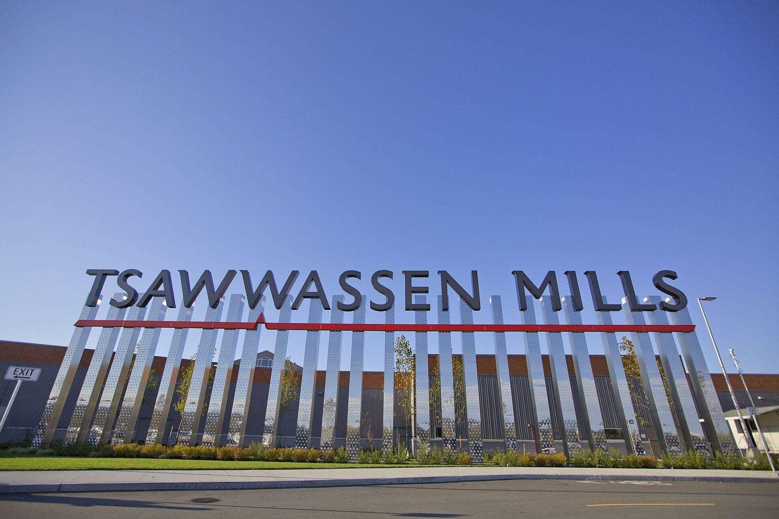
Tsawwassen Mills opened on October 5, 2016, with about 200 stores in 1.2 million square feet, roughly 111,000 square metres. The outdoor Tsawwassen Commons opened in phases across the road around the same time.
Not everyone was celebrating. Before the opening, CBC reported that many small business owners in South Delta expected to lose sales. Independent shops on 56 Street planned their own sales to compete.
In 2022 Ivanhoé Cambridge sold the mall to Central Walk. It sits at Highway 17 and 52nd Street, a short drive from the ferry terminal.
Local tip: 2026 marks the mall’s 10th anniversary. If you remember the farmland that was there before, this is the year to dig out the old photos.
11. The snowy owl winters on the Boundary Bay dyke (Boundary Bay)
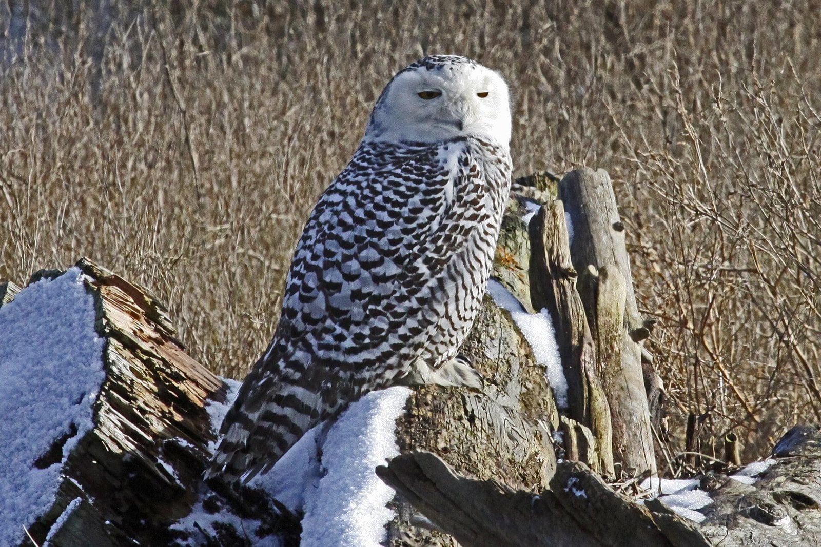
Where: Boundary Bay dyke, at the foot of 72 Street
When: Winters of 2011-12 and 2012-13; irruptions are irregular
Cost: Free
Getting there: Park at the end of 72 Street in Delta
In the winter of 2011-12 an unusually large number of snowy owls came to Boundary Bay. About 20 gathered just west of the 72 Street dyke entrance, and the crowds followed. The spectacle made the evening news and even the New York Times.
The owls came back the next winter, which was unusual. They normally show up only every few years. These southward surges are called irruptions and are linked to the owls’ Arctic food supply.
Irruptions are irregular, so don’t count on owls in any given year. The dyke is still the place for winter raptors. Park at the end of 72 Street, and the dyke trail runs along the bay.
Waterfowl hunting is legal in season (roughly September to March 10) along the Boundary Bay dyke from 64 Street east to the Surrey border, which includes the 72 Street area, so expect gunfire and wear bright clothing. Stay on the trail, keep dogs leashed and give the birds plenty of room. Farm vehicles use the dyke trail too, so move aside to let them pass.
10. RCAF Station Boundary Bay and its 1941 hangar (Boundary Bay Airport)
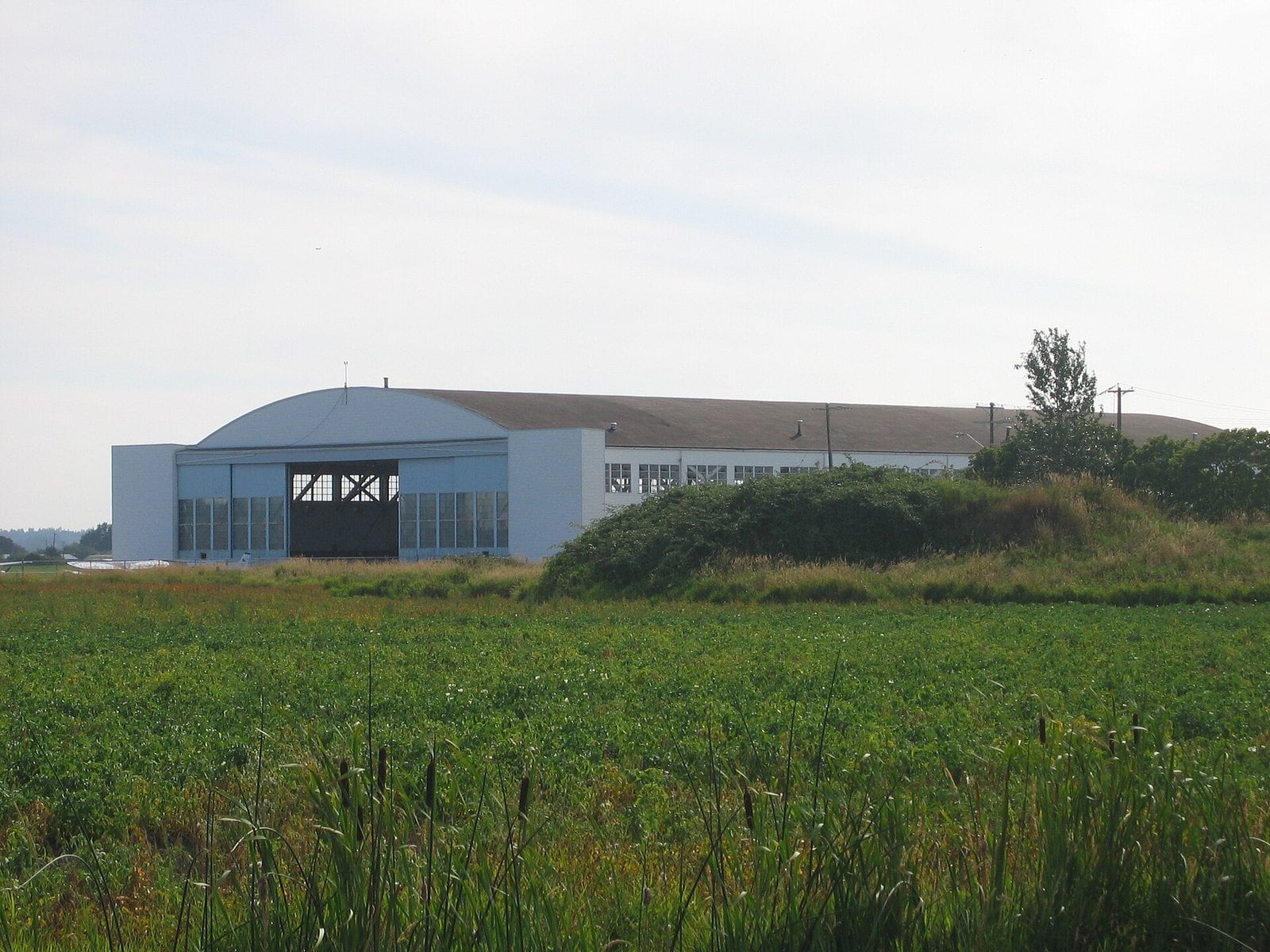
Where: Boundary Bay Airport, 4400 72nd Street, Delta (East Ladner)
When: Opened 1941; decommissioned 1946; hangar still in use
Cost: No public admission information
Getting there: The airport says it is less than 40 minutes from downtown Vancouver
In late 1940 the federal government expropriated 480 acres, about 194 hectares, of Delta farmland for an air training base. RCAF Station Boundary Bay officially opened on July 2, 1941, with Prime Minister Mackenzie King in attendance.
The RCAF decommissioned the base in 1946. The site was later used for radio communications and signals intelligence until it closed again in 1971. Today it is Boundary Bay Airport, owned by the City of Delta.
One of the two hangars built in 1941 is still standing. It is a heritage-registered, bow-arched timber structure, and it still works as a hangar. The Optimist calls it a favourite for movie shoots, so you may have seen it on screen without knowing. Its heritage listing has the details.
Local tip: the North 40 Park Reserve, just north of the airport, is a City of Delta park and a good way to see the open land the base was built on.
9. The Roberts Bank coal port opening (Roberts Bank)
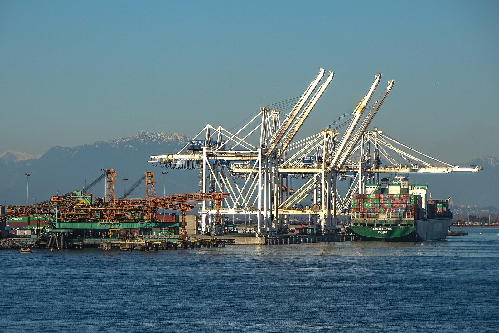
Where: Roberts Bank causeway, west of Tsawwassen
When: Officially opened June 15, 1970
Cost: Working port; no public access
Getting there: Visible from the Tsawwassen area and the Highway 17 corridor
Delta’s coal port officially opened at Roberts Bank on June 15, 1970. That was ten years to the day after the first ferry left Tsawwassen. Thousands attended, including Prime Minister Pierre Trudeau and Premier W.A.C. Bennett.
The bulk loading facility covered 55 acres, about 22 hectares, and was estimated to cost $9 million. The opening came with an omen. The Optimist reported that a large cloud of dust rose when the first rail car of coal was dumped.
That dust became a long local argument, and the Optimist covered pollution concerns from the first day. A container terminal followed in the late 1990s. Westshore Terminals still runs around the clock.
You can see the port from around Tsawwassen and along Highway 17. The causeway is a working industrial area with no public access.
8. The Alex Fraser Bridge opening (North Delta)
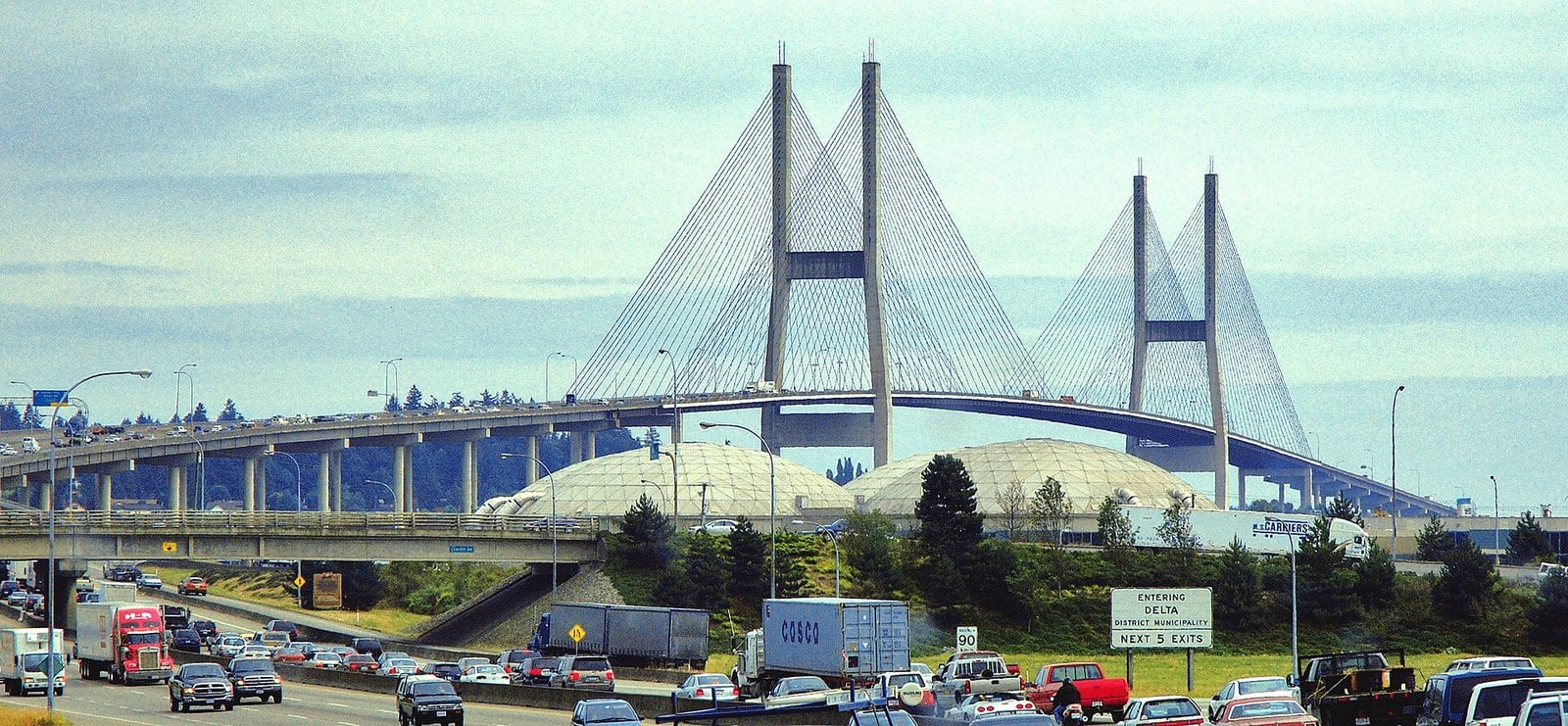
Where: Highway 91, North Delta to Annacis Island
When: Officially opened September 22, 1986
Cost: Toll-free
Getting there: Highway 91 through North Delta
The Alex Fraser Bridge officially opened on September 22, 1986, linking North Delta to Richmond and New Westminster. Its 465-metre main span made it the longest cable-stayed bridge in the world at the time.
It opened with four lanes but was built so it could be converted to six. It now has seven, including a counterflow lane added in 2019. It was expected to take almost 25 per cent of the traffic off the Massey Tunnel and the Pattullo Bridge. Anyone who has sat in a tunnel lineup since can judge how that went.
Many locals still call it the Annacis Bridge. It is on Highway 91 through North Delta.
Local tip: the Optimist’s throwback column on the 1986 opening makes good then-and-now reading, traffic predictions included.
| Crossing | Opened | Connects | Notable detail | Toll today |
|---|---|---|---|---|
| Westham Island Bridge | March 29, 1910 | Ladner to Westham Island, over Canoe Pass | About 325 m with a swing span; oldest of TransLink’s four bridges | Free |
| Ladner to Woodward’s Landing ferry | 1913 | Ferry Road, Ladner, to No. 5 Road, Richmond | Ended May 1959 when the tunnel opened | No longer runs |
| Deas Island (George Massey) Tunnel | May 23, 1959 | South Delta to Richmond on Highway 99 | Toll until 1964; replacement expected by September 2031 | Toll-free |
| Alex Fraser Bridge | September 22, 1986 | North Delta to Annacis Island on Highway 91 | 465 m main span, longest cable-stayed bridge in the world when it opened | Toll-free |
7. Duck walks at the Reifel Bird Sanctuary (Westham Island)
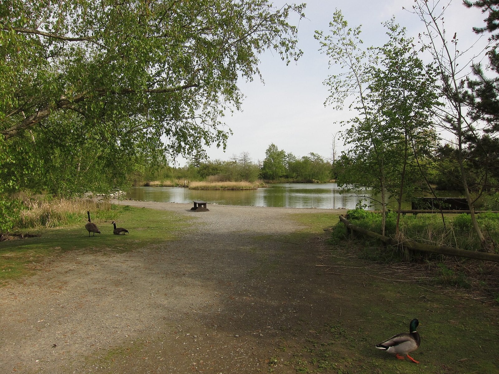
Where: 5191 Robertson Road, Westham Island, Delta
When: 9 am to 4 pm; closed Mondays except some statutory holidays
Cost: Free reservation; admission paid at the gate
Getting there: Through Ladner and over the Westham Island Bridge to Robertson Road
The Reifel family bought land at the north end of Westham Island in 1927 and used it as a family retreat. In March 1963 they granted a long-term lease on part of it to the new BC Waterfowl Society. That is how the sanctuary began. In 1972 the family sold and donated the land to the federal government, on condition that it be managed mainly for waterfowl.
The sanctuary covers about 300 hectares of ponds, treed paths and marsh, and the Waterfowl Society still runs it. Most visitors spend 1 to 1.5 hours walking, a manageable outing with kids.
Hours are 9 am to 4 pm. It is closed Mondays, except some statutory holidays. The sanctuary lists last entry at 2:30 pm for drop-ins and 3 pm with a reservation, but it also says reservations are required for everyone. Reservations are required and free. Admission is $10 for adults, $8 for seniors 65+ and $7 for children 2 to 14. Bird seed is $2, and outside seed isn’t allowed.
Local tip: you can book on the sanctuary’s planning page from three days ahead until 8 am on the day of your visit. Check the Westham Island Bridge status first.
6. Centennial Beach in summer (Tsawwassen)
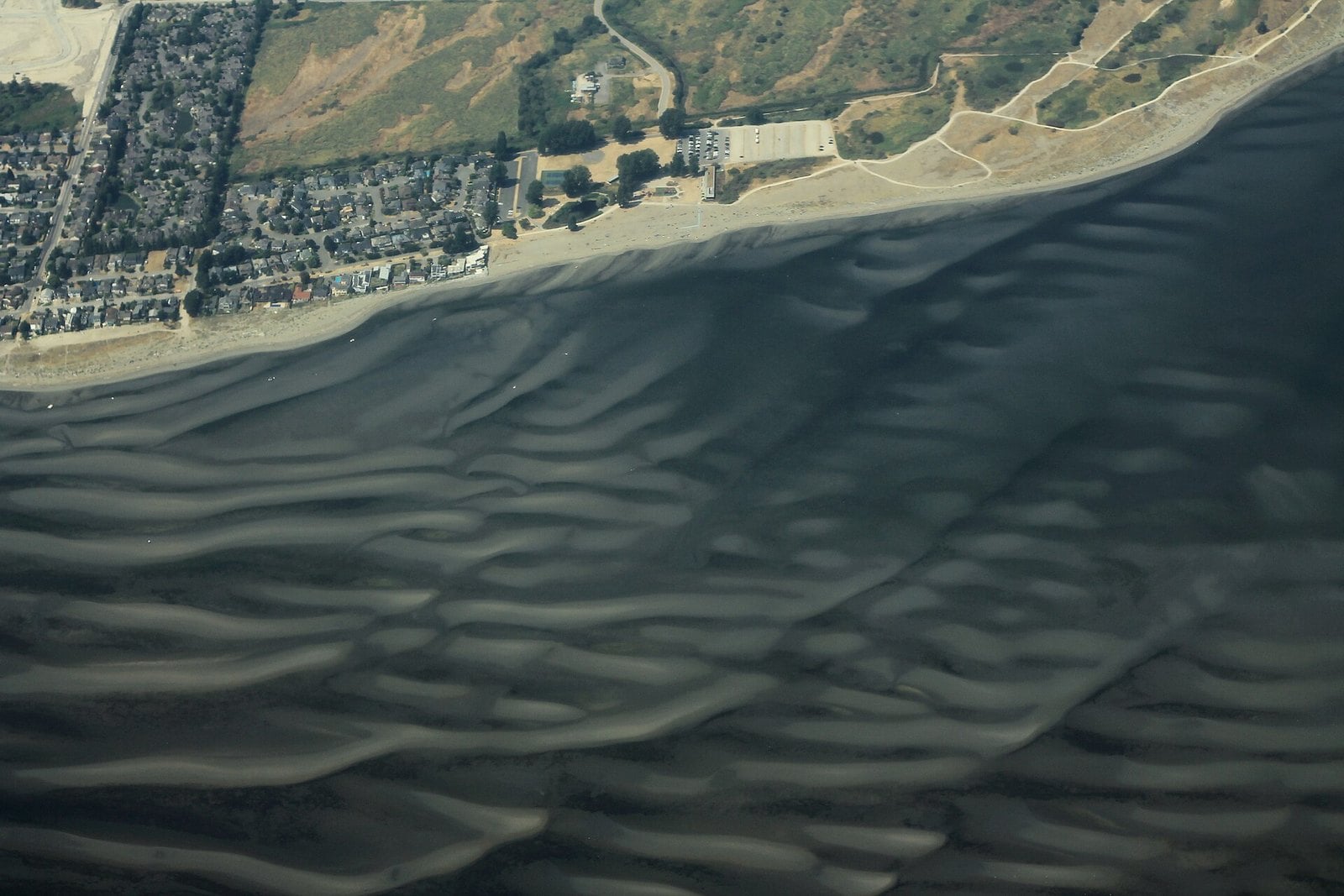
Where: Boundary Bay Regional Park, Tsawwassen
When: Earliest closing 5 pm (times posted at entrances); café mid-April to mid-October
Cost: Free; the Optimist reported no pay parking in 2024. Boundary Bay neighbourhood permit parking (with limited visitor time) applies on weekends and statutory holidays, May 1 to Sept. 8
Getting there: Boundary Bay Road to its end; two large parking lots
Centennial Beach is run by Metro Vancouver as part of Boundary Bay Regional Park. In July 1964 council brought in a 50-cent parking charge. Some drivers turned around and left. Another 380 paid on the first weekend.
If you grew up going there, you remember the old concession and washroom building, rundown for years before Metro Vancouver opened the current concession in 2012 and tore the old one down. The beach has only grown more popular. The park recorded 1,025,800 visits in 2024.
Closing times are posted at the park entrances and vary through the year; the earliest is 5 pm. The café runs seasonally, mid-April to mid-October. The Optimist reported no pay parking at the beach in 2024, but check before you go.
Swimming is allowed, but there is no lifeguard, so swim at your own risk and keep an eye on the kids. Dogs must be leashed and are not allowed on the beach or in wildlife reserves. Metro Vancouver’s park brochure has the full rules.
5. The one-lane wooden Westham Island Bridge (Canoe Pass)
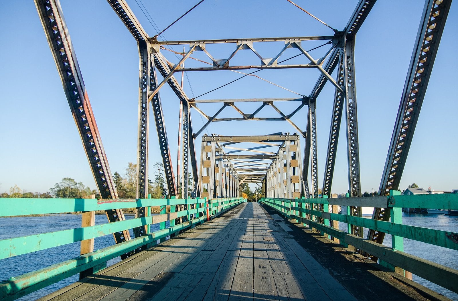
Where: Over Canoe Pass, between Ladner and Westham Island
When: Opened March 29, 1910; damaged by a vessel strike January 20, 2026; reopened March 28, 2026
Cost: Free
Getting there: Westham Island Road, west of Ladner
The Westham Island Bridge opened on March 29, 1910. It is about 325 metres long and has a swing span that opens for boats. It is the oldest of TransLink’s four bridges and also its narrowest.
It is one of the few bridges in Metro Vancouver that still has wooden parts, which explains the rumble under your tires. Generations of Delta families have crossed that timber deck on the way to Westham Island’s farm stands and the bird sanctuary.
On January 20, 2026, a vessel struck the bridge while TransLink was in the early stages of planning its replacement. It was closed to vehicles for 67 days and reopened on March 28, 2026. Maintenance is ongoing: vehicles can’t cross overnight on Nov. 12 and 13, 2026, from 9 pm to 5 am. During inspections on Nov. 16 to 18, from 9 am to 2 pm, vehicles can cross only for about 10 minutes at the start of each hour. Pedestrians and cyclists can still cross during the overnight closures, and pedestrians during the inspections. Check TransLink’s bridge projects page before you drive out.
Even on a normal day, expect waits when the swing span opens for boats.
4. The Ladner to Woodward’s Landing ferry and the Delta Princess (Ferry Road, Ladner)
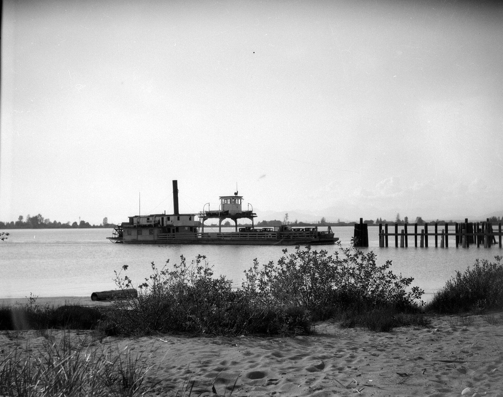
Where: North end of Ferry Road, Ladner, to the south end of No. 5 Road, Richmond
When: 1913 to May 1959
Cost: No longer operates
Getting there: Drive to the north end of Ferry Road to see the old landing site
Before the tunnel, the main way to drive from Ladner to Vancouver was a government ferry across the South Arm of the Fraser. It ran from the north end of Ferry Road to Woodward’s Landing at the south end of No. 5 Road in Richmond. The road name is the clue most newcomers miss.
Ladner’s ferry service began in 1913, and it caught on quickly. In its early years, 3,000 passengers were carried in the first 12 days of one April alone. It ran for more than four decades, then ended as soon as the tunnel opened in May 1959. About 200 people rode the Delta Princess on its last trip.
You can drive to the north end of Ferry Road to stand where the landing was.
Local tip: the Optimist’s Delta throwback columns have run Delta Archives photos of cars loading onto the ferry in summer 1958. Send them to whoever in your family still talks about the wait.
3. The early days of the Tsawwassen ferry terminal (Tsawwassen)
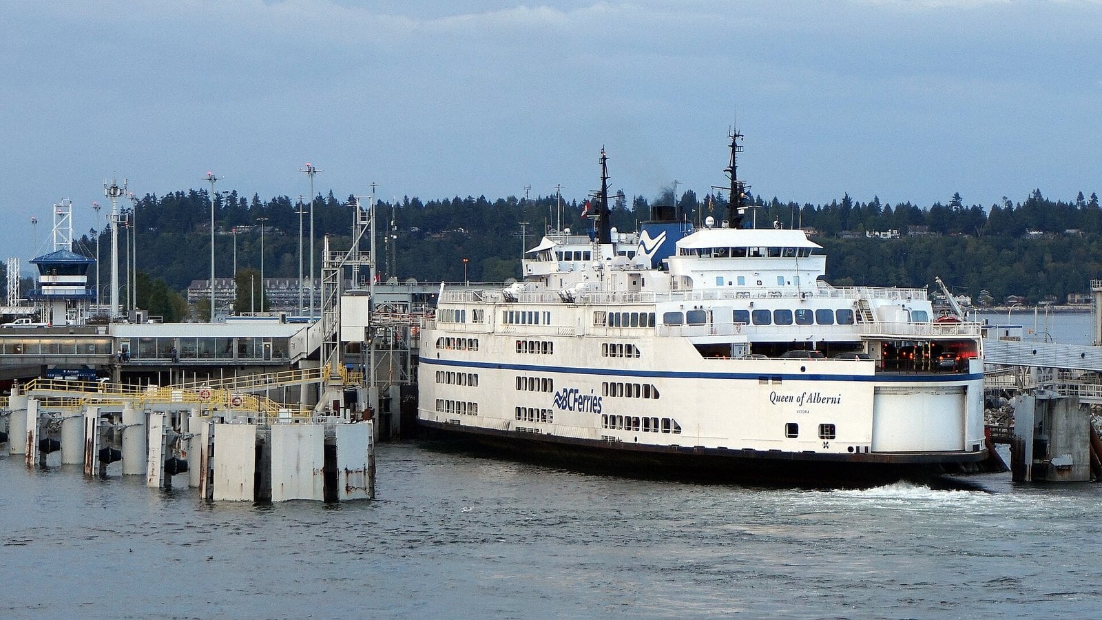
Where: 1 Ferry Causeway, Tsawwassen (Delta)
When: First sailing June 15, 1960; Quay Market added 2005
Cost: Fares vary; check bcferries.com
Getting there: Highway 17 to the end of the causeway in Tsawwassen
BC Ferries’ first sailing left the newly built Tsawwassen terminal for Swartz Bay on June 15, 1960. The tunnel had opened barely a year earlier. The company started with one route, two ships and 191 employees.
The reason it exists at all goes back to 1958. A strike at the private ferry company briefly cut Vancouver Island off, and the government service was created in response. For Tsawwassen, it meant a causeway out into the Strait and a steady stream of traffic heading to the boats.
The terminal has been expanded many times since. The Tsawwassen Quay Market shops were added in 2005, so if your memories of the terminal involve a cafeteria and a long wait in the lineup, you are dating yourself.
Fares vary by route and season. Check bcferries.com before you go.
2. Point Roberts runs for gas, milk and parcels (Point Roberts, Washington)
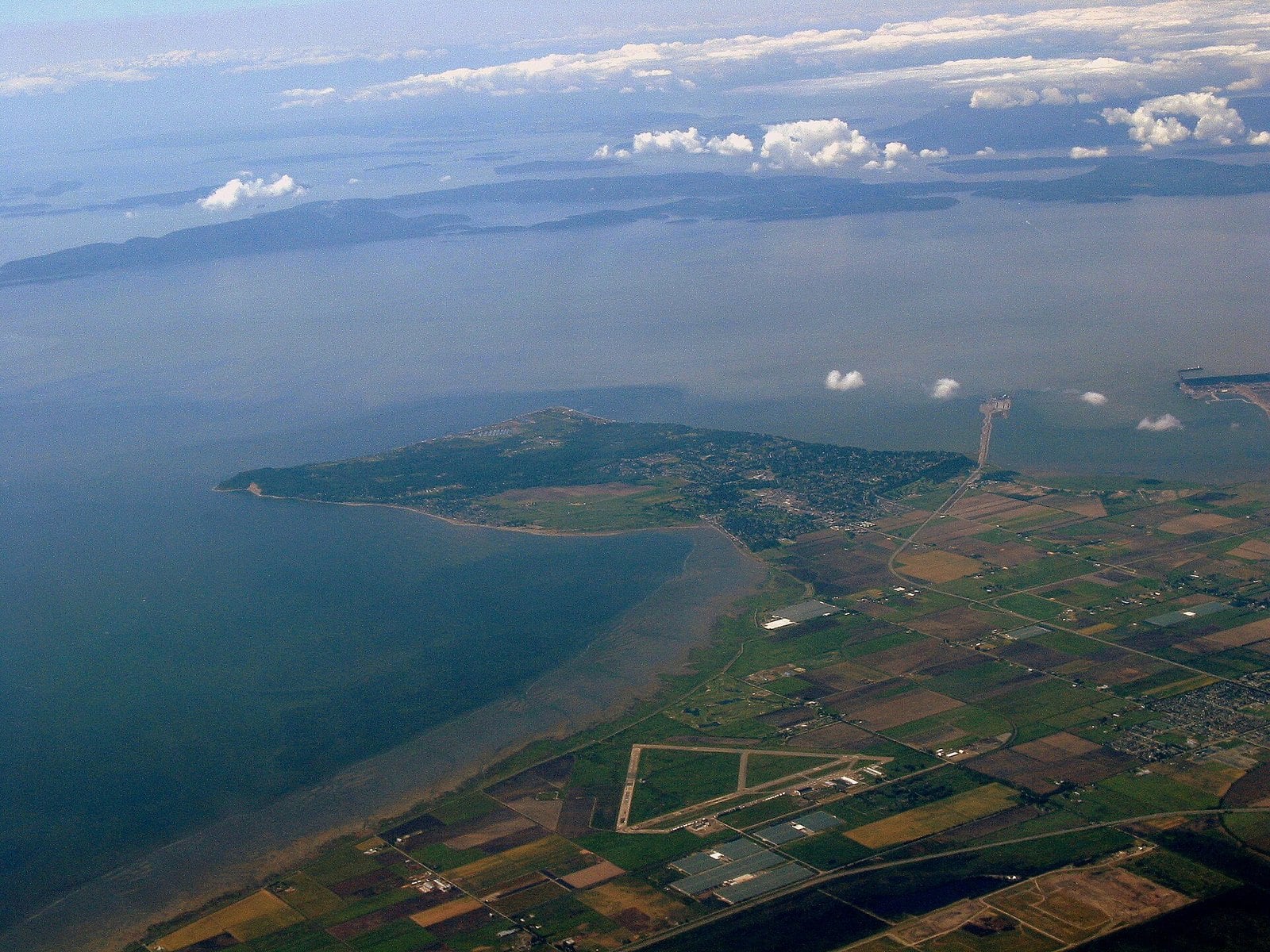
Where: Point Roberts, Washington, via the 56th Street crossing in Tsawwassen
When: Border open 24 hours a day
Cost: Prices vary; duty and document rules apply
Getting there: Highway 17 to 56th Street, then south to the border
Point Roberts can only be reached by land through Delta. For decades, South Delta drivers have slipped across for cheaper gas, milk, cheese and alcohol.
The scale of it was real. In 1991 the Seattle Times reported gas about 20 cents a litre cheaper than in Tsawwassen. Cross-border traffic had tripled in a decade, to 2.4 million vehicles in 1990. Older locals remember a different kind of trip too: weekend crowds crossing to drink, dance, gamble and see bands at the Point’s tavern.
The crossing is at the south end of 56th Street, off Highway 17. The border is open 24 hours a day. Adults need a passport, a NEXUS card or another accepted document; the Point Roberts Chamber of Commerce border page lists them.
Local tip: gas on the Point is priced in litres. Same-day trips get no duty-free exemption, so check the CBSA rules before you stock up.
1. The Deas Island Tunnel, now the George Massey Tunnel (Highway 99)
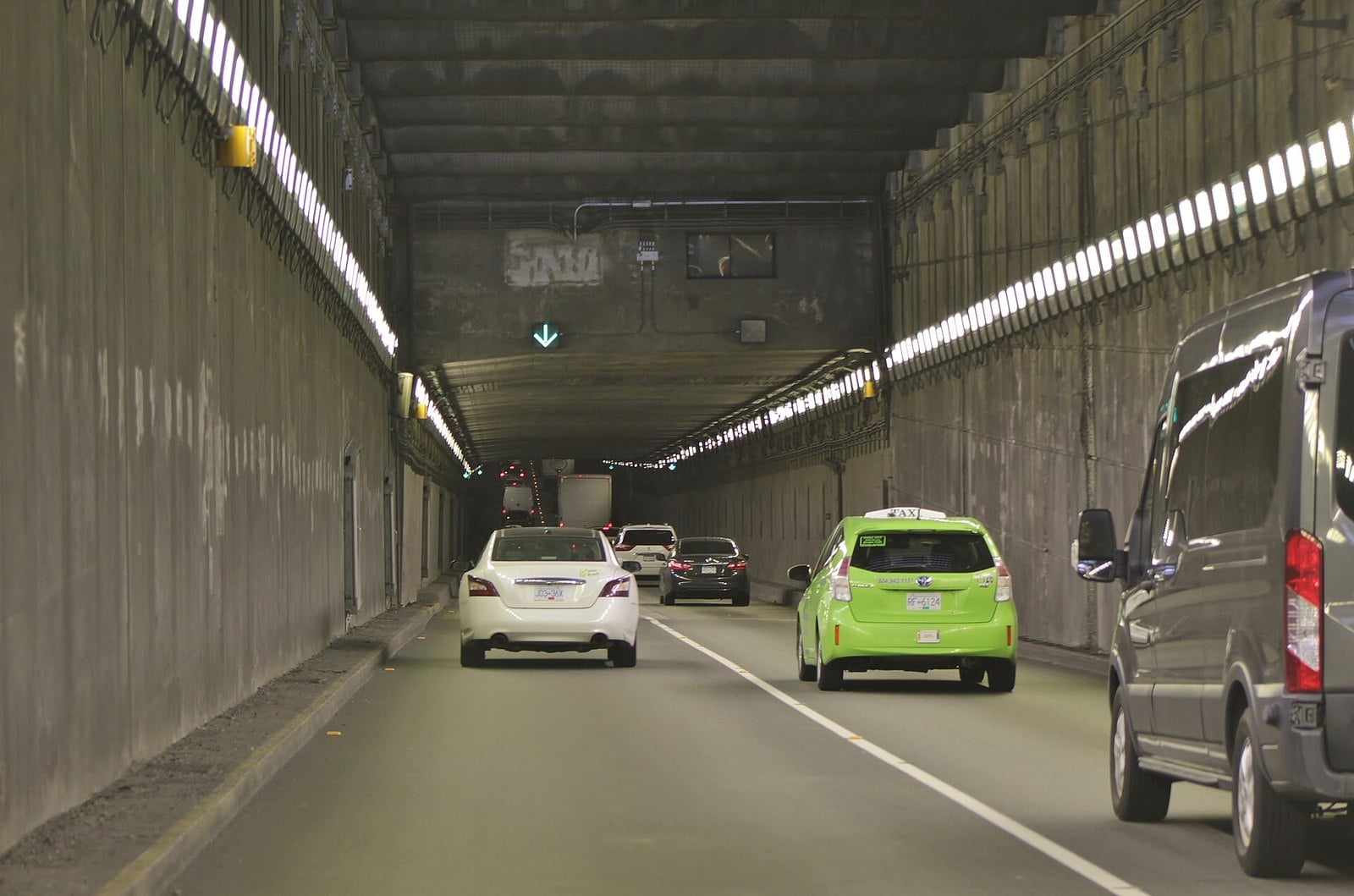
Where: Highway 99, between Deas Island (Delta) and Richmond
When: Opened to traffic May 23, 1959; official opening July 15, 1959; renamed 1967
Cost: Toll-free since 1964
Getting there: Highway 99 between Richmond and South Delta
The first cars drove through the Deas Island Tunnel on Saturday, May 23, 1959. Queen Elizabeth II officially opened it on July 15 that year. Anyone living in Ladner then remembers it as the moment the trip to Vancouver stopped depending on a ferry schedule.
It started as a toll crossing. In 1964 George Massey, the Delta MLA who had pushed for the tunnel, was the last person to pay the toll, handing over $1. It was renamed after him in 1967. The Delta Optimist calls the opening the most significant event in Delta’s history. It ended South Delta’s isolation and set off the suburban boom. In the decades that followed, Delta went from fewer than 10,000 people to more than 70,000.
The tunnel is still in daily use while the Province builds a toll-free, eight-lane immersed-tube tunnel to replace it. Early works began in January 2026. Major construction is expected to start in 2027, and completion is now expected by September 2031. Construction brings periodic ramp and road closures, plus intermittent lane reductions, with work on a temporary trestle bridge running through February 2027, so check the project’s current work page before a late drive.
Local tip: Deas Island Regional Park, on the Delta side, is the best spot to see the river the tunnel runs under and the island it was first named for.
| Year | Event |
|---|---|
| 1873 | Government Wharf built at Ladner’s Landing |
| 1910 | Westham Island Bridge opens (March 29) |
| 1913 | Ladner–Richmond ferry service begins |
| 1941 | RCAF Station Boundary Bay officially opens (July 2) |
| 1959 | Deas Island Tunnel opens to traffic (May 23); ferry ends |
| 1960 | First BC Ferries sailing, Tsawwassen–Swartz Bay (June 15) |
| 1970 | Roberts Bank coal port opens (June 15) |
| 1986 | Alex Fraser Bridge opens (Sept. 22) |
| 2009 | Tsawwassen First Nation treaty takes effect (April 3) |
| 2016 | Tsawwassen Mills opens (Oct. 5) |
| 2031 | Replacement tunnel completion now expected (September) |
Where to dig into the history yourself
The Delta Archives and the Edgar Dunning Reading Room are inside the Douglas J. Husband Discovery Centre at 4450 Clarence Taylor Crescent in Ladner. The archives collect records for Ladner, Tsawwassen and North Delta, including local newspapers on microfilm going back to 1902.
Reading room and reference services run Monday to Friday, 10 am to 5 pm, and the archives library is open Saturday and Sunday, noon to 5 pm. Drop-ins are welcome, but appointments are recommended. Call 604-952-3829 or email deltaarchives@delta.ca, or start with the City of Delta archives page.
Closures and advisories (as of November 2026)
- Early construction for the Massey Tunnel replacement is causing periodic ramp and road closures. Work is scheduled from late July 2026 through spring 2027. Check highway99tunnel.ca.
- The Westham Island Bridge reopened on March 28, 2026, after a January vessel strike, and TransLink is planning its replacement. Maintenance closes it to vehicles overnight (9 pm to 5 am) on Nov. 12 and 13, 2026. From Nov. 16 to 18, between 9 am and 2 pm, vehicles can cross only for about 10 minutes at the start of each hour. Pedestrians can still cross during both, and cyclists during the overnight closures. Check TransLink before heading to Reifel or the island’s farm stands.
When to go
- Summer: Centennial Beach. The park opens at 7 am, and the café runs mid-April to mid-October.
- Year-round: the Reifel Bird Sanctuary, 9 am to 4 pm, closed Mondays except some statutory holidays.
- Winter: the Boundary Bay dyke for raptors. Snowy owls come only in irruption years. Waterfowl hunting season overlaps, so expect hunters east of 64 Street.
- Any time: the Point Roberts border is open 24 hours a day.
What to bring
- A passport, NEXUS card or other accepted document for every adult if you’re crossing to Point Roberts.
- Your Reifel reservation. Book from three days ahead until 8 am on the day, and plan on 1 to 1.5 hours of walking.
- A leash. Dogs must be leashed in Boundary Bay Regional Park and aren’t allowed on the beach.
Etiquette and safety
- There is no lifeguard at Centennial Beach. Swim at your own risk and watch the kids.
- Keep dogs leashed and under control, off the beach and out of wildlife reserves.
- Farm vehicles use the dyke trail. Move aside to let them pass.
- Give owls and other birds room, and stay on the trail.
- Waterfowl hunting is allowed in season (roughly September to March) from the Boundary Bay dyke between 64 Street and the Surrey border. Expect gunfire and wear bright colours.
- Duty-free limits depend on how long you are away. Check CBSA rules before you shop in Point Roberts.
Getting there
From Richmond, Highway 99 takes you through the Massey Tunnel into South Delta. From the northeast, Highway 91 crosses the Alex Fraser Bridge into North Delta. Highway 17 runs to Tsawwassen, the ferry causeway and the 56th Street turnoff for Point Roberts. For Reifel, go through Ladner and take Westham Island Road over the bridge to Robertson Road; check TransLink’s bridge page first, as maintenance brings periodic vehicle closures and restrictions (including Nov. 12–13 overnight and Nov. 16–18 daytime in 2026). Boundary Bay Airport says it is less than 40 minutes from downtown Vancouver.
Most of what made Delta what it is came down to how you got in and out. A ferry, then a tunnel, then a bridge, and now a second tunnel on the way. Some of these memories you can still drive to. The beach, the dyke, the ducks and the old hangar are all still there. For the rest, the Delta Archives reading room in Ladner has the newspapers going back to 1902.
Get the weekend plan in your inbox. Burrard Bulletin is a free email on what’s actually on from Vancouver to Whistler. Sign up here.
Photo credits
- George Massey Tunnel southbound.jpg by SounderBruce, CC BY-SA 4.0 (combined into a montage, cropped). Via Wikimedia Commons.
- Ladner Ferry 1931.jpg by Stuart Thomson (1881-1960), Public domain (combined into a montage, cropped). Via Wikimedia Commons.
- Tsawwassen Ferry Terminal, British Columbia, Canada.jpg by Kalamazadkhan, CC BY-SA 4.0 (combined into a montage, cropped). Via Wikimedia Commons.
- CZBB Main Hangar.JPG by The original uploader was Lommer at English Wikipedia., CC BY-SA 3.0 (combined into a montage, cropped). Via Wikimedia Commons.
- Centennial Beach Aerial – Delta Tsawwassen (50729694332).jpg by formulanone, CC BY-SA 2.0 (resized). Via Wikimedia Commons.
- Boundary Bay, Tsawwassen and Point Roberts (539674842).jpg by Shawn from Airdrie, Canada, CC BY-SA 2.0 (resized). Via Wikimedia Commons.
- Westham Island Bridge road deck.jpg by Jeff Hitchcock, CC BY 2.0 (resized). Via Wikimedia Commons.
- George C. Reifel Migratory Bird Sanctuary (4553308670).jpg by GoToVan, CC BY 2.0 (resized). Via Wikimedia Commons.
- Weekend trip to Nanaimo – BC Ferries from Duke Point to Tswassen – Roberts Bank coal port – loading a container ship – (19534665252).jpg by Murray Foubister, CC BY-SA 2.0 (resized). Via Wikimedia Commons.
- AlexFraserBridge.jpg by Bobanny, Public domain (resized). Via Wikimedia Commons.
- Snowy Owl – Bubo scandiacus, Boundary Bay, British Columbia – 6704936907.jpg by Judy Gallagher, CC BY 2.0 (resized). Via Wikimedia Commons.
- Tsawwassen Mills entrance sign.jpg by GoToVan, CC BY 2.0 (resized). Via Wikimedia Commons.
