BC Towns Where Homes Are Still Valued Under $500K
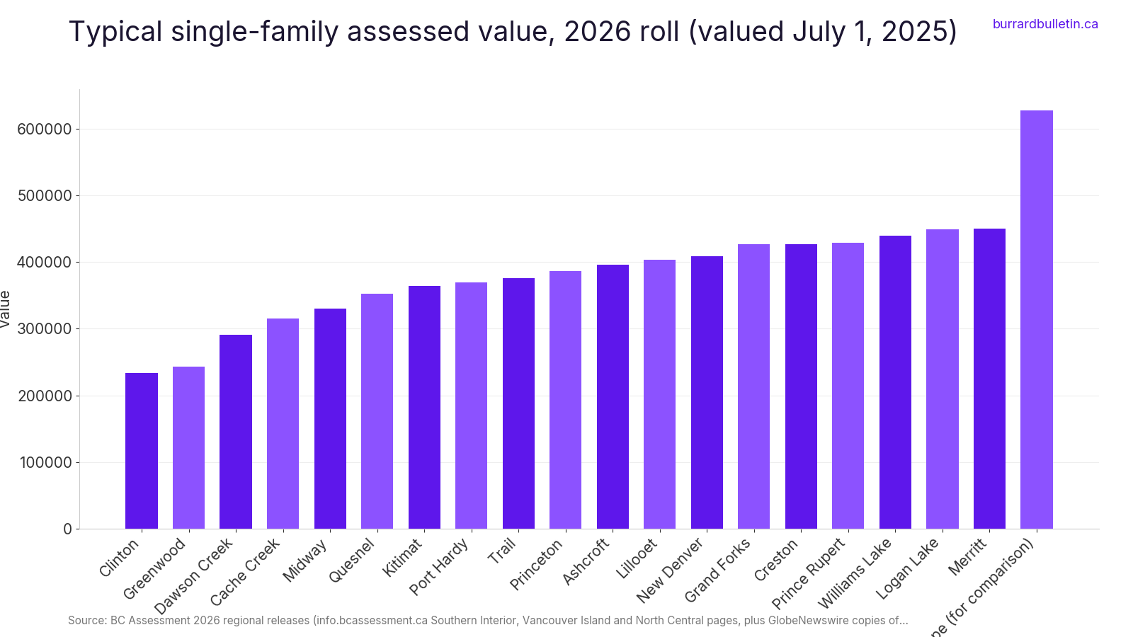
Hope is the last Fraser Valley town before the Coquihalla. Its typical single-family value on the 2026 roll is $628,000. Keep driving and the numbers start to fall. Past Hope, up the Cariboo, along Highway 3 and out to the North Coast, there are still BC towns where a typical detached house is valued under half a million dollars.
For scale, the Metro Vancouver detached benchmark was $1,784,700 in September 2026. In the BC Northern Real Estate Board area, the average sale price was $433,250 in the first quarter of 2026. Those are two different housing markets in one province.
This guide uses BC Assessment’s 2026 typical values. These are medians that reflect market value on July 1, 2025. An assessment is not a sale price. So wherever the BC Northern Real Estate Board or the Vancouver Island board publishes actual sales, those numbers are checked too. Towns where houses sell well above their assessments were left off or flagged. Each entry covers the number, the story behind the place and what to look at when you go.
18. New Denver, Silverton, Slocan and Nakusp (Slocan Lake and Arrow Lakes)
Where: Slocan Lake and Arrow Lakes, West Kootenay
When: 2026 roll; Nikkei centre open May 1 to September 30 (closed for the rest of 2026)
Cost: New Denver $409,000; Silverton $443,000; Slocan $407,000; Nakusp $438,000
Getting there: Highway 6 and Highway 31A; Nakusp route can involve inland ferries
Around Slocan Lake, every village’s 2026 typical single-family value is under $500K. New Denver is $409,000, Silverton $443,000 and Slocan $407,000. Nakusp, on the Arrow Lakes, is $438,000, up 5%.
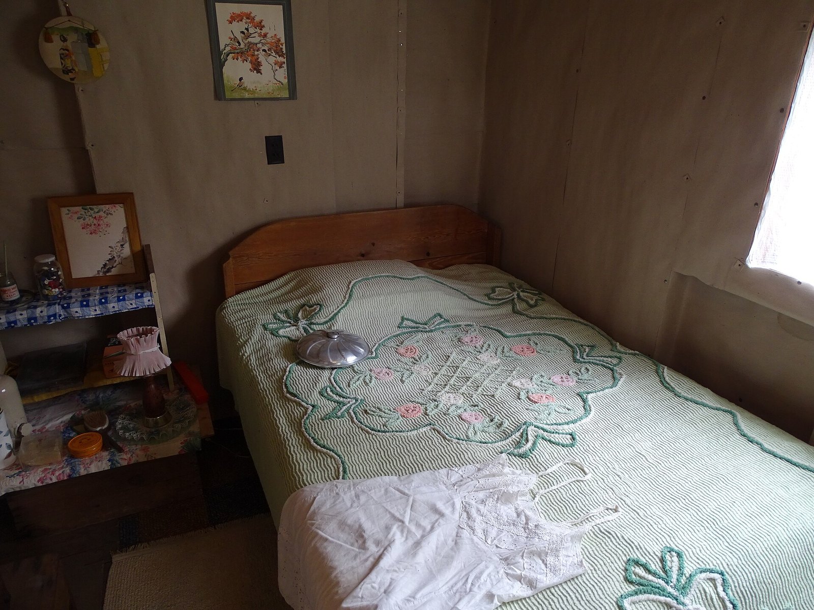
New Denver holds an important piece of BC history. The Orchard is a rare WWII internment camp that was not dismantled after the war. Its rehabilitated shacks are now part of the Nikkei Internment Memorial Centre, a National Historic Site.
The centre has been listed as open daily May 1 to September 30, 10 am to 5 pm. That season has ended for 2026, so check the 2027 schedule before you go.
These villages are reached by Highway 6 and Highway 31A. The Nakusp route can involve inland ferries, so build that into your timing.
17. Trail (West Kootenay)
Where: West Kootenay, Columbia River
When: 2026 roll; Teck smelter tours by appointment, May to October
Cost: Typical single-family assessed value $376,000 (flat)
Getting there: Highway 3 east across southern BC
Trail has the lowest typical value of any West Kootenay municipality: $376,000, unchanged for 2026. Its neighbours are under the line too, with Montrose at $453,000 and Fruitvale at $470,000. Rossland, up the hill, is $625,000.
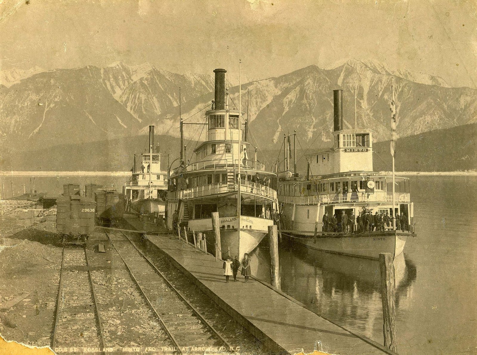
According to Teck, Trail was established in the 1890s. Gold had been found in nearby Rossland, and a smelter went up above the Columbia River. A large wave of Italian immigrants followed and still shapes the town’s character.
Hockey matters here. The Trail Smoke Eaters are remembered for world championship wins in 1939 and 1961.
Teck Trail Operations offers free guided smelter tours by appointment from May to October. Advance booking through the Trail and District Chamber of Commerce is required. Trail is reached via Highway 3 east across southern BC, then Highway 3B or 22; check DriveBC before you go.
16. Dawson Creek (Peace River)
Where: Peace River
When: 2026 roll, valued July 1, 2025
Cost: Typical single-family assessed value $291,000 (up 3%)
Getting there: Highway 97 north through Prince George, or fly
Dawson Creek’s 2026 typical single-family value is $291,000, up 3% from $282,000. Nearby Chetwynd, at $277,000, and Hudson’s Hope, at $204,000, are lower still.
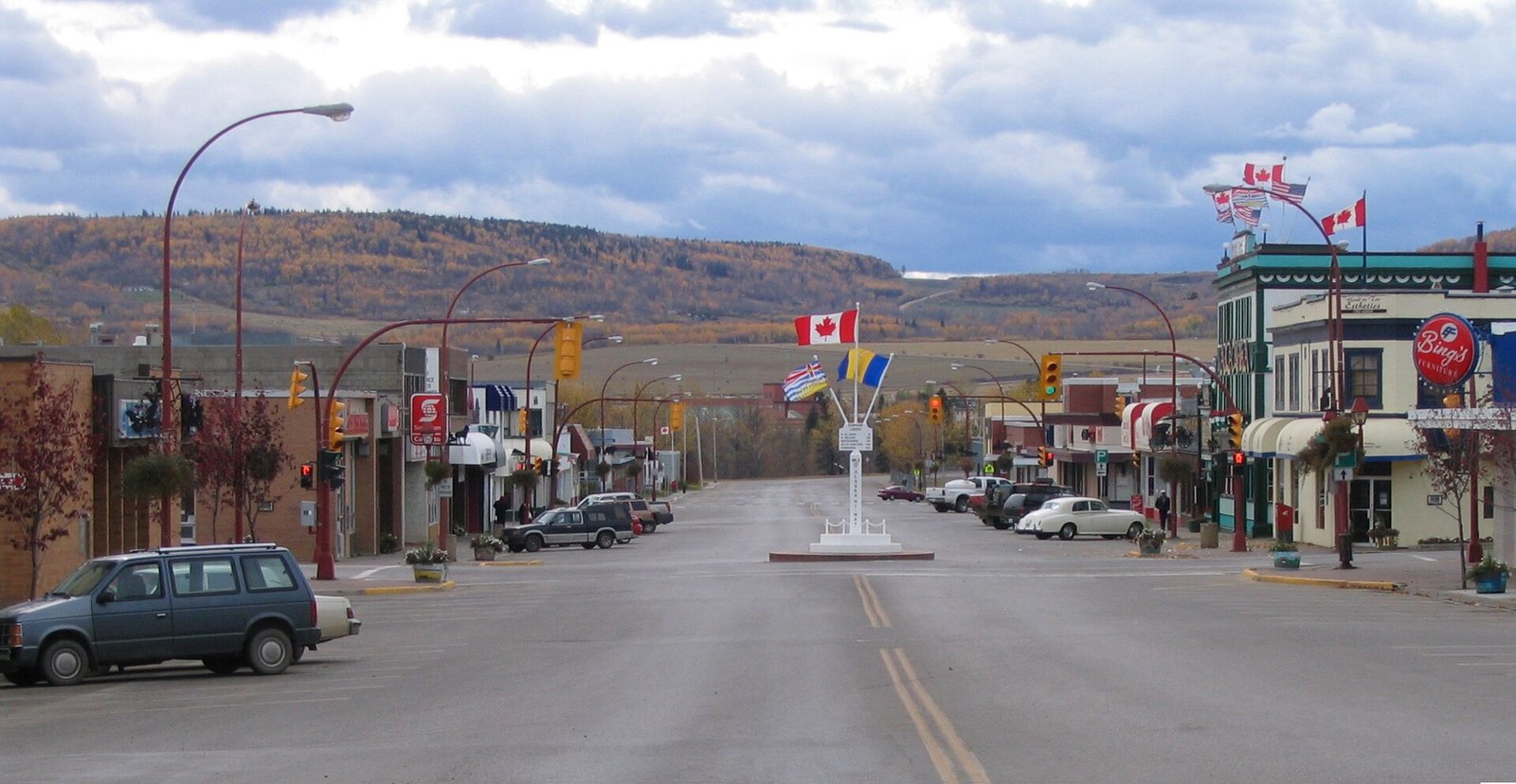
Dawson Creek is the start of the Alaska Highway. According to a local history site, the original four-foot post marking the start was hit by a car in 1946. The local Jaycees replaced it with a larger 10-foot Mile 0 post downtown, the forerunner of the metal post people photograph today.
Fort St. John, up the road, is assessed at $352,000. Half of its 255 single-family sales from January to September 2026 went for less than $425,000.
Getting here means Highway 97 north through Prince George, which is a very long drive, or a flight.
15. Kitimat (North Coast)
Where: Head of Douglas Channel, North Coast
When: 2026 roll; sales January to September 2026
Cost: Assessed $364,000; median single-family sale $381,500
Getting there: Highways 97 and 16 to Terrace, then south; or fly to Terrace
Kitimat’s 2026 typical single-family value is $364,000, up 6% from $344,000. Half of the 95 single-family homes sold from January to September 2026 went for less than $381,500.
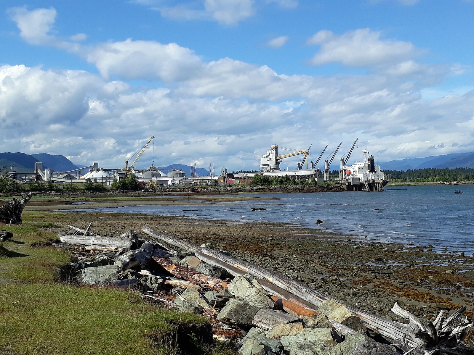
Few towns in BC have an origin like this one. According to the Kitimat Museum, the District of Kitimat was incorporated in 1953 as the first town in BC with no residents. American town planner Clarence S. Stein and the New York planners Mayer & Whittlesey planned it for Alcan’s smelter workers.
Kitimat is at the head of Douglas Channel. It’s a long drive via Highway 97 and Highway 16 to Terrace, then south, or you can fly into Terrace. Terrace itself is over the line, with a median sale of $545,000.
14. Williams Lake (Cariboo)
Where: Cariboo
When: 2026 roll; sales January 1 to September 30, 2026
Cost: Assessed $440,000; median single-family sale $490,000; average $503,462
Getting there: Highway 97 north through the Cariboo
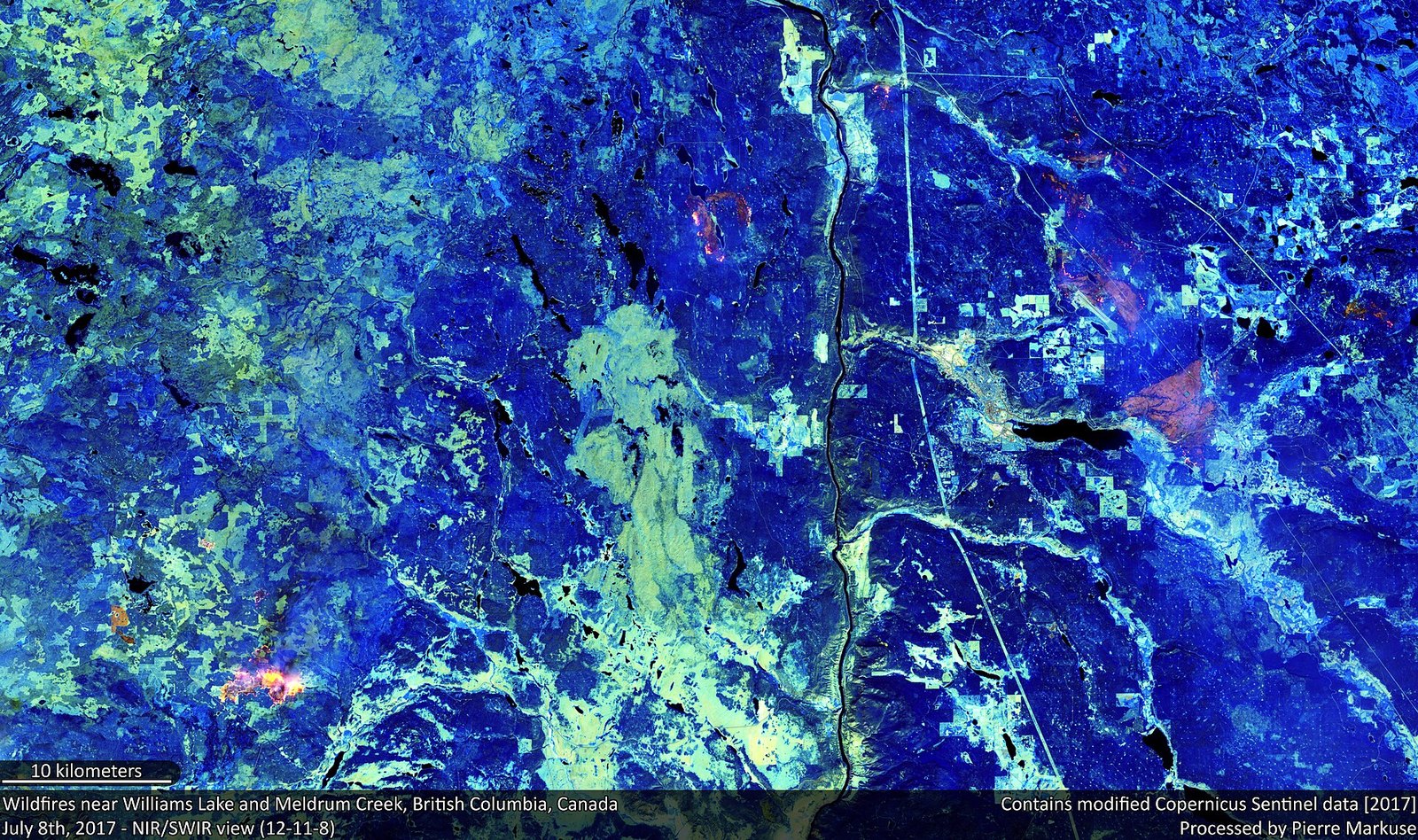
Williams Lake’s 2026 typical single-family assessed value is $440,000, up 5% from $419,000. The sales data is closer to the line. Of the 109 single-family homes sold by the end of September 2026, half went for less than $490,000. The January to September average was $503,462, just over the line.
That average has moved around. It was $474,488 in 2024 and $526,288 in 2025. Williams Lake is a borderline town, so budget right around half a million.
The city says it became a hub for forestry, mining and transportation after the Pacific Great Eastern Railway arrived. The city hosts the annual Williams Lake Stampede, over the Canada Day long weekend.
You get here on Highway 97 north through the Cariboo. If you’d rather see the town on a regular weekend, avoid Stampede weekend.
13. Prince Rupert (Kaien Island)
Where: Kaien Island, North Coast
When: 2026 roll; sales January to September 2026
Cost: Assessed $429,000; average single-family sale $455,288
Getting there: Highway 16 west from Prince George, or BC Ferries from Port Hardy
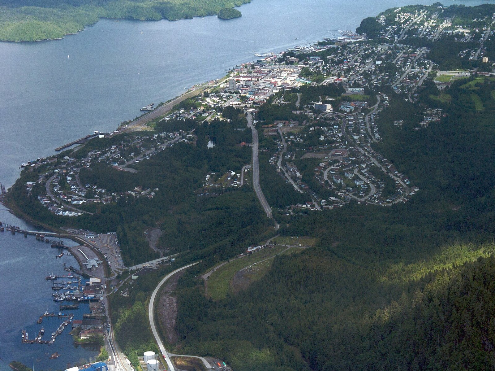
Prince Rupert’s 2026 typical single-family value is $429,000, up 3% from $417,000. The average single-family sale from January to September 2026 was $455,288 across 93 sales. That is down from $474,797 over the same months of 2025.
The city was built as the terminus of the Grand Trunk Pacific Railway, whose last spike was driven in 1914. The railway’s promoter, Charles Melville Hays, died on the Titanic.
Cow Bay was once the hub of the halibut fishery. The old Atlin Fish Plant is now the Atlin Terminal, home to the Port Authority and its Port Information Centre.
The Canadian Encyclopedia calls Prince Rupert Canada’s wettest city, with an average of 2,619 mm of precipitation a year. Pack real rain gear. You get here on Highway 16 west from Prince George, or on BC Ferries from Port Hardy.
12. Port Hardy and the North Island (Vancouver Island)
Where: North Vancouver Island, Mount Waddington
When: 2026 roll; benchmark September 2026
Cost: Assessed $370,000; North Island benchmark $474,600
Getting there: BC Ferries to Nanaimo, then Highway 19 north
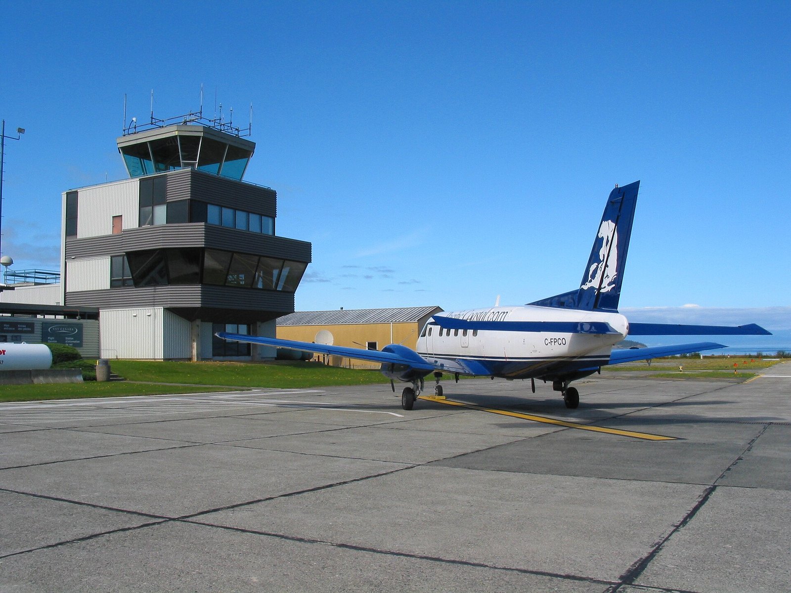
Port Hardy’s 2026 typical single-family value is $370,000, up 3% from $360,000. Nearby, Port McNeill is $434,000, Port Alice $335,000 and Gold River, on the west side, $333,000.
The sales side holds up too. The VIREB benchmark for a North Island single-family home rose 6% to $474,600 in September 2026. That is still under $500K.
The district calls itself the gateway to the Central Coast and to the Cape Scott and North Coast trails. It is also BC Ferries’ northern terminus for the Prince Rupert and Discovery Coast routes.
Take BC Ferries to Nanaimo, then Highway 19 to the north end. The district says the road to Campbell River was only paved in December 1979. Port Alberni doesn’t qualify: it is assessed at $485,000, but its benchmark is $522,000.
11. Creston (Creston Valley)
Where: Creston Valley, south end of Kootenay Lake
When: 2026 roll; Columbia Brewery tours run weekdays in summer
Cost: Typical single-family assessed value $427,000 (up 1%)
Getting there: Highway 3 over Kootenay Pass from Salmo
Creston’s 2026 typical single-family value is $427,000, up 1% from $422,000. The town is at the south end of Kootenay Lake, and it is farm country.
The Creston Valley Wildlife Management Area is a Ramsar-designated wetland. It covers 17,000 acres (about 6,900 hectares) and has 32 km of walking trails. Kootenay Rockies Tourism says more than 300 bird species live there.
The Columbia Brewery, home of Kokanee, runs weekday tours in summer. Kootenay Rockies Tourism lists them Monday to Friday, 10 am to 4 pm.
From Salmo, Highway 3 crosses Kootenay Pass, a mountain pass with winter-tire rules. Visit once in summer for the farmers market and fruit stands. Visit again in winter so you know what the pass is like before you commit to living on the other side of it.
10. Princeton (Similkameen)
Where: Similkameen, Okanagan-Similkameen
When: 2026 roll; Princeton museum open Mon–Fri 10 am–4 pm, weekends and holidays noon–4 pm
Cost: Typical single-family assessed value $387,000 (up 2%)
Getting there: Highway 3 (Hope-Princeton) east from Hope
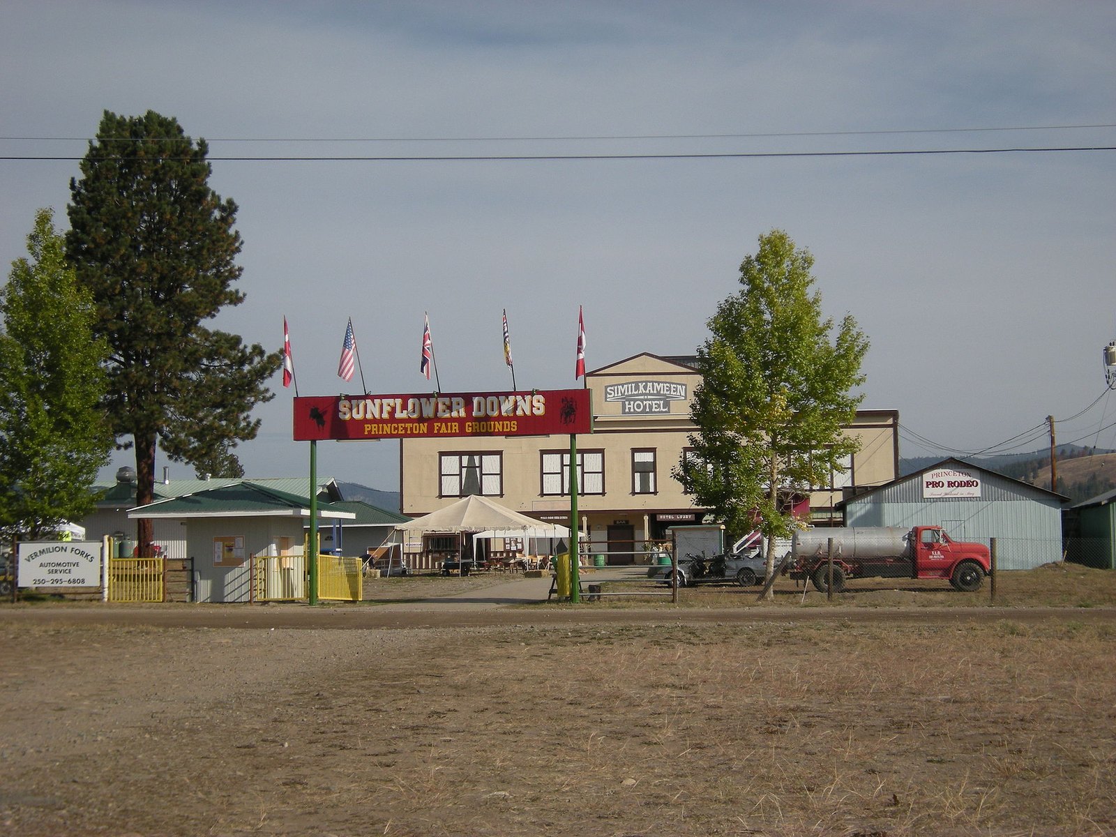
Princeton’s 2026 typical single-family value is $387,000, up 2% from $379,000. That is the lowest of any Okanagan-Similkameen town on BC Assessment’s list. It gets you Okanagan-adjacent living for well under $400,000.
The town sits in the foothills of the Cascade Mountains, where the Tulameen and Similkameen rivers meet. It also has a place in railway history. The last spike of the Kettle Valley Railway was driven here.
The Princeton and District Museum and Archives, at 167 Vermilion Avenue, is open Monday to Friday 10 am to 4 pm and noon to 4 pm on weekends and holidays. Admission is by donation.
The way in is Highway 3, the Hope-Princeton, east from Hope. It is a mountain-pass route covered by the winter-tire rules. Once you arrive, walk the downtown and the riverside before you open the listings.
9. Cache Creek (Highway 1 and 97 junction)
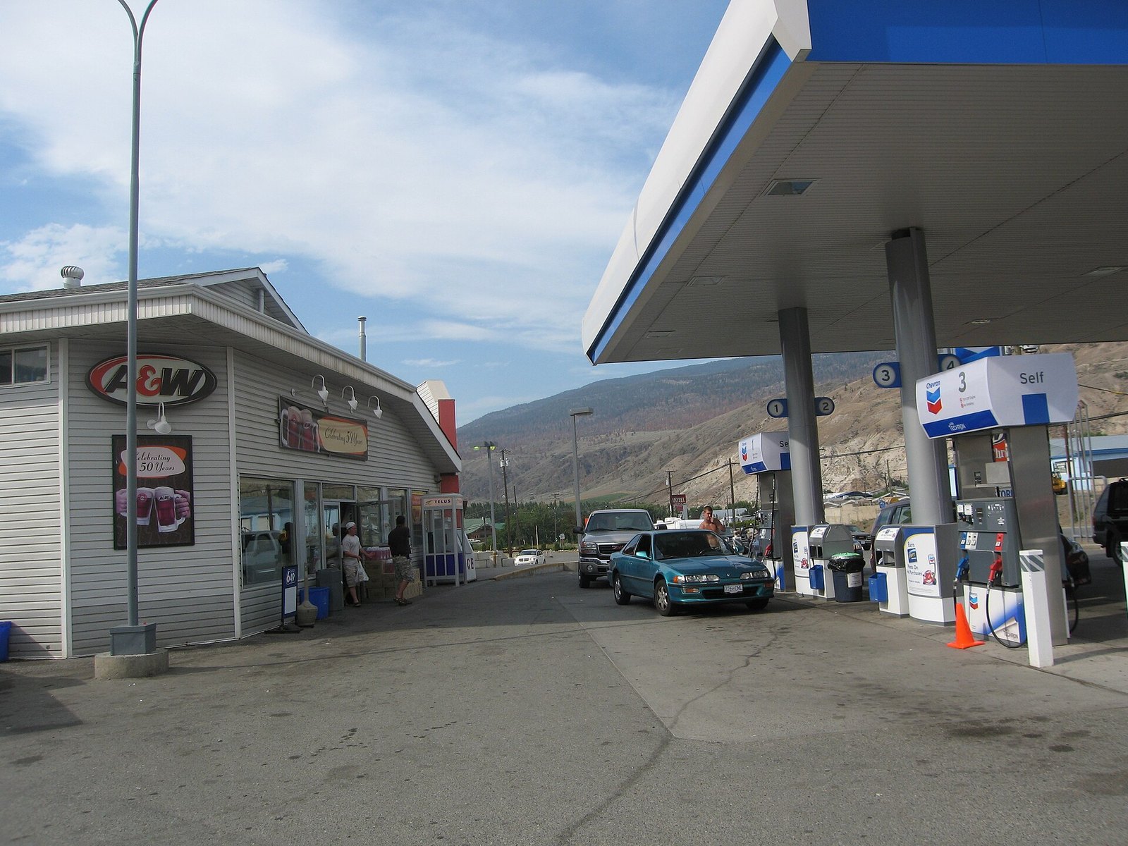
Where: Highway 1 and 97 junction, Thompson-Nicola
When: 2026 roll; Hat Creek Ranch open May 1 to Sept 30 (closed for the rest of 2026)
Cost: Typical single-family assessed value $315,000 (down 1%)
Getting there: Highway 1 through the Fraser Canyon, or the Coquihalla then west
Cache Creek’s 2026 typical single-family value is $315,000, down 1% from $318,000. That makes it one of the lowest in the southern Interior.
The village sits in the dry belt at the junction of Highways 1 and 97. It takes its name from fur traders who cached supplies nearby.
Historic Hat Creek Ranch is 14 km north. It covers about 130 hectares and has twenty historic buildings dating from 1861. A stretch of the original Cariboo Wagon Road runs through it. The ranch is a seasonal attraction, so confirm its opening dates before you go.
Most people know Cache Creek only from the highway strip. Drive past it into the residential streets before you form an opinion.
8. Clinton (South Cariboo)
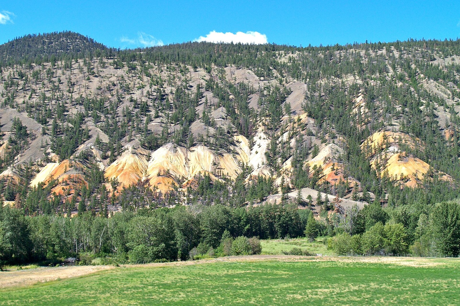
Where: South Cariboo, Thompson-Nicola
When: 2026 roll, valued July 1, 2025
Cost: Typical single-family assessed value $234,000 (flat)
Getting there: Highway 97 north of Cache Creek
Clinton’s typical single-family value held at $234,000 for 2026, according to BC Assessment. That is the lowest of any municipality in this southern group.
The village grew where the Lillooet road met the Yale-Cariboo road. It was first known as Junction or 47 Mile and was renamed Clinton in 1863.
The village says several of the original ranches are still operating. Expect a ranch-country lifestyle, not a commuter town. Clinton is on Highway 97, north of Cache Creek.
7. Lillooet (Fraser Canyon)
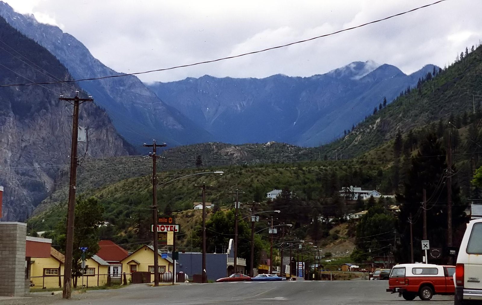
Where: Fraser Canyon, Squamish-Lillooet Regional District
When: 2026 roll, valued July 1, 2025
Cost: Typical single-family assessed value $404,000 (up 3%)
Getting there: Highway 99 (Duffey Lake Road) from Pemberton
Lillooet’s 2026 typical single-family value is $404,000, up 3% from $394,000. For Sea to Sky locals, it is the under-$500K town in their own regional district. Lillooet is in the same regional district as Squamish, Whistler and Pemberton.
The history runs deep. Lillooet was Mile 0 of the Cariboo wagon road to the gold fields. The Mile 0 Cairn went up in 1939.
The regional district says Lillooet remains one of the world’s great sources of nephrite jade.
From Whistler and Pemberton, take Highway 99, the Duffey Lake Road. BC Parks puts Duffey Lake about 35 km east of Pemberton, nearly halfway to Lillooet. In winter, check DriveBC before you commit to the route.
6. Greenwood and Midway (Boundary Country)
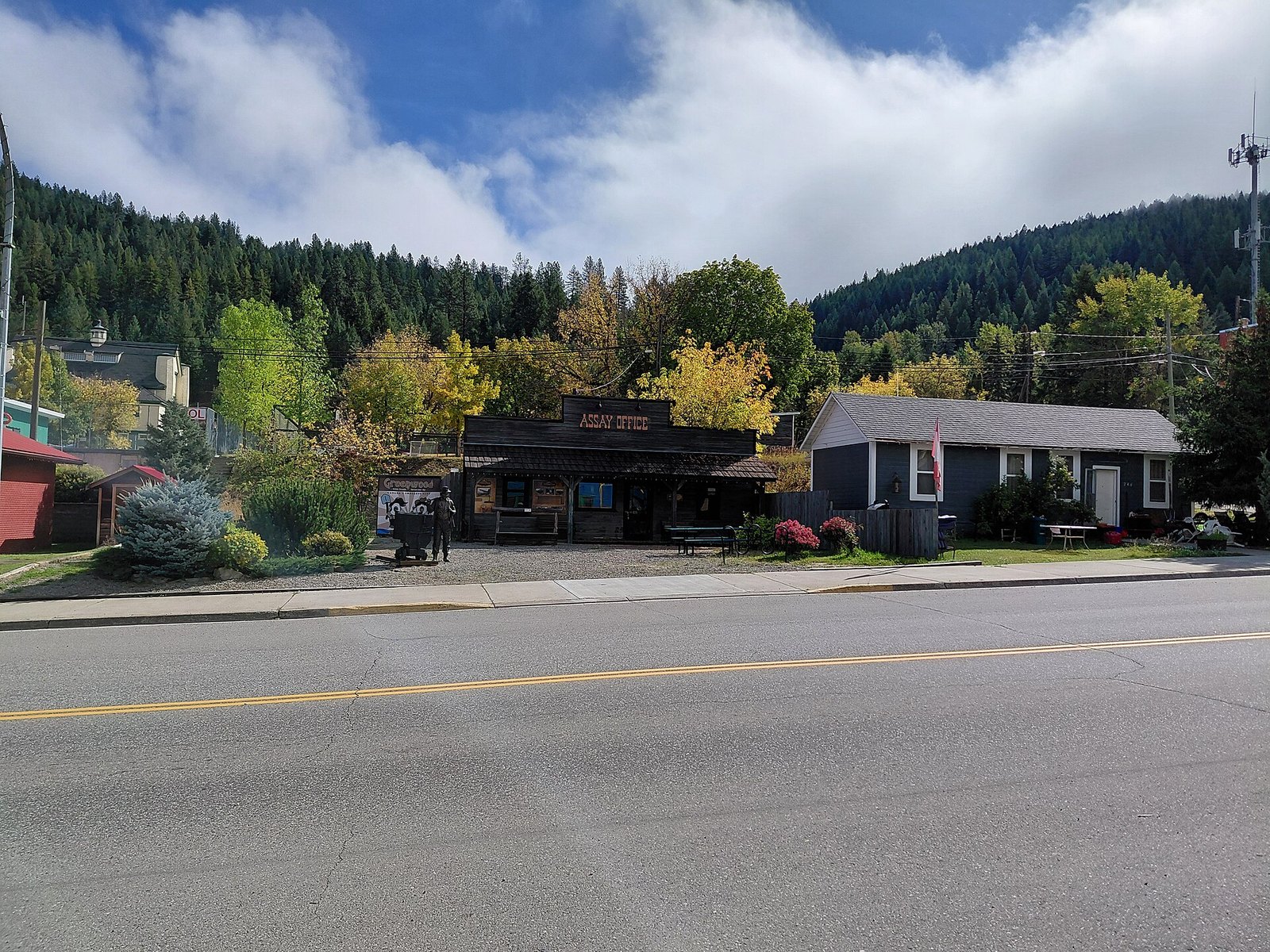
Where: Boundary Country, Highway 3
When: 2026 roll, valued July 1, 2025
Cost: Greenwood $243,000; Midway $330,000 (typical assessed)
Getting there: Highway 3 between Osoyoos and Grand Forks
Greenwood calls itself Canada’s smallest incorporated city. Its 2026 typical single-family value is $243,000, down 2% from $249,000. Midway, down the highway, is $330,000, down 3% from $340,000.
Greenwood was incorporated in 1897 and boomed after the BC Copper Company smelter was built in 1901. Its later history is harder. In 1942 it became BC’s first Japanese Canadian internment camp, housing about 1,200 people.
The city counts more than 60 heritage buildings. A lot of the town looks the way it did a century ago.
Start at the Greenwood Museum and Visitor Centre on Copper Avenue, which is Highway 3. Then try the municipal water from the trough by the Assay Office replica. The city says that water won an international tasting award in 2012.
5. Grand Forks (Boundary Country)
Where: Boundary Country
When: 2026 roll, valued July 1, 2025
Cost: Typical single-family assessed value $427,000 (up 1%)
Getting there: Highway 3 east through Osoyoos
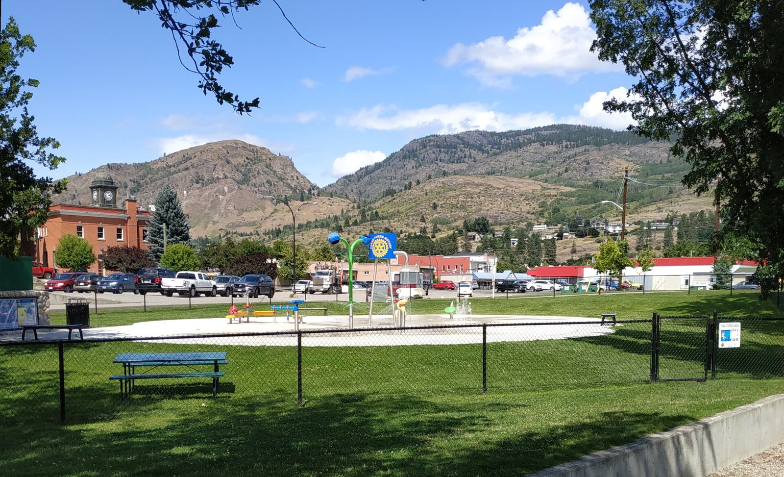
Grand Forks’ 2026 typical single-family value is $427,000, up 1% from $422,000.
The city was incorporated in 1897. Its name comes from the confluence of the Kettle and North Kettle (Granby) rivers. The city says it has run its own water and electrical system since as early as 1898.
The Boundary Museum’s heritage walking tour brochure lists many of the early officials’ homes. It’s an easy way to see the older neighbourhoods before you look at what’s for sale.
Grand Forks is on Highway 3, east of Osoyoos.
4. Logan Lake (Highland Valley)
Where: Highland Valley, Thompson-Nicola
When: 2026 roll, valued July 1, 2025
Cost: Typical single-family assessed value $449,000 (flat)
Getting there: 17 km west of the Coquihalla, between Kamloops and Merritt
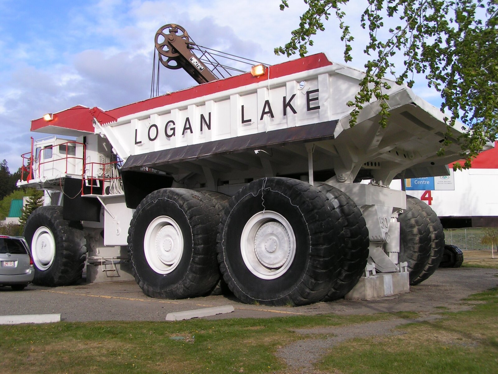
Logan Lake’s 2026 typical single-family value is $449,000. Last year it was $450,000, so prices here are essentially flat. It sits a thousand dollars under Merritt.
This is a company town with a clear origin. The district was incorporated in 1970 because of a new open-pit copper mine. It was built to house Highland Valley Copper workers. The land was bought from local ranchers, and the first 100 families moved in in 1971.
The Thompson-Nicola Regional District describes it as one of the highest-elevation communities in BC, known for year-round recreation. The Canadian Encyclopedia places it 17 km west of the Coquihalla, between Kamloops and Merritt.
Elevation means real winter. Put your winter tires on before you drive up to see houses between October and spring.
3. Ashcroft (Thompson River)
Where: Thompson River, Thompson-Nicola
When: 2026 roll, valued July 1, 2025
Cost: Typical single-family assessed value $396,000 (down 5%)
Getting there: Off Highway 1, just south of Cache Creek
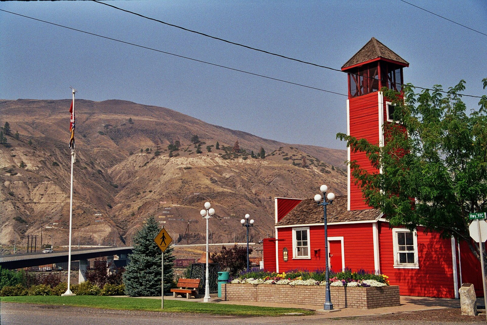
Ashcroft’s typical single-family value fell 5% on the 2026 roll, from $416,000 to $396,000. If you’re watching for softening prices, this is one of the few towns on the list where assessments fell.
The village says it played an important role in the Gold Rush. It has been known as a railway town since 1885, and it sits on the Thompson River. The village describes its museum as one of the best in BC.
Ashcroft is just south of Cache Creek, off Highway 1. The two towns are close together, so plan to see both on the same trip.
2. Merritt (Nicola Valley)
Where: Nicola Valley, Thompson-Nicola
When: 2026 roll, valued July 1, 2025
Cost: Typical single-family assessed value $450,000 (down 2%)
Getting there: Coquihalla Highway (Hwy 5) from Hope
The typical single-family value for the City of Merritt is $450,000 on the 2026 roll. That is down 2% from $458,000 a year earlier. Merritt is one of the closest under-$500K cities to the Lower Mainland. A typical house here is valued at about a quarter of the Metro Vancouver detached benchmark.
The city brands itself the Canadian Country Music Capital of Canada. That identity shapes the downtown, so spend some time there before you look at listings.
You get here on the Coquihalla (Highway 5) from Hope. Check DriveBC before you leave. Winter tires are required on most designated BC highways, including the Coquihalla, from October 1 to April 30.
Buyers looking here usually also look at Logan Lake, up the road, at $449,000. You can see both towns in a single day.
1. Quesnel (North Cariboo)
Where: North Cariboo
When: 2026 roll; sales January to September 2026
Cost: Assessed $352,000; median single-family sale $387,900
Getting there: Highway 97 north of Williams Lake
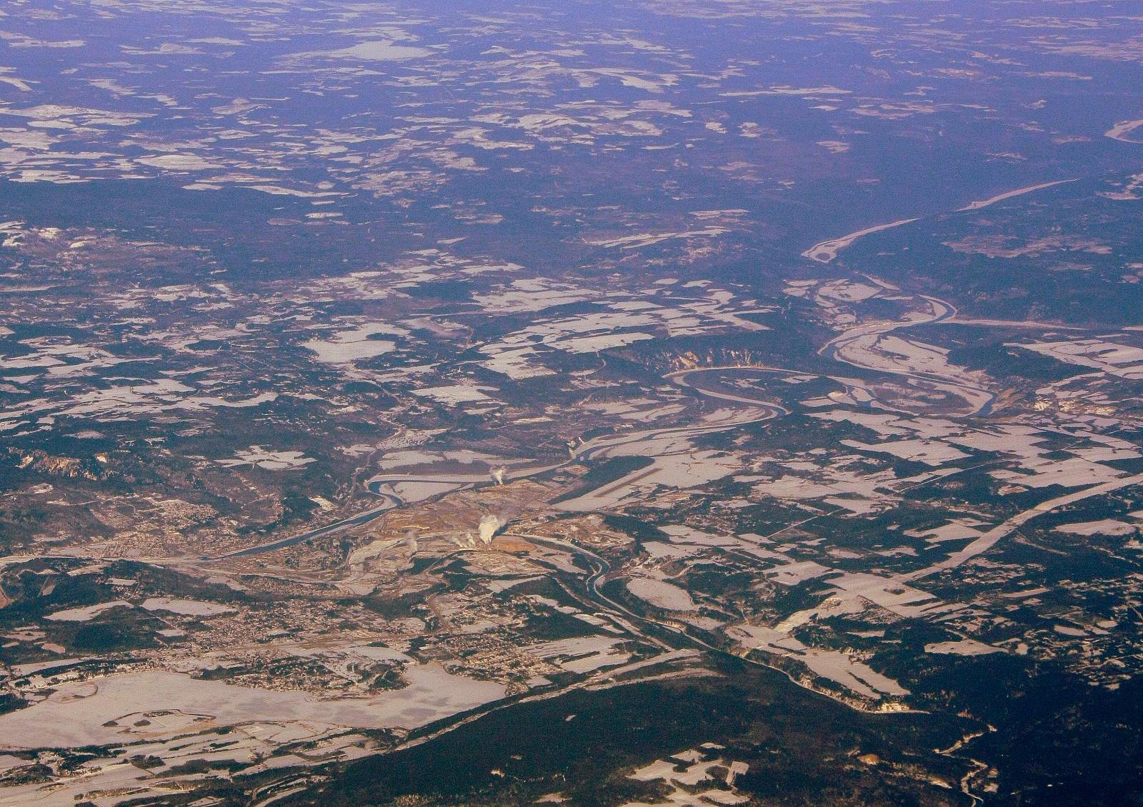
Quesnel is the clearest under-$500K city in the Cariboo. Its 2026 typical assessed value is $352,000, up 4% from $339,000. Half of the 93 single-family homes sold from January to September 2026 went for less than $387,900.
Both the assessment and the sales say the same thing. That agreement is less common than you’d think.
The paved Riverfront Trail has two sections joined by the Fraser River Footbridge. The downtown loop is 5 km and takes about an hour at a leisurely walking pace. It starts at Lhtako Dene Park, where the Quesnel and Fraser rivers meet.
Walk that loop before you book showings. The City says part of it currently has a detour, with signs posted. It runs through North Quesnel along both rivers and gives you a good look at the neighbourhoods. Quesnel is on Highway 97, north of Williams Lake.
| Town | 2026 typical assessed value | Sales measure (2026) | Sales figure |
|---|---|---|---|
| Quesnel | $352,000 | Median single-family sale, Jan to Sep | $387,900 |
| Kitimat | $364,000 | Median single-family sale, Jan to Sep | $381,500 |
| Port Hardy | $370,000 | North Island single-family benchmark, Sep | $474,600 |
| Prince Rupert | $429,000 | Average single-family sale, Jan to Sep | $455,288 |
| Williams Lake | $440,000 | Average single-family sale, Jan to Sep | $503,462 |
| 100 Mile House (borderline: median $495,000) | $398,000 | Average single-family sale, Jan to Sep | $525,971 |
| Port Alberni (over the line) | $485,000 | Single-family benchmark, Sep | $522,000 |
| Community | Median | Sales |
|---|---|---|
| Vanderhoof | 342250 | 42 |
| Kitimat | 381500 | 95 |
| Quesnel | 387900 | 93 |
| Fort St. John | 425000 | 255 |
| Williams Lake | 490000 | 109 |
| Terrace (over the line) | 545000 | 100 |
| Smithers (over the line) | 547500 | 60 |
Read the numbers right
- BC Assessment’s typical value is a median assessed value as of July 1, 2025. It is not what sellers are asking this fall.
- Some towns are assessed well under $500K but sell much closer to it. 100 Mile House is assessed at $398,000, but its January to September 2026 single-family average was $525,971 and its median was $495,000.
- Port Alberni is assessed at $485,000, but its VIREB benchmark was $522,000 in September 2026.
- Prince George is assessed at $459,000. It was left off this list because its January to September 2026 single-family average was $539,144, according to the BC Northern Real Estate Board.
- In the southern Interior, there is no official town-level sales data. The Kootenay benchmark is regional ($638,300 for a single-family home in September 2026, per the Association of Interior Realtors), so assessments are the only per-town measure there.
When to go
Most of the seasonal attractions in this guide run in the warmer months. The Nikkei Internment Memorial Centre has been listed from May 1 to September 30. That season has ended for 2026. Teck’s Trail smelter tours run by appointment from May to October, so book ahead. Princeton’s museum is open all week, so you can still visit it on a trip now. Check their 2027 schedules before planning a spring or summer trip.
Winter visits have a different value. They show you what the roads and passes are like in the season you’d be living with longest. If you go to Williams Lake over the Canada Day long weekend, you’ll be there for the Stampede.
Winter driving: go prepared
- Winter tire and chain requirements apply on most designated BC highways from October 1 to April 30.
- On a few select highways that don’t go through mountain passes or high-snowfall areas, the requirement ends March 31 instead. Designated routes are marked by signs.
- Driving a designated highway without proper winter tires can bring a $121 fine.
- The Coquihalla, the Hope-Princeton, Kootenay Pass and the Duffey Lake Road are all mountain routes where winter tires are required; check the province’s winter tire and chain-up route map for the exact end date on each. Check DriveBC before you leave, and carry the basics in case you’re delayed.
Getting there
- Nicola Valley and Thompson: The Coquihalla (Highway 5) from Hope serves Merritt and Logan Lake. Highway 1 through the Fraser Canyon serves Ashcroft and Cache Creek.
- Sea to Sky side: Highway 99 over the Duffey Lake Road takes you from Pemberton to Lillooet.
- Southern route: Highway 3 runs to Princeton, Greenwood, Midway, Grand Forks and Creston, with Trail a short drive south of it.
- Cariboo and Peace: Highway 97 runs north through Clinton, Williams Lake, Quesnel and Prince George to Dawson Creek.
- North Coast: Highway 16 serves Prince Rupert, and via Terrace, Kitimat. You can also take BC Ferries from Port Hardy to Prince Rupert.
- North Island: Take BC Ferries to Nanaimo, then Highway 19.
Plan your timing and check road conditions with DriveBC.
Check a specific house
Any property’s 2026 assessment can be looked up at bcassessment.ca with BC Assessment’s Assessment Search tool. Run the address before you make an offer. Then compare it with recent sales in that town. The two can be tens of thousands of dollars apart.
| Region | Municipality | Typical assessed value |
|---|---|---|
| Thompson-Nicola | Clearwater | $423,000 |
| Thompson-Nicola | Barriere | $417,000 |
| Kootenay | Salmo | $391,000 |
| Kootenay | Kaslo | $488,000 |
| Kootenay | Fruitvale | $470,000 |
| Kootenay | Montrose | $453,000 |
| Kootenay | Elkford | $406,000 |
| Kootenay | Sparwood | $457,000 |
| Kootenay | Canal Flats | $356,000 |
| North | Mackenzie | $184,000 |
| North | Fraser Lake | $206,000 |
| North | Fort St James | $244,000 |
| North | Burns Lake | $273,000 |
| North | Houston | $264,000 |
| North | Hazelton | $293,000 |
| North | New Hazelton | $241,000 |
| North | Granisle | $113,000 |
| North | McBride | $237,000 |
| North | Wells | $189,000 |
| North | Masset | $251,000 |
| North | Daajing Giids | $428,000 |
| North | Vanderhoof | $337,000 |
Under-$500K houses still exist in BC. You just have to drive past Hope to find them. The closest are in the Nicola Valley and up the Fraser Canyon. The cheapest are in the Cariboo, the Boundary and the North, where Clinton, Greenwood and Dawson Creek are all valued under $300,000.
Treat the assessment as a starting point. Where sales data exists, Quesnel, Kitimat, Prince Rupert and the North Island stay under the line, while Williams Lake sits right on it. Pick two or three towns, check the roads, and go see them in more than one season.
Get the weekend plan in your inbox. Burrard Bulletin is a free email on what’s actually on from Vancouver to Whistler. Sign up here.
Photo credits
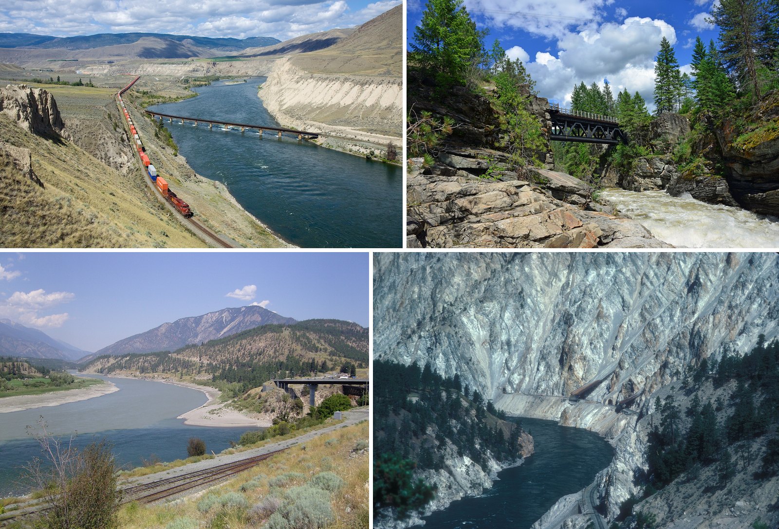
- CPR GE AC4400CW Ashcroft – Kamloops.jpg by Kabelleger / David Gubler (http://www.bahnbilder.ch), CC BY-SA 3.0 (combined into a montage, cropped). Via Wikimedia Commons.
- The Old Railway Bridge.jpg by Migjohanson, CC BY-SA 4.0 (combined into a montage, cropped). Via Wikimedia Commons.
- Thomson Frasier Confluence Lytton.JPG by Cash4alex, CC BY-SA 3.0 (combined into a montage, cropped). Via Wikimedia Commons.
- THOMPSON CANYON, BRITISH COLUMBIA.jpg by JERRYE AND ROY KLOTZ MD, CC BY-SA 3.0 (combined into a montage, cropped). Via Wikimedia Commons.
- Quesnel, BC (3348683769).jpg by Shawn from Airdrie, Canada, CC BY-SA 2.0 (resized; cropped for the featured image). Via Wikimedia Commons.
- Logan Lake Mining Dump Truck 2.jpg by dave_7 from Lethbridge, Canada, CC BY-SA 2.0 (resized). Via Wikimedia Commons.
- Princeton, BC – fairgrounds.jpg by Joe Mabel, CC BY-SA 3.0 (resized). Via Wikimedia Commons.
- Lillooet BBC Canada 1992.jpg by Phillip Capper, CC BY 2.0 (resized). Via Wikimedia Commons.
- Ashcroft Firehall.JPG by User:Themightyquill, CC BY-SA 2.5 (resized). Via Wikimedia Commons.
- Cache Creek, British Columbia at the Chevron Station.jpg by User: (WT-shared) Kazbar at wts wikivoyage, Public domain (resized). Via Wikimedia Commons.
- Clinton – panoramio.jpg by Jack Borno, CC BY-SA 3.0 (resized). Via Wikimedia Commons.
- Wildifires Williams Lake S2A 12118 crop 10 (35488467500).jpg by Pierre Markuse, CC BY 2.0 (resized). Via Wikimedia Commons.
- Steamers Trail, Rossland and Minto at Arrowhead, British Columbia c.1900.jpg by Richard H. Trueman (1855-1911), a photographer with a shop in Revelstoke, BC, Public domain (resized). Via Wikimedia Commons.
- Grand forks bc (cropped).jpg by Vxceprex, CC BY-SA 3.0 (resized). Via Wikimedia Commons.
- Greenwood, BC 20260914 105330.jpg by MuzikMachine, CC BY 4.0 (resized). Via Wikimedia Commons.
- Nikkei Internment Memorial Centre, New Denver, BC 06.jpg by Adam Jones, CC BY-SA 2.0 (resized). Via Wikimedia Commons.
- Port Hardy (105079130).jpg by Shawn from Airdrie, Canada, CC BY-SA 2.0 (resized). Via Wikimedia Commons.
- Rio Tinto Aluminium smelter at Kitimat.jpg by Iain Cameron, CC BY 2.0 (resized). Via Wikimedia Commons.
- Aerial view of Prince Rupert.jpg by Sam Beebe, CC BY 2.0 (resized). Via Wikimedia Commons.
- Mile Zero Post.jpg by unknown, CC BY-SA 3.0 (resized). Via Wikimedia Commons.