Easy, Flat Walks near Vancouver with Big Mountain Views (no Hiking Boots Needed)
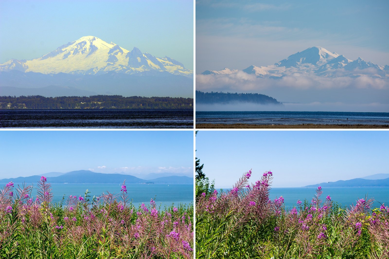
You don’t need to climb a mountain to look at one. Vancouver’s seaside greenway runs 28 km without a break, from the Vancouver Convention Centre to Spanish Banks Park. The City’s Spanish Banks walk changes height by only 5 m, and from it you can still pick out the tops of Seymour, Grouse and Cypress.
This guide covers seawalls, river dykes, a jetty and a few valley paths from Delta to Whistler. They’re flat, mostly firm underfoot and fine in running shoes. Several work with a stroller or wheelchair, and the notes say where. Each one faces something big: the North Shore mountains, the peaks behind Pitt Lake, the Chief or Whistler and Blackcomb.
Fall brings a few catches. Part of the Stanley Park Seawall is closed into November, a trail at ƛ̓éxətəm (Colony Farm) is closed until about December, and the Squamish Estuary trails have been under a Conservation Officer advisory since May. Those details sit in each section below.
| Walk | What you look at | Who says so |
|---|---|---|
| Spanish Banks | Tops of Seymour, Grouse and Cypress; West Vancouver lighthouse | City of Vancouver |
| Stanley Park Seawall, Coal Harbour side | North Shore mountains across Burrard Inlet | City of Vancouver |
| Centennial Seawalk | Coast Mountains, Burrard Inlet, Lions Gate Bridge, city skyline | District of West Vancouver |
| West Dyke Trail | Coastal Mountains, Gulf Islands, Fraser River, YVR | City of Richmond |
| Boundary Bay 12 Ave Dyke | Ocean and mountains (Mount Baker per non-official guides) | Metro Vancouver |
| Pitt River Greenway | Mountains, rivers and working farmland | City of Pitt Meadows |
| Squamish Estuary | Stawamus Chief and Shannon Falls | District of Squamish |
| Whistler Valley Trail at Rainbow Park | Whistler and Blackcomb mountains | Tourism Whistler |
12. Squamish Estuary trails, check status first (Downtown Squamish)
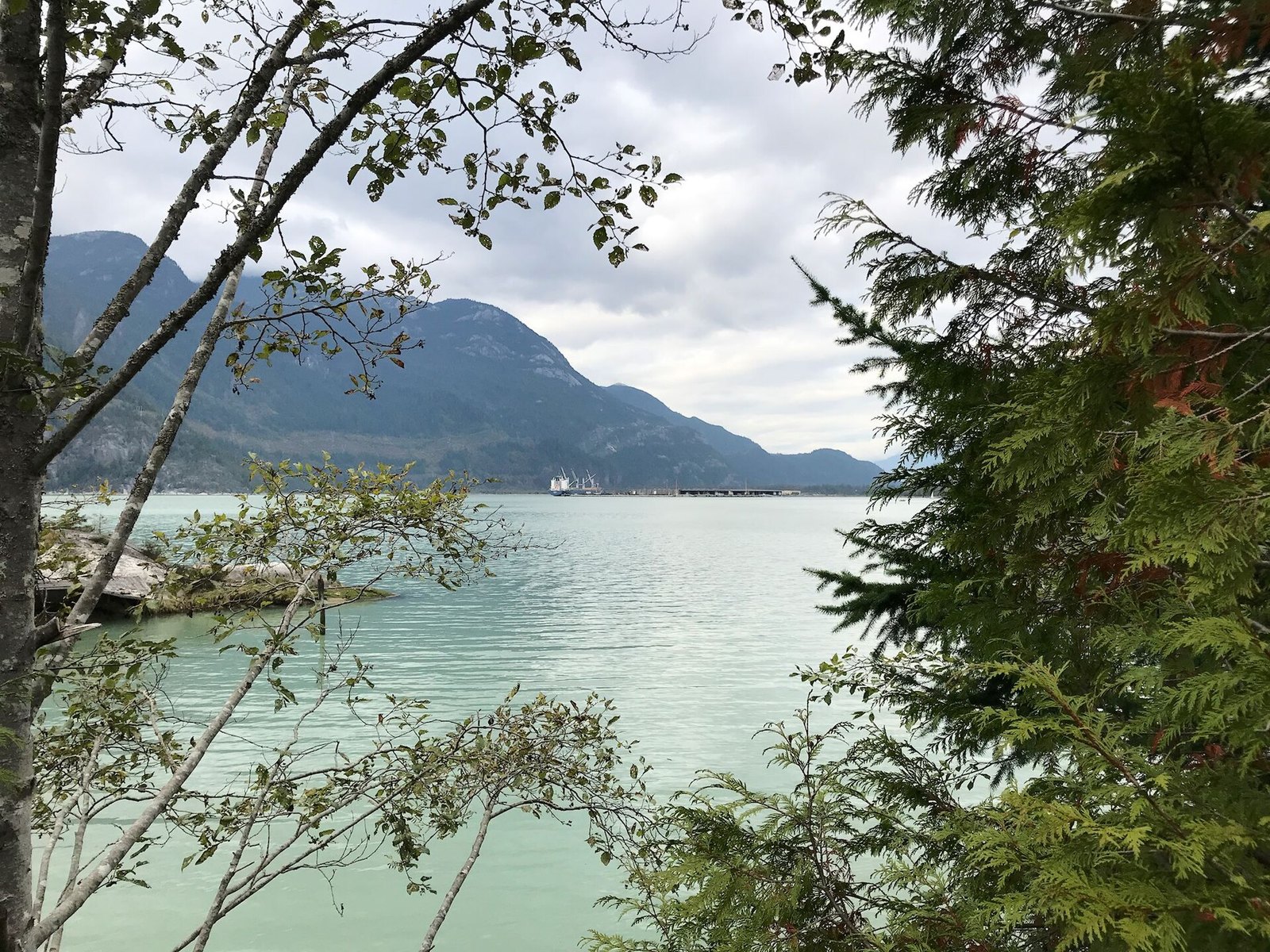
Where: Skwelwil’em Squamish Estuary Wildlife Management Area
When: Under a Conservation Officer advisory since May 26, 2026; check before going
Cost: Free
Getting there: Corner of Vancouver Street and Second Avenue, Squamish
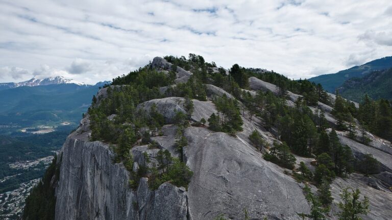
On paper this is the best flat view of the Chief anywhere. The District of Squamish says the estuary trails offer some of the best views of the Stawamus Chief and Shannon Falls. The estuary is habitat for more than 200 species of wintering and migrating birds. The network runs 11.5 km, mostly paved on the east side and mostly gravel on the west.
Right now, though, it comes with a warning. On May 26, 2026, the BC Conservation Officer Service asked people to avoid the estuary trails until further notice after a black bear attack off Spit Road. A District notice says the Conservation Officer Service has since reopened the trail network after a two-month closure, but it is undated, and the estuary has closed in past autumns for foraging bears. Check the District’s wildlife alerts before you drive up.
If the trails are open, access is at the corner of Vancouver Street and Second Avenue. It’s a Wildlife Management Area, so all dogs must be on leash. Go in a group, make noise on blind corners and carry bear spray, as Conservation Officers advise.
11. Stanley Park Seawall, open sections this fall (Downtown Vancouver)
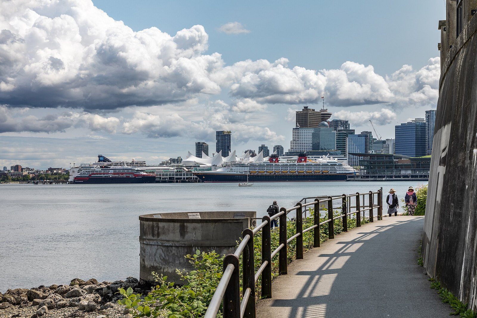
Where: Coal Harbour to Lumberman’s Arch, Stanley Park
When: Park open 6 am to 10 pm unless posted; Lumberman’s Arch to Third Beach closed until Nov 14, 2026, possibly intermittently to Nov 20
Cost: Free to walk; pay parking in the park
Getting there: Walk from downtown to the Coal Harbour end of the seawall
The seawall is the walk most people picture when they think flat and Vancouver. Walkers and joggers get the lane closest to the water. Cyclists and inline skaters use the inside path. The City says the full 9 km loop around Stanley Park takes 2 to 3 hours on foot.
This fall, the full loop is off the table. The seawall between Lumberman’s Arch and Third Beach is fully closed until November 14, 2026, and intermittent closures may continue until November 20. Crews are removing the speed (maze) gates near Lumberman’s Arch, Prospect Point and Third Beach, and combining that with annual rock scaling. Detour signs send walkers and cyclists through Beaver Lake. The City’s project page has the current status.
The good news is that the Coal Harbour side stays open up to Lumberman’s Arch. That stretch looks north across Burrard Inlet to the North Shore mountains. Start at Coal Harbour, walk toward Brockton Point and Lumberman’s Arch, then turn around rather than taking the forest detour. You keep the water and the mountains the whole way.
You can walk to the Coal Harbour end from downtown. The park is open 6 am to 10 pm unless otherwise posted, and washrooms are open dawn to dusk, per the Stanley Park page. Parking in the park is pay parking.
10. Eagle Run dyke (Brackendale, Squamish)
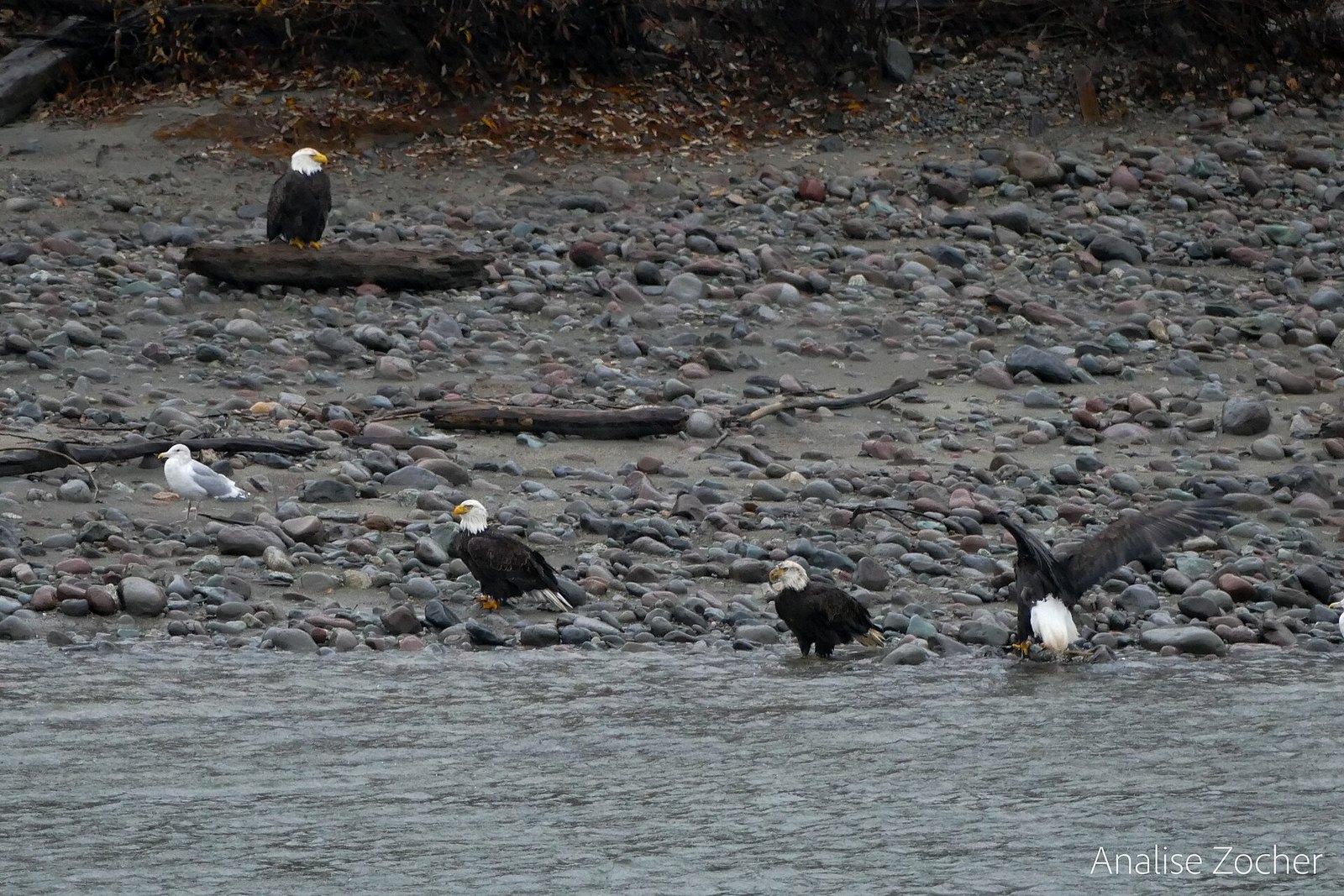
Where: Government Road, opposite 41015 Government Road, Brackendale
When: Peak November to December; EagleWatch starts Nov 7, 2026
Cost: Free
Getting there: Hwy 99 to Squamish, then north to Brackendale and Government Road
This short, flat riverside dyke looks across the Squamish River to Brackendale Eagles Park, with mountains behind. BC Parks says the Squamish River Valley has long been one of the most significant wintering areas for bald eagles in North America. You can’t reach the park itself across the river. The public watches from the dyke instead, opposite the Easter Seals Camp at 41015 Government Road.
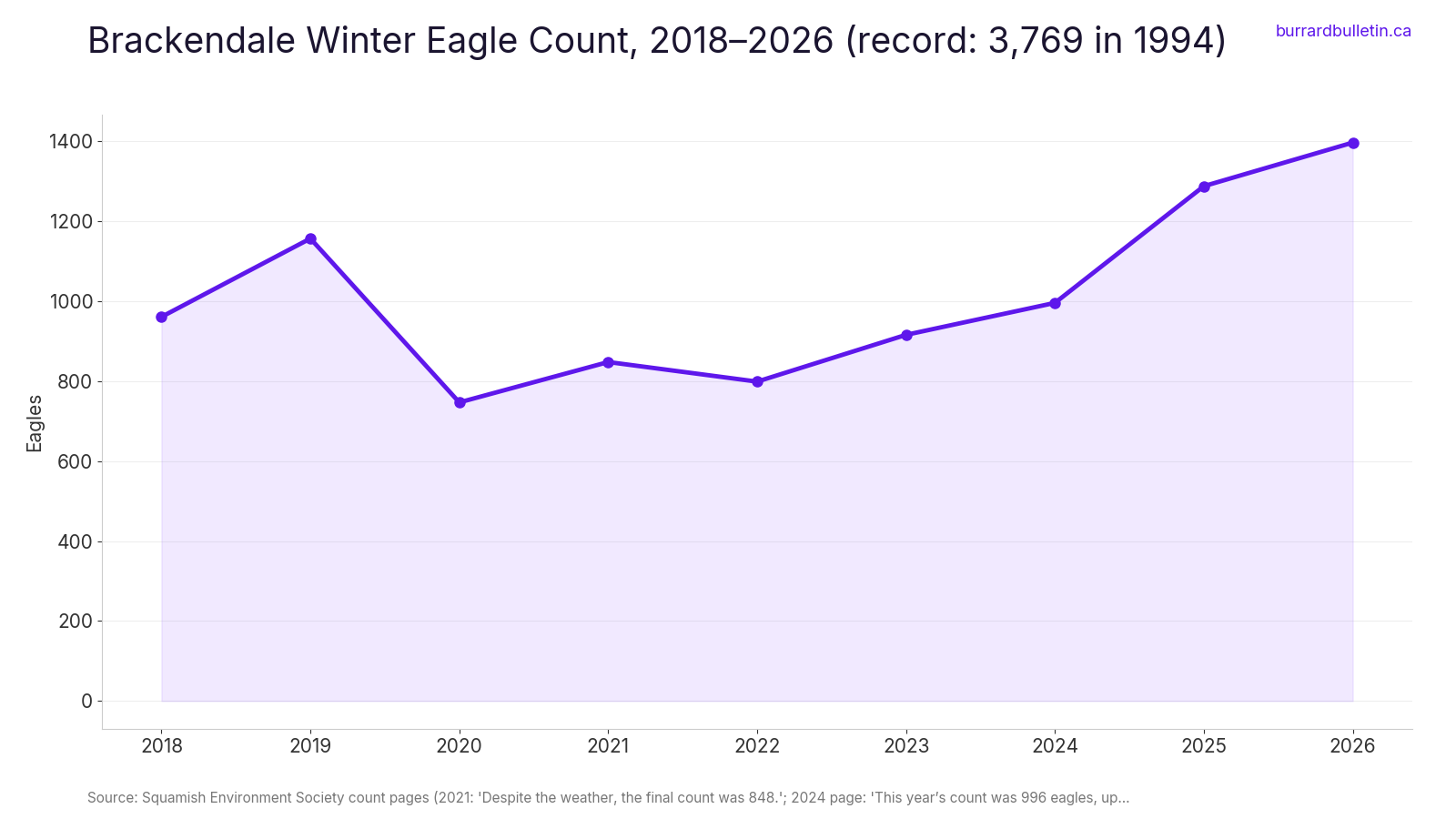
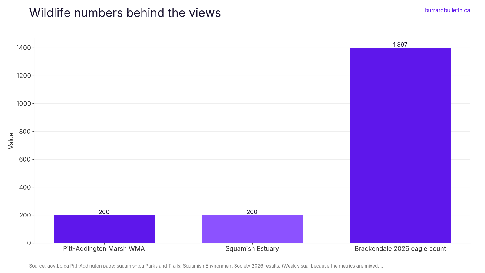
The numbers have a history. The 1994 count set a world record of 3,769 eagles. The Squamish Environment Society puts the 40-year average at 1,320, and recent counts have been climbing. EagleWatch volunteers count on the dyke every day in season, and the 2026 season starts November 7.
Timing matters more here than anywhere else in this guide. BC Parks says viewing peaks from November to December, with significant numbers possible from November to January. Tourism Squamish says the dyke is accessible, with a ramp at the south end.
Take the Sea to Sky to Squamish, then head north to Brackendale and Government Road. Stay on the dyke and keep dogs and people out of the riverbed so feeding eagles aren’t disturbed.
9. Whistler Valley Trail, Village to Rainbow Park (Whistler)
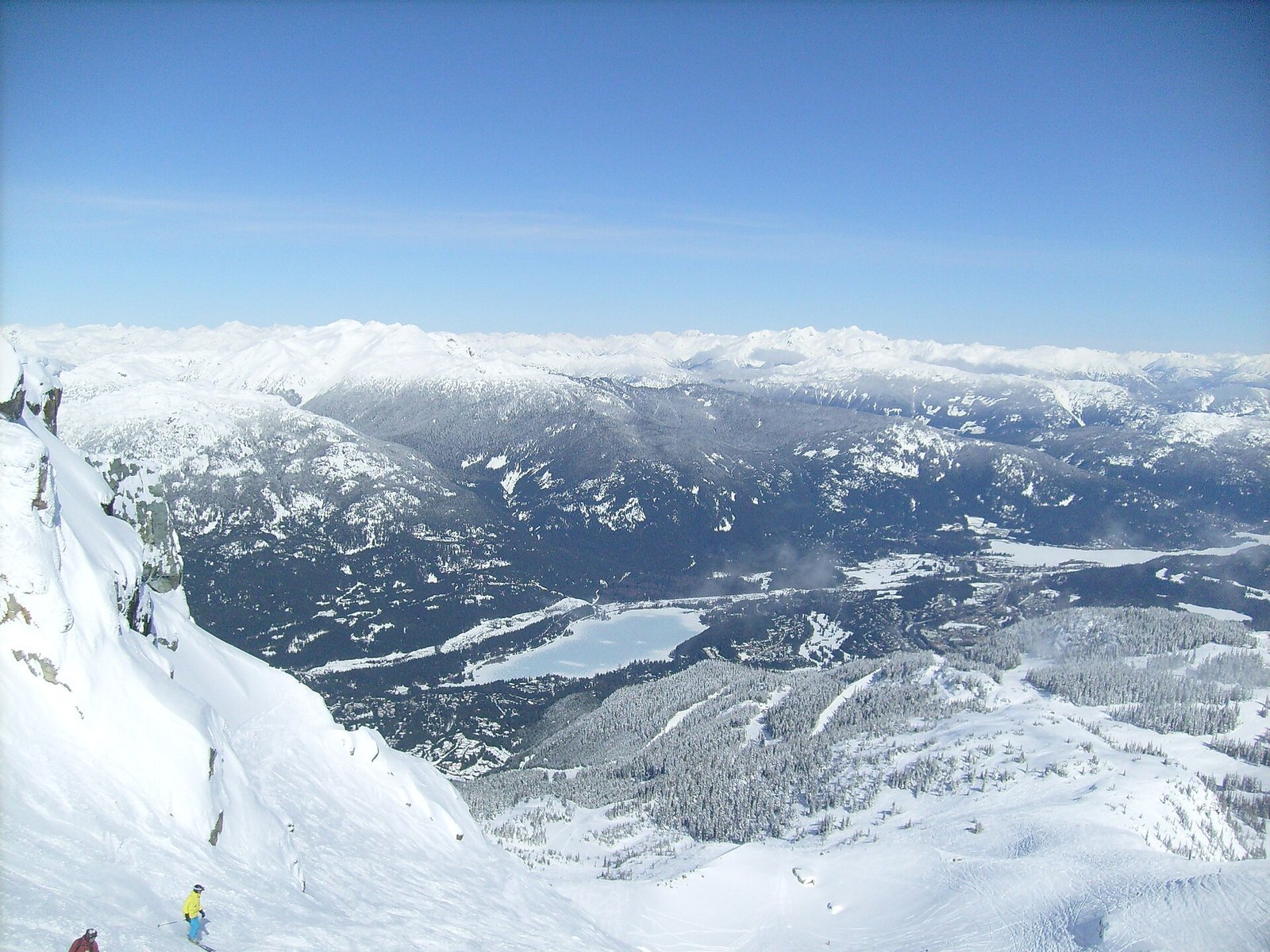
Where: Whistler Village to Rainbow Park, Alta Lake
When: Year-round; expect ice in winter
Cost: Free
Getting there: Underpass at the Whistler Golf Club entrance by the Conference Centre
Whistler’s Valley Trail is about 50 km of paved, shared-use path linking the Village with parks and neighbourhoods. Tourism Whistler’s route heads from the Village past the Whistler Golf Club and along the River of Golden Dreams to Rainbow Park on Alta Lake. It calls this a flat section, and you’ll often see paddlers on the water.
Rainbow Park is the turnaround and the view. Tourism Whistler’s winter walking guide suggests stopping there to look at Whistler and Blackcomb mountains. In the shoulder season the peaks often already carry snow while the trail is still bare.
Winter changes the rules a little. The Resort Municipality keeps roughly 38 km of the Valley Trail snow-cleared for walking, biking and general use. Some sections are groomed for cross-country skiing rather than cleared, so expect skiers. Sections can be slippery or icy.
From the Village, take the underpass at the Whistler Golf Club entrance by the Conference Centre and follow the signs to Rainbow Park. This is bear country, so the usual habits apply.
8. ƛ̓éxətəm, formerly Colony Farm, dyke trails (Coquitlam and Port Coquitlam)
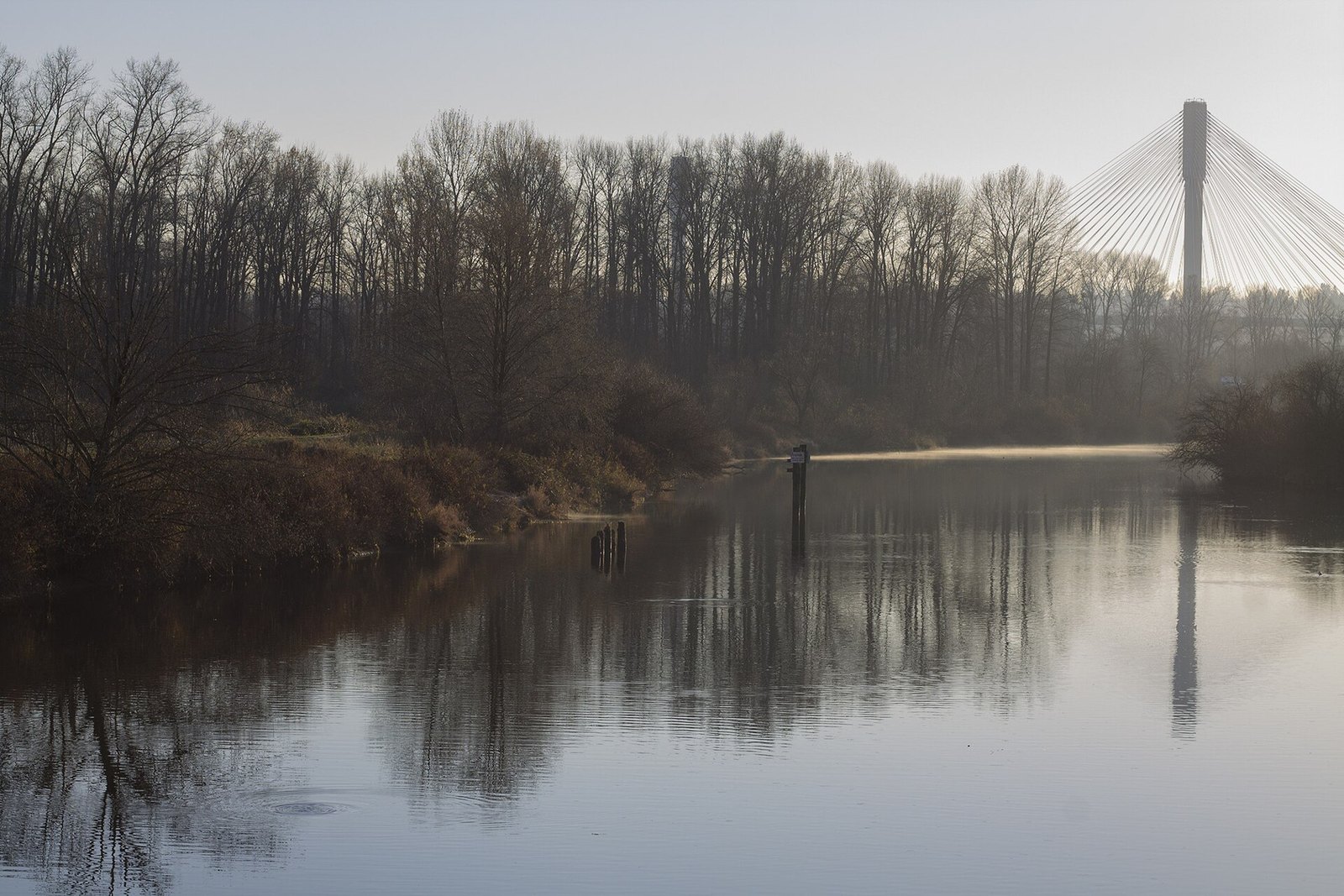
Where: Along the Coquitlam River, Coquitlam and Port Coquitlam
When: Year-round; a trail section closed until approximately December 2026
Cost: Free
Getting there: Main entrance off Colony Farm Road (ƛ̓éxətəm Road) near the Lougheed Highway
This is open parkland along the Coquitlam River, split in two by the water and joined by the Millennium Bridge. Metro Vancouver’s brochure suggests scanning the riverbanks for river otters, muskrats and herons, strolling the organic gardens and watching coyotes, hawks and owls hunt over the open fields. The views here are wide and open, with the mountains rising beyond the fields.
The name is worth knowing. The Kwikwetlem First Nation shared ƛ̓éxətəm, pronounced tla-hut-um, which means “to be invited”.
Expect detours this fall. Metro Vancouver has extended a trail closure until approximately December 2026 for erosion protection and bank stabilization on the Coquitlam River, per a Port Coquitlam notice from October 22. The park brochure also says a section of Home Farm Dyke Trail south of the Millennium Bridge is closed until further notice.
Use the main entrance off Colony Farm Road (ƛ̓éxətəm Road) near the Lougheed Highway. There’s no cycling access to the dyke trails from that road or the main entrance. From the main lot, the Garden Trail makes a short, flat out-and-back with open views across the fields.
7. Iona Jetty (Iona Beach Regional Park, Richmond)
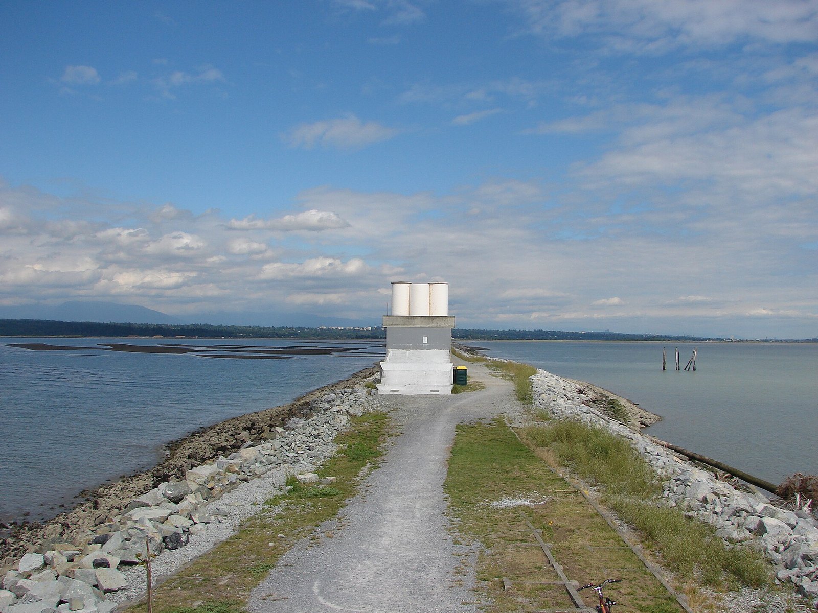
Where: Iona Island, Richmond, beside YVR
When: Year-round; gates close at night (check the posted hours)
Cost: Free (no fee found)
Getting there: Arthur Laing Bridge to Sea Island, then Ferguson Road
This one is strange in the best way. A dead-straight 4 km path runs out into the Strait of Georgia from Iona Island, right next to YVR. The City of Richmond’s park page describes walking toward the setting sun under an endless sky, with wilderness on one side and air and river traffic all around. Planes, open water and big sky are the show here.
It’s exposed. There’s no shade and it can be very windy. Destination Vancouver, the region’s tourism agency, says there are two wind shelters along the jetty. Out and back is 8 km with no water, so bring your own, plus some for the dog.
Dogs get a rare break. Metro Vancouver’s park brochure says dogs must be leashed everywhere in the park except the lower road on the jetty. Destination Vancouver adds that dogs aren’t allowed near the ponds on the east side of the park or on the beach between the Iona Jetty and the North Jetty.
Cross the Arthur Laing Bridge to Sea Island and follow Ferguson Road to the park. The gates close at night. Destination Vancouver gives winter hours of 7 am to 5 pm, with longer hours the rest of the year, but that isn’t from the park operator. Check the sign at the entrance so you don’t get locked in.
6. West Dyke Trail, Garry Point to Terra Nova (Richmond)
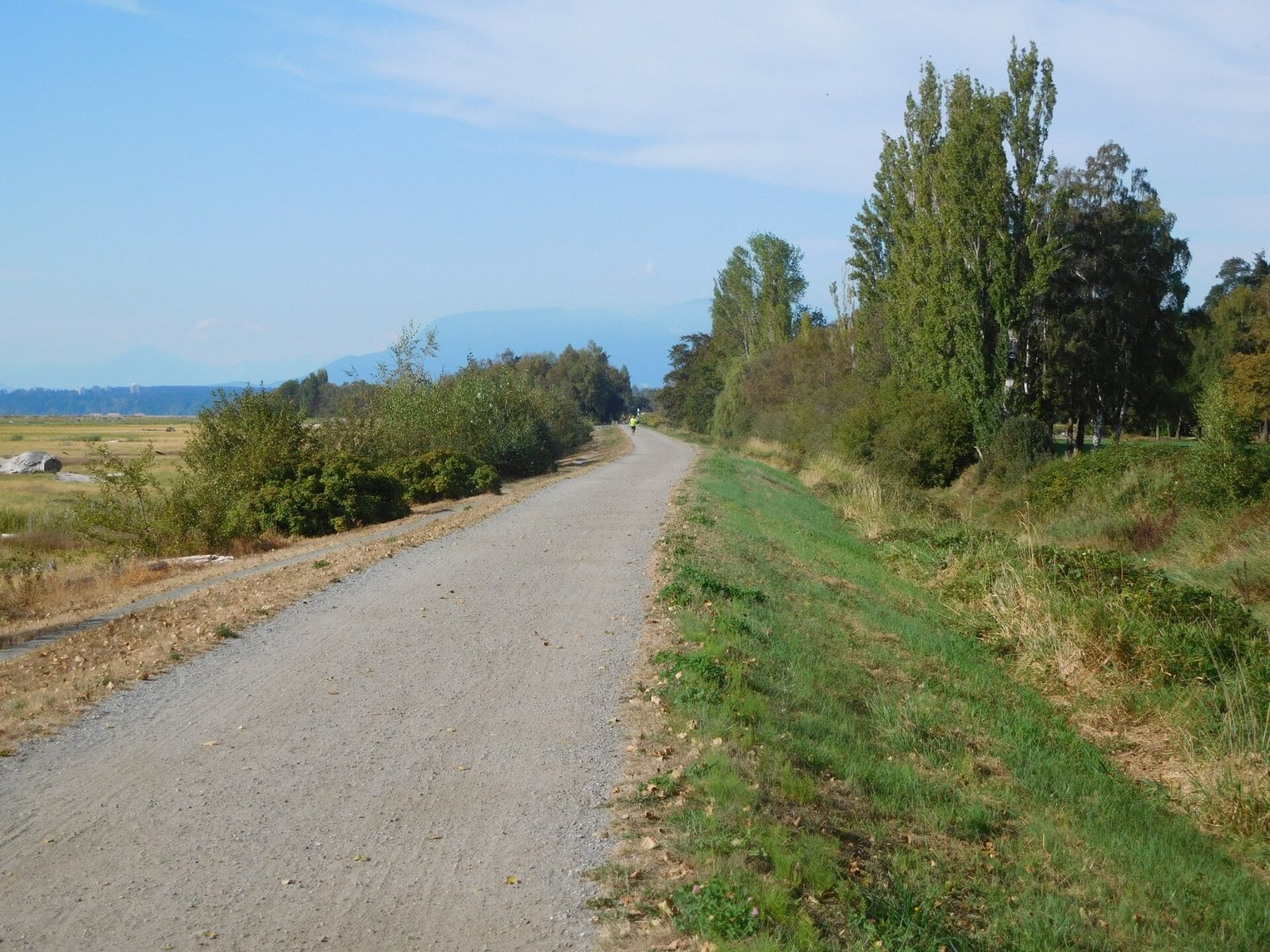
Where: Garry Point Park, Steveston, to Terra Nova Rural Park
When: Year-round, daylight only (no lights)
Cost: Free
Getting there: Garry Point Park in Steveston, or Terra Nova Rural Park (exact access points unverified)
This flat gravel dyke runs along Richmond’s western shore beside Sturgeon Banks. Richmond’s walking guide promises views of the Fraser River, the Gulf Islands and the Coastal Mountains. The City’s trail page adds the airport, tidal flats and wildlife to that list.
The marsh is the reason to come back. Sturgeon Banks is a large estuary on the Fraser delta that draws migrating birds. Come back as the seasons change and the marsh colours shift. At the north end, Terra Nova Rural Park has open fields and trails where wintering birds gather.
There are no lights, so plan for daylight. Start at Garry Point Park in Steveston, or at Terra Nova Rural Park at the north end. Parking at Terra Nova is limited. Starting at Garry Point and walking north keeps the mountains ahead of you, and Steveston is right there for a snack afterward.
5. Pitt River Regional Greenway from Harris Landing (Pitt Meadows)
Where: Harris Landing, foot of Harris Road, Pitt Meadows
When: Year-round; clear winter days for the Golden Ears
Cost: Free
Getting there: Harris Road at Fraser Way
The first phase of this greenway runs 10.2 km along the Fraser and Pitt River dykes, from Harris Landing at the foot of Harris Road to Ferry Slip Road. The City of Pitt Meadows promises views of mountains, rivers and working farmland. On a clear winter day, the snowy Golden Ears to the north do most of the work.
Surfaces are honest gravel. The main trail at Harris Landing is 900 m of semi-firm fine gravel at least 1.5 m wide. The dyke trail is at least 3 m wide, with loose gravel in places. One catch for strollers and wheelchairs is a steep 10% slope from the parking area down to the trails. The washrooms at Harris Landing are wheelchair accessible.
You don’t have to do the whole thing. Harris Landing to the industrial area is 3 km each way, so about 6 km there and back makes a flat morning walk. Find the start at Harris Road and Fraser Way.
4. Boundary Bay 12 Ave Dyke Trail from Centennial Beach (Tsawwassen, Delta)
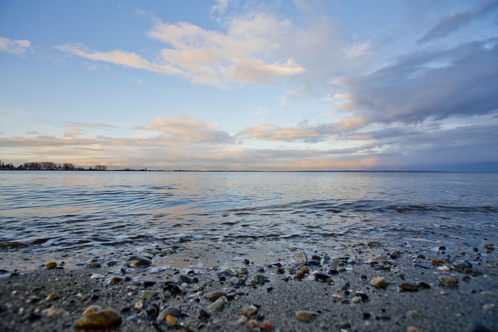
Where: Centennial Beach, Boundary Bay Regional Park, Tsawwassen
When: Opens 7 am; earliest closing 5 pm (check posted hours)
Cost: Free entry; parking fee not confirmed
Getting there: Hwy 99 south to Hwy 17, then 56 St and 12 Ave (Boundary Bay Road)
Metro Vancouver lists the 12 Ave Dyke Trail at 4.0 km and about 1 to 1.5 hours. It’s 4 m wide with a semi-firm surface, some patches of coarse gravel and minimal slopes. Hikers and cyclists share it.
The park brochure invites you to watch northern harriers and other raptors over the fields, and to take in the ocean and mountain views from the dyke. Non-official guides agree that the big peak across the bay is Mount Baker. Low winter sun in the afternoon tends to light it up. Keep an eye on the fields too, where harriers hunt low beside the dyke.
Centennial Beach has accessible washrooms, change rooms and a playground, which helps with kids. Parking restrictions are strictly enforced. The park opens at 7 am and the earliest closing time is 5 pm. Actual hours are posted at the entrances, and the gates are locked when the park is closed.
Take Hwy 99 south through the tunnel to Hwy 17, then 56 St and 12 Ave, which becomes Boundary Bay Road, to Centennial Beach.
3. Pitt-Addington Marsh dykes at Grant Narrows (Pitt Meadows)
Where: North end of Rannie Road, south end of Pitt Lake
When: Year-round
Cost: Parking fee unconfirmed ($5/day reported in 2024)
Getting there: From the Lougheed Highway, follow Wildlife Watch signs 17 km
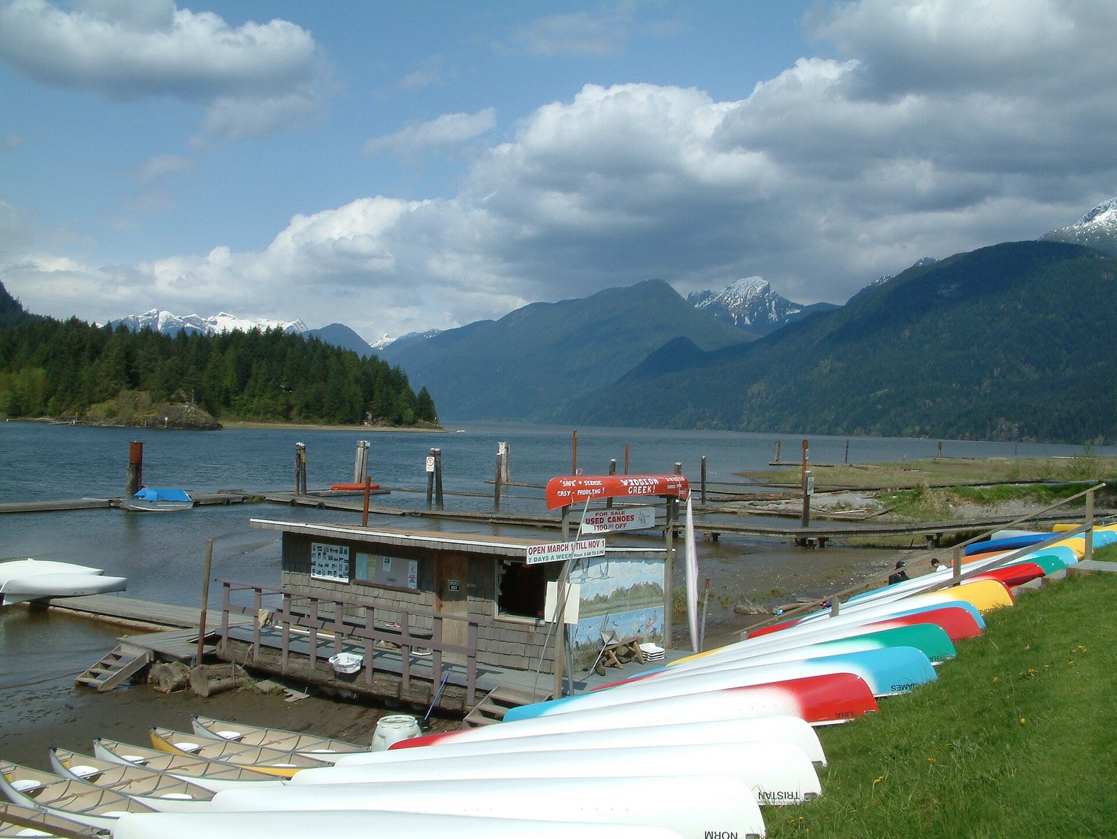
At the south end of Pitt Lake, the valley floor goes flat and the mountains go straight up. The Province designated the Pitt-Addington Marsh Wildlife Management Area in 1987. It covers 2,972 hectares and supports more than 200 bird species and 29 mammal species. It’s also one of only two Greater Sandhill Crane nesting sites in the Lower Fraser Valley. The Province calls Pitt Lake the largest tidal freshwater lake in the world.
A provincial brochure describes many looping dyke trails leading to three covered viewing towers. Climb one for the classic view up Pitt Lake toward the mountains, and bring binoculars. A separate mountainside trail has steep inclines and needs sturdy footwear, so stick to the dykes if you came in runners. A non-official source says Crane Dyke closes March 15 to August 15 for crane nesting. That isn’t confirmed, so watch for signs.
The Province puts the area 60 km east-northeast of Vancouver. From the Lougheed Highway in Pitt Meadows, follow the Wildlife Watch binocular signs for 17 km to the parking area at the south end of Pitt Lake. The recreation site is run by the Katzie First Nation. Local news reported a $5 daily parking fee in 2024, but no current official fee page was found.
2. Centennial Seawalk, Ambleside to Dundarave (West Vancouver)
Where: Foot of 18th Street (Ambleside) to Dundarave Park
When: Year-round
Cost: Free
Getting there: Start at the foot of 18th Street or at Dundarave Park
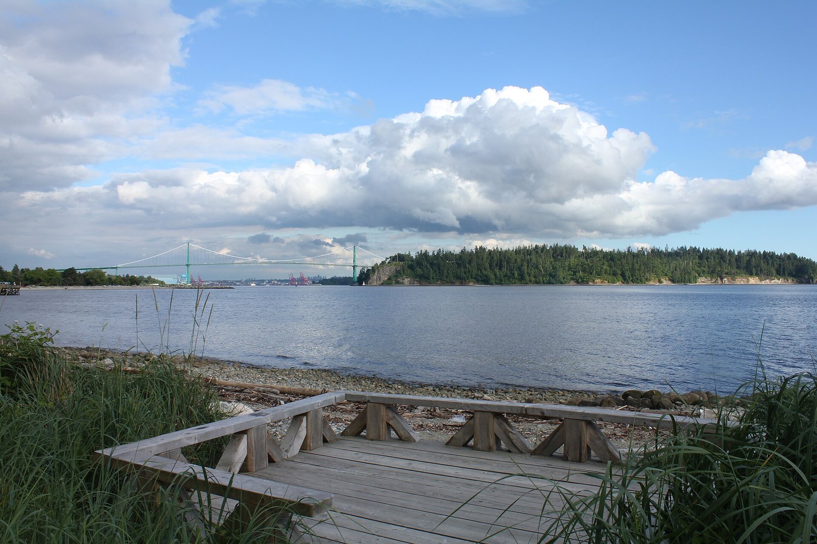
West Vancouver calls this an easy 1.7 km route from the bottom of 18th Street to Dundarave Park. It’s short, paved and right on the water. Views take in Burrard Inlet, the Coast Mountains, the Vancouver skyline and ships passing under the Lions Gate Bridge.
What sets it apart is the rule sheet. The seawalk is for walkers only, so bikes, boards and rollerblades aren’t permitted. That makes it one of the calmer flat waterfront strolls on the Shore for small kids who wander. Dogs are welcome on a leash no longer than two metres, with a maximum of two per person. The only off-leash area is the fenced dog path between 19th and 24th Street. The full rules are on the District’s seawalk page.
Start at the foot of 18th Street in Ambleside or at Dundarave Park. Walk west in the morning, then turn around and you get the Lions Gate Bridge in front of you on the way back.
1. Spanish Banks seawall, with Locarno and Jericho (West Point Grey, Vancouver)
Where: Spanish Banks, Locarno and Jericho beaches, West Point Grey
When: Year-round; clear days for the mountain view
Cost: Free to walk; Park Board pay parking (check the meter)
Getting there: West on 4th Avenue past Jericho Beach Park, then NW Marine Drive
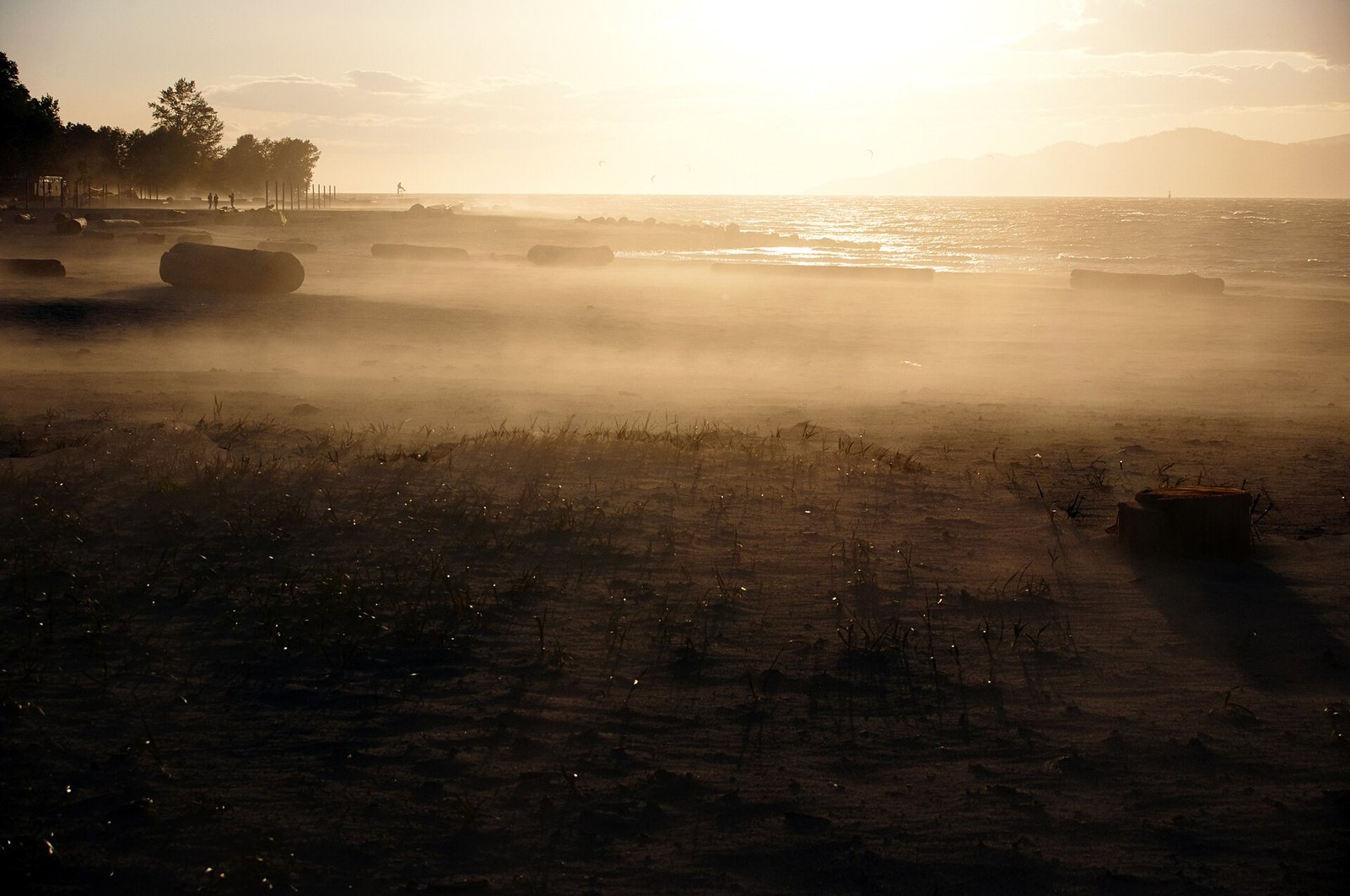
This is one of the flattest mountain views in the city. The City of Vancouver lists Spanish Banks as a 2.46 km linear “destination walk” with only 5 m of elevation change. It comes in three sections: Spanish East, Spanish West and the Spanish Banks Extension. You walk along the beach with English Bay on one side and nothing taller than a log on the other.
The payoff is across the water. Look past Stanley Park and the City says you can find the tops of Seymour, Grouse and Cypress, plus the lighthouse on the point in West Vancouver. The walk faces north, so the mountains stay in front of you heading east and over your shoulder coming back. Pick a clear day. After rain the Shore’s peaks often stand out sharpest.
If you want more distance, the City links the Jericho Park walk to Spanish Banks by way of Locarno Beach. That combined route is about 3.8 km. The Jericho portion is wheelchair accessible on mixed pavement and hard-packed gravel, which makes it the easier half for strollers too.
Get there by driving west on 4th Avenue past Jericho Beach Park, then following NW Marine Drive along Locarno and Spanish Banks. The beach lots are Park Board pay lots. Rates weren’t confirmed on the Park Board’s own page, so read the meter.
| Walk | Distance | Surface | Dogs |
|---|---|---|---|
| Spanish Banks | 2.46 km linear (3.8 km with Jericho) | seawall / gravel | unverified |
| Stanley Park Seawall | 9 km loop (part closed to Nov 14) | paved | unverified |
| Centennial Seawalk | 1.7 km one way | paved | leashed, max 2 |
| Iona Jetty | 4 km one way | gravel, upper and lower | leashed, except lower road |
| West Dyke Trail | 5 km (walking guide) | flat gravel, no lights | unverified |
| Boundary Bay 12 Ave Dyke | 4.0 km, 1–1.5 hrs | semi-firm, 4 m wide | unverified |
| Pitt River Greenway | 10.2 km (3 km Harris Landing–industrial area) | fine gravel / dyke | unverified |
| Whistler Valley Trail | 50+ km network | paved | pet-friendly groomed section in winter |
Closures and advisories this fall (as of Oct 23, 2026)
- Stanley Park Seawall: fully closed between Lumberman’s Arch and Third Beach until November 14, 2026, with intermittent closures possible until November 20. The detour runs through Beaver Lake. Check the City’s seawall page.
- ƛ̓éxətəm (Colony Farm): a trail section is closed until approximately December 2026 for Coquitlam River bank work. A section of Home Farm Dyke Trail south of the Millennium Bridge is closed until further notice.
- Squamish Estuary: Conservation Officers asked the public to avoid the trails until further notice on May 26, 2026. No official reopening notice was found.
When to go
- Clear days, any season: the mountain views are the point, so watch the forecast. After rain the North Shore peaks often stand out best.
- November to December: peak eagle viewing at the Eagle Run dyke in Brackendale, with significant numbers possible into January. EagleWatch starts November 7, 2026.
- Winter in Whistler: about 38 km of the Valley Trail is snow-cleared, but sections can be icy.
- Gate hours: Boundary Bay opens at 7 am and the earliest closing is 5 pm. Iona’s gates also close at night. Read the posted hours at the entrance.
- Daylight: the West Dyke Trail has no lights.
What to bring
- A windproof layer for the jetty and dykes, even when it’s sunny. Iona has wind shelters along the jetty for a reason.
- Water for you and the dog. Iona, Boundary Bay and the river dykes have little or no shade.
- Binoculars for Pitt-Addington Marsh, the West Dyke and Brackendale.
- Bear spray in Squamish, Whistler and around Pitt Lake.
Dogs
- Iona: leashed everywhere except the lower road on the jetty.
- Centennial Seawalk: dogs are allowed on leash; the District of West Vancouver posts leash-length, dog-limit and off-leash rules on site and on its Centennial Seawalk page, so check before you go.
- Squamish Estuary: leash required in the Wildlife Management Area.
- Brackendale: keep dogs out of the riverbed.
- Dog rules for Spanish Banks, the Stanley Park Seawall, the West Dyke, Boundary Bay and the Pitt River Greenway weren’t confirmed on official pages, so follow the posted signs.
Etiquette and safety
On shared dykes like Boundary Bay, which Metro Vancouver opens to both walkers and cyclists, slow down, give way to others and follow any posted trail signs. On the Stanley Park Seawall, walkers keep to the lane by the water. Around wildlife areas, stay on the trail and give birds space.
In bear country, go prepared: travel in a group, make noise on blind corners and carry bear spray. That’s Conservation Officer advice, not a formality.
Getting there
Drive times weren’t confirmed from official sources, so they’re left out here. Spanish Banks and the Stanley Park Seawall are inside Vancouver, and you can walk to the Coal Harbour end of the seawall from downtown. Iona is over the Arthur Laing Bridge, the West Dyke starts in Steveston, and Boundary Bay is off Hwy 17 past the tunnel. Pitt Meadows walks start from the Lougheed Highway. Brackendale, the Squamish Estuary and Whistler are all on the Sea to Sky.
Pick the walk by what you want to look at. For the Shore’s peaks, stay in the city. For Mount Baker or the Golden Ears, head south or east. For the Chief and the eagles, drive the Sea to Sky in November. Check the closures first, bring a warm layer and let the mountains do the climbing.
Get the weekend plan in your inbox. Burrard Bulletin is a free email on what’s actually on from Vancouver to Whistler. Sign up here.
Photo credits
- Mount baker from point roberts.jpg by Gnatdroid (talk · contribs), CC BY-SA 3.0 (combined into a montage, cropped). Via Wikimedia Commons.
- Mount Baker Boundary Bay.jpg by Hop Phan, CC BY 2.0 (combined into a montage, cropped). Via Wikimedia Commons.
- English Bay from Point Grey 01.jpg by Xicotencatl, CC BY-SA 3.0 (combined into a montage, cropped). Via Wikimedia Commons.
- English Bay from Point Grey 04.jpg by Xicotencatl, CC BY-SA 3.0 (combined into a montage, cropped). Via Wikimedia Commons.
- Spanish Banks, Vancouver BC.jpg by Blackie Ray, CC BY-SA 4.0 (resized; cropped for the featured image). Via Wikimedia Commons.
- Vancouver (BC, Canada), Stanley Park, Stanley Park Seawall Path — 2022 — 2056.jpg by Dietmar Rabich, CC BY-SA 4.0 (resized). Via Wikimedia Commons.
- Ambleside Park, West Vancouver (5871879198).jpg by GoToVan, CC BY 2.0 (resized). Via Wikimedia Commons.
- Iona Jetty – panoramio.jpg by SpiderRider3, CC BY-SA 3.0 (resized). Via Wikimedia Commons.
- West Dyke bike trail in Richmond, BC. (29758844405).jpg by Robert Ashworth from Bellingham, WA., USA, CC BY 2.0 (resized). Via Wikimedia Commons.
- Boundary Bay Regional Park in Tsawwassen.jpg by GoToVan, CC BY 2.0 (resized). Via Wikimedia Commons.
- Colony Farm (130422405).jpeg by Jeff Macleod, CC BY-SA 3.0 (resized). Via Wikimedia Commons.
- Pitt Lake with Canoes.jpg by Jonathan Rodgers, CC BY-SA 4.0 (resized). Via Wikimedia Commons.
- Bald eagles (39714818171).jpg by Analise Zocher, CC BY 2.0 (resized). Via Wikimedia Commons.
- Ship at dock on Howe Sound in Squamish (48772521681).jpg by dvs from Vermont, USA, CC BY 2.0 (resized). Via Wikimedia Commons.
- Whistler bowl+lake.JPG by OOroyOo, CC BY-SA 3.0 (resized). Via Wikimedia Commons.