Sea to Sky Hikes to Skip If You’re Afraid of Heights
Plenty of the Sea to Sky’s best-known hikes are really about exposure. The Chief has chains and a ladder. Both hike-up routes to the Sea to Sky Gondola use fixed ropes, and one adds ladders. Whistler Peak has a skybridge over Whistler Bowl at 2,182 m.
If heights make your legs go soft, these are the routes to know about before you commit. Each section explains the part that bothers people, using the land manager’s, operator’s or official tourism body’s own description. Each one also gives you a calmer way to get a similar view.
Status is current as of Oct 23, 2026. The Chief’s main trail is open again after a rockfall closure. Whistler’s Peak Express has closed for the season. Garibaldi day-use passes stopped being required on Oct 12.
10. Cloudraker Skybridge and Raven’s Eye (Whistler Peak)
Where: Whistler Peak
When: Closed for 2026. The 2027 dates aren’t posted yet.
Cost: Included with the Summer Alpine Experience ticket. 2027 prices aren’t posted.
Getting there: Whistler Village Gondola, then the Peak Express chair
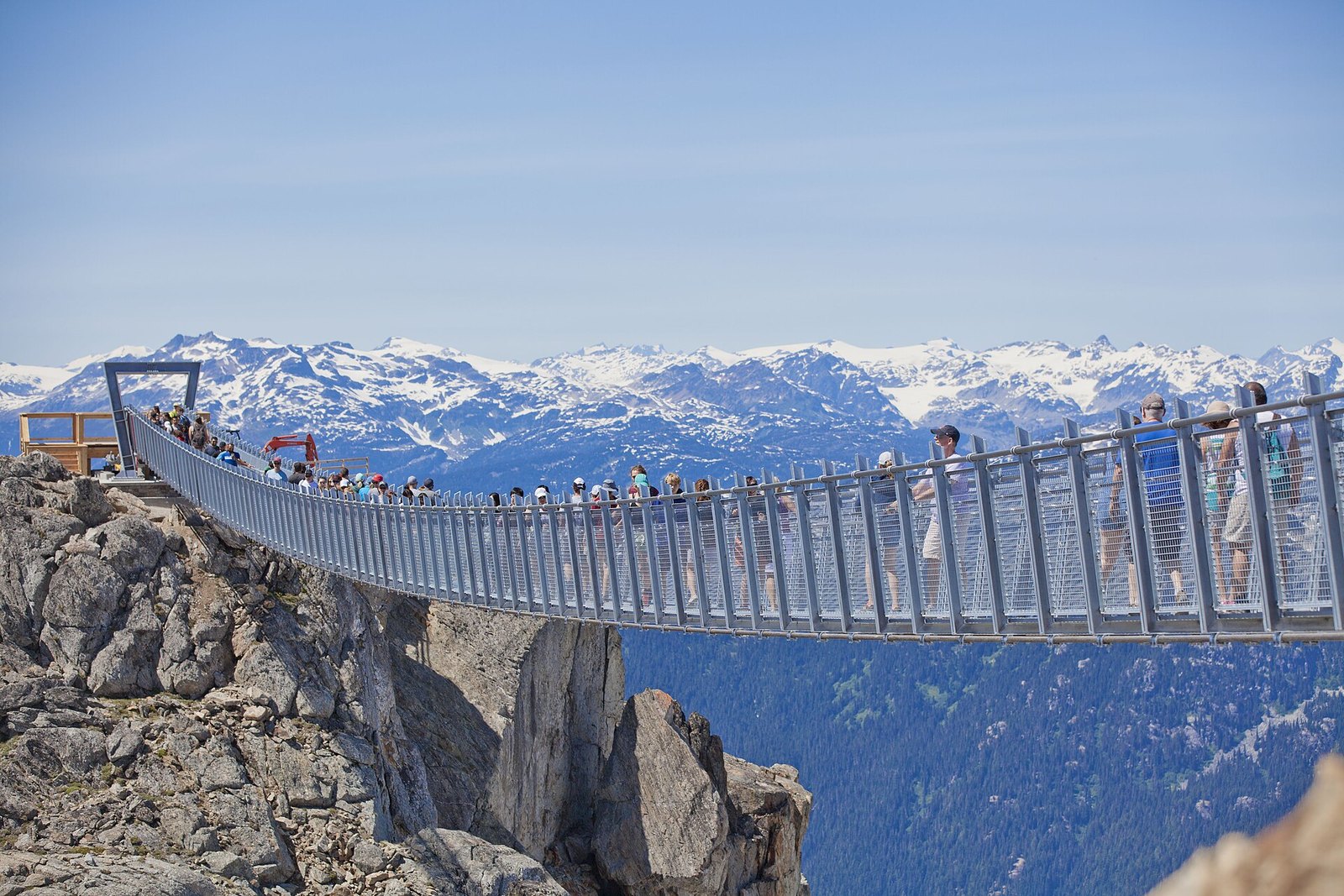
Tourism Whistler says the Cloudraker Skybridge runs 130 m from the top of Whistler Peak to the West Ridge. It crosses Whistler Bowl at 2,182 m above sea level. At the far end, the Raven’s Eye Cliff Walk is a 360-degree viewing platform. The bridge opened in summer 2018.
There’s no partial version of this one. The crossing is the attraction.
It’s closed for 2026. Whistler Blackcomb’s hours page confirms the Peak Chair is closed for the season. The bridge is included with the Summer Alpine Experience ticket. The 2027 dates and prices aren’t posted yet. You get there the same way as the High Note: Whistler Village Gondola, then the Peak Express chair.
If the open chairlift alone is too much, the Whistler Village and PEAK 2 PEAK gondolas are enclosed cabins.
9. High Note Trail (Whistler Mountain)
Where: Whistler Blackcomb, at the edge of Garibaldi Park
When: Closed for 2026. The 2027 dates aren’t posted yet.
Cost: Summer Alpine Experience ticket required. 2027 prices aren’t posted.
Getting there: Whistler Village Gondola, then the Peak Express Traverse, then the Peak Express chair
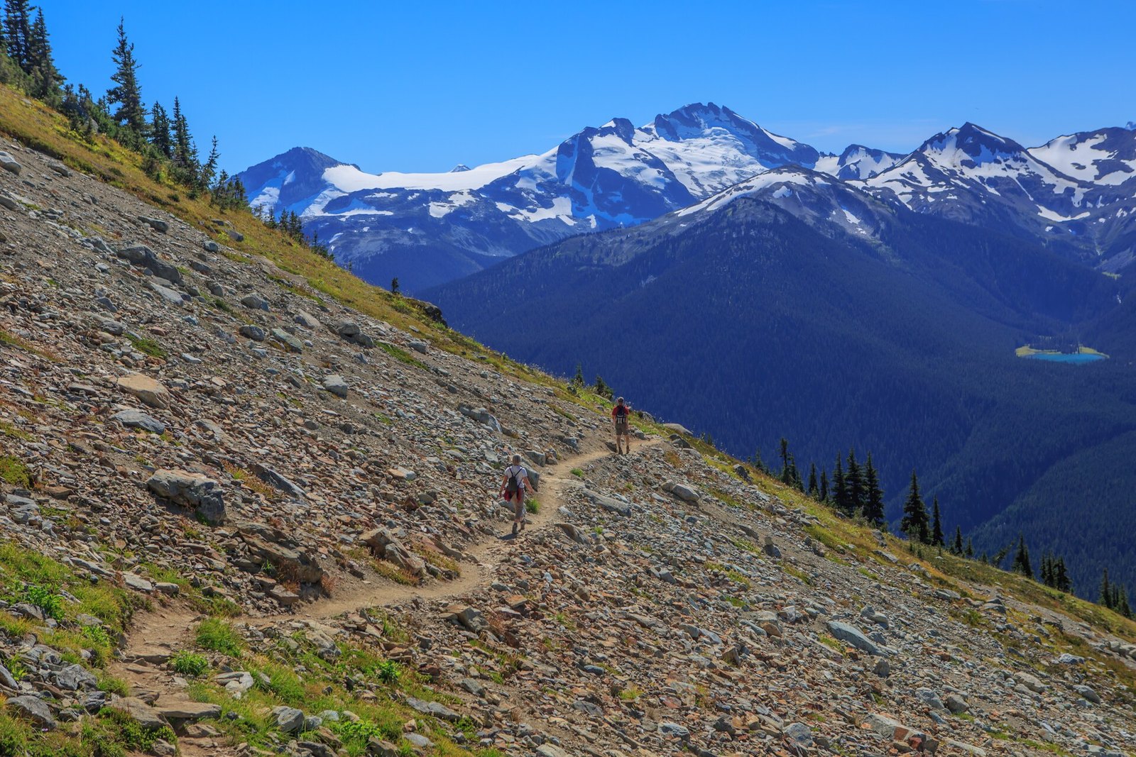
The High Note starts at the top of Whistler’s Peak Express chair. Whistler Blackcomb’s 2026 trail map lists it at 9.4 km and about 4 hours. Along the way you get views of Black Tusk and Cheakamus Lake.
Two things make it a poor pick if heights bother you. Tourism Whistler rates it Advanced and says its most technical section has a rope, a chain and a small metal bridge. To reach the trailhead, you also have to ride the open-air Peak Express.
The High Note is closed for 2026. The Peak Express’s last day was Sept 13. The 2027 dates aren’t posted yet. Access requires a Summer Alpine Experience ticket, and 2027 prices aren’t posted either.
Tourism Whistler’s hiking guide lists the Lakeside Loop to Blackcomb Lake (4.8 km, 72 m of elevation, just under two hours) as an intermediate option. The guide doesn’t say whether it avoids exposed sections, so ask before you count on it.
8. The Lions and the Howe Sound Crest Trail beyond Bowen Lookout (Cypress and Lions Bay)

Where: Cypress Park and Lions Bay, Howe Sound
When: BC Parks doesn’t recommend winter use beyond Bowen Lookout
Cost: Check Lions Bay trailhead parking rates before you go
Getting there: Cypress Mountain at the south end, or the Binkert trail from Lions Bay
BC Parks describes the Howe Sound Crest Trail as a 29 km route running north from Cypress past the Lions to Hwy 99. It says some sections are extremely rugged and easy to lose in bad weather. Only experienced, well-equipped backcountry travellers should go past Bowen Lookout.
The West and East Lion summits are scrambles. In 2024, CBC reported a North Shore Rescue call-out after a man solo-scrambling the East Lion fell many metres.
BC Parks says winter use of the trail is not recommended beyond Bowen Lookout. Late October snow is arriving, so casual hikers should treat the ridge as off the table until next season.
The trail’s south end starts at Cypress Mountain, and the Binkert trail comes up from Lions Bay. For a Howe Sound view without the ridge, stop at Bowen Lookout, which is BC Parks’ own cut-off point. Details are on the BC Parks Cypress hiking page.
7. Black Tusk, beyond the BC Parks viewpoint (Garibaldi Park)
Where: Garibaldi Park, Rubble Creek trailhead between Squamish and Whistler
When: Day-use passes ended Oct 12, 2026. The access road isn’t plowed in winter.
Cost: Day-use passes free when required. Backcountry camping needs a reservation year-round.
Getting there: Right off Hwy 99 past the Rubble Creek Bridge, 37 km north of Squamish, then 2.5 km of paved road
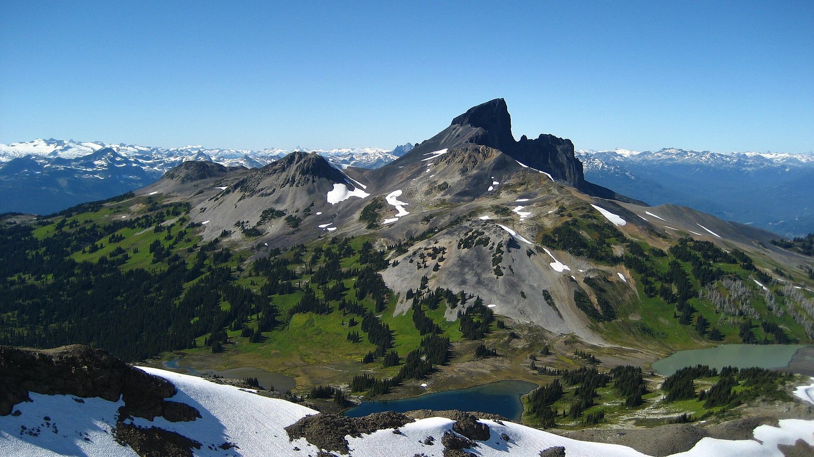
The Black Tusk is a 2,319 m volcanic spire. BC Parks maintains the trail only as far as a viewpoint kiosk. It says any trails or scrambles past that point are not part of its trail system. The park’s trail sheet, updated May 19, 2026, says climbing the Tusk is not recommended. It cites difficult navigation, fall hazard and loose rock.
Even stopping at the kiosk makes for a big day. The Garibaldi Lake campground is 9 km from the parking lot. Go prepared for a long alpine day.
Turn right off Hwy 99 just past the Rubble Creek Bridge. That’s 37 km north of Squamish or 19 km south of Whistler. Then drive 2.5 km of paved road to the lot. Day-use passes were required June 12 to Oct 12, 2026, so that requirement has ended for the year. BC Parks says the Rubble Creek road isn’t plowed in winter. Backcountry camping needs a reservation year-round.
The kiosk is where the maintained trail ends, so treat it as your summit. If you want to see the Tusk without a hike, Brandywine Falls has a viewpoint toward Daisy Lake and the Black Tusk. Trail details are on the BC Parks Black Tusk page.
6. Wedgemount Lake (Garibaldi Park, north of Whistler)
Where: Garibaldi Park, north of Whistler
When: Check bcparks.ca for current conditions
Cost: No day-use fee listed by BC Parks; check bcparks.ca. Overnight stays need a reservation and camping fees apply year-round.
Getting there: Right off Hwy 99, 13 km north of Whistler, across a railway crossing, then 2 km up a forest service road
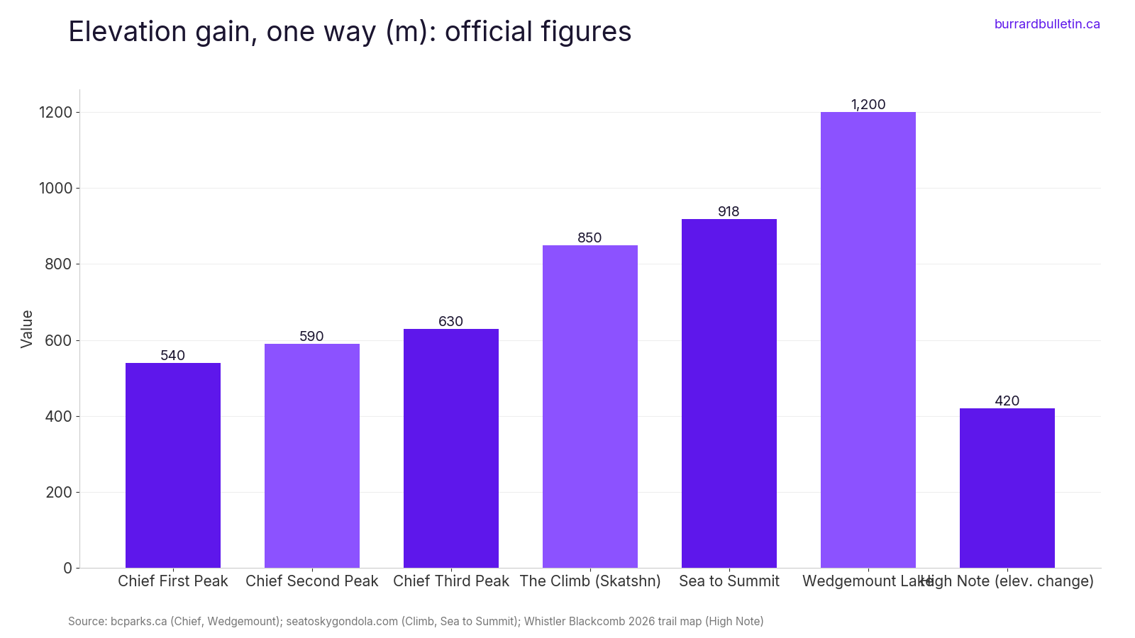
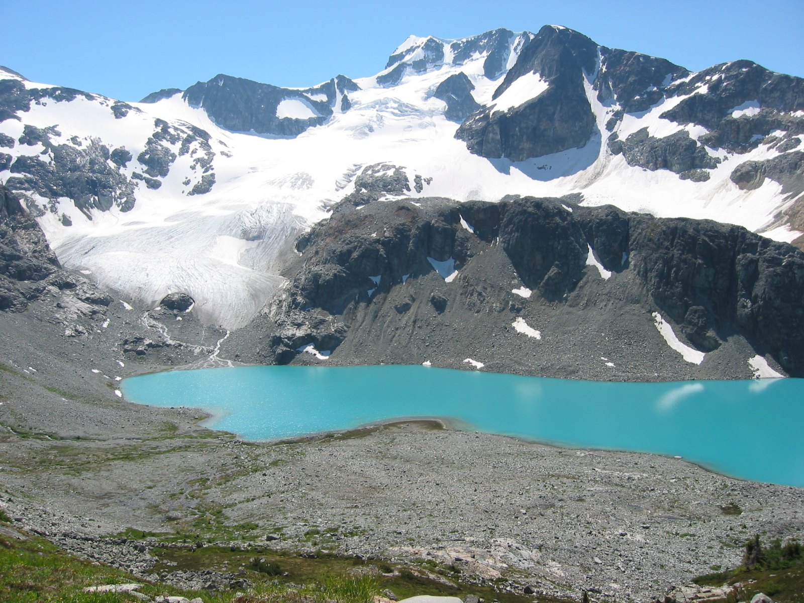
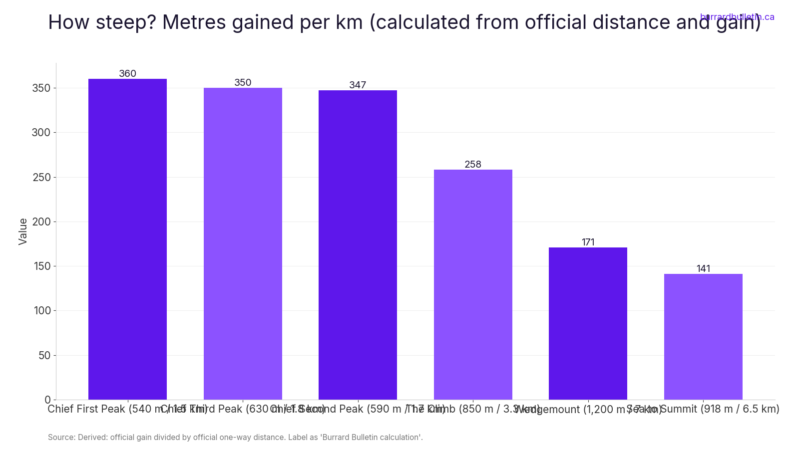
Wedgemount Lake is on this list as a judgment call. BC Parks lists the trail at 7 km with 1,200 m of elevation change, and suggests 4 to 6 hours one way. The upper trail looks out on a waterfall that drops almost 300 m.
The hard part isn’t a cliff edge. BC Parks says the last section climbs steeply up a boulder-strewn slope that can be slippery when wet. If open drop-offs are what bothers you, this trail may be fine. If you freeze on steep slopes, think twice.
An older BC Parks page says to turn right off Hwy 99 13 km north of Whistler and cross an uncontrolled railway crossing. The lot is 2 km up a forest service road. Late October can bring early snow to the upper slope. Check the BC Parks Wedgemount page for current conditions.
The descent is the harder half. If the boulder slope looks bad on the way up, turn around at the waterfall viewpoint.
5. Squamish Via Ferrata (Sea to Sky Gondola summit area)
Where: Sea to Sky Gondola summit area, Squamish
When: Year-round, guided. Book with the operator.
Cost: From $114 per adult. Ask whether a gondola ticket is included.
Getting there: Meet at the Sea to Sky Gondola, about 1 hour from downtown Vancouver
Mountain Skills Academy & Adventures runs a guided via ferrata at the Sea to Sky Gondola. You clip a lanyard onto a steel cable. Then you climb a rock headwall on metal ladder rungs and short suspension bridges, finishing at the top of the gondola. The operator says the tour lasts 1 to 1.5 hours.
The cable keeps you attached the whole way. It doesn’t change what you see when you look down. This route is exposed from start to finish, which is the reason people do it.
The operator says it runs year-round, and you book directly. The operator’s site listed prices from $114 per adult when we checked; confirm current rates when you book. When you book, ask whether a gondola ticket is included. Destination Vancouver lists a minimum age of 8. If heights are the issue, you can watch the climbers from the Summit Lodge deck instead.
4. Sky Pilot Suspension Bridge (Sea to Sky Gondola summit)
Where: Sea to Sky Gondola summit, Squamish
When: Year-round, whenever the gondola runs
Cost: Included with a gondola day ticket. Check current prices.
Getting there: 10-minute gondola ride from the base, about 1 hour from downtown Vancouver
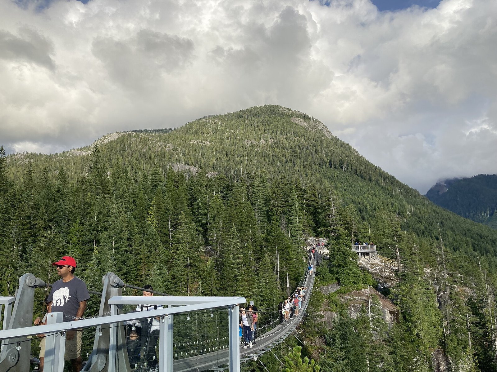
This one is a walk, not a hike. It’s the first thing you reach after the 10-minute gondola ride. The operator says the bridge is about 100 m long. The operator’s 2013 blog post about the bridge’s construction puts it at roughly 65 m high.
The operator describes the bridge as giving you a greater feeling of exposure and height over land. It’s open year-round whenever the gondola runs, and it’s stroller- and wheelchair-accessible. Easy access doesn’t help much if the drop is your problem.
The bridge is included with a gondola day ticket. Check current prices on the hours and prices page. Skipping the bridge doesn’t mean skipping the summit. The operator’s FAQ says the Panorama Trail and Spirit Trail are stroller-accessible.
3. Sea to Summit Trail (Sea to Sky Gondola, Squamish)
Where: Starts at the Sea to Sky Gondola parking lot, Squamish
When: Listed for summer and winter. Start before 11 am on your first time.
Cost: Free to hike up. Ride-down ticket extra. Check current prices.
Getting there: Sea to Sky Gondola base, about 1 hour from downtown Vancouver on Hwy 99
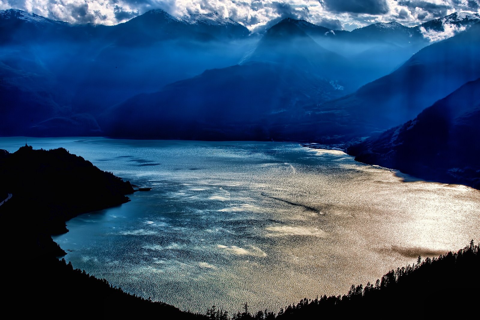
This is the longer of the two ways to hike up to the Sea to Sky Gondola. The operator rates it Advanced. It is 6.5 km one way with 918 m of gain and takes 3 to 5 hours. It starts on the Chief trail, traverses toward Shannon Creek, then climbs to the Summit Lodge.
The official trail page lists fixed lines, roots, granite bluffs, steep sections and technical terrain. The daily conditions page adds steep stairs, fixed ropes and chains. The trail page doesn’t mention ladders, so this is the milder of the two hike-up routes. That’s a relative claim.
The gondola doesn’t recommend hiking down because the trail was built as an up-trail, so most people buy a ride-down ticket. If it’s your first time, the operator says to start before 11 am and carry a headlamp. The hours page lists 9 am to 5 pm from Oct 24 to Nov 15, with the last ride down at 6 pm.
Dogs can ride down on a ride-down ticket too. The operator’s blog says you may need to help your dog up steps about 90 cm high.
2. The Climb, or Skatshn (Sea to Sky Gondola, Squamish)
Where: Sea to Sky Gondola base, Squamish
When: Listed for summer and winter
Cost: Free to hike up. Pay to ride down.
Getting there: Sea to Sky Gondola base, about 1 hour from downtown Vancouver
The Climb, also called Skatshn, is the gondola’s steeper and more direct way up. It’s 3.3 km one way with 850 m of gain, and the operator still estimates 3 to 5 hours. You gain nearly as much height as on Sea to Summit in about half the distance.
The official description says the route includes scrambling and the use of ropes and ladders. It’s labelled for Advanced and Expert hikers only. If ladders are your limit, skip this route first. The Sea to Summit page doesn’t mention ladders at all.
The Climb is listed for summer and winter. You hike up for free and pay to ride down.
1. Stawamus Chief: First, Second and Third peaks (Squamish)
Where: Stawamus Chief Park, just south of Squamish on Hwy 99
When: Main trail open since March 27, 2026. Stairs can be slippery in winter, and ice can fall.
Cost: Free to hike. Check bcparks.ca for parking fees.
Getting there: Day-use lot near the campground, reached by turning right off Hwy 99 just after the first traffic light in Squamish, or from neighbouring Shannon Falls Park
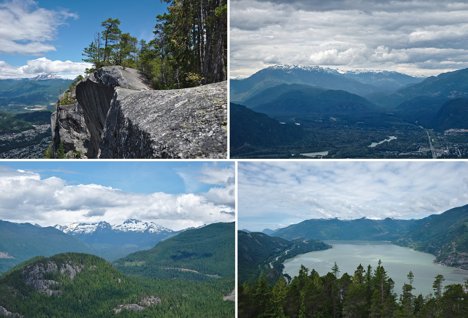
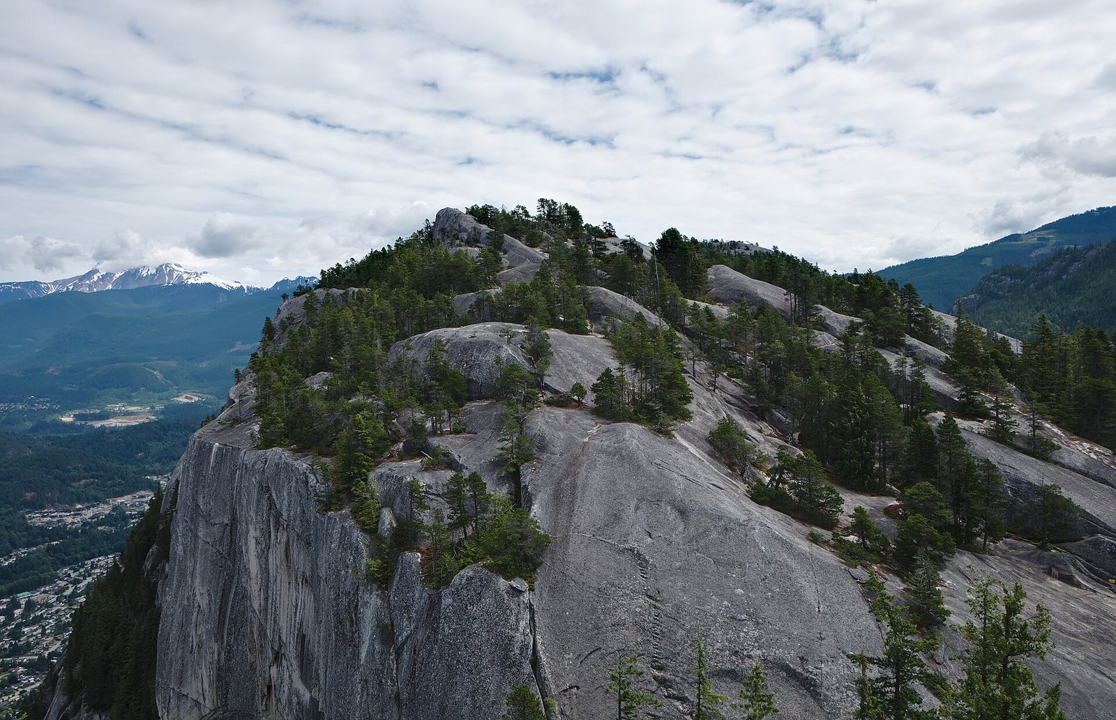
The peaks route starts with a long staircase. Higher up, you use a metal ladder and fixed chains to get onto bare granite. BC Parks lists First Peak at 1.5 km and 540 m of gain. Second Peak is 1.7 km and 590 m, and Third Peak is 1.8 km and 630 m. The summits sit at 610 m, 655 m and 702 m above sea level, right over Howe Sound.
The BC Parks brochure calls the Chief the second-largest granite monolith in the world. That size is what draws people, and it’s also the problem. Destination Vancouver says the trail may not suit people with a fear of heights. It also says the only safe way off a summit is the way you came up, because every other line is a climbing route.
The main trail reopened on March 27, 2026, after a months-long closure caused by rockfall. BC Parks says rockfall can happen anywhere in the park at any time. It also warns that stair treads can be slippery in winter and that ice can fall. On a wet or icy day, the chains and ladder get harder. Check the BC Parks Stawamus Chief page before you go.
BC Parks requires pets to be leashed at all times except on the Chief Peaks Trail. Destination Vancouver says dogs are not recommended because of the steep slopes and drop-offs. For a calmer option, BC Parks lists a 1.5 km walk from the Stawamus lot to Shannon Falls. You get the granite from below, with no chains involved.
| Column 1 | Column 2 | Column 3 |
|---|---|---|
| Route | Height feature (official wording) | Status Oct 23, 2026 |
| Stawamus Chief | Ladders and chains up rock outcrops | Open |
| Sea to Summit | Fixed ropes and chains, granite bluffs | Open (gondola running) |
| The Climb | Scrambling, ropes and ladders | Open |
| Via Ferrata | Cable plus ladder rungs on a rock headwall | Year-round, guided |
| Black Tusk summit | Fall hazard, loose rock, unmaintained | Not recommended by BC Parks |
| High Note | Rope, chain, small metal bridge | Closed (lift) |
| Cloudraker Skybridge | 130 m bridge over Whistler Bowl | Closed (lift) |
| Howe Sound Crest beyond Bowen Lookout | Extremely rugged, experienced only | Winter use not recommended |
Do this instead
- Shannon Falls: the BC Parks brochure describes a short walk to views of the falls at the base of the Chief (distance to be confirmed against the brochure).
- Sea to Sky Gondola summit: the Panorama Trail and Spirit Trail are stroller-accessible.
- Brandywine Falls: a 10 to 20 minute walk one way crosses a covered footbridge to a viewing platform. A second viewpoint looks toward Daisy Lake and the Black Tusk. BC Parks says trails there aren’t maintained in winter.
- Via ferrata: watch it from the Summit Lodge deck.
Late-October status check
- Stawamus Chief: open. BC Parks says stair treads may be slippery in winter and warns of falling ice.
- Sea to Sky Gondola: open 9 am to 5 pm from Oct 24 to Nov 15, with the last ride down at 6 pm. The hours page also shows a maintenance closure from Nov 16 to 26. Confirm it applies this year on the official page.
- Garibaldi day-use passes: required June 12 to Oct 12, 2026, so they’re no longer needed this year.
- Whistler alpine: the Peak Express, Cloudraker Skybridge and High Note are closed for 2026. The 2027 dates aren’t posted yet.
What to bring
- For the gondola hike-up routes, the operator says to carry the 10 essentials, a headlamp and at least one litre of water.
- For the Chief, bring sturdy footwear, food, water and clothing for changing weather.
- Pack the headlamp even on a short day. Late October light goes early.
Etiquette and safety
- Ladders and chains bottleneck on busy days. Wait your turn, and let people coming down finish first.
- Don’t throw anything off the Chief’s summits, because climbers may be below.
- On the Chief, come down the way you went up. Every other line is a climbing route.
- Rockfall can happen anywhere in Stawamus Chief Park at any time, according to BC Parks.
- A good place to turn around is wherever the maintained trail ends. That means the Black Tusk viewpoint kiosk, where the BC Parks trail system ends, and Bowen Lookout, beyond which BC Parks says only experienced, well-equipped backcountry travellers should continue.
Getting there
- Stawamus Chief and Sea to Sky Gondola: the shared base area is on Hwy 99 just south of Squamish. The operator says it’s about 1 hour from downtown Vancouver.
- Black Tusk and Garibaldi Lake: turn right off Hwy 99 just past the Rubble Creek Bridge, 37 km north of Squamish or 19 km south of Whistler. Then drive 2.5 km of paved road to the lot.
- Wedgemount Lake: turn right off Hwy 99 13 km north of Whistler and cross the railway. Then drive 2 km up a forest service road.
- Whistler Peak: Whistler Village Gondola, then the Peak Express chair, next season.
- Howe Sound Crest Trail: Cypress Mountain at the south end, or Lions Bay for the Binkert trail.
| If you’d skip | Try instead | What the official source says |
|---|---|---|
| Stawamus Chief peaks | Shannon Falls | Easy 350 m walk to views of the falls |
| Stawamus Chief peaks | Stawamus lot to Shannon Falls | 1.5 km walk |
| Sky Pilot Suspension Bridge | Panorama Trail and Spirit Trail | Stroller-accessible |
| Black Tusk summit | Viewpoint kiosk | End of the maintained BC Parks trail |
| Black Tusk summit | Brandywine Falls | 10 to 20 minute walk one way, with a viewpoint toward Daisy Lake and the Black Tusk |
| Howe Sound Crest Trail | Bowen Lookout | BC Parks’ cut-off point for all but experienced backcountry travellers |
None of these routes is off-limits if you’re ready for it. The chains, ladders and open bridges are the reason most people go. If heights are your problem, though, the Sea to Sky still has plenty to offer. You can stand at the base of Shannon Falls, walk the gondola’s summit trails or look at the Tusk from Brandywine. You’ll see the same granite and the same Howe Sound, and you can enjoy the view instead of gripping a chain.
Get the weekend plan in your inbox. Burrard Bulletin is a free email on what’s actually on from Vancouver to Whistler. Sign up here.
Photo credits
- Stawamus Chief Provincial Park, BC (DSCF7818).jpg by Trougnouf, CC BY 4.0 (combined into a montage, cropped). Via Wikimedia Commons.
- Stawamus Chief Provincial Park, BC (DSCF7884).jpg by Trougnouf, CC BY 4.0 (combined into a montage, cropped). Via Wikimedia Commons.
- Stawamus Chief Provincial Park, BC (DSCF7828).jpg by Trougnouf, CC BY 4.0 (combined into a montage, cropped). Via Wikimedia Commons.
- Stawamus Chief Provincial Park, BC (DSCF7644).jpg by Trougnouf, CC BY 4.0 (combined into a montage, cropped). Via Wikimedia Commons.
- Stawamus Chief Provincial Park, BC (DSCF7743).jpg by Trougnouf, CC BY 4.0 (resized). Via Wikimedia Commons.
- From Sea o Sky Gondola.jpg by Zunnun, CC BY-SA 4.0 (resized). Via Wikimedia Commons.
- Sea to Sky Gondola 03.jpg by DarkNight0917, CC BY-SA 4.0 (resized). Via Wikimedia Commons.
- Black Tusk 4.jpg by Andysonic777 (talk · contribs), CC BY-SA 3.0 (resized). Via Wikimedia Commons.
- Wedgemount lake.jpg by Kilrogg, CC BY-SA 3.0 (resized). Via Wikimedia Commons.
- Along the High note trail atop Whistler Mtn. (7958953652).jpg by Murray Foubister, CC BY-SA 2.0 (resized). Via Wikimedia Commons.
- Cloudraker Skybridge, Whistler Mountain – 29547284798.jpg by GoToVan, CC BY 2.0 (resized). Via Wikimedia Commons.
- The Lions peaks (British Columbia) banner.jpg by Shaundd, CC BY-SA 3.0 (resized). Via Wikimedia Commons.