3 Lighthouses You Can Walk to Around Vancouver
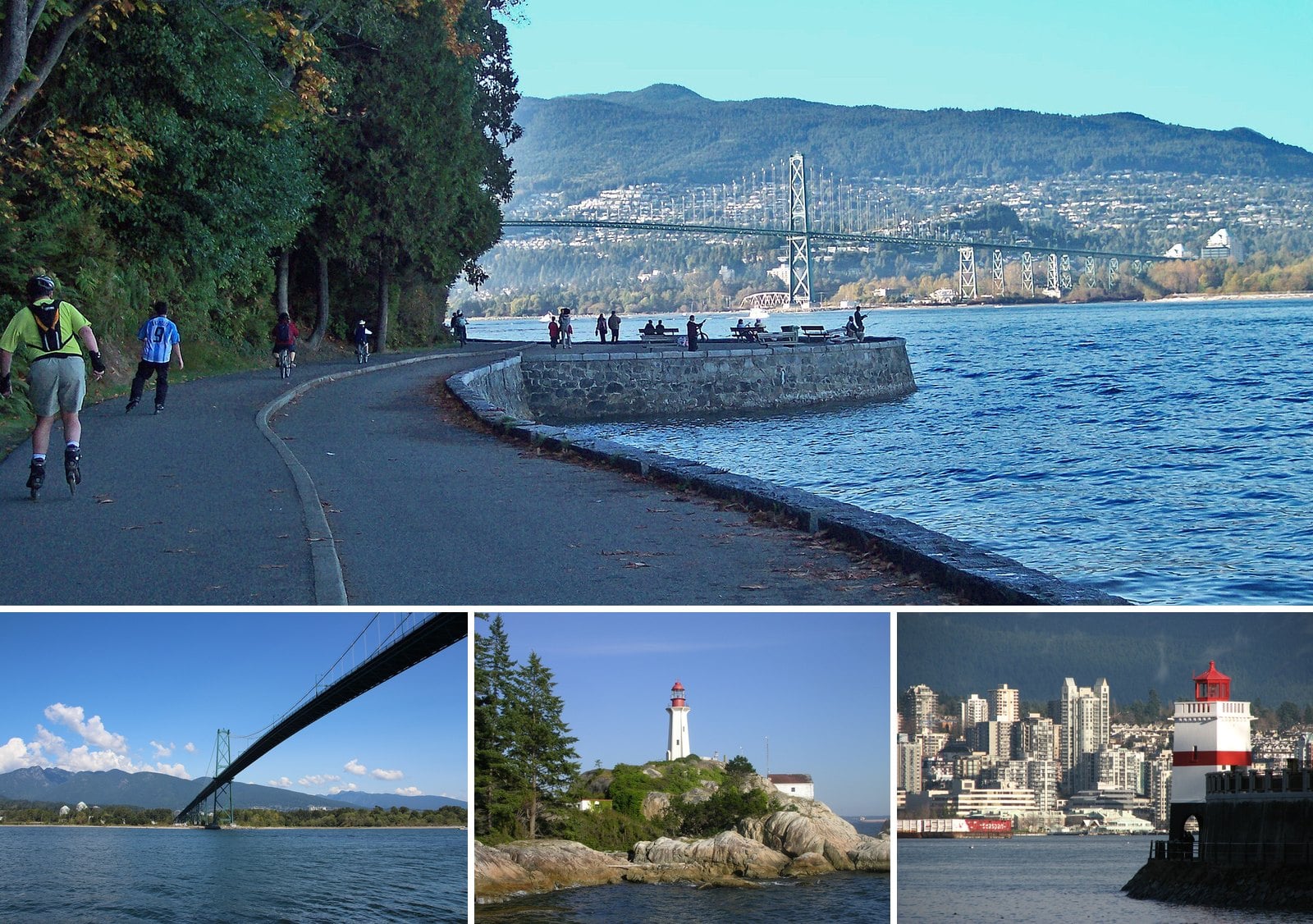
Some of the lights that have guided ships into Vancouver are close enough to walk to. Two stand on the Stanley Park seawall. The other is at the end of a forest trail in West Vancouver, where a concrete tower from 1912 still does its job.
This guide covers what you’ll see at each one, the history behind it, and how to get there by bus, bike or car. It also covers the catch. Part of the seawall is closed until November 14, 2026, and the closed stretch includes Prospect Point.
You can’t go inside any of these towers. You get the walk, the water and a good look at how the port grew up.
3. Prospect Point Lighthouse (Stanley Park)
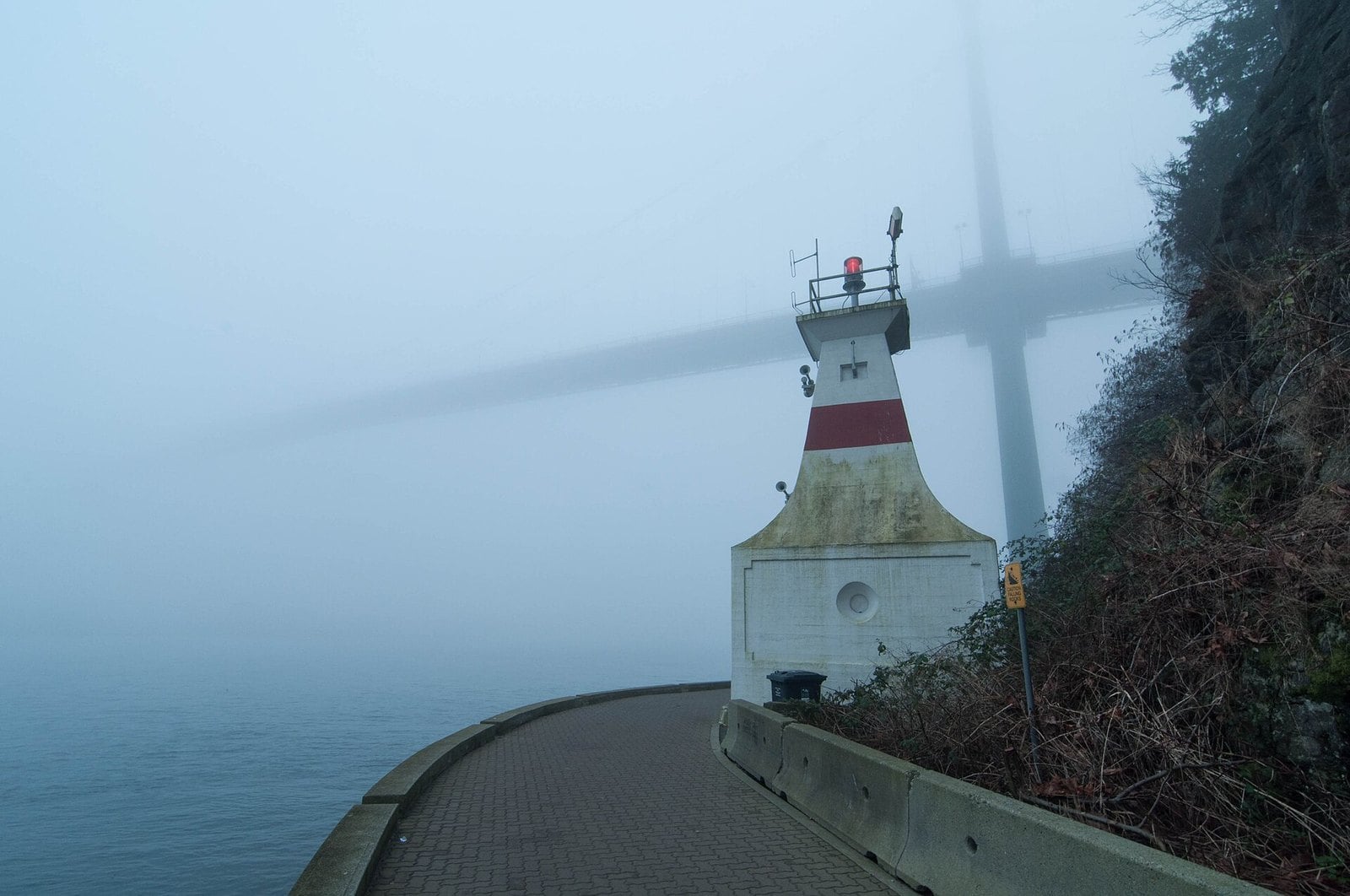
Where: Seawall level below Prospect Point, just west of the Lions Gate Bridge
When: Seawall closed from Lumberman’s Arch to Third Beach until November 14, 2026; intermittent closures possible to November 20, 2026
Cost: Free to walk to; Stanley Park parking is paid
Getting there: #19 bus into Stanley Park, then the seawall west from Brockton Point once it reopens
Start with the bad news. The seawall between Lumberman’s Arch and Third Beach is fully closed until November 14, 2026, with intermittent closures possible until November 20, 2026. That stretch includes the Prospect Point Lighthouse, so you can’t walk to it right now. Detour signs send seawall traffic through Beaver Lake. Check the Park Board’s seawall page before you go, because this section closes often for rock scaling and slope work.
Once it reopens, this is the one with the best setting. It sits at seawall level just west of the Lions Gate Bridge, a square concrete tower with a focal plane about 11.6 metres (38 feet) above the water. You can’t go inside, but you can walk right up to it and almost underneath, with the bridge overhead and Burrard Inlet in front of you.
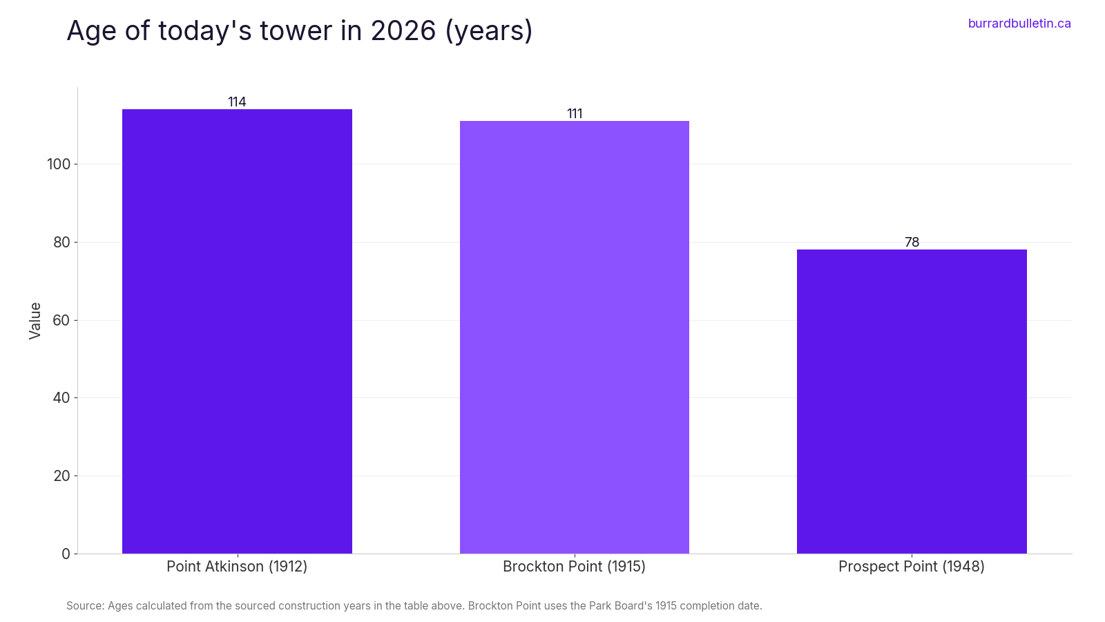
There has been a light at Prospect Point since 1888. The current tower dates from 1948. The Prospect Point Tea Room opened after the lighthouse was built, and the lookout up top has been a sightseeing stop ever since.
When the seawall is open, walk west from Brockton Point and under the Lions Gate Bridge. The full Stanley Park seawall is about 9 km and takes two to three hours on foot. Pedestrians and cyclists share the path at Prospect Point, so keep to your side. The Prospect Point café is seasonal and its website currently lists it as closed for the season, so don’t count on a coffee stop until it reopens.
| Lighthouse | Tower | Height | Designed by | Status today |
|---|---|---|---|---|
| Point Atkinson | Hexagonal reinforced concrete with exterior buttresses | 18.3 metres tall | William P. Anderson, Department of Marine | Automated, still guiding ships; National Historic Site since 1974 |
| Brockton Point | Square white tower with red band, archway at base | Not listed | T. Mawson and Associates | Taken over by the Park Board after it was no longer needed for navigation |
| Prospect Point | Square concrete tower | Focal plane about 11.6 metres (38 feet) above the water | Not listed | Seawall access closed until November 14, 2026 |
2. Brockton Point Lighthouse (Stanley Park)
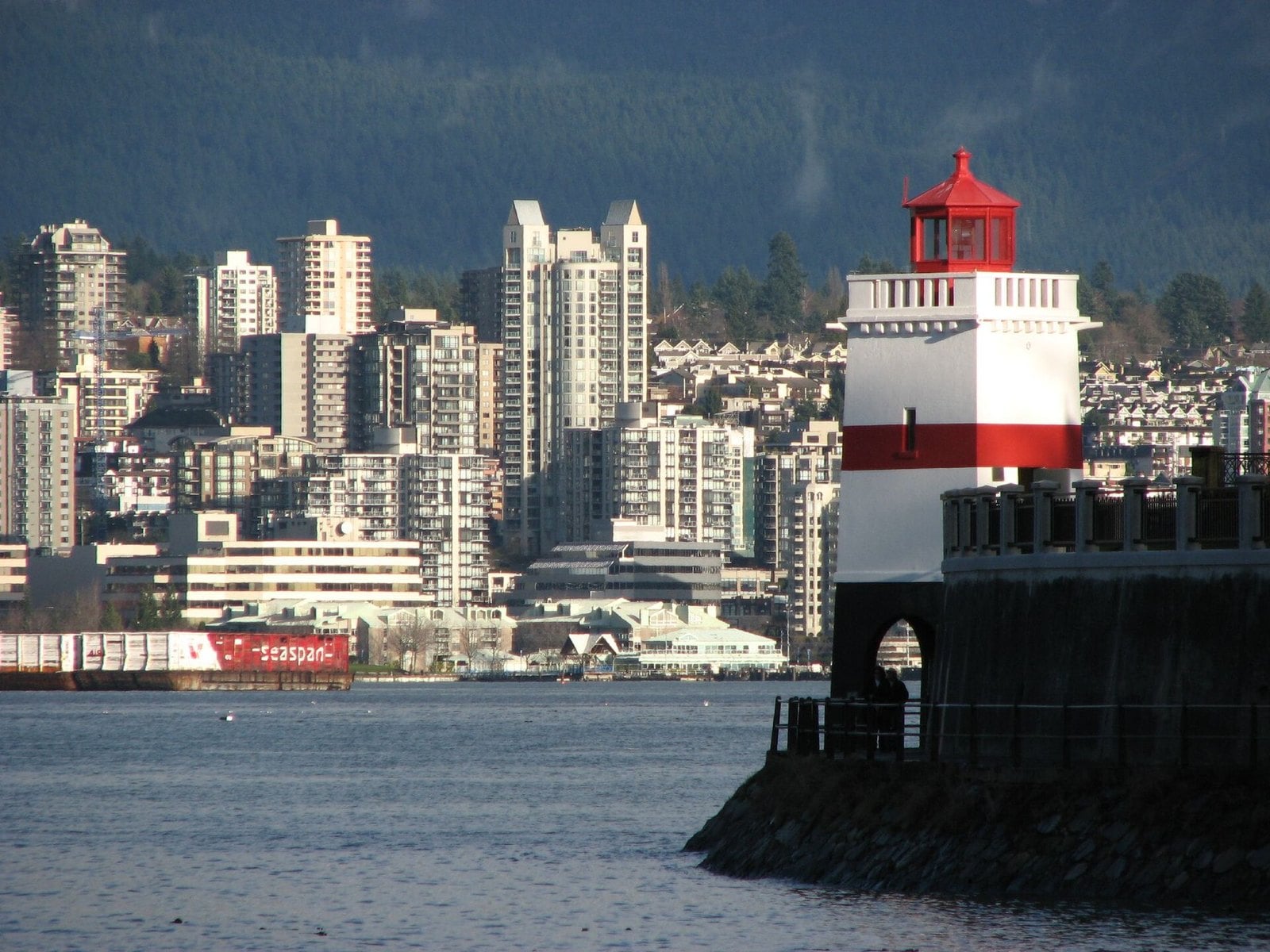
Where: Brockton Point, eastern tip of Stanley Park
When: Stanley Park is open year-round; this section of seawall is not part of the current closure
Cost: Free to walk to; Stanley Park parking is paid
Getting there: #19 bus to Stanley Park Loop or Stanley Park Drive and Pipeline Road, then walk, or the Coal Harbour seawall from downtown
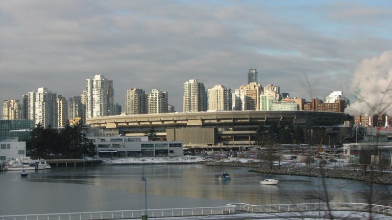
This is the square white tower with the red band at the eastern tip of Stanley Park. The lower seawall runs straight through an archway at its base, so you walk under the lighthouse rather than around it. A Park Board interpretive panel at the lighthouse plaza explains its role guiding ships in and out of the harbour.
A wood-frame light first went into service here in 1890. The current tower was completed in 1915, according to the Park Board, though many sources give 1914. The Park Board’s 2006 report credits the design to the English landscape architecture firm T. Mawson and Associates, though some sources credit William P. Anderson. That archway was meant to be a boathouse, but the tides and currents made launching a boat nearly impossible. In 2006 the Park Board approved taking the lighthouse over from Fisheries and Oceans Canada after it was no longer needed for navigation.
The Brockton Point section of the seawall is not part of the current closure. The #19 bus goes into Stanley Park, stopping at Stanley Park Drive and Pipeline Road (near Lost Lagoon) and at Stanley Park Loop (near the Miniature Train). From either stop it’s a walk to the point. You can also walk or cycle the Coal Harbour seawall from downtown. All parking in Stanley Park is paid. A daily pass lets you park anywhere in the park, while an hourly ticket is only valid near the meter where you bought it. The City’s directions page has the details.
The totem poles at Brockton Point are just around the point, and Destination Vancouver calls them one of the most-visited attractions in BC. For a then-and-now comparison, the City of Vancouver Archives has historic photos of this spot, including the first 1890 light and its fog bell.
1. Point Atkinson Lighthouse (Lighthouse Park, West Vancouver)
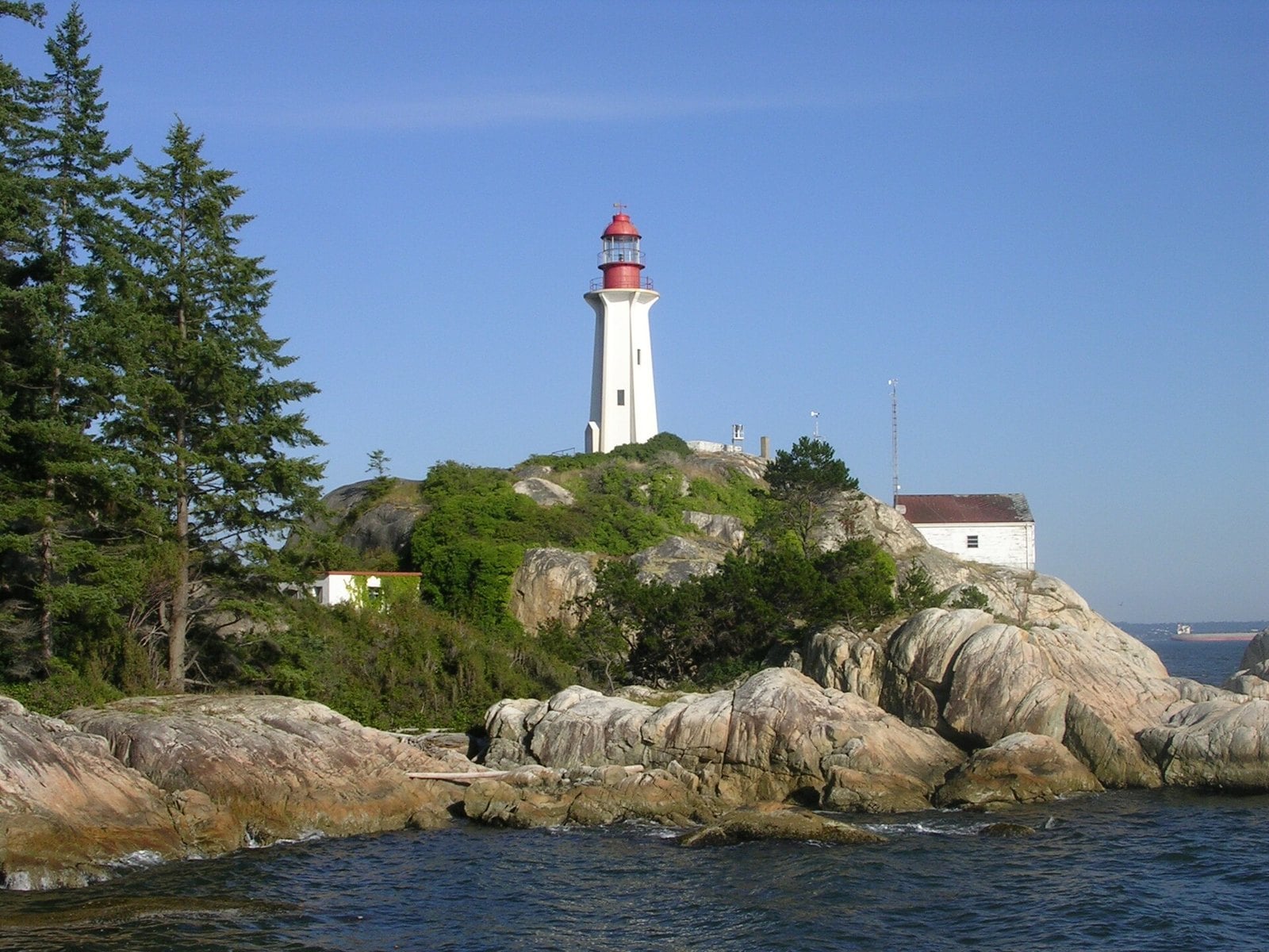
Where: South end of Beacon Lane off Marine Drive, West Vancouver
When: Park open 7 a.m. to 10 p.m. daily, year-round
Cost: Parking $5.08/hr (District-listed rate)
Getting there: #250 Horseshoe Bay bus to Marine Drive at Beacon Lane, or drive and follow the park signs
The walk in is half the point. Between the parking lot and the water you pass through roughly 75 hectares of old-growth coastal forest. At the end, the lighthouse viewpoint looks across to a hexagonal reinforced-concrete tower, 18.3 metres tall, braced by exterior buttresses. A keeper’s cottage and a group of Second World War army huts stand beside it.
This was the first of three lighthouses built to serve the Port of Vancouver. Contractor W.H. Rourke built the current tower in 1912 to replace a wooden structure from 1875, working from designs by William P. Anderson, chief engineer at the Department of Marine. It became a National Historic Site of Canada in 1974. It’s automated now, and according to Parks Canada it still guides marine traffic approaching Vancouver from the northwest.
The park is open 7 a.m. to 10 p.m. every day, all year. Drive west on Marine Drive toward Horseshoe Bay, turn left on Beacon Lane and follow the Lighthouse Park signs to the lot. The lot is small and fills quickly in good weather, so arrive early on sunny weekends. Pay parking is in effect at the District’s listed rate of $5.08 an hour; check the District’s page for hours and payment options. Without a car, take the #250 Horseshoe Bay bus from West Georgia Street to Marine Drive at Beacon Lane and walk down Beacon Lane.
Well-behaved dogs that stay on the trails can be off-leash on most trails here, but they must be leashed on Birdsong Path. Drones are banned. The light station grounds are closed to the public, so the viewpoint is as close as you get. The washrooms are portable toilets at the lot, near the Beacon Lane entrance, so stop there before you head down. Some trails are challenging, and West Vancouver suggests good walking shoes or hiking boots.
| Lighthouse | First light | Current tower |
|---|---|---|
| Point Atkinson | 1875 | 1912 |
| Prospect Point | 1888 | 1948 |
| Brockton Point | 1890 | 1915 |
When to go
- Lighthouse Park is open 7 a.m. to 10 p.m. daily, year-round. The lot fills fast on good-weather days, so go early.
- The seawall near Prospect Point closes often. The Park Board told CBC one section was shut for 85 days in a single year.
- Check vancouver.ca before any Stanley Park lighthouse walk, especially from late fall through winter.
Getting there without a car
- Stanley Park: the #19 bus stops at Stanley Park Drive and Pipeline Road and at Stanley Park Loop.
- No transit runs around the park, so getting from Brockton Point to Prospect Point means walking or cycling the seawall, but note that the seawall between Lumberman’s Arch and Third Beach (including Prospect Point) is fully closed until November 14, 2026, with a signed detour through Beaver Lake.
- Lighthouse Park: take the #250 Horseshoe Bay bus from West Georgia Street to Marine Drive at Beacon Lane, then walk down Beacon Lane.
Parking
- West Vancouver started pay parking at Lighthouse Park on February 12, 2024.
- The District now lists $5.08 an hour.
- All parking in Stanley Park is paid; check the Park Board’s website for current rates and rules.
What to bring
- Good walking shoes or hiking boots for Lighthouse Park, where some trails are challenging.
- A parking app or a credit card for the Lighthouse Park pay station.
Etiquette and safety
- None of these lighthouses can be entered.
- At Point Atkinson the light station grounds are off-limits, so stay at the viewpoint.
- Drones are prohibited in West Vancouver parks under the Parks Regulation Bylaw.
- Dogs can be off-leash in Lighthouse Park only if they’re well-behaved and stay on the trails, and they must be leashed on Birdsong Path.
For now, Point Atkinson and Brockton Point are the walks you can actually do. Point Atkinson gives you the forest and a working light. Brockton Point gives you a tower you can stroll straight through on the seawall. Prospect Point has to wait until the seawall reopens, so put it on the list for after November 14, 2026 and check the Park Board page first.
Get the weekend plan in your inbox. Burrard Bulletin is a free email on what’s actually on from Vancouver to Whistler. Sign up here.
Photo credits
- Stanley Seawall.jpg by bobanny, Public domain (combined into a montage, cropped). Via Wikimedia Commons.
- Lions Gate Bridge from seawall path.jpg by Keely Hill, CC BY-SA 4.0 (combined into a montage, cropped). Via Wikimedia Commons.
- Lighthouse Lighthouse Park.JPG by Clayoquot, CC BY-SA 3.0 (combined into a montage, cropped). Via Wikimedia Commons.
- Brockton Point Light and Vancouver.jpg by Andrea Schaffer, CC BY 2.0 (combined into a montage, cropped). Via Wikimedia Commons.
- Prospect Point Lighthouse + Lion’s Gate Bridge, foggy (8443052977).jpg by Colin Knowles from Vancouver, CC BY-SA 2.0 (resized). Via Wikimedia Commons.